Glanum Archaeological Park: A Celto-Ligurian and Roman City in France

Site at a Glance
- Rating
- 4.5
- Popularity
- Medium
- Country
- France
- Primary era
- Classical
- External website
- Open
- Eras represented
- Iron Age, Classical
- Civilizations
- Roman
- Site type
- City
On this page32 sections
History
Glanum Archaeological Park in France preserves the remains of an ancient city at Saint-Rémy-de-Provence. Glanum originated as a settlement of the Salyens, a major Celto-Ligurian people of ancient Provence, around the sixth century BC, although earlier occupation is represented by Bronze Age pottery and bronze pins. The settlement grew around a permanent spring at a protected passage through the Alpilles and became a meeting point for Gallic, Greek, and Roman traditions.
Origins and Salyen Glanum
Occupation at the site reaches back to the beginning of the first millennium BC. Material from the final Bronze Age, approximately 1150 to 800 BC, includes pottery fragments and bronze pins, while clearer but intermittent evidence belongs to the seventh and sixth centuries BC. By the sixth century BC, the Salyens had established a settlement around the spring, where fertile soil, natural protection from the ridges, and a reliable water supply supported habitation.
The spring was dedicated to Glan, a local Celtic healing deity associated with the purity and curative power of water. It was also connected with the Glanicae, female divinities linked to the same cult. The settlement’s name developed from the Gaulish Glano to Glanon during the Hellenistic period and eventually to the Latinized Glanum. Personal names, local gods, pottery, figurines, cooking practices, and the display of severed enemy heads all preserve elements of its strong Gallic identity.
Greek Influence and Conflict with Rome
Glanum’s position near Massalia, modern Marseille, brought it into Mediterranean commercial and cultural networks. From the second century BC, Greek influence appeared in monumental planning, architecture, inscriptions written in the Greek alphabet but expressing the Celtic language, and silver coins bearing the ethnic designation “of the Glaniques.” The settlement prospered through trade, its position near the Via Domitia, a Roman road linking Italy with Hispania through southern Gaul, its coinage, and the reputation of its spring as therapeutic.
Relations between the Salyens and Rome were violent. After the Roman destruction of Entremont in 125 BC by the consul Caius Sextius Calvinus, earlier civic and religious buildings at Glanum were dismantled or replaced. A further revolt against Rome around 90 BC brought another destruction, after which major monuments were replaced by more modest structures. These conflicts reshaped the settlement before its incorporation into the Roman political system.
Roman Expansion and Religious Life
After Julius Caesar’s conquest of Gaul in 49 BC, Glanum became an oppidum latinum, a fortified community granted Latin civic rights within the Roman system. Its inhabitants could enter municipal magistracies, and some received Roman citizenship. Glanum expanded northward and became the capital of a civitas, a Roman territorial community or civic district, with a degree of local autonomy. This administrative role probably ended around AD 200, when its territory was attached to the neighboring civitas of Avignon.
Roman rule introduced a monumental civic and religious center, public baths, water infrastructure, and temples connected with the emperor and imperial family. Under Augustus, the first Roman emperor, Glanum acquired paired temples for imperial worship and other prestigious facilities. Religious activity around the spring also increased. The older cult continued, while Valetudo, the Roman goddess of health, and Hercules became associated with the water. Veterans visited the spring seeking treatment for injuries, and Agrippa, Augustus’s principal military and political associate, was traditionally understood to have dedicated the Temple of Valetudo after treatment for a leg ailment.
Destruction, Abandonment, and Rediscovery
Glanum was sacked and destroyed during Germanic, or Alamannic, invasions around the later third century AD. The city was gradually abandoned, and its inhabitants moved north to develop the settlement that became Saint-Rémy-de-Provence. Stone from the ancient city was reused there, while alluvial deposits washed down from the Alpilles progressively buried Glanum.
Early-modern observers recorded the site in the sixteenth century, but for centuries its fame rested mainly on Les Antiques, the surviving arch and Julii monument outside the ancient city. King Charles IX visited the monuments and ordered their surroundings cleaned and maintained. Excavations around them during the sixteenth and seventeenth centuries recovered sculptures and coins. Further investigation was undertaken in the nineteenth century by the Marquis de Lagoy.
Systematic excavation began in 1921 under Jules Formigé, an architect responsible for historic monuments, and Pierre de Brun, a botanist and geologist. De Brun worked at Glanum until 1941 and identified the northern baths, basilica, and houses. Henri Rolland investigated the Iron Age sanctuary from 1928 to 1933 and later excavated the forum and sanctuary between 1942 and 1969. Research resumed in the 1980s, including work associated with the CNRS and the Institut de recherche sur l’Architecture antique in Aix-en-Provence. Later investigations examined deposits beneath earlier excavations, and the forum’s restitution was completed in 2008. Conservation and presentation efforts, especially from 1988 onward, sought to clarify the superimposed Celto-Ligurian, Hellenistic, and Roman phases while protecting the surrounding natural setting.
Remains
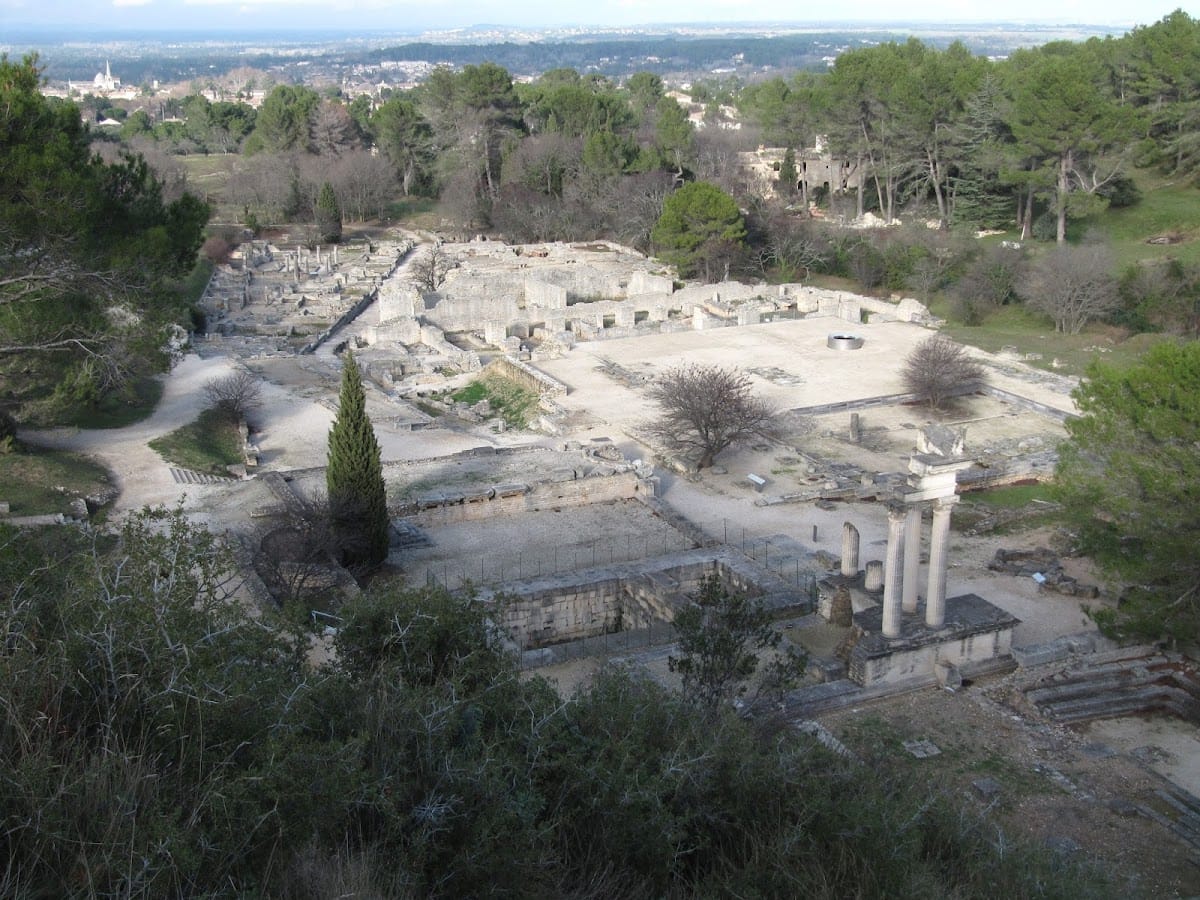
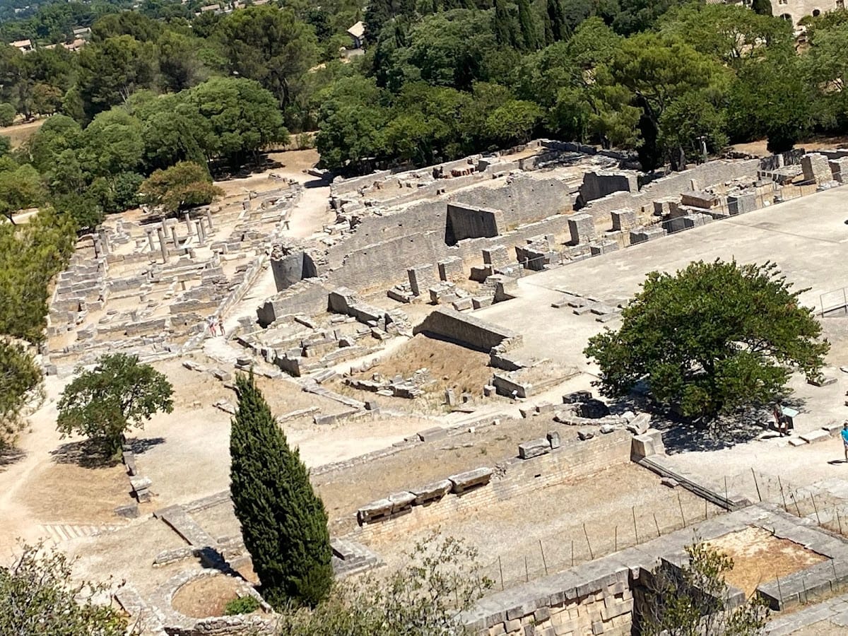
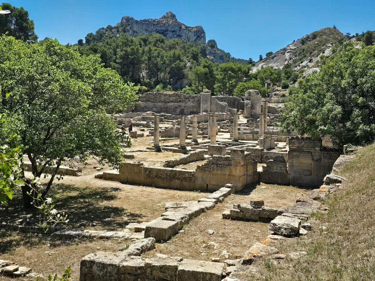
Glanum lies in a valley and ravine system at the foot of the Alpilles, extending along a north-south axis. The known ancient city covered approximately twenty hectares, while the archaeological park presents about two hectares. The residential quarter and public baths occupy the north, the monumental civic quarter lies in the center, and the sacred quarter with the spring and grotto stands in the higher southern part. The surviving remains include pre-Roman and Roman quarters, public buildings, private houses, roads, water systems, and features extending from Les Antiques to indigenous habitation beyond the southern fortification.
Fortifications, Roads, and Water
Southern Fortification
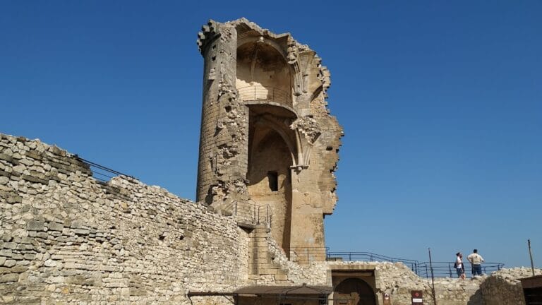
A stone fortification enclosed the southern valley in the late second or early first century BC. Its entrance had a gate broad enough for chariots, a square tower, and a narrower passage for pedestrians. Older walls on both sides date from approximately the sixth to third centuries BC and formed a rampart about sixteen metres high.
Streets and Water Infrastructure
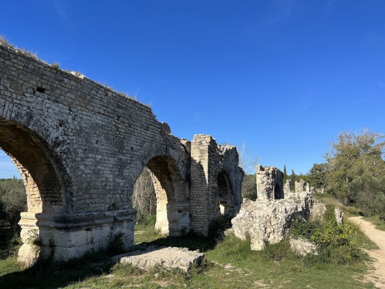
The principal north-south street was paved with slabs, with a sewer running beneath or beside it. Lead pipes, drains, sewers, a spring catchment system, a dam, and an aqueduct supplied fountains and baths. These installations connected the sacred spring and the civic areas through a planned network of collection, drainage, and distribution.
Sacred Quarter
Sacred Spring
The sacred spring occupies the highest part of Glanum. A paved corridor and a staircase of three flights, each with twenty-two steps, descend to the underground fountain. The original basin was cut into bedrock. During the second century BC, it was enclosed within a single-storey trapezoidal building whose stone facade was arranged in a fish-scale pattern. A catchment gallery channels water from the watershed into the deep reservoir, which is supplied throughout the year. A partly rebuilt ashlar arch supports the roof and helps stabilize the walls.
Ritual Building
Immediately inside the southern gate stood a building with a Doric portico. Its earliest remains date from the second to first centuries BC, and it was rebuilt around 40 BC. Basins supplied by conduits in the rear wall indicate that pilgrims washed and purified themselves there before approaching the spring.
Temple of Valetudo
The Temple of Valetudo is a small Corinthian building dedicated to the Roman goddess of health. An inscription attributes its construction to Agrippa, and its columns reflect the architectural style of the late Roman Republic. The temple probably dates from Agrippa’s first journey to Gaul in 39 BC.
Hercules Chapel and Votive Features
Near the spring stood a small chapel dedicated to Hercules as guardian of springs. Six altars to Hercules were found there, together with the torso of a large statue about 1.3 metres high holding a water vessel. An inscription on the statue’s base commemorated the safe return of the tribune C. Licinius Macer and Glanum’s centurions and soldiers from a second-century AD campaign.
Beside the stairway to the spring, the veteran M. Licinius Verecundus erected an altar in the first century AD. Its dedication invoked Glanis, the Glanicae, and Fortuna Redux, a Roman goddess associated with the safe return of travellers and soldiers, and recorded the veteran’s fulfillment of a vow.
Hellenistic Civic Area
Bouleuterion
The Hellenistic bouleuterion, a Greek-style council hall for civic notables, was built in large ashlar masonry at the end of the second century BC. Its rectangular meeting space had stepped seating on three sides, a broad portico with three columns, a small speaker’s platform, and a circular altar at the center.
The altar was decorated with a garland and bulls’ heads. Its crown resembled an Ionic capital, with papyrus scrolls and dolphins engraved on the sides. During the early Roman period, the northern part of the building was covered by the enclosure of the paired temples. The southern part survived for a time as a Roman curia, the meeting hall of the city council.
Dromos Well
The dromos well, a deep water installation reached by a descending passage, dates from the late second century BC. It lies beneath the Roman forum and is approximately ten metres deep and three metres wide. A covered staircase of thirty-seven steps led to the water. Its form and its connection with a nearby temple indicate a sacred installation rather than an ordinary public well.
The Roman forum later covered the well. After Glanum was destroyed and abandoned, the well was used as a reservoir by stone quarry workers and later as a dumping place. Finds from it include three limestone theatre masks, marble imperial dedications, and a head of Hercules.
Early Fountain
A small circular stone fountain beside the principal street dates from the period of Greek influence, approximately the second to first centuries BC. It formed part of the early forum area.
Roman Forum and Public Buildings
First Forum
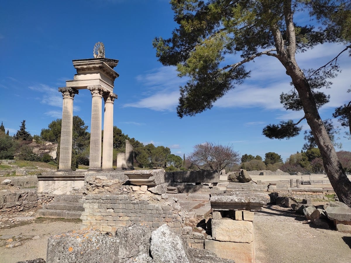
The first Roman forum was built around 20 BC. Its paired Corinthian temples were similar in design but unequal in size, and a colonnaded enclosure surrounded them on three sides. Three columns and part of the facade of the smaller temple have been reconstructed to convey the building’s original proportions.
The complex also contained a basilica, a curia, tribunals, and fountains. A larger building with an apse housed the curia and tribunal. An adjoining basilica had a colonnaded plan, with the bases of twenty-four pillars surviving. Remains of an earlier basilica and three Hellenistic houses lie beneath it.
Later Forum
A later Roman forum developed between the first and third centuries AD. It served as a market, business center, court, seat of government, and setting for official imperial rituals. Porticoes bounded its open space. The southern side contained a semicircular exedra, while the northern side included the basilica, which measured approximately 47 by 24 metres and was supported by twenty-four large columns. The facade has disappeared, but the rear and side walls remain.
The curia stood behind the basilica and contained a niche for an imperial statue. A central square room functioned as a tribunal and as a chapel for the imperial cult. Near the southern end of the earlier forum, a monumental fountain dating to about 20 BC consisted of a rectangular basin and a semicircular Corinthian apse that probably sheltered a statue. An aqueduct supplied it from the nearby dam.
Residential Quarter and Baths
Public Baths
The northern quarter contains houses and public baths. The bath complex included a cold room, two heated rooms using hypocausts, an underfloor system that circulated hot air, a palaestra, and a swimming pool called a natatio. Water entered the pool through the mouth of a stone theatre mask. The original mask is preserved in the nearby museum, while a reproduction occupies its former position.
House of the Antes
The House of the Antes is a two-storey Hellenistic residence with three wings around a twelve-column Tuscan peristyle, an open courtyard surrounded by columns. Seven columns have been re-erected. The house takes its name from two fluted square pilasters flanking the entrance, each with a Corinthian capital. A small basin collected rainwater from the roof, directing it into a cistern and then into the sewer beneath the street.
House of Atys
The House of Atys dates from the second century BC and was named after a marble relief of Atys found during excavation. It contained an impluvium, a shallow basin for collecting rainwater, a well with a raised curb at the edge of the pavement, and stone benches. The building probably served as a reception hall, or schola, for the college of Dendrophores associated with the neighboring sanctuary of Bona Dea.
Other Houses and Workshops
Other residential remains include a small Roman house near the entrance and a Hellenistic house near the palaestra and swimming pool. The latter contained a mosaic with a caprid head, set in a tile-and-concrete floor scattered with black tesserae and stone fragments. A small Hellenistic building with a Doric-Tuscan peristyle stood between the northern houses and the Roman civic buildings. Other houses include the House of the Two Alcoves, the House of Sulla, named after a name inscribed on one of its mosaics, and the House of Painted Plaster.
Some structures served as wine-smoking installations, where wine was smoked to improve its preservation. Indigenous houses formed part of the original Gallic settlement, while non-defensive walls marked the limits of the central administrative, commercial, and religious quarter.
Bona Dea Sanctuary
The Hellenistic marketplace consisted of shops arranged around a colonnaded courtyard with Doric columns. Around AD 100, its southern half was converted into a sanctuary of Bona Dea, the “Good Goddess,” a Roman deity associated with healing, fertility, and secret rites. At Glanum, the goddess was later associated with Cybele, an Anatolian earth deity whose worship used the sacred pine as a symbol of Atys.
The sanctuary contained a bench and an altar dedicated by the priestess Loreia. The altar was decorated with ears, symbolizing the goddess’s ability to hear prayers, and the original is displayed at the site. During the spring ritual, the Glanic Dendrophores, a religious college whose name refers to the carrying of sacred trees, brought a pine tree representing Atys.
Les Antiques and Sculptural Remains
Julii Monument
Les Antiques stand at the northern entrance, outside the city gate. The Julii monument is a funerary cenotaph dating from the late first century BC. Its upper stage is a circular Corinthian chapel containing two togate statues, probably members of the Julii family. Reliefs and an inscription identify a dedication by Sextus, Marcus, and Lucius Julius to their ancestors.
The reliefs combine historical and mythological scenes associated with the battle of Zela in 47 BC, the conflict between Greeks and Amazons, the Trojan War and the struggle for Patroclus’s body, and the Calydonian boar hunt involving Meleager, Castor, and Pollux. The upper part originally held two statues about two metres high, while the base was decorated with reliefs.
Municipal Triumphal Arch
The municipal triumphal arch stood beside the Julii monument outside the northern gate. Built near the end of Augustus’s reign, it represented Roman authority. Its upper section, including the dedicatory inscription, has disappeared. Reliefs show Roman victory and defeated Gallic enemies. One panel depicts a seated female figure on weapons beside a bound Gallic prisoner, while another shows a second prisoner with a smaller Romanized figure. Two further pairs of Gallic prisoners appear on the reverse.
Sculpture and Portraits
Excavations produced sculptures from Gallic and Roman phases, including near-life-size seated figures carved from local limestone and dressed with detailed elite clothing. White Carrara-marble portraits identified as Octavia, Augustus’s sister, and Livia, his wife, show that official statues stood at Glanum by 35 BC.
Landscape and Natural Setting
The archaeological remains stand within a varied natural setting that includes dry-stone structures, watering places, and several habitats. Crevices in the ruins provide breeding sites for cavity-nesting birds, while dry-stone walls shelter reptiles including the ocellated lizard. Dry meadows support the Mediterranean orchid Ophrys elevata, alongside almond, Judas, hackberry, rosemary, and terebinth vegetation.