Dong Lakhon Historical City: A Dvaravati Settlement in Thailand
Site at a Glance
- Rating
- 4.3
- Popularity
- Low
- Country
- Thailand
- Primary era
- Medieval
- Eras represented
- Medieval
- Civilizations
- Dvaravati
- Site type
- City
On this page13 sections
History
Dong Lakhon historical city is an ancient Dvaravati settlement in Nakhon Nayok Province, Thailand, occupied from approximately the sixth or seventh century through the thirteenth century. Associated with Mon communities, it developed as a Buddhist city with the moats, earthen ramparts, and brick religious architecture characteristic of the Dvaravati cultural tradition.
Settlement and Maritime Connections
The settlement stood beside an earlier course of the Nakhon Nayok River, whose connection to the coast supported farming and access to maritime exchange. Imported goods and raw materials indicate that Dong Lakhon participated in networks linking China, India, and the Persian Gulf. The city may also have served as a passage for trade between southern Thailand and the central plain.
Archaeological work has identified occupation from roughly the seventh to the eleventh centuries. Dvaravati religious objects, ceramics, beads, Chinese wares, and Persian Gulf pottery point to sustained long-distance contacts. These finds place Dong Lakhon within a wider regional economy rather than treating it as an isolated inland settlement.
Khmer Influence and Decline
Khmer cultural influence became strong around the middle of the tenth century, when the area is understood to have come within the Khmer Empire, a major mainland Southeast Asian polity centred in Cambodia. Dong Lakhon retained a Dvaravati cultural character while absorbing Khmer artistic and religious influences, including objects associated with the Baphuon and Bayon styles of Khmer temple art.
The city was probably abandoned by the fourteenth century. A later shift in the Nakhon Nayok River reduced its water supply and diminished its importance, encouraging residents to move to settlements along the new river course, including the area of present-day Nakhon Nayok. During the second fall of Ayutthaya, residents are believed to have moved toward the Khao Yai area to escape Burmese incursions, creating another period of abandonment.
Later Communities and Local Traditions
Lao Phuan, Lao Wiang, and Mon communities settled in the area during the early Rattanakosin period and mainly cultivated rice. Wild elephants often entered the rice fields before retreating toward Khao Yai as settlement expanded. Local residents formerly called the place Laplae. The name Dong Lakhon has uncertain origins. One tradition connects it with Dong Nakhon, meaning “city in the forest,” while another tells of villagers hearing Mahori music at night and imagining a royal performance among the trees.
After visiting Prachin Buri, King Chulalongkorn interpreted Dong Lakhon as the residence of an ancient Khmer queen. This remains a historical tradition rather than an archaeological explanation. Another interpretation attributed the site to Khmer builders after the area came under Thai control, based on Khmer-style objects. Archaeological evidence instead presents Dong Lakhon as a Dvaravati city shaped by both Dvaravati and Khmer cultural influences.
Excavation and Protection
Farming repeatedly brought antiquities to the surface. Formal excavation and conservation began in 1972 under the Fine Arts Department, directed by an archaeologist who was then a professor at Silpakorn University. Major excavations continued between 1972 and 2013, revealing religious remains, imported objects, craft materials, and evidence of changing Buddhist practices.
Dong Lakhon was registered as a National Ancient Site by the Fine Arts Department on 8 March 1935. It is publicly owned, managed by the department, and has received partial restoration.
Remains
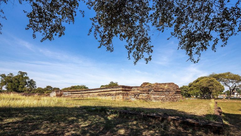
Dong Lakhon occupies a low plateau near the former Nakhon Nayok River, in a former shoreline zone of the Gulf of Thailand. The wider archaeological area covers approximately 6 square kilometres. The ancient city forms an almost circular oval about 700 to 800 metres across, while the central oval area known as Dong Lek has a perimeter of about 1.8 kilometres and may have served as the rulers’ residential quarter. The wider population lived around it.
Moat, Ramparts, and Gates
The city was enclosed by a moat and two earthen ramparts. The inner rampart, about 5 to 6 metres high, was taller, stronger, and more intact than the outer rampart, which stood approximately 1 to 2 metres high and has eroded in some places. Together, the moat and ramparts formed a defensive zone about 60 metres wide. These earthworks represent a characteristic Dvaravati approach to city construction.
The former river course supplied the moat. After the river changed direction, the moat silted up and became an earthen depression containing trees. Four gates opened to the north, east, south, and west. The eastern gate, called Nong Krapor, was the principal entrance. Ponds beside the gates may have served practical or ritual washing, and may also have hindered attacks using logs against the entrances. The ponds and moat retain water during the rainy season.
The northern pond was excavated and also functioned as a small laterite quarry. Laterite is a porous reddish stone widely used for foundations and masonry in tropical regions. The eastern pond is largely covered by vegetation.
Religious and Archaeological Structures
Historical Site 1
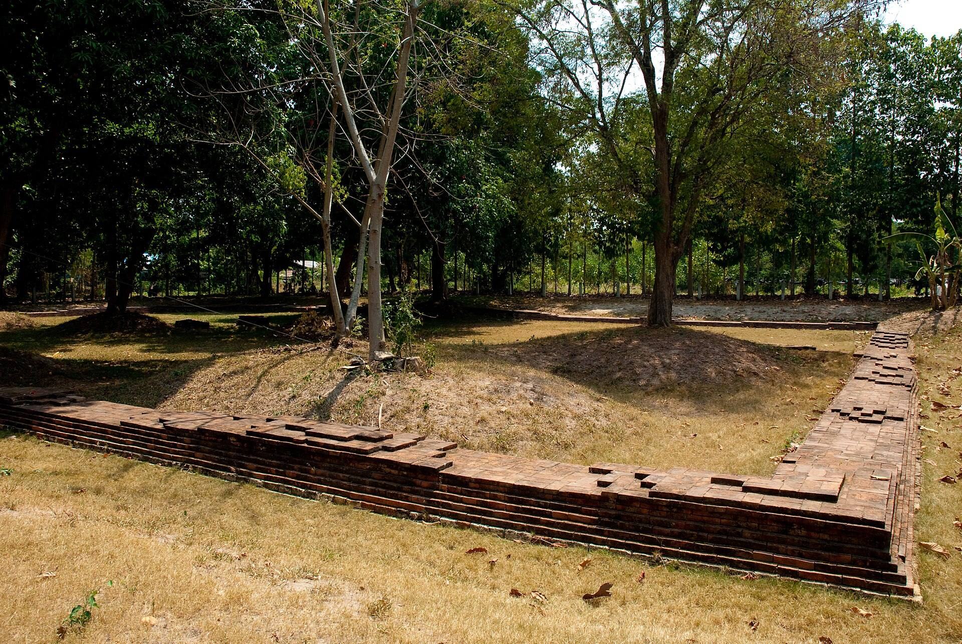
Historical Site 1 lies in the outer part of the city, about 250 metres north of the inner gate. It consists of a rectangular brick foundation or enclosure roughly 12 metres wide, with an entrance on the south. The foundation covers about 75 square metres and probably belonged to a Buddhist temple or shrine. Two image pedestals were found inside, although the arrangement may originally have included three. The site is locally called the House of Three Stones.
Excavations in 1988 and 1989, followed by restoration in 1993, recovered a gilded Dvaravati Buddha head, small gold sheets, carbonized rice grains, fragments of a ridged Dvaravati cooking pot, and a bronze mirror. The associated material is dated to approximately the eighteenth Buddhist century, a Thai chronological convention using a Buddhist Era that begins 543 years before the Common Era.
Historical Site 2
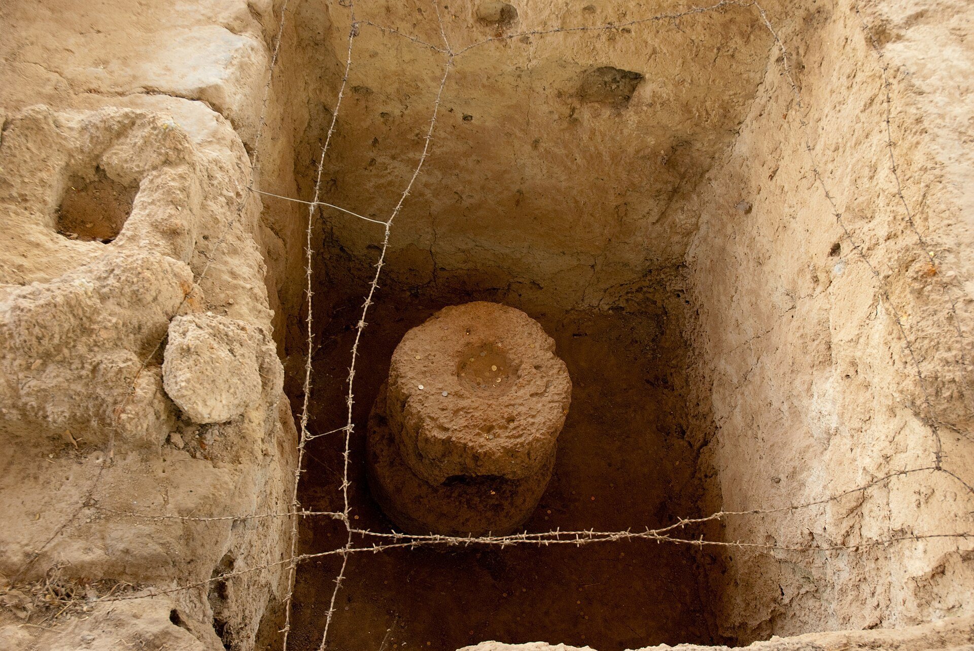
Historical Site 2 is also about 250 metres north of the inner gate. A laterite frame, approximately 3.7 metres wide and 4 metres long, encloses the remains of a large cylindrical laterite stupa. The monument was formed in two superimposed layers, and excavation in 1989 identified nearby small stupa remains. A stupa is a Buddhist monument associated with relics, commemorative deposits, or sacred remains.
Finds from the site include Dvaravati-style terracotta Buddha images and moulds, bronze rings, bracelets and earrings, coloured-stone rings, about 2,000 glass and stone beads, and carved stones probably used as seals. The seal designs include crabs and elephants. The large stupa may have contained the bones of an important person or may have served as a foundation deposit, but its precise purpose remains uncertain.
Central Stupa Area
The central area contains the disturbed remains of a Dvaravati-period stupa. Surveys and excavations in 1996 and 1997 exposed its laterite base. The monument has been tentatively reconstructed as an inverted-bell-shaped stupa with stacked finial elements above it and is estimated to have been built no later than the fifteenth Buddhist century.
A pottery vessel from the area bears a fragmentary inscription containing the ye dhammā formula, a Buddhist statement about causes and the cessation of phenomena. Postholes indicate that a timber building was later erected over the former stupa area, and Sangkhalok ceramics were also found. A Buddha head protected by a naga points to continued Buddhist activity during a later phase associated with Mahayana Buddhism, one of the major Buddhist traditions. After the 1997 excavation, the Fine Arts Department reburied the opening, leaving the central remains represented mainly by the laterite base and disturbed archaeological evidence.
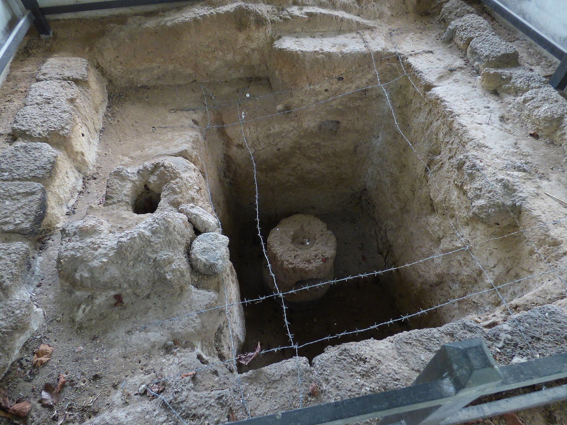
Sacred Well
A former river-line well lies beside the old course of the Nakhon Nayok River. Known today as the Sacred Well, it may originally have been dug to obtain laterite for construction elsewhere in the city. It was abandoned as the settlement declined.
After a religious hall opened nearby in 1990, local ritual specialists reportedly used water from the well in ceremonies. Residents later drank or bathed in the water, believing that it brought good fortune and cured illness. In 1999, water from the well was taken for the royal ceremony marking the sixth-cycle birthday of the king.
Materials and Exchange
Buildings at Dong Lakhon used brick and laterite. Excavated materials include Dvaravati pottery, brown-glazed ceramics, Tang and Song Chinese wares, multicoloured glass, eye and mosaic beads, carnelian and agate beads, Persian Gulf turquoise-glazed pottery, bronze bracelets, bronze mirrors, bronze religious images, gold leaves, and bronze bells.
Some pottery is tentatively linked to production in the Persian Gulf, possibly in Iran or Iraq. Quartz objects may have used stone from a source in Ban Na District, about 20 kilometres away. Two bronze bracelets may have come from Lopburi, while polished stone axes were made from andesite and rhyolite associated with a production source in Krabi Province. Other imported or externally connected objects include a faience bead attributed to the Levant or Egypt and potash glass of Indian, Vietnamese, or Chinese type. Together, these materials illuminate the broad exchange networks connected to the Dvaravati city.