Château des Rois ducs: A Medieval Fortress in France


Site at a Glance
- Rating
- 3.9
- Popularity
- Very Low
- Country
- France
- Primary era
- Medieval
- Eras represented
- Medieval
- Civilizations
- English, French
- Site type
- Military
- Remains
- Castle
On this page20 sections
History
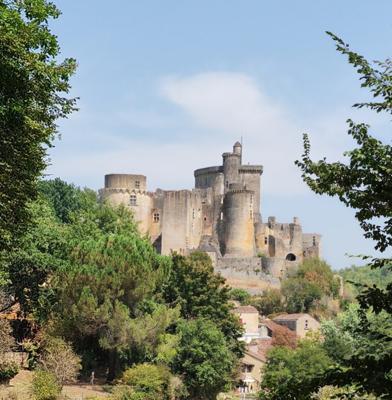
Château des Rois ducs, also known as Château de Sauveterre, is a medieval fortified castle in Sauveterre-la-Lémance, France, built by Edward I of England in 1289. Edward, who also ruled the Duchy of Aquitaine, established the fortress in a period of English efforts to strengthen royal control and fortifications in southwestern France. The castle occupied a principal route between Périgord and Agenais and was intended to regulate movement through the region.
Foundation and the Fortified Settlement
The first written evidence for the castle dates from 1290. Raymond Hugues de Tarnac was appointed châtelain, the official responsible for administering and defending a castle, and bailli, a local administrative and judicial officer, in 1304. He was probably the first castellan. Works recorded in that year indicate that construction was delayed or altered during the War of Guyenne.
A fortified settlement known as “the town” developed alongside the castle. The grant of a consulate and the presence of enclosing walls indicate a castelnau, a settlement organized around a castle or other stronghold. Its precise internal arrangement is unknown, but the settlement was closely associated with the fortress.
Conflict and Changing Allegiances
During the War of Saint-Sardos in 1323–1324, a short Anglo-French conflict over jurisdiction and territory in southwestern France, Sauveterre formed part of the English king’s defensive system. The crown invested in strengthening several strongholds in the area, and Château de Sauveterre served a logistical purpose. No battle at the castle is documented.
Control of the fortress shifted repeatedly during the Hundred Years’ War, the prolonged series of conflicts between the English and French crowns conventionally dated from 1337 to 1453. The castle was under French control in 1346, when Evrard de la Roche served as captain. Edward III transferred it to Bertrand de Durfort in 1348, indicating an English recovery, and Hugues de Blanquefort retook it for the French king in 1352. After the Treaty of Brétigny in 1360, the site again became English.
Seigneurial Ownership
Naudonnet de Lustrac, a powerful baron of Agenais, took control of the castle in 1432. He became captain of several strongholds and an important administrator for the French king, receiving substantial payments for their defence.
In 1476, the site was granted to Jean de Sermet for services against the English. His family settled permanently at Sauveterre and became the first stable seigneurial dynasty associated with the castle. Jean de Sermet became governor of Périgord in 1480.
Following a legal dispute with the Cugnac family over the Sermet inheritance, the castle passed to Antoine de Saint-Astier in the middle of the sixteenth century. At the beginning of the seventeenth century, marriage transferred it to a branch of the Losse family, which retained the property until the French Revolution.
Revolution and Later Preservation
The castle was burned in 1789 during the French Revolution. The aviator Jean Mermoz bought it in 1936, less than a year before his death, after seeing it from the air. Following his death, the property was abandoned, passed to the commune, and was sold again during the 1980s.
Later investigation and the clearance of vegetation clarified several elements of the fortress, including the original position of the main gate, masonry in the lower bailey, and a gun aperture. The castle has been restored and remains privately owned. The entire castle, its site, and its moat were classified as historic monuments by an order dated 19 September 2003.
Remains
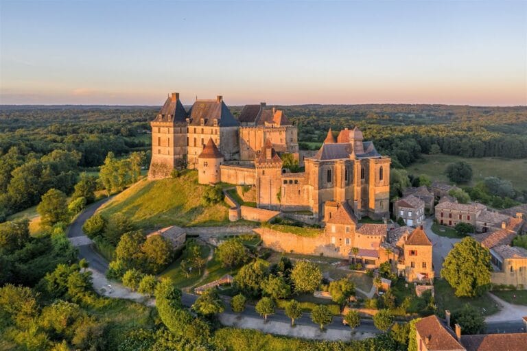
The fortress occupies the end of a rocky spur overlooking the valleys of the Lémance and Sendroux. It stands at an elevation of about 119 metres, with a drop of more than 70 metres towards the Lémance valley. This position allowed wide territorial surveillance and made approach difficult. The castle has an elongated pentagonal plan extending westward and covers approximately 5,000 square metres, excluding the moat.
High-Court Enclosure
Enclosing Walls
The high-court enclosure is formed by three connected sections. A southern wall runs from the gate to the west tower, a northwestern section joins the west and north towers, and a short northeastern section connects the north tower to the keep. The towers are linked at first-floor level by the enceinte, the enclosing defensive wall circuit, and its wall-walk.
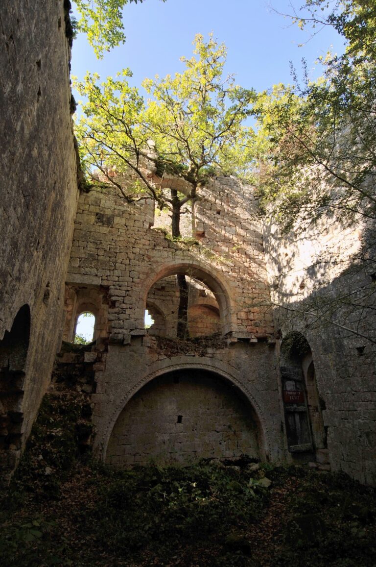
The southern wall is about 1.4 metres thick. It rises approximately 3.5 metres above the courtyard and about twice that height on the exterior, extending for roughly 23 to 24 metres. Five cruciform arrow slits with stirrups pierce the wall, which also carries a wall-walk. The northwestern section reaches 1.8 metres in thickness, about 5.8 metres in internal height, and approximately 45 metres in length between the west and north towers. It contains a cruciform arrow slit, two projecting latrines, and two pairs of windows resembling those in the north tower. These windows may indicate the former position of a chapel.
The northeastern wall is less than 15 metres long, but it is the highest and thickest part of the enclosure. It measures about 2.8 metres across and 9.5 metres high. Its dimensions reflect a position on a direct attack route not protected by the bailey. Three surviving corbels may have supported a bretèche, a small projecting defensive platform, rather than a continuous machicolation.
The high-court masonry is structurally consistent. Thirteenth-century architectural elements use medium-sized, carefully squared ashlar laid with lime mortar. Seven triple cruciform arrow slits with stirrups occur in the inner-court enceinte. Their lower sections were deliberately changed into cruciform openings with paddle-shaped sections and stirrups, with the stone between the second and third crosses broken away.
Gates and Access
The principal early gate was partly rebuilt. Its original position was identified from surviving ground-level masonry on the southern face of the thirteenth-century residential building. A second opening was cut near the keep, probably in the fifteenth century. Its exposed position and lack of flanking defences indicate that it was made for convenience after the main period of conflict rather than as a defensive entrance.
Keep and Towers
Keep
The keep, or main tower, has a regular geometric design. Its interior forms a perfect hexagon, while its exterior is partly circular on the side facing the bailey and slightly more than semicircular on that side. The tower is about 13 metres in diameter, has walls 3.5 metres thick, and stands approximately 20 metres high.
Inside the keep, a blind ground-floor chamber and two upper levels are connected by a stair within the wall. The ground floor is reached only through a trapdoor in the centre of the first-floor room. Beam holes in its walls may indicate a former additional floor, since the chamber rises more than nine metres.
The first floor is reached through two doors. One opens north towards the wall-walk and north tower, while the other opens south towards the thirteenth-century residential building. A large plain fireplace and projecting latrines indicate a residential use alongside the tower’s defensive role. The ground-floor and first-floor rooms have sexpartite rib vaults, which are vaults divided into six sections by structural ribs, on hexagonal plans.
The uppermost level is a crenellated platform, half-circular and half-hexagonal. Its elevated position allowed command of the other towers, the enceinte, and the bailey.
North Tower
The north tower is smaller and lower than the keep. It has a diameter of about nine metres and walls approximately 1.4 metres thick. Its original height is unknown, while several upper levels have disappeared. Internally, it is hexagonal on every level. Externally, its northern side forms a quarter-circle, combined with the remaining sides of a hexagon incorporated into the enceinte.
The ground floor contains a hexagonal room with a sexpartite rib vault, two simple cruciform arrow slits with stirrups, and a small passage leading to projecting latrines. A stair within the western wall reaches the first floor and the northern wall-walk.
The first-floor room has another sexpartite rib vault, a double cruciform arrow slit with stirrups, a high narrow pointed-arch window, a large fireplace, and a southern door towards the keep. Beam holes 2.5 metres above the floor indicate a former floor, which has been reinserted. The tower commands the northern wall of the village, the northern enceinte, and the view along the Lémance valley towards Villefranche-du-Périgord.
West Tower
The west tower stands at the outer end of the rocky spur. Its exterior is approximately semicircular and its interior hexagonal, like the keep. It measures more than 8.5 metres across, has walls 1.6 metres thick, and rises about 12.5 metres from the crenellation to the courtyard floor. It contains two habitable levels and a crenellated summit platform.
A short passage leads into the ground floor through two inward-opening doors. These could isolate the tower or provide a route of retreat. A perpendicular passage within the wall leads to projecting latrines. The ground-floor chamber has a sexpartite rib vault on a hexagonal plan, with a carved rose on its keystone. The rose is interpreted as a symbol of the English kings.
Three inverted-paddle arrow slits with stirrups pierce the ground-floor chamber. The northern opening preserves traces of an earlier horizontal form, indicating that the arrow slits were altered during construction. A stair in the southern wall leads to the first floor, the southern enceinte, and the crenellated summit.
The first-floor hexagonal room opens onto the other wall-walk. It contains two half-mullioned windows, a small pointed-arch opening, and a large fireplace, combining military and residential functions. The ground-floor masonry uses larger stones than the first floor, suggesting that the tower was heightened after its initial construction.
Bailey and Outer Defences
Bailey Wall and Gate
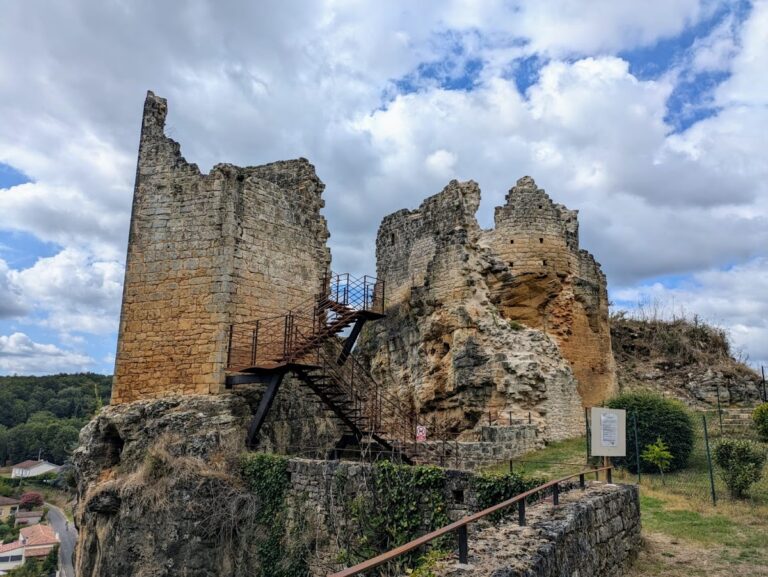
The bailey was bounded partly by the keep and the southern section of the high-court enceinte, and partly by a straight fortified wall with arrow slits. Its principal gate stood at the southern end of this wall within a small square tower that is partly ruined.
The surviving bailey wall runs approximately north to south. It is about 44 metres long, 1.2 to 1.4 metres thick, and approximately 3.5 metres high, excluding its lost crenellation. Eight cruciform arrow slits with stirrups pierce the wall. A wall-walk was reached by a stair beside the entrance tower, and this route probably also led to the guardhouse.
Moat and Western Wall
The bailey wall overlooks a rock-cut moat approximately 24 metres wide and up to 6.5 metres deep at its northern end. Together, the wall and moat formed a vertical obstacle of about 10 metres. The rocky sides also hindered attempts to undermine the defences.
A wall extends westward from the bailey gate for about 40 metres towards the remains of a possible lookout turret. A small, slightly projecting rounded masonry base survives, and the feature was still shown on cadastral plans in 1827. A gun aperture exposed during vegetation clearance lies about six metres from the base. It is approximately one metre high, 80 centimetres wide, and strongly splayed outward.
The lower part of the wall around the aperture uses homogeneous, well-jointed, squared masonry resembling the thirteenth-century fabric. The upper or replacement section uses more loosely jointed, less carefully dressed stone. The aperture indicates that the ground level was higher in the fifteenth century, and certainly also in the thirteenth century, than it is now.
Residential and Water Installations
Residential Buildings
Part of the thirteenth-century lodging survives above the gate, including a large first-floor fireplace. Two large first-floor corbels probably supported a balcony and are associated with fifteenth-century alterations.
A section of the fifteenth-century residential range survives beside the earlier lodging. It includes a small stair tower with a spiral staircase. Beam holes mark two floors, and the staircase appears to continue towards a possible third floor, although that level has been destroyed. A row of beam holes along the inner face of the southern wall may mark a former floor, while a row of corbels may have supported another floor or a roof structure.
Cisterns and Water Supply
A large cistern stands at the foot of the north tower against the northeastern enceinte. Rainwater entered through a large circular opening in its roof. A short stair descended to the buried base, where an opening about 50 centimetres above the floor served as a water outlet. The castle also had a well and another open-air cistern in the courtyard. Corbels above the large cistern indicate former structures, probably domestic, at that level.
Defensive Openings
The castle contains 21 recorded arrow slits, excluding narrow vertical openings in stairways that provided light. All are set within deep, broad niches. Nine double cruciform arrow slits with stirrups occur in the bailey enceinte, while another is located on the first floor of the north tower. Three inverted-paddle openings with stirrups are found on the west tower’s ground floor. The surviving gun apertures in the bailey form a further element of the fortress’s later defensive arrangements.