Château de Rochebrune: A Medieval Moated Castle in France


Site at a Glance
- Rating
- 4.4
- Popularity
- Low
- Country
- France
- Primary era
- Medieval
- External website
- Open
- Eras represented
- Medieval, Early Modern
- Civilizations
- Duchy of Aquitaine, French
- Site type
- Military
- Remains
- Castle
On this page9 sections
History
Château de Rochebrune is a medieval moated castle in France, located at Rochebrune in Étagnac, in the Charente department of Nouvelle-Aquitaine. It originated during the period of the First Crusades and occupied a strategic crossroads between routes leading from Limoges, Angoulême, and Niort. The area historically belonged to Limousin.
Foundation and medieval expansion
Jourdain I de Chabanais commissioned the castle’s first tower before leaving for Jerusalem, where he died in 1099. About a century later, three further towers were added. Jourdain’s descendants then enlarged the fortress in stages, creating the complex that survives in substantially expanded form.
Wars of Religion and rebuilding
In 1561, during the French Wars of Religion, a series of sixteenth-century conflicts between Catholics and Protestants, Rochebrune passed to Blaise de Montesquiou, better known as Blaise de Montluc. A Catholic military commander and Marshal of France, he used Rochebrune as part of a defensive line formed with Chabanais and Confolens against Protestant forces advancing from the south.
Protestant forces burned the castle in 1569. Blaise de Montluc’s daughter-in-law later made it habitable by introducing openings into the façades. Before this alteration, the walls carried a continuous wall-walk, a passage along the top of a defensive wall, linking the four towers.
The Colbert-Chabanais and modern estate
Rochebrune subsequently passed by marriage to the Escoubleau de Sourdis family. In the following generation, Angélique Charlotte d’Escoubleau de Sourdis of Chabanais married François-Gilbert Colbert, Marquis de Saint-Pouange. Their marriage contract prompted Louis XIV, the Bourbon king of France, to raise the Chabanais estates to a marquisate in 1702. A marquisate was a territorial lordship governed by a marquis. The Colbert-Chabanais family later enlarged the castle’s windows.
During the eighteenth century, the former drawbridge was replaced by the broad bridge that now provides access to the residence. Pierre Dupont de l’Étang, a count, an officer under Napoleon, and a general of the Empire, acquired Rochebrune in 1805. His grandson, who had no descendants, left the property to his cousin, the Count of Richemont, whose family includes Henri de Richemont, the current owner. A park was planted during the First Empire, Napoleon Bonaparte’s imperial regime in France, conventionally dated from 1804 to 1814–1815.
The castle’s façades and roofs, its moat, and the eastern outbuildings have been protected as historical monuments since 24 June 1959.
Remains
Castle layout and defensive fabric
Main wings and corner towers
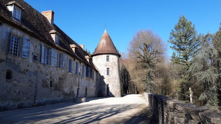
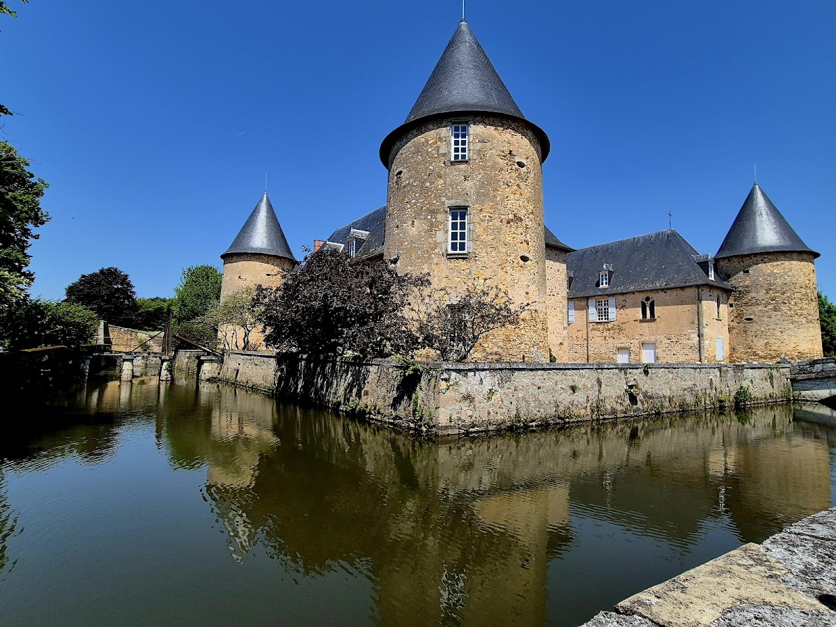
Château de Rochebrune stands on a small plateau about 261 metres above sea level, roughly 500 metres east of the centre of Étagnac. Three two-storey wings form a north-northeast-oriented rectangle measuring approximately 43 by 36 metres. Four round corner towers, each about 9 metres in diameter, flank the complex. Their walls are about 2 metres thick, and their loopholes, narrow openings for observation or outward fire, were arranged so that the combined fields of fire left no dead angles for defenders.
The main wings have two-pitched roofs covered with slate. These replaced the original flat tiles. The corner towers retain conical pepper-pot roofs, small pointed roofs characteristic of turret forms. A fourth wing once enclosed the courtyard, but it was demolished in 1808. Large window openings were later made in the surviving wings, reflecting the castle’s adaptation from a more enclosed defensive structure to a residence.
Moat, bridge, and outbuildings
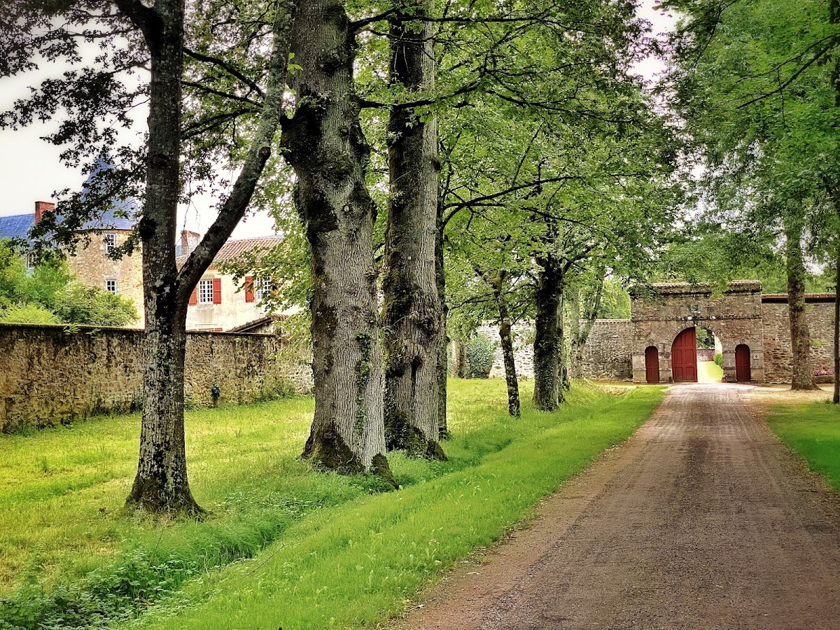
A water-filled moat surrounds the entire castle and measures approximately 5 to 10 metres in width. Eastern outbuildings stand in front of the moat. The former drawbridge was replaced in the eighteenth century by a broad bridge, which forms the present approach to the residence.
Setting and interior evidence
The castle occupies the approximately 305-million-year-old Chirac-Étagnac Granite, a medium-grained biotite granite formed during the Upper Carboniferous period. Along the eastern side, this granite meets paragneisses belonging to the Limousin Upper Gneiss Nappe. These rocks have a southeast-trending, steeply northeast-dipping foliation, meaning a visible alignment within the rock, and were thrust over the Lower Gneiss Nappe about 500 metres farther south.
The Ruisseau de l’Étang drains eastward towards the Vienne, which flows about 4 kilometres south at an elevation of approximately 161 metres. Within the castle, a painted ceiling dated 1581 survives in the lower level. It bears the coats of arms of the Montluc and Rochechouart families, preserving a direct heraldic connection with the sixteenth-century history of the building.
Nearby sites