Cassinomagus Archaeological Park: A Gallo-Roman Monumental Complex in France


Site at a Glance
- Rating
- 4.5
- Popularity
- Low
- Country
- France
- Primary era
- Classical
- External website
- Open
- Eras represented
- Iron Age, Classical
- Civilizations
- Roman
- Site type
- City
On this page20 sections
History
Cassinomagus Archaeological Park in France preserves the remains of a Gallo-Roman settlement at Chassenon, whose monumental complex developed between the first and fourth centuries AD. The ancient settlement occupied the western part of the territory of the Lemovices, near the lands of the Pictones, Santones, and Petrocores, and its name appears on the Peutinger Map, a medieval copy of an ancient Roman road map. Its position at the meeting point of several routes helped connect it with Saintes, Lyon, Périgueux, Poitiers, Aulnay, and Limoges, the regional capital, by road and river.
Before the Roman settlement
Human activity at Chassenon began in the Stone Age. The most substantial pre-Roman evidence belongs to the later Iron Age, especially the second half of the first century BC. Two V-shaped boundary ditches, postholes, ceramics, imported wine amphora fragments, an ard share, an iron socketed chisel, and daub indicate an established occupation. One ditch filled rapidly, while the richer pottery collection may point to a high-status settlement, ceremonial drinking, or aristocratic burials.
These Iron Age ditches lay east of the later baths. Their alignment may have influenced the course of the Roman aqueduct, although that relationship remains uncertain. Two paired structures east of the future bathing complex may also represent pre-Roman sanctuaries. Activity continued around the turn of the first century AD, including a timber-and-earth building south of the aqueduct that preceded later Gallo-Roman housing. A well with a northward gallery may have supplied a basin between the future baths and the paired structures.
Expansion under Rome
The Gallo-Roman settlement began to expand in the late first or early second century AD. By the second century, it covered about 140 hectares, including areas of low-density occupation. Its monumental center occupied approximately 20 hectares, while residential and craft districts extended mainly to the north-west, east, and south. The public complex brought together the Montélu sanctuary, a large bathing establishment, paired temple-like buildings, an amphitheatre, and an aqueduct.
Cassinomagus stood within a network of Gallic territories whose principal communities were centered at Limoges, Poitiers, Saintes, and Périgueux. Its roads included the Agrippa Road between Saintes and Lyon, a route crossing the Vienne near Pilas between Périgueux and Poitiers, and another road toward Aulnay. The settlement also maintained connections with Limoges by both land and water, strengthening its position within the region.
The baths were constructed from around AD 90 and developed through successive stages for roughly 80 to 90 years, reaching completion around AD 180. Their construction formed part of the wider growth of the monumental center. The settlement began to decline from the start of the third century, and its principal public buildings had been abandoned by the end of that century. A fire damaged the baths around AD 275 to 280, possibly in connection with inadequate maintenance.
After the Roman period
Following the Gallo-Roman period, surviving inhabitants concentrated near the cemetery and church. Stone from the ancient monuments was reused in buildings across the surrounding area. A post-Roman structure occupied the northern gymnasium of the baths and continued in use into the sixth century. Materials from the ruins were also incorporated into an early medieval church.
The name Cassinomagus may combine a Gaulish word associated with oak with magos, a term that meant “plain” and later “market,” producing the possible meanings “oak field” or “oak market.” Another explanation derives the first element from the personal name Cassinus. The later name Longeas became locally associated with the elongated underground spaces of the baths, which were once mistaken for a palace or a governor’s residence. The bathing complex itself was initially described as a palace or as “caves.”
Excavation and protection
Jean-Henri Michon began the first major excavations at Chassenon in 1844, preparing early plans and publishing accounts of the settlement. The Montélu sanctuary was excavated in 1844 and 1845. Late nineteenth-century investigations by the Société des Amis des sciences et des arts de Rochechouart and other scholars examined eight wells and parts of the sanctuary, the performance building, and the baths between 1889 and 1901.
Agricultural work led to the demolition of the surviving upper structures of the baths and temple in 1888. Stone quarrying also damaged the ancient performance building until the 1930s. The amphitheatre remains received protection as a historical monument in 1936. Renewed research began in 1958 under Jean-Henri Moreau, who identified the Longeas ruins as public baths in 1961. He investigated their underground wastewater circulation and helped consolidate the remains and protect them from water. Protective roofs were installed over the baths during the 1970s.
The Department of Charente acquired land held by the local archaeological association in 1984 and progressively purchased additional parcels from 1985. Geophysical and field surveys later clarified the extent and organization of Cassinomagus and identified occupation or reoccupation during the fifth and sixth centuries. A research initiative launched in 2003 led to the creation of a 28-hectare archaeological reserve. The site expanded from 2006, the amphitheatre land passed to the Department of Charente in 2007, and an administrative public institution was established in 2008 to manage the developing archaeological park. Direct departmental administration took over in 2016.
Research since 2003 has considered the entire monumental and natural setting, with particular attention to the supply, distribution, and evacuation of water. A collective program begun in 2011 and extended through 2018 examined chronology, organization, building methods, and the functions of less well-understood structures. Annual excavations have continued through departmental and university partnerships. In 2011, approximately 35,000 photographs were used to create three-dimensional models of the baths. The ancient settlement and its archaeological remains were classified as a single protected site in 2023, alongside earlier historical-monument protections for individual structures.
Remains
The monumental enclosure
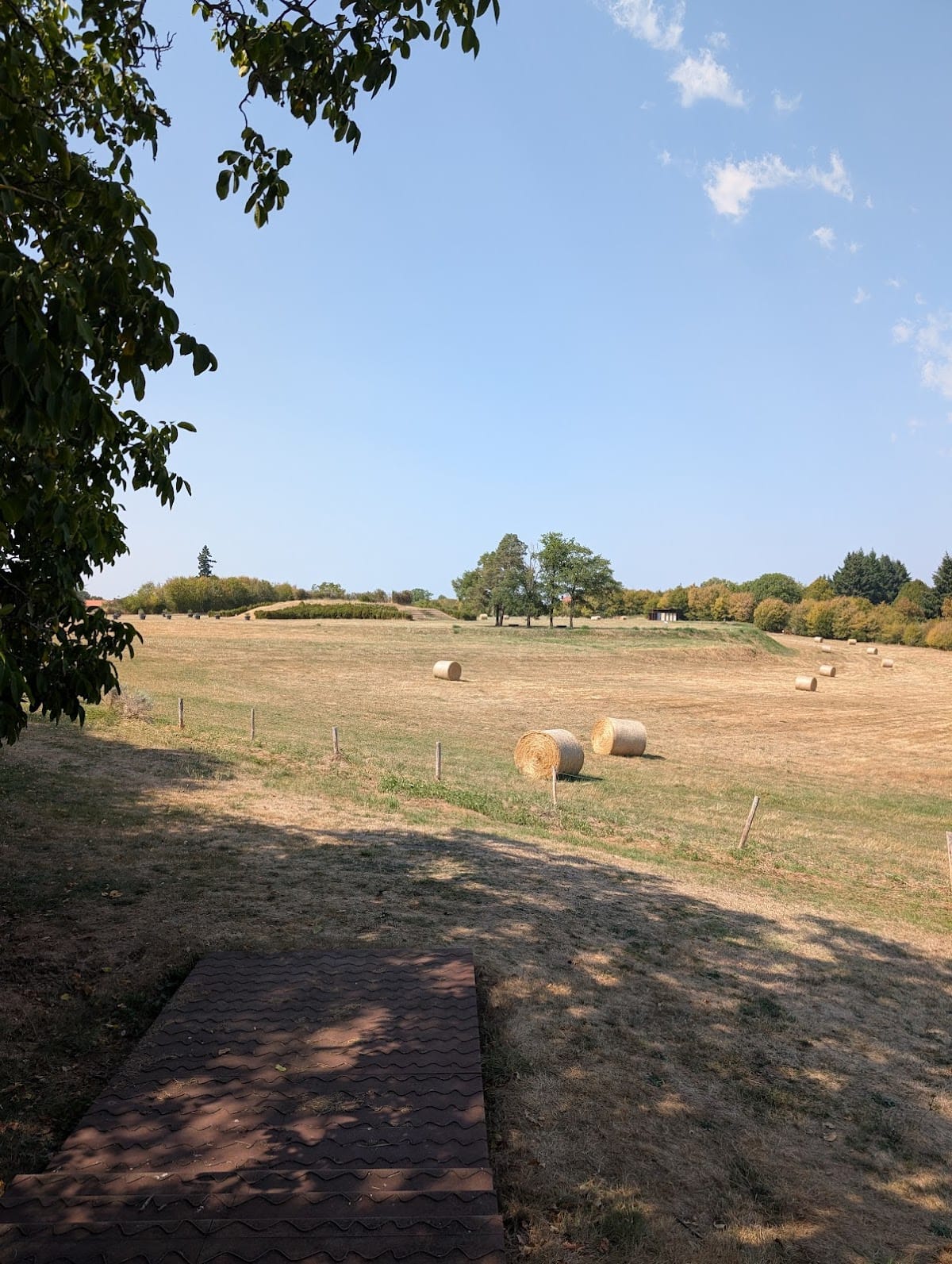
The monumental complex occupies a plateau bordered by the Vienne to the north and by the southern end of a valley about 1.2 kilometres long. Its principal buildings were concentrated south-east of modern Chassenon. Within an enclosure of about 20 hectares, the Montélu temple stood to the west, the baths occupied the center, and two paired structures stood to the east. The amphitheatre lay north of the temple. A double wall, probably incorporating a portico about 6.30 metres wide, separated the amphitheatre from the temple and baths. The aqueduct marked the southern edge of the enclosure, with residential districts beyond it.
Baths of Longeas
The baths of Chassenon, also called the baths of Longeas, form a roughly square complex about 120 metres on each side and cover approximately 12,500 square metres. They were built on two levels, with technical rooms below and bathing areas above. Some walls survive to about seven metres, making the complex exceptionally well preserved. The design is a symmetrical double bath organized along an east-west axis. Two looped circuits began near the center and ended at opposite ends of the building, with a therapeutic route to the south and a hygienic route to the north. The northern circuit also accommodated ritual washing before entry into the Montélu sanctuary.
The baths were raised and levelled over about two hectares. Vaulted rooms supported the western side, where the ground sloped, while fill raised the eastern side. Construction proceeded in stages, with several teams building the supporting vaults using temporary timber supports and formwork. Load-bearing walls and lower rooms were followed closely by furnaces and pools. The southern half was built first, while the northern side was drained or constructed; after the northern rooms were completed, decoration in the southern rooms was renewed.
Bathing rooms and water systems
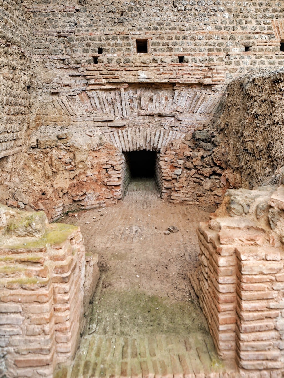
The two hot pools of the southern therapeutic circuit each measure about 15 by 10 metres. Their rooms contain small brick channels that carried heated air upward, alongside walls with brick ledges that raised the circulation floor to the level of adjoining rooms. Each pool room had a praefurnium, the furnace opening that supplied heat, in its eastern wall. The southern entrance area included a gymnasium, or palaestra, and corresponding spaces occupied the northern side.
A cold pool, or natatio, and an adjoining room extended from the south-eastern side, where Longeas Road partly cuts through the remains. A vestibule, entrance portico, and probably an access staircase occupied the eastern side. A small alveus, or bathing basin, adjoined the south-eastern corner of the cold room, while a previously unidentified north-eastern room measured about 40 by 15 metres. The complex also contained interconnected systems for supplying water, managing overflow, draining rooms, and carrying wastewater underground.
Montélu sanctuary
The Montélu temple, also called the Chenevières sanctuary, stood on an esplanade about 50 metres in diameter. Its outer structure was octagonal, approximately 18 metres across, and built from cement and irregular rubble. It rose 2.94 metres above the tuff bedrock, or about two metres above the surrounding ground. Four ramps or stairways at the cardinal points led to a broad surrounding gallery. At the center, the cella, the temple’s principal sacred chamber, had a circular interior and an octagonal exterior.
Rectangular marble slabs survive in the floor, alternating between veined red marble and grey-white micaceous marble. A plinth of cipolin marble lined the walls, while marble revetment covered the pilasters and perhaps the lower walls. Excavations recovered fragments of fluted pilasters, mouldings, cornices, and plaques of Eastern porphyry and ophite. Building the temple required major terracing on its eastern side. In places, the fill reached two metres, and the north-eastern retaining wall incorporated relieving arches.
Amphitheatre
The amphitheatre, locally called La Lena, survives mainly at ground-floor level. Its galleries provided access for animals entering the arena. Estimates of its original form include an ellipse about 60 by 40 metres, a horseshoe-shaped plan about 70 metres across with a 50-metre stage, and a circular outline about 80 metres in diameter indicated by magnetic survey. The eastern and south-eastern sides were cut into bedrock to form seating, while the opposite side was raised on a 22-metre-wide mass of stone set in cement. Seating and much of the large outer stone facing were removed.
A vaulted branch of the village aqueduct reached the center of the stage. When recorded in 1937, its channel measured about 70 to 120 centimetres wide, 3.50 metres deep, and at least 71 metres long. The amphitheatre’s land was transferred to the Department of Charente in 2007 after decades of archaeological investigation and protection.
Aqueduct and entrances
The principal aqueduct, built in the late first or early second century AD, supplied the monumental buildings, including the baths. It ran generally from east to west, with its source to the east. Near the complex, it first passed through a tunnel and then continued for 190 metres in a trench beneath a masonry vault that sometimes reached two metres in internal height. About 200 metres from the baths, it became elevated and turned slightly north.
The elevated section followed a 32-metre parapet wall and then crossed a 180-metre bridge carried by 44 piers. Two piers survive, and the bridge reached about ten metres in height. A further parapet wall continued the channel for 240 metres. Near the Montélu temple, the main line turned 92 degrees north and continued for 8.45 metres, ending 50 metres from the temple’s south-eastern corner. A distribution basin divided the water between two branches, one running west to the temple and the other east to the baths.
Seven cart passages passed beneath the aqueduct’s arches south-east of the enclosure. A small pedestrian entrance opened onto the principal façade of the baths, while a separate two-arched pedestrian entrance was built into the western branch of a secondary aqueduct.
Other structures and settlement districts
Paired temples and southern features
The paired structures east of the baths are interpreted as temples or fana, Gallo-Roman sanctuaries consisting of a central chamber surrounded by a gallery. Other monumental buildings were detected north and east of them. A magnetic survey also identified a building about 30 by 22 metres approximately 150 metres east of the amphitheatre. South of the Montélu temple, 49 cylindrical pits were arranged in seven rows of seven. Each was about 1.2 metres deep, and small channels may have linked them to a collecting conduit. Champonger Road cuts through this complex.
Residential quarters and wells
Residential areas extended to the north-west, east, and south of the monumental center. Several quarters occupied the southern part of the settlement, including two west of Champonger Road and two east of it beside the southern side of the aqueduct. At Les Coutis, excavations and ploughing brought to light wall-plaster spacers, vaulted heating bricks, and seven wells. Eleven wells were identified at Pré Roby.
The wells were generally cylindrical, measuring between one and 1.80 metres across. Some had square rims, including one covered by a square slab 1.80 metres wide, while another had a rim made from four triangular slabs. Their recorded depths ranged from one to 10.80 metres. Finds included complete vessels, tiles, loom weights, decorated pottery, metal fragments, coins, animal bones, a gold ring, and a gold leaf. A seated Celtic deity statue came from a well near Coldebœuf Farm.
Objects from Les Coutis
Well 12 at Les Coutis contained a carved wooden object associated with spinning or weaving. Warping in wet ground reduced its surviving length to 18.5 centimetres, although it probably measured about 21 centimetres originally. One end is thickened, while the other bears a carved rooster. Transverse grooves and mouldings resemble objects interpreted as distaffs from female or child burials. The wood was once identified as boxwood, though maple is also possible. The well also contained a second knotted wooden rod of similar size, pierced at both ends.
Well 13 held 13 jugs throughout its fill, including one marked “TOVTI,” together with a patera, a shallow vessel used for pouring or serving liquids, and a large bronze coin of Antoninus dating from AD 138 to 161. Animal remains from the wells included horse, cattle, deer, and goat bones, as well as dog skulls.
Cemetery and quarries
The old cemetery along the D29 contains numerous Gallo-Roman Christian graves. Sarcophagi were reused in the eleventh century as building material in the walls of other structures. Many were destroyed when the cemetery wall was rebuilt in 1892.
At least eight impactite quarries were identified at Chassenon. Impactite is rock altered, melted, or ejected by a meteorite impact. At least three quarries have an ancient origin. The Trous et les Vignes quarries lay about 500 metres south of Longeas, while the Grande Pièce quarry stood about 500 metres south-east of them and later supplied impactite for restoration work on the baths. The Mouillères quarry also produced an unfinished millstone about 1.40 metres in diameter.
Building materials and decoration
Impactite was used widely in the baths and other Gallo-Roman monuments, as well as in later local buildings. Granite blocks used for the hot-pool door frames came from the Cognac-la-Forêt massif about 40 kilometres east. Limestone wall and floor slabs came from the La Rochefoucauld region about 40 kilometres south-west. River transport probably carried these materials where possible.
The ancient buildings generally used a granite-derived sand mixed into lime mortar in a consistent proportion of one part lime to three or four parts sand. The baths employed 22 standardized brick modules for walls, vaults, pools, and heating systems. Rectangular bricks measured about 31.5 to 50 centimetres long and 23 to 33 centimetres wide. Grooved bricks were used systematically on pool steps and may also have served in ceilings, vaults, damp-room linings, and partitions. Hollow heating bricks carried comb marks made with tools having either 14 or six teeth.
Building EA42
Building EA42, known as the Building with Rosettes, was excavated immediately east of the seven cart passages in 2007. It was attached along one short side to the north side of the aqueduct and was the only known non-monumental building inside the monumental enclosure. Its foundations were shallower than those of the aqueduct, showing that the building was later, although its western wall was anchored into the aqueduct.
EA42 had a trapezoidal plan and painted interior decoration. Ochre-red corners framed a dark burgundy-red dado, above which green foliage appeared in four shades. The ceiling carried a white-ground geometric pattern of red, green, brown, and black circles and squares. Two-tone rosettes filled some circles, whose depressed centers suggest that a compass was used. The pigments included carbon black, glauconite greens, calcite, and Egyptian blue. The decoration was carefully made but not especially luxurious.
Other excavated buildings
Building EA21 stood opposite EA42 on the south side of the aqueduct without being attached to it. South-west of the Montélu temple, aerial survey identified buildings on both sides of the southern road, including a large quadrangular space and a circular building about 13 metres in diameter with radial structures and possible wells. Interpretations of this group include a temple and a market building.
Two large buildings were formerly excavated in the north-west of Cassinomagus, where two roads met. One may have been a public warehouse or a roadside stopping place, with excavated foundations extending for about 450 metres. The other stood beside a stream descending from the Chassenon fountain. Its masonry walls were 1.60 metres thick and survived to three metres high; it was proposed as a bath building, although that interpretation remains unverified.
The archaeological park now encompasses the baths, aqueduct, and temple remains within approximately 20 hectares. Its physical setting also includes the archaeological deposit and the Botanical Garden of Pliny, where plants used by the Gallo-Romans are cultivated.