Castello di Alboino: The Fortified Citadel of Feltre
Site at a Glance
- Rating
- 4.2
- Popularity
- Very Low
- Country
- Italy
- Primary era
- Medieval
- Eras represented
- Medieval, Early Modern, Modern
- Civilizations
- Habsburg, Venetian
- Site type
- Military
- Remains
- Castle
On this page16 sections
History
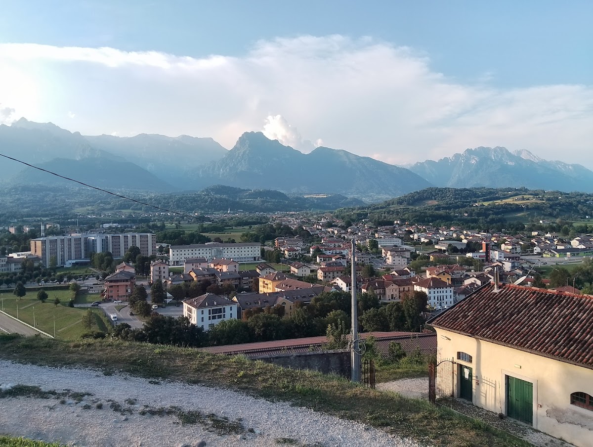
Castello di Alboino is a fortified complex in Feltre, Italy, traditionally associated with a Lombard construction around 570 on the highest point of the Colle delle Capre. Its position within the citadel helped defend a city set at the meeting point of the Valbelluna, the Piave corridor, the Primiero valley, the Valsugana, and the Valbrenta. The castle’s strategic importance continued through the medieval period, although the earliest secure references to it date from the eleventh century.
Lombard origins and medieval defence
Local tradition attributes the first construction to Alboin, the sixth-century Lombard king linked with the Lombard conquest of northern Italy. Earlier Roman fortifications may have occupied the site, but the Lombard foundation remains a tradition rather than a confirmed fact. The present name is also a later attribution. It is considered incorrect because Alboin did not pass through Feltre and therefore could not have ordered the construction of the castle.
During the Middle Ages, the fortification formed part of a wider warning system along the Piave corridor. Military positions extended from the area of the Sanctuary of Saints Victor and Corona toward the Venetian plain, maintaining visual links across the landscape. Smoke signals could carry warnings from one position to another, and this system remained in use throughout the medieval period.
The castle became especially important during the thirteenth and fourteenth centuries, when Feltre was successively contested by the Da Romano, the Carraresi, the Scaligeri, the Holy Roman Empire, and the Visconti. The Scaligeri, also known as the della Scala dynasty, ruled Verona and controlled Feltre for part of the fourteenth century. A bas-relief dated 1324, bearing the arms of Cangrande della Scala, reflects that period of political control.
Venetian rule and the destruction of 1510
In 1404, Feltre transferred its territory and sovereignty to the Republic of Venice, the maritime and territorial state that governed much of northeastern Italy. The city retained its existing political institutions. When Venice reorganized its military system in 1421 and ordered the destruction of many castles, Feltre’s fortification was spared because of the city’s strategic position near the Tyrolean border.
Venetian rule brought a period of peace that reduced the castle’s military importance. For about three centuries, the complex was underused and converted into an arsenal. Shortly after the War of the League of Cambrai, an anti-Venetian alliance whose conflict affected much of northeastern Italy, parts of the castle were also used temporarily for civic meetings while the Palazzo Pretorio was completed in 1533.
In 1510, troops commanded by Maximilian I burned Feltre during the War of the League of Cambrai. Maximilian I was the Holy Roman Emperor from 1493 to 1519. Much of the city was built of wood and was destroyed by the fire, while the castle survived along with a small number of other monuments. Feltre was later rebuilt according to rational Renaissance principles, leaving the fortification as one of the reminders of the medieval city.
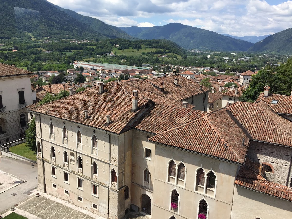
The fire altered the castle’s entrance and reduced its extent. Several lines of late-medieval walls had run parallel to modern Via Luzzo, but many sections were demolished after the disaster. The sixteenth century also brought the construction of the Rectors’ lodging beside the clock tower. Lorenzo Luzzo, an Italian painter also known as Morto da Feltre, decorated the exterior and interior of the castle’s main body in 1518.
Decline, refurbishment, and changing uses
Seventeenth-century drawings show the surviving medieval enclosure walls in a ruinous condition, reflecting the loss of their defensive function. During the nineteenth century, under Austrian rule, the complex was refurbished and a new northern wing was added. The wing belongs to a later phase than the main body, although it was integrated into the overall appearance of the castle.
In the twentieth century, ownership and control of the complex became divided among the state, military authorities, and private owners. This fragmentation continues to complicate complete acquisition and restoration. During the 1960s, parts of the castle were converted into a youth hostel. The Torre dell’Orologio housed Radio Feltre, while other rooms became private dwellings.
Conservation in the modern period
Castello di Alboino is recognized as Italian national heritage. The towers have undergone restoration, while the main body awaits further intervention. The crescent-shaped weather vane was restored in 2017. The Torre dell’Orologio was restored and opened to visitors in 2018, and the Torre del Campanon was restored between 2020 and 2021.
On 29 and 30 October 2018, the Vaia storm uprooted trees around the fortification and damaged some wall surfaces. A project to reorganize the surrounding area and the affected section of Bosco drio le Rive began in 2020, addressing both the woodland and the masonry affected by the storm.
Remains
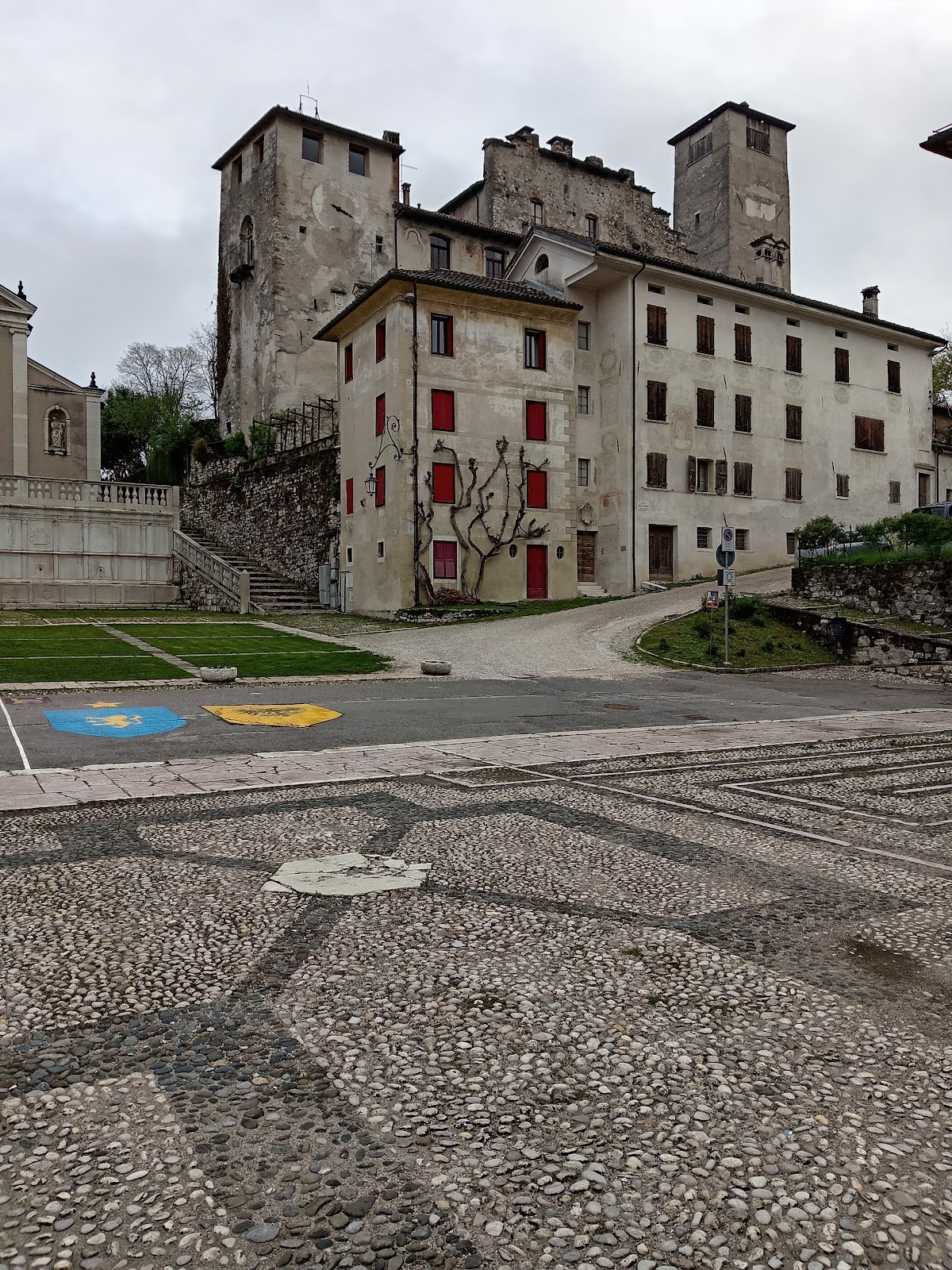
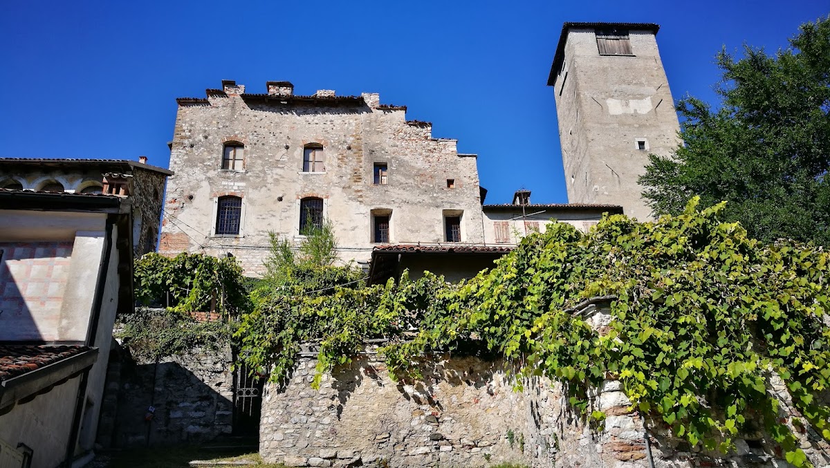
Built from brick and local stone, the complex rises in a layered arrangement on the summit of the Colle delle Capre. Its surviving form combines the medieval defensive core with later changes, including the nineteenth-century northern wing. The castle once occupied a larger fortified area with several wall circuits, while the present remains are concentrated around the two surviving towers, the main body, the former central court, and sections of the hillside enclosure.
Surviving towers and defensive circuits
Torre dell’Orologio
The former entrance stood on the western side of the Torre dell’Orologio. An earthwork occupied the area corresponding to the forecourt of San Rocco, and a drawbridge crossed the moat around the fortification. Vertical marks on the tower’s western face still outline the original arched portal. A bas-relief dated 1324 is set into the tower and carries the coat of arms of Cangrande della Scala.
After the 1510 fire, the entrance was altered and access developed from Salita Ramponi. The Rectors’ lodging was built beside the tower during the sixteenth century, and fragments of its exterior frescoes remain. The summit carries a crescent-shaped weather vane of Middle Eastern origin. Its route to Feltre is unknown, while the idea that it was captured at the Battle of Lepanto in 1571 conflicts with seventeenth-century drawings showing a small bell on the tower. The crescent is more plausibly connected with the late nineteenth century, when it first began to be mentioned.
During the First World War, Austro-Hungarian soldiers used the crescent as a target. Gunfire and weather split it in two, and it remained damaged until 2017. The restored original is now kept in a case inside the tower, while a copy stands at the summit. Corroded parts were replaced so that the weather vane could again indicate wind direction. The restored tower also contains an interactive presentation of the successive rebuilding phases of Piazza Maggiore after the 1510 fire and provides views over the square.
Torre del Campanon
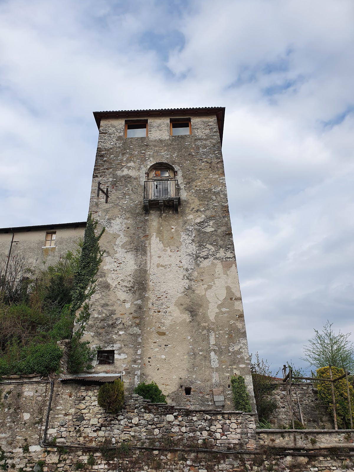
The Torre del Campanon is the castle’s keep, the principal fortified tower and a strong defensive and administrative centre. It rises approximately 35 metres and takes its name from the large bell housed within it. The bell traditionally announced the beginning of capital executions and civic assemblies. The present bell dates from 1664, identifies Bormio as its place of casting, and continued to call meetings of the municipal council until 1970.
Above the entrance is a bas-relief with three coats of arms. The shield on the right belongs to the della Scala dynasty, which ruled Feltre during part of the fourteenth century. The central shield represents the city, while the meaning of the shield on the left remains unknown. On the southern side, about 25 metres above the ground, a lighter area of plaster marks the former position of a large fresco depicting the Lion of Saint Mark. Morto da Feltre probably painted it in 1518, and it was later removed during the French period of Napoleonic rule.
Enclosure walls
The Torre dell’Orologio and Torre del Campanon are the last surviving towers of a larger series visible in seventeenth-century drawings, when the remaining structures were already in precarious condition. An outer enclosure linked the clock tower with three other similar structures, while an inner enclosure surrounded the keep and the main body of the castle. Sections of these former wall systems survive around the complex and help indicate its earlier scale.
Central court and castle buildings
Former central court and wellhead
The former central court is reached from the end of Salita Ramponi and by an unpaved road along the hillside, laid out during the nineteenth century. A wellhead probably dating from the late Middle Ages stands in the court. Although it appears buried, its substructures remain intact and were built using Venetian construction methods.
Main body and northern wing
The main body has a broad façade of pale limestone, four substantial squared Guelph merlons, and a stepped profile along its side. Guelph merlons are squared crenellations traditionally associated with the Guelph political faction. The building contains a private chapel, a kitchen hall, and an armoury. The frescoes painted by Lorenzo Luzzo in 1518 are almost entirely lost on the exterior, while a considerable number survive inside.
The northern wing was added during the nineteenth-century refurbishment under Austrian rule. It is not contemporary with the main body, but its design was made to fit visually with the older structure. Together, the two parts preserve the castle’s transition from a medieval military complex to a refurbished and partly residential building.
Hill slopes and woodland
Northern slope
The steep northern side of the Colle delle Capre historically carried no buildings. Sections of the former defensive walls remain visible along the slope, which was later used for grazing sheep after the fortifications declined.
Bosco drio le Rive
During the Fascist period, the slope was planted as an arboretum called Bosco Littorio. After the Second World War, it became a vertical urban park known as Bosco drio le Rive. Trees extended up to the summit and surrounded the castle until the Vaia storm of 2018 uprooted them and damaged parts of the masonry. The resulting reorganization project, begun in 2020, concerns the woodland and the affected sections of the fortification.