Carnac Stones: Prehistoric Alignments and Burial Monuments in France
Site at a Glance
- Popularity
- Very High
- Country
- France
- Primary era
- Stone Age
- Eras represented
- Stone Age, Modern
- Civilizations
- French
- Site type
- Religious
- Remains
- Sanctuary
On this page30 sections
History
The Carnac stones are a complex of prehistoric standing-stone rows and burial monuments at Carnac, France. The stones were erected during the Neolithic, the later Stone Age, with many probably raised around 3300 BC and some monuments possibly dating to about 4500 BC. Their builders are often described as pre-Celtic, but their cultural identity remains debated. One interpretation associates them with Mesolithic hunter-gatherers rather than Neolithic farming communities.
Prehistoric monuments and later traditions
The four principal alignments, Ménec, Kermario, Kerlescan, and Petit-Ménec, may once have formed a visually continuous complex. Stone removal for reuse and the planting of pine woods in the twentieth century contributed to their present separation. The wider group also includes burial mounds and stone tombs.
Three large burial mounds in the Carnac–Morbihan area, Saint-Michel, Tumiac, and Mané-er-Hroëk, date to the middle of the fifth millennium BC. Each held a burial chamber for one person. Their scale, grave goods, and construction effort have been interpreted as evidence of elite burials, perhaps including rulers.
Local Christian and other legends offer later explanations for the stones. In one tradition, Saint Cornelius, an early pope, turned pagan soldiers pursuing him to stone. Another says that Merlin, a magician in Arthurian legend, transformed a Roman legion into the straight rows. These stories belong to the monuments’ later cultural history, not to accounts of their prehistoric construction.
Interpretation and early archaeological study
Interest in explaining the alignments grew from the 1720s. In 1732, André-François Boureau-Deslandes attributed them to the biblical Flood. Royer de la Sauvagère proposed a Roman military camp in 1755, an explanation Anne-Claude de Caylus rejected in 1764. Later proposals connected the rows with gatherings of Druids, religious specialists in ancient Celtic societies, or with religious and astronomical purposes. These ideas remain interpretations rather than established explanations.
Early surveys included Jean-Baptiste-Joseph Jorand’s topographical work in 1823 and Murray Vicars’s regional plan in 1832. Francis Ronalds and Alexander Blair surveyed the stones in 1834, and Ronalds made accurate drawings. Prosper Mérimée, a French inspector of historic monuments, examined the alignments that year and described them in 1835. The monuments appeared on France’s first list of endangered historic monuments in 1840.
James Miln carried out extensive excavations during the 1860s and reported that fewer than 700 of roughly 3,000 stones remained standing. From about 1875, local archaeologist Zacharie Le Rouzic worked with Miln and learned through fieldwork. Miln’s results went to the town, where his brother Robert founded a museum for the finds. Le Rouzic later directed the museum and left his own research results to the town; the museum now bears both men’s names. Miln excavated the Kermario alignment in 1877–78.
Research continued to advance different explanations for the arrangement of the stones. In 1887, H. de Cleuziou proposed a relationship between the rows and the directions of sunsets at the solstices. Between 1970 and 1974, Alexander Thom and his son Archie surveyed the alignments and argued for astronomical planning and a standard unit they called the megalithic yard. That proposed unit and Thom’s measurement theory have been challenged. Another hypothesis suggested that dolmens might have served as primitive earthquake detectors.
Protection, disturbance, and conservation
The French state established a commission for megalithic monuments in 1879 to acquire major sites in Brittany. It gained the power to expropriate sites in 1887, and the Ménec, Kermario, and Kerlescan alignments were listed as historic monuments in 1889. The state acquired and catalogued further monuments in the early twentieth century as protection against quarrying.
During the German occupation of France in the Second World War, archaeologists working through the German Archaeological Institute studied the alignments to support a theory of influence from northern populations. Nazi ideologue Alfred Rosenberg oversaw the work, which received German air force assistance with topographical surveys.
Construction work altered some of the stones in the 1930s and 1980s, when bulldozers rearranged stones and set others upright to make way for roads and other structures. A road plan approved in 1947 would have crossed the southern part of the Ménec alignment. After disputes began with construction in 1953, the road was diverted to the south, but archaeological layers and southern rows were damaged.
The Ministry of Culture renewed conservation efforts in 1984. In 1991, the Mission Carnac was established to guide research, conservation planning, and management of the alignments, including limits on public access. Fencing encouraged vegetation growth, and sheep grazing was later used to control weeds. Management decisions and access remained contested; protests in 2002 called for local input and an end to the plans then in place.
Recent damage and international recognition
In 2023, construction of a do-it-yourself store at Montaubin led to the destruction of 39 standing stones. The site lies outside the UNESCO-protected area and is separate from the main Ménec and Kermario sites. A building permit had been issued in 2022. The mayor, Olivier Lepick, defended the decision on legal and archaeological grounds, while cultural officials said that only four stones might have archaeological value. The Koun Breizh association filed a complaint alleging deliberate destruction of archaeological heritage.
In 2025, the Carnac stones became part of the UNESCO World Heritage property Megaliths of Carnac and of the shores of Morbihan. The property includes 550 monuments in 28 towns and villages and meets criteria recognizing human creative achievement and an outstanding architectural ensemble or landscape illustrating a stage of human history.
Remains
Layout and construction
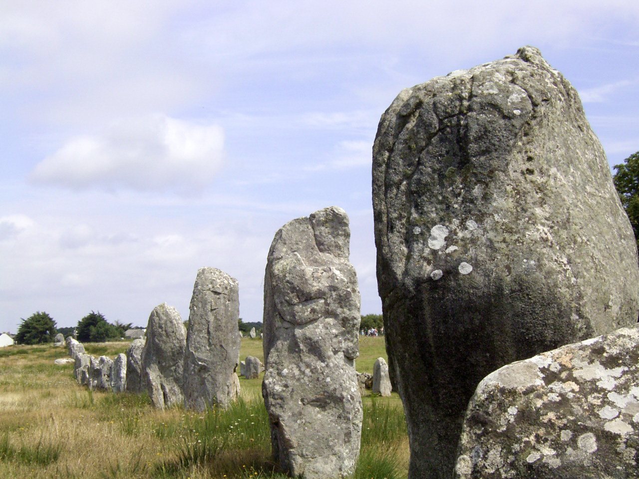
The complex lies mainly in Carnac, with parts extending east into La Trinité-sur-Mer. Its alignments run for about 4 km between Plouharnel Bay and the river at La Trinité-sur-Mer. They may once have continued as far as the Crac’h river, which would make their full extent about 8 km. Roughly 3,000 standing stones, or menhirs, are associated with the complex, probably fewer than stood there in the Neolithic.
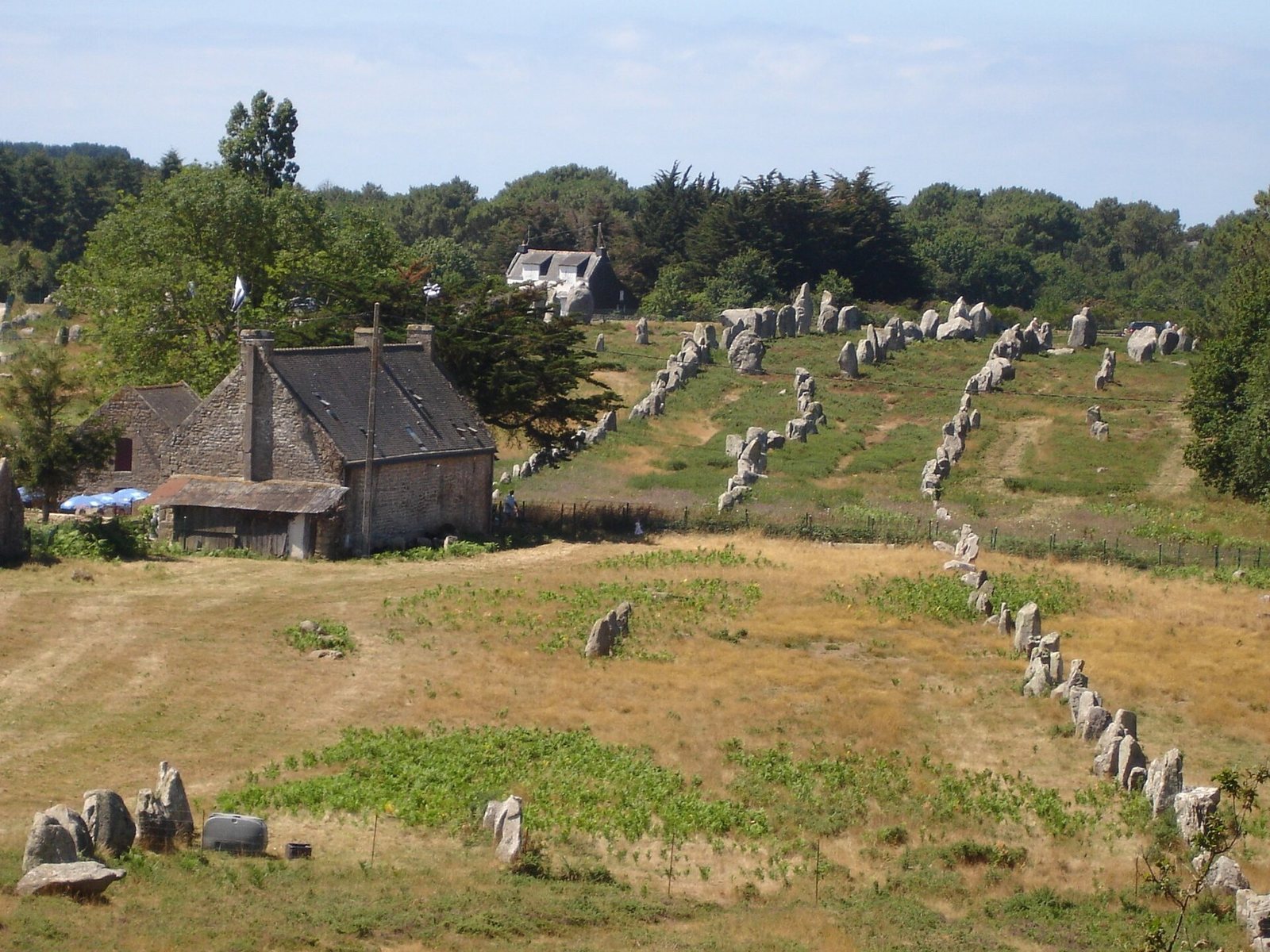
The rows generally run southwest to northeast on a bearing of about 65 degrees, and converge rather than remaining parallel. They are associated with stone enclosures, isolated standing stones, burial mounds, and individual and collective graves. In many groups, an enclosure lies at the western head of the rows. The arrangement responds to the terrain: stones often more than 3 m tall tend to occupy higher ground, usually to the west, while those often below 0.9 m stand on lower ground. Within a row, each stone’s narrower side faces along the row’s axis.
The stones are made from local granite containing two kinds of mica and zones of larger crystals set in finer rock. The granite formed through the melting of older rock, and local fissures often offered natural lines for extracting blocks. Many stones are roughly rectangular and unworked, while some appear to have had their tops shaped. Natural erosion, before and after erection, accounts for irregular forms among the largest examples. Engravings on some megaliths depict curved throwing weapons, axes, and sceptres, interpreted as signs of power and authority.
Standing-stone alignments
Ménec
At Ménec, eleven converging rows extend about 1 km across a width of roughly 100 m. Around 1,050 stones belong to the alignment. The largest, reaching about 4 m, stand at its broad western end. The stones become smaller toward the east, then increase in height again at the far end. A western enclosure includes a ring of 71 stones; a second enclosure at the eastern end is badly damaged. A road divides the alignment, and its eastern part is also called Toulchignan.
Kermario
The fan-shaped Kermario alignment consists of ten rows and roughly 1,000 stones over about 1.2 km. A stone circle toward the eastern end, where the stones are shorter, was identified in aerial photographs. Nineteenth-century excavation of the Kerloquet pond destroyed part of the rows. The stones visible beyond the pond are called the Kerloquet alignment; they may form a separate group or the eastern continuation of Kermario.
Kerlescan
The main Kerlescan alignment has thirteen nonparallel rows, about 350 m long, with around 300 stones remaining. The wider Kerlescan group contains about 555 stones across roughly 800 m. A circle of 39 stones marks the western end, and another circle may lie to the north. A rectangular enclosure stands on slightly raised ground at the west, so that from the east the rows appear to rise toward it.
Petit-Ménec
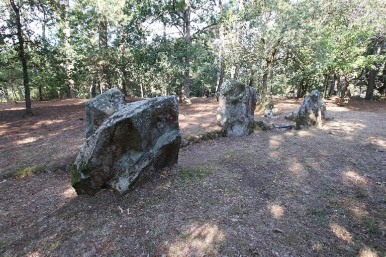
Petit-Ménec continues east beyond Kerlescan and the road to La Trinité-sur-Mer, extending into that commune. Woodland largely obscures this heavily damaged group. Many of its stones are covered with moss and ivy.
Burial mounds and chamber tombs
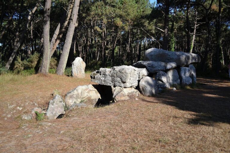
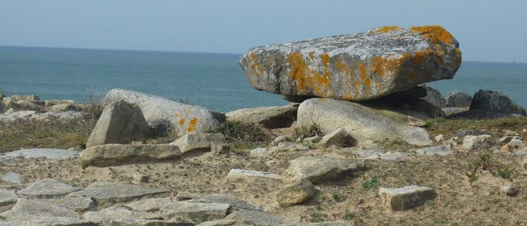
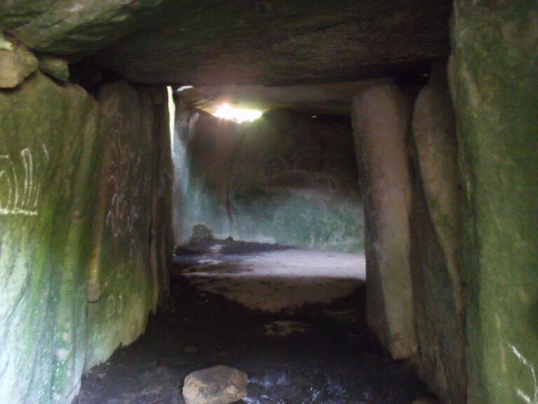
Dolmens are tombs built from large supporting stones and one or more capstones, originally covered by an earth mound. The Carnac area contains tombs of different sizes and forms. Acidic soil has eroded human remains.
Saint-Michel tumulus
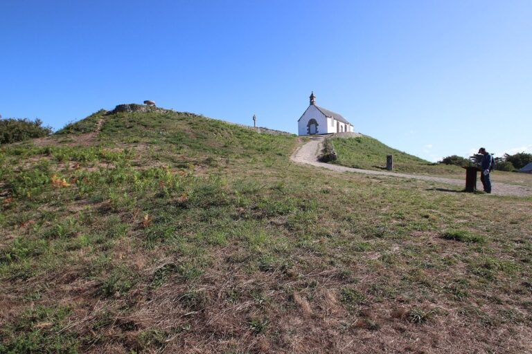
Saint-Michel is a burial mound measuring about 125 by 60 m at its base and 12 m high. Excavations found fifteen stone chests and other funerary objects. René Galles excavated the mound in 1862; Zacharie Le Rouzic investigated it further from 1900 to 1907, discovering the tomb and stone chests. Finds include large jade axes, pottery, and callaïs jewellery. Callaïs is a prehistoric ornamental stone that includes variscite and turquoise. Most of the objects are held at the Museum of Prehistory of Carnac. A chapel built on the mound in 1663 was rebuilt in 1813, destroyed in 1923, and reconstructed in 1926 to match the earlier building.
Tumiac tumulus
At Arzon on the Rhuys peninsula, south of the Gulf of Morbihan, Tumiac is a circular-to-oval mound built in layers of clay. It measures about 50 m across and 15 m high. Its central rectangular chamber is 4.40 m long, 2.40 m wide, and 1.75 m high. Three single-block supports carry a quartz roof slab 4.80 m long; the chamber had a wooden floor and two engraved side slabs. Carbon-14 dating places the mound between 4790 and 4530 BC. A crater at the summit corresponds to a vertical excavation shaft.
The chamber contained eleven jadeite axes, 26 fibrolite axes, and 249 callaïs beads. Fibrolite is another name for sillimanite. The objects are now held at the Archaeological Museum of Vannes. Excavation took place in 1853, followed by further investigation in 1934, when secondary burials were found.
Mané-er-Hroëk tumulus
At Locmariaquer, the Mané-er-Hroëk mound measures about 100 m long and 60 m wide, rising nearly 8 m above the natural ground. Its rectangular burial vault measures about 5 by 3 m and is covered by two roofing slabs. A modern staircase leads to the entrance, beside which stands a broken engraved stone slab. Excavation by the Polymathic Society of Morbihan in 1863 uncovered the vault, the slab, and grave goods. Finds included 106 precious-stone axes, the largest 46 cm long, as well as 49 callaïs beads and nine pendants. They were deposited at the Archaeological Museum of Vannes.
Moustoir, or Er Mané
This chamber tomb measures about 85 m long, 35 m wide, and 5 m high. A dolmen stands at its western end, two tombs occupy the eastern end, and a small standing stone about 3 m high is nearby.
Burial goods and materials
Across the three large Carnac–Morbihan mounds, grave goods included polished stone axeheads, stone arm-rings, and callaïs jewellery. Analyses identify many of the axeheads as jade from the Italian Alps and the callaïs as material brought from southwestern Iberia, probably by boat across the Bay of Biscay. Some jade axeheads reach 46 cm in length and may have taken more than a thousand hours to make, in addition to the work of quarrying and transport.
Dolmens
Er-Roc’h-Feutet
This northern dolmen, near the Chapel of La Madeleine, retains a complete covering of roof stones.
La Madeleine
Near the chapel of the same name, this dolmen measures about 12 by 5 m. Its broken capstone is about 5 m long. The nearby chapel remains in use.
Kercado
South of the Kermario alignment, Kercado is a rare dolmen that retains its original cairn, a mound built mainly of stones. The cairn measures 25–30 m across and about 5 m high, with a small standing stone on top. Small stones once surrounded it at a distance of about 4 m. A passage about 6.5 m long leads to the chamber. Finds include axes, arrowheads, animal and human teeth, beads, pottery fragments, and 26 bluish nephrite beads. Carvings on the inner surfaces include serpent-like forms and a human-sized double-axe symbol below the main roof slab. Built around 4600 BC, the monument was used for about 3,000 years.
Kerlescan dolmen
This dolmen has a roughly rectangular mound and an east–west orientation. Its passage entrance faces south.
Kermarquer
Situated on a small hill, the Kermarquer dolmen has two separate chambers.
Mané-Kerioned
This group of three dolmens was once covered by a burial mound. The tombs form a horseshoe arrangement, a plan described as unusual in Brittany. The eastern dolmen, the largest of the three, is 11 m long.
Crucuno dolmen
A flat capstone measuring 7.6 m and weighing about 40 tonnes rests on supports about 1.8 m high.
Other stone arrangements
Crucuno stone rectangle
Twenty-one standing stones form a rectangle with sides in a 3:4:5 proportion. The stones range from 0.91 to 2.4 m in height, and the rectangle’s diagonal aligns with the midsummer sunrise. Alexander Thom proposed that its dimensions measured 40 by 30 of his disputed megalithic yards.
Manio quadrilateral
Originally centred on an earthen burial mound, this stone arrangement forms a rectangle or trapezoid 37 m long. It runs east-northeast to west-southwest, measuring 10 m wide at the eastern end and 7 m at the western end.
Manio Giant
Near the quadrilateral, the Manio Giant is a single standing stone more than 6.5 m tall. Zacharie Le Rouzic re-erected it around 1900. It stands above the nearby Kerlescan alignment.