Mané-Lud Tumulus: A Neolithic Megalithic Monument in France
Site at a Glance
- Popularity
- Medium
- Country
- France
- Primary era
- Stone Age
- Eras represented
- Stone Age
- Civilizations
- Unclassified
- Site type
- Burial
- Remains
- Burial Mound
On this page23 sections
History
The Mané-Lud Tumulus is a Neolithic megalithic monument in Locmariaquer, France, and part of the Locmariaquer megalithic complex. The Neolithic was the later Stone Age period associated in Europe with farming communities and megalithic building. The monument is dated broadly to 4500–4000 BC; its dolmen, a stone tomb with a chamber reached by a passage, dates to about 4200–4000 BC. It is regarded as one of Brittany’s largest and most important megalithic monuments.
Neolithic construction
Work on the mound continued over several centuries. A smaller initial structure may have been enlarged more than once. Since the mound partly covers the dolmen’s large roof slab, at least part of the mound was added after the tomb had been built.
Early accounts and archaeological work
Between 1727 and 1737, President de Robien, a Breton magistrate and antiquarian, visited the complex and regarded its mounds as ancient Gallic tombs. Construction in the neighboring village had disturbed the western end of the Mané-Lud mound before R. Galles and A. Mauricet excavated it in 1863–1864. By then, the dolmen’s roof slab was exposed. In 1865–1866, L. Davy de Cussé prepared a plan and made the first record of the monument’s engraved signs.
Zacharie Le Rouzic excavated the site again in 1911. The state acquired the monument in 1882, and it was listed as a protected historic monument in 1889.
The name Mané-Lud
Earlier forms of the site’s name include Mané Helleu and Mané Nélud. Names associated with the neighboring hamlet include Helau, Hellu, and Helleu. In Mané-Lud, Mané means “mound”; Lud probably derives from the Breton superlative Uhelan, meaning “very high” or “from above.”
Remains
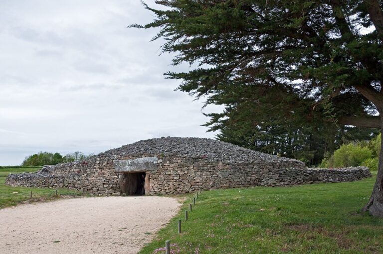
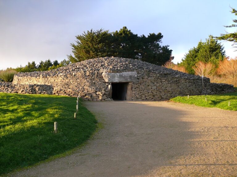
The monument stands at the highest point of a peninsula on the northern edge of Locmariaquer. Its main mound runs east to west, with the dolmen at its western end and a separate funerary construction in its eastern part. The mound is chiefly built from earth, while the eastern structure includes standing stones, a stone pavement, a cairn, and a burial cist.
The mound
Form and construction
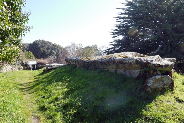
The oblong mound is about 80 m long, up to 50 m wide, and approximately 5.5 m high, although it has been levelled. Galles described it as layers of mud or silt laid down to the natural ground and estimated its volume at about 10,000 m³. Its construction is mainly earth fill, unlike nearby mounds made with rubble.
The dolmen and its carved stones
Passage and chamber
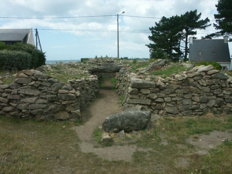
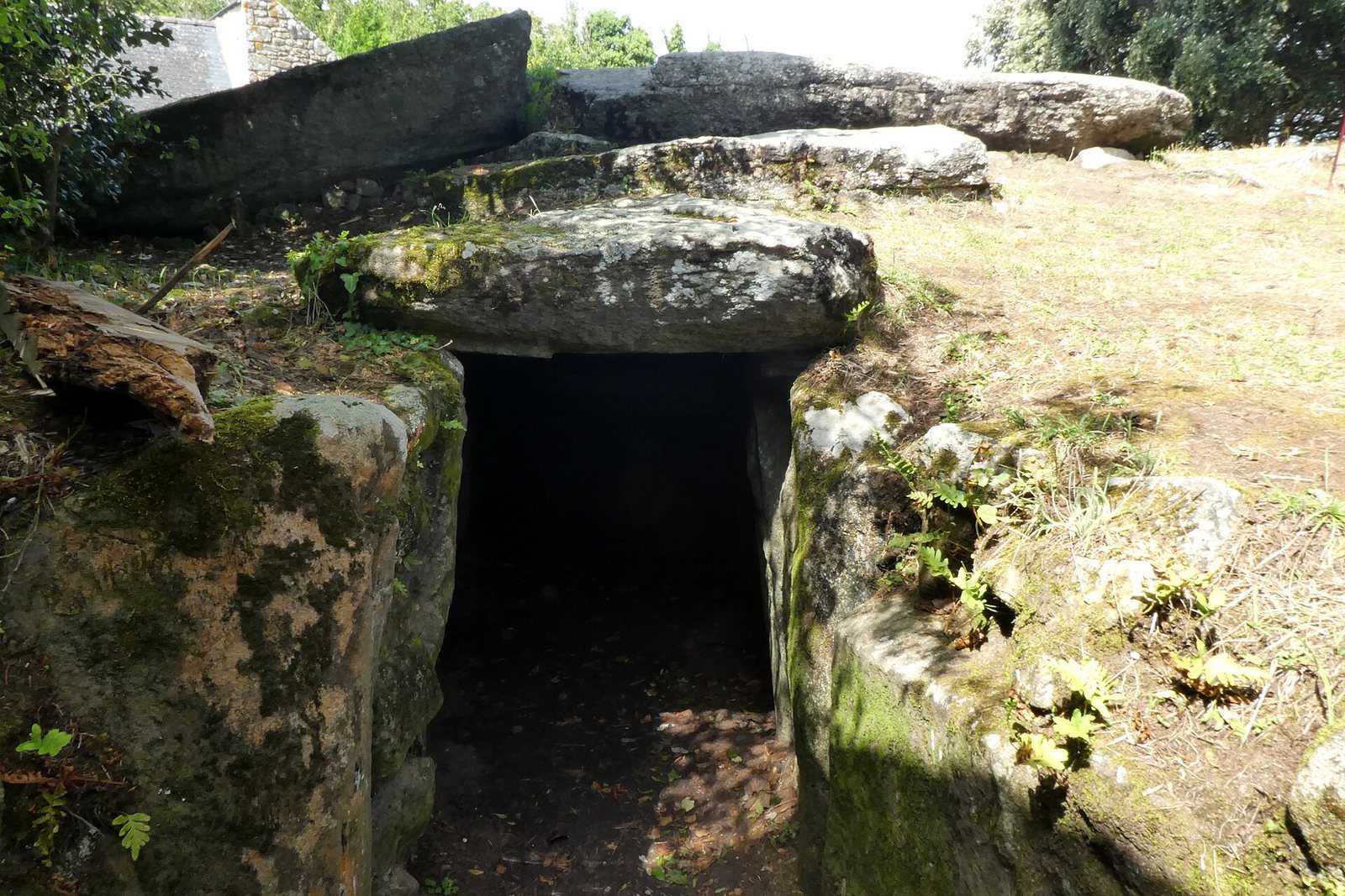
The dolmen’s south-facing entrance is partly obstructed by a modern building. Its passage is about 10.35 m long and 1–1.5 m wide. More than 20 upright slabs originally lined it, and the passage rises slightly in height from the entrance towards the chamber. Covering slabs survive over its final 5 m and above the chamber. Most passage stones are granite.
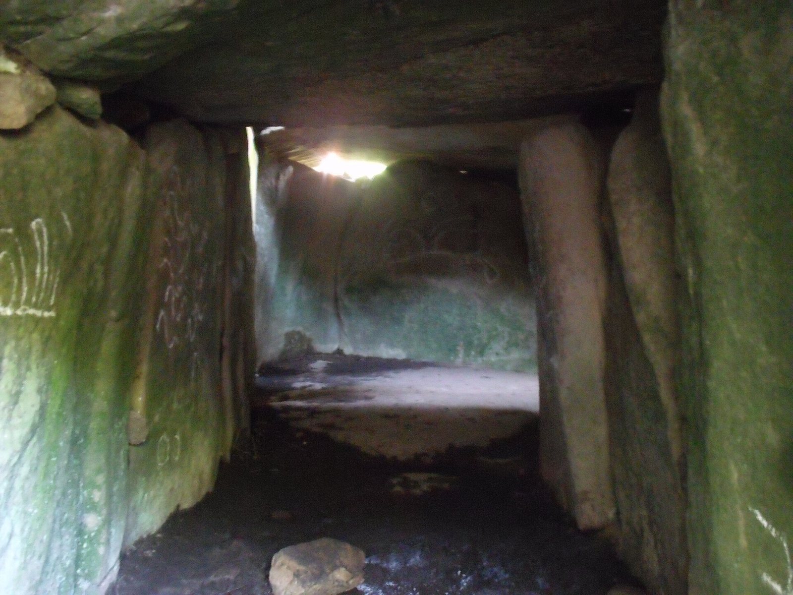
The chamber measures 3.6 m by 2.95 m. Its average height beneath the roof slabs is about 1.7 m, with another measurement placing it at approximately 1.8 m. Twenty-three upright slabs, or orthostats, form its walls; five slabs cover it. A second row of blocks reinforces the chamber supports and some of the passage stones. The chamber stones are chiefly orthogneiss, a metamorphic rock formed from igneous rock and easier to work and engrave than the passage granite. This stone came from the Auray area, about 10 km north. The chamber slabs were probably reused menhirs, or upright standing stones, possibly toppled earlier.
Large roof slab
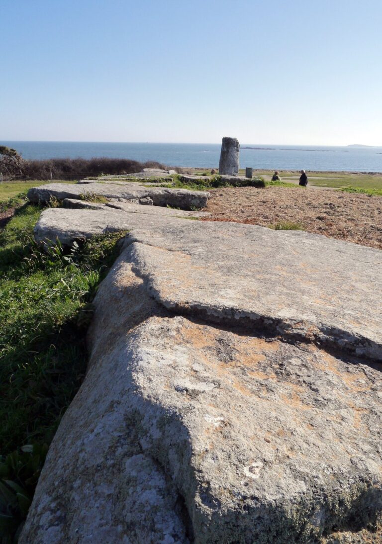
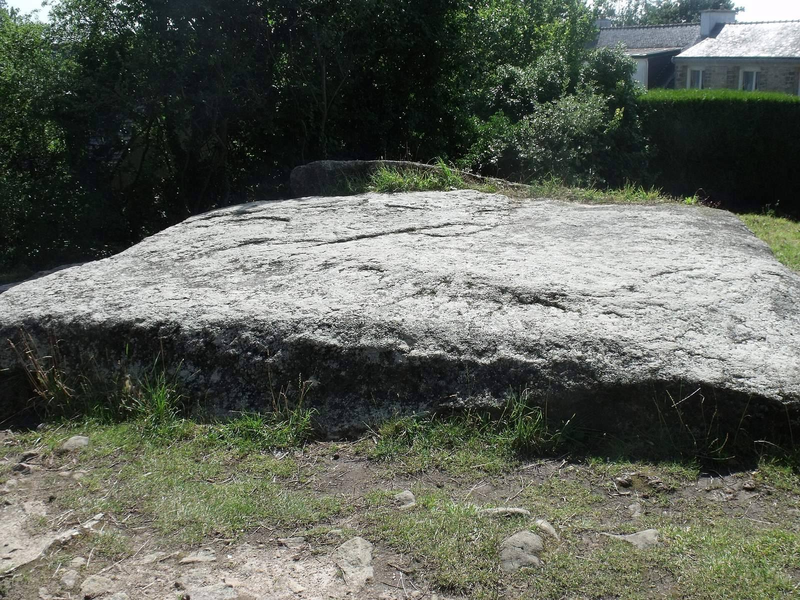
A large covering slab measures 8.3 m long, 4 m wide, and 0.5 m thick. One half lies over the chamber, while the other remains concealed within the mound. Its upper face is heavily weathered, apparently after exposure over several millennia. The slab fractured because it was inadequately supported.
Chamber floor and passage slab
The chamber floor is a single pointed slab shaped like a stele, an upright stone marker. It is made of orthogneiss, and its outline determines the form of the chamber. Extensive engravings cover its surface, although they are indistinct. At the northern end of the passage floor lies a roughly trimmed flat slab measuring 2 m by 0.9 m by 0.4 m. Beneath it, Galles found an earth-filled cavity cut into the rock, 0.4 m wide and 0.8 m deep.
Orthostat 1
The slab at the end of the chamber, identified as Orthostat 1, was long interpreted as showing an “axe-plough.” Serge Cassen instead reads it as a naturalistic sperm whale. In his interpretation, the image has an elongated, four-sided head, a spout, and a submerged tail fluke turned slightly from its usual horizontal position. He relates the carving to contact between maritime hunter-gatherers of the late Mesolithic and the first farming communities of the Neolithic, which coexisted along the Atlantic coast.
Orthostat 1A
Partly overlapped by Orthostat 1 in the rear-right corner of the chamber, Orthostat 1A bears four nested jug-like signs: one small form and three much larger ones. Cassen interprets the group as birds in flight.
Orthostat 2
Orthostat 2 is weathered and fractured, a condition consistent with its possible earlier use as a menhir. Its carvings run from a four-sided sign at the top through two opposed crooks, three linked jug-like or bird-like forms, and a radiating sign. Lower down are a horizontal crescent, which Cassen reads as a boat, and an upward-pointing triangular axe blade.
Orthostat 6
Orthostat 6 carries a cross, a jug-like or bird-like sign, three axes with hafts, two crescent or boat forms, two four-sided signs, and two U-shaped figures crossed by a vertical line.
Orthostat 16
Two groups of signs appear on Orthostat 16. The upper-left group includes two crooks pointing left, vertical strokes, and a jug-like or bird-like form. Near the centre-right are a smaller jug-like or bird-like sign and a four-sided sign.
Orthostat 17
Orthostat 17 is a relatively flat granite slab whose top was cut down to make it easier to cover. It bears 14 jug-like or bird-like signs, two of them incomplete and uncertain.
Orthostat 19
Orthostat 19 is shaped like a rectangular block and has naturally regular edges. A four-sided sign divided by a vertical line occupies its lower part; above it are a large crook and a jug-like or bird-like sign.
Orthostat 21
Orthostat 21 may also have been reused from a menhir. Its 14 obliquely arranged signs include five crooks, two jug-like forms, two axes with blades pointing left, three cross-shaped figures, a square, and a horizontal crescent topped by a vertical stroke.
Engravings were noted on five slabs in the passage and chamber, as well as on the chamber floor; eight orthostats are identified as carved. The signs have prompted varied readings, including axes, goddesses, snakes, boats, waves, and crooks. Their meanings remain debated.
Finds from the dolmen
Le Rouzic’s 1911 excavation yielded fragments of chalice-shaped vessels with dotted decoration, coarse and rimmed pottery, and a fine brown earthenware vessel. Other finds included three gold strips pierced at their ends, two flat gold fragments, 26 callaïs beads (beads made from green ornamental stone), one bead of white material, and two tortoise-shell fragments. The stone objects comprised two tanged-and-barbed arrowheads, one triangular arrowhead, four flint blades, two scrapers, 12 flint flakes, and a granite disk.
The eastern funerary structure
Stone enclosure and pavement
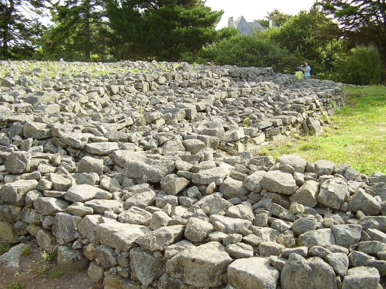
Galles found a second construction in the eastern part of the mound. A north–south row, 12 m long, consists of small blocks 0.4–0.5 m high that he described as menhirs. Each of the five northern blocks had a horse skull on top. At the row’s northern end, flat stones laid at the same height continue it for about 3 m. A second line of standing stones lies 2.6 m west of the first, with its stones spaced about 6 m apart. Together, the lines define an approximately oval area 40 m long and averaging 18 m wide. A dry-stone pavement, 0.4 m thick, covers its floor.
Cairn and burial cist
Within the paved enclosure is a stone cairn, or mound, 10 m in radius and 2.6 m high. It contains a dry-stone burial cist measuring 2.25 m by 1.25 m by 1.1 m. Human remains recovered from the cist included burned bones. Dr. Mauricet’s examination indicated that no more than two people were represented and that they had been cremated outdoors. Horse bones found outside the cairn were heavily burned.