Burg Stolzeneck: A Hilltop Castle Ruin above the Neckar


Site at a Glance
- Rating
- 4.1
- Popularity
- Low
- Country
- Germany
- Primary era
- Medieval
- Eras represented
- Medieval, Early Modern
- Civilizations
- Electoral Palatinate, Holy Roman Empire
- Site type
- Military
- Remains
- Castle
On this page8 sections
History
Burg Stolzeneck is a hilltop castle ruin above the Neckar near Neunkirchen in Baden-Württemberg, Germany. It was probably built around 1200 as an imperial castle, a fortress held directly under the authority of the Holy Roman Emperor. The site later became connected with the Electoral Palatinate, a major principality ruled by the counts palatine of the Rhine.
Early records and Electoral Palatinate rule
The name Stoltzinecke first appears in 1268 in connection with a widow. Count Palatine Ludwig II acquired the castle in 1284. In 1291, King Albert I promised Ludwig recognition of his rights to Stolzeneck and Reichenstein, together with enfeoffment with Kammerstein and Dilsberg, if Ludwig were re-elected. Enfeoffment meant receiving land or a fortress from a superior lord in return for service.
The castle and its limited associated holdings were subsequently granted as fiefs to several noble families. These possessions included the castle hamlet of Krösselbach, property in Rockenau, small landholdings, and fishing rights. Stolzeneck was again held directly by the Electoral Palatinate from 1418 to 1458, before being assigned to further feudal holders.
Damage, abandonment, and demolition
The castle was probably damaged during the War of the Palatine-Bavarian Succession in 1504. In 1509, Count Palatine Ludwig V reached an agreement with Philipp von Seldeneck concerning the timber cutting needed for rebuilding. After the Barons of Frauenberg became extinct in 1610, Stolzeneck returned to the Electoral Palatinate and was not granted out again.
A report from 1611 described the entire complex as dilapidated. The Electoral Palatine court chamber then decided to abandon the fief. In 1612, the castle, its associated lands, fishing rights, and other property were sold for demolition. The proceeds particularly supported the last inhabitants of Krösselbach, which was also abandoned, helping to establish the financial basis for their relocation to Zwingenberg.
The court chamber first ordered the dressed stones to be removed and carried by barges on the Neckar to Mannheim for reuse. The plan would have required about 1,000 barge journeys and was not carried out. The ruin later fell into obscurity. It was cleared again in the 1960s, and excavations took place in 1964.
Remains
Layout and defensive works
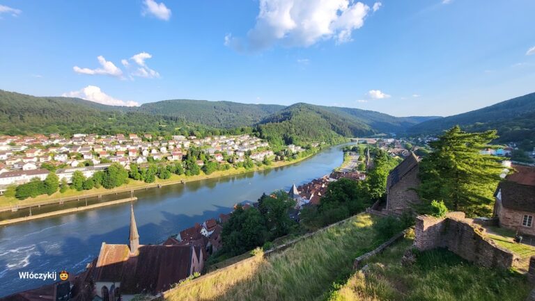
Burg Stolzeneck occupies a rocky spur at 215 metres above sea level, about 80 metres above the northward-flowing Neckar. It stands in the acute angle at the mouth of a small hillside ravine, about 2 kilometres south of Rockenau. The small spur plateau is now wooded. The complex contains a core castle, an outer bailey, and a zwinger, an enclosed defensive area between the main fortification and an outer obstacle. The ground descends toward the northeast, with the core castle in the southwest and the outer bailey extending down the slope.
Shield wall and neck ditch
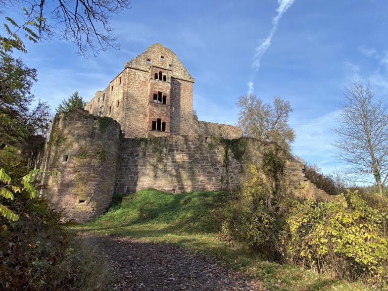
A shield wall, a particularly strong defensive wall on the most threatened side of a castle, protects the core castle to the west, where the ground continues to rise. A neck ditch, cut across the narrow spur to isolate the fortified area, reinforces this side. The core castle is also enclosed by a zwinger. The shield wall includes a wall-walk and rises about 21 metres, with a thickness of approximately 2.85 metres. Its base appears to be the only part belonging to the thirteenth century and is built from bossed ashlar, carefully cut stone blocks with projecting central faces. The wall’s overall dimensions correspond more closely to defensive needs of later centuries. It can be climbed and, before the spur became wooded, provided a broad view over the Neckar valley.
Palas and changing core castle
The core castle contains a four-storey palas, the principal residential and representational building of a medieval castle, positioned northeast of the shield wall. The building incorporates features from different periods and was altered several times. Excavations in 1964 revealed foundations running diagonally to the walls of the surviving palas and the enclosure. These remains indicate that the present palas was probably built after 1350, or possibly during alterations in the sixteenth century, when an earlier palas was abandoned and the core-castle courtyard enlarged.
Outer bailey and water supply
The outer bailey and zwinger, including a cistern for collecting and storing water, were built in the fifteenth or sixteenth century. Foundation remains in the outer bailey mark the former positions of service and farm buildings. The surviving fabric therefore includes the shield wall, extensive wall remains, the neck ditch, the palas, the outer-bailey cistern, and foundations associated with the castle’s economic buildings.
The original entrance lay at the eastern connection between the outer bailey and the zwinger. The present main entrance uses an artificially created opening on the western side, reflecting a later change to access through the surviving ruin.