Bubastis: Ancient Egyptian City and Center of the Cult of Bastet
Site at a Glance
- Rating
- 4
- Popularity
- Medium
- Country
- Egypt
- Primary era
- Iron Age
- Eras represented
- Bronze Age, Iron Age, Classical
- Civilizations
- Egyptian
- Site type
- City
On this page19 sections
History
Bubastis was an ancient Egyptian city at Tell Basta, on the southeastern edge of modern Zagazig in Egypt, whose settlement began by the end of the fourth or the beginning of the third millennium BC. It stood on the eastern bank of the Pelusiac branch of the Nile near the entrance to Wadi Tumilat, and became especially important as the home of the cult of Bastet, a goddess associated with cats, protection, joy, and festivity.
Origins and early development
The city was probably known in Egyptian as Bast or Per-Bastet, meaning “House of Bastet.” Greek writers called it Bubastis or Bubastos, while later Coptic forms included Bubasti. Most researchers identify it with the biblical Pi-Beseth. Its early administrative position was within the nineteenth nome of Lower Egypt, an ancient Egyptian district called Imenti.
Bubastis became an important center from the Sixth Dynasty onward. Teti II and Pepi I established temples there in the twenty-fourth or twenty-third centuries BC. An inscription on the gateway of Pepi I’s temple is described as the earliest known written mention of the city. Blocks bearing the names of Khufu and Khafre were reused in later construction, so they do not demonstrate that Bubastis was already a major center under the Fourth Dynasty.
A later tradition says that the ground opened at Bubastis during the reign of Hotepsekhemwy, perhaps describing an earthquake that caused many deaths. The event has no historical confirmation. In the seventeenth century BC, Bubastis came under Hyksos rule, while its principal temple of Bastet probably continued in use. Its position near Egypt’s northeastern frontier supported royal administration and military activity during the Middle Kingdom and the Second Intermediate Period.
Royal center and trading gateway
During the New Kingdom, Bubastis served as the capital or principal center of the eighteenth Lower Egyptian nome and acted as a military and commercial gateway toward the Sinai. Amenhotep II, Amenhotep III, Ramesses II, Seti I, and Seti II all undertook work connected with the city. Bubastis also participated in royal Sed festivals, jubilees intended to renew and legitimize a pharaoh’s rule.
The city’s economy drew on grain cultivation, livestock raising, river transport, and long-distance trade. A canal south of Bubastis connected the Nile system with the Red Sea through Wadi Tumilat and the Bitter Lakes. Probably first cut in the fifteenth century BC, the canal periodically fell out of use and was restored or reused under Necho II, Darius I, Ptolemy II, and probably Trajan. Its operation affected the movement of supplies, employment, and commercial activity. Routes from the city connected Egypt with Sinai and the Levant by land, and with the Red Sea, Punt, East Africa, and Arabia by canal and maritime routes.
The Twenty-Second Dynasty
Bubastis reached major political prominence during the Third Intermediate Period. Sheshonq I, a military commander and vizier of partly Libyan ancestry, founded the Twenty-Second Dynasty around 943 BC and chose Bubastis as his royal residence. This dynasty is often called the Libyan Dynasty because its ruling family emerged from Libyan groups settled in the Nile Delta.
Bubastis is sometimes described as a capital of Egypt during the tenth to eighth centuries BC. That status was conditional, because Upper Egyptian rulers and the high priests of Amun retained power at Thebes. Sheshonq I enriched the city after his campaign in Palestine, and later rulers of the dynasty restored and enlarged its sanctuaries. Bubastis may also have been connected with the origin or rule of the Twenty-Third Dynasty, although Tanis is more commonly identified as that dynasty’s capital.
Assyrian, Persian, and Hellenistic rule
During the Twenty-Fifth Dynasty, Bubastis became the center of the eighteenth nome after its separation from the older nineteenth nome. In the Late Period and early Hellenistic period, the city and its surrounding nome belonged to a coalition of four powerful eastern Delta nomes. The coalition opposed Persian rule and later supported the Macedonian conquest, although its authority became nominal under the early Ptolemies.
Assyrian forces under Esarhaddon conquered Lower Egypt in 671 BC and installed local rulers and an Assyrian governor at Bubastis. In 343 BC, the Persian army of Artaxerxes III besieged and captured the city. After this conquest, its walls were dismantled or destroyed, and other Lower Egyptian cities followed its example in surrendering. Alexander the Great’s army passed through Bubastis during the Macedonian conquest of Egypt in 332 BC.
The city continued under Ptolemaic and Roman rule, although its political importance declined. It belonged successively to several Roman Egyptian provinces, and the canal south of the city may have been restored around AD 108. Bubastis became the seat of a Christian bishop in approximately the third or fourth century. It remained linked with the Alexandrian Christian tradition and later formed part of the ecclesiastical landscape of Augustamnica Secunda. By approximately the middle of the first millennium AD, its inhabitants had abandoned the city, which fell into ruin.
Religion and archaeology
Bastet was Bubastis’s principal deity and the focus of a major Egyptian cult. Her festival, described by Herodotus, drew pilgrims from across Egypt. They traveled by boat, performed music and dances, made offerings, and drank large quantities of wine. Herodotus claimed that as many as 700,000 people attended, although that figure is not necessarily reliable. Other cults at Bubastis included those of Atum, Mahes, Thoth, Wadjet, Horakhty, Shu, Seth, Ptah, and possibly Amun-Ra. Cats and ichneumons were associated with local religious practice, and the city developed extensive animal cemeteries.
European investigation began with French scholars accompanying Napoleon’s Egyptian expedition between 1798 and 1801. J. G. Wilkinson described the site in 1840, and systematic excavation began under the Swiss Egyptologist Edouard Naville in 1887, initially focusing on the Temple of Bastet. Later Egyptian, German, French, and university expeditions investigated temples, palaces, cemeteries, and industrial areas. Work by teams from Zagazig University and the University of Potsdam contributed to research into the city’s long history.
Excavations revealed cat and ichneumon cemeteries in 1887 to 1889, royal treasures during railway construction in 1906, Middle Kingdom and Sixth-Dynasty palace remains, Old Kingdom mastabas, a cache of gold figurines and pottery in 1992, an Old Kingdom limestone gateway in 1996, a trilingual copy of the Canopus Decree in 2004, and a well-preserved fragment of a statue of Ramesses II in 2008. Modern development, stone quarrying, looting, cultivation, and the expansion of Zagazig have restricted the archaeological zone. During unrest in 2011, the main archaeological storeroom at Zagazig was broken into. Tell Basta is now a protected archaeological zone and small open-air museum.
Remains
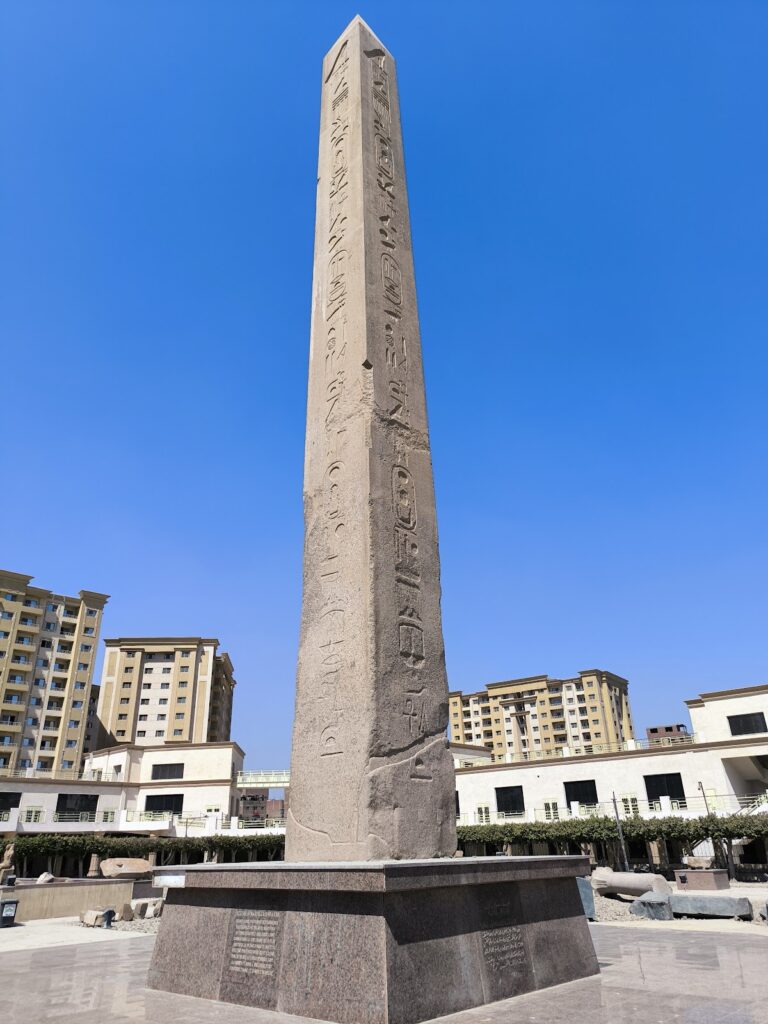
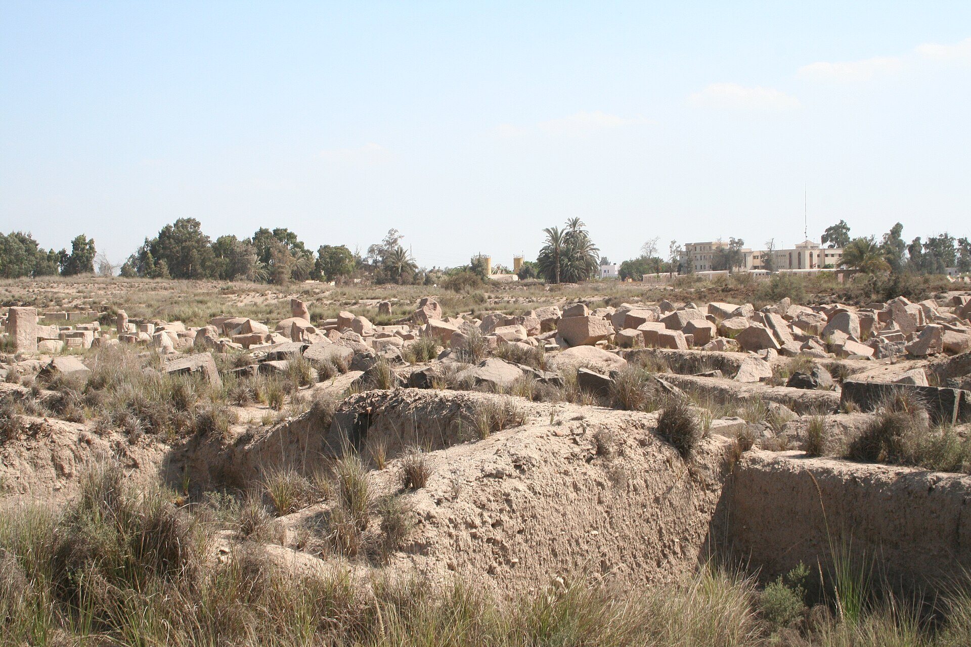
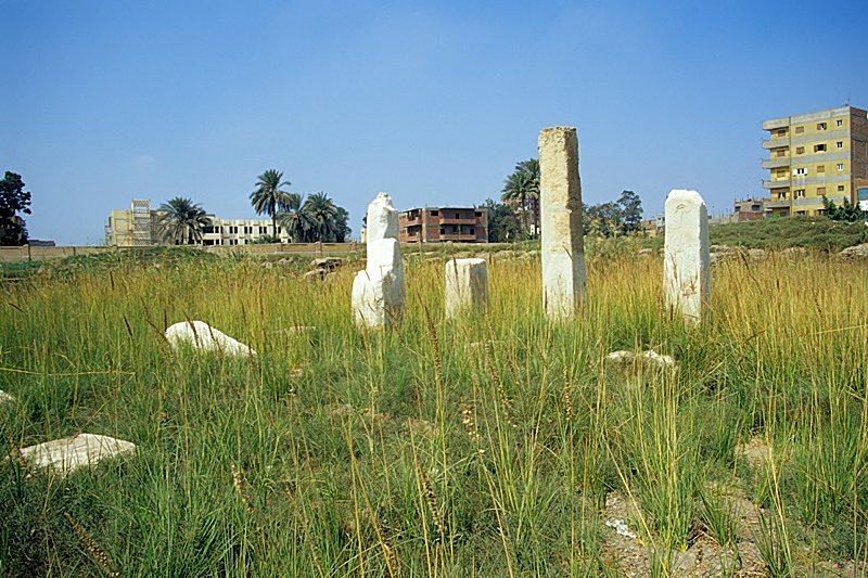
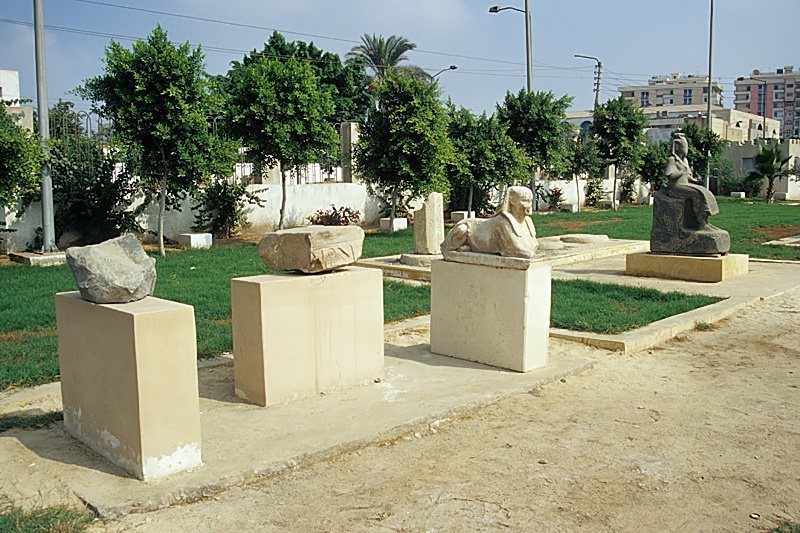
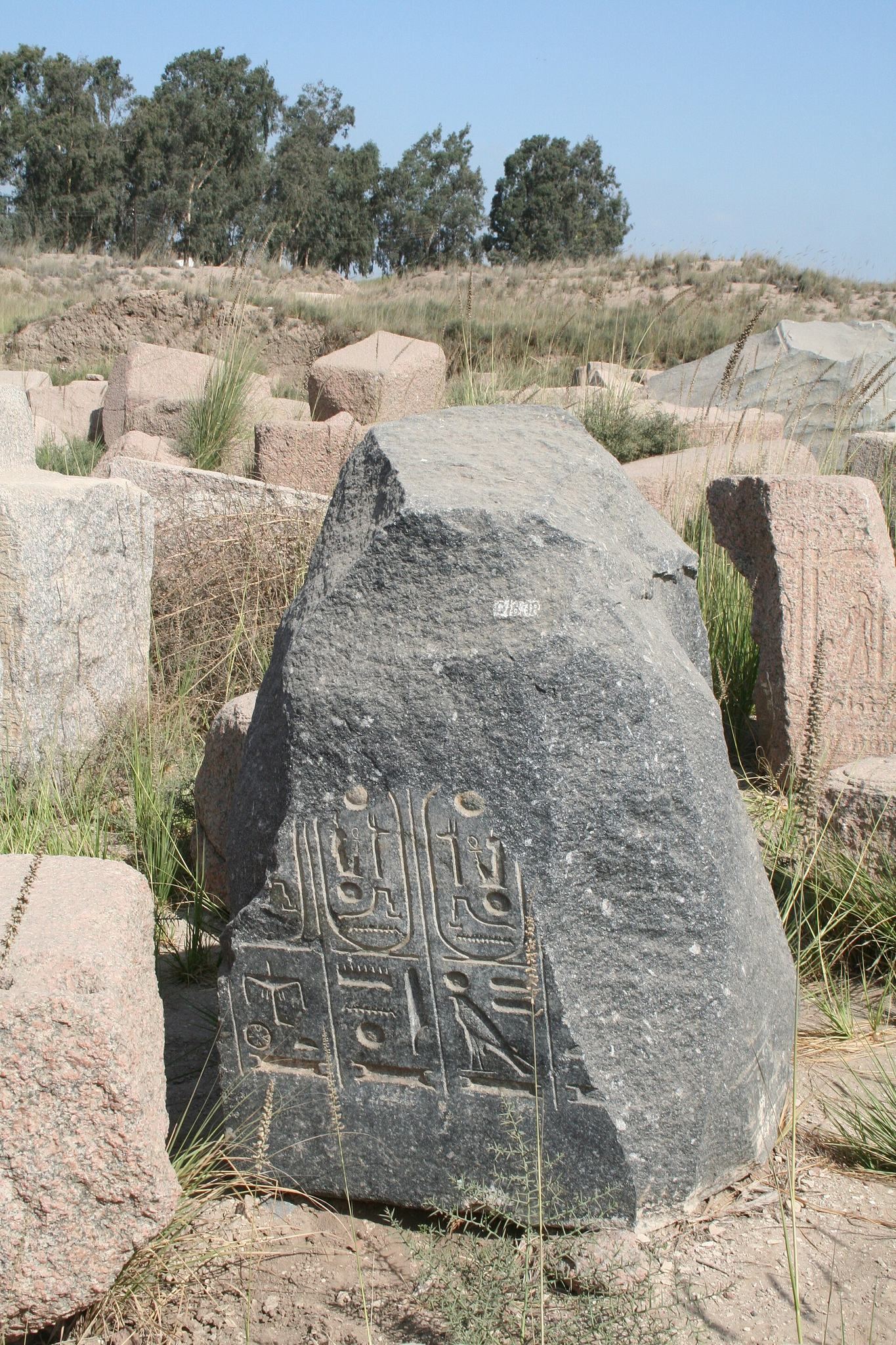
The ancient settlement occupied elevated earth mounds above the Nile flood level. During the Third Intermediate Period, the city walls extended for approximately 5 kilometers. The ruins covered nearly 80 hectares, although parts of the ancient settlement now lie beneath modern development or agricultural land. The present archaeological zone consists of a grass-covered mound with granite blocks, excavation trenches, installed statues, ruined walls, and fragments of halls and sanctuaries.
The Temple of Bastet
Temple layout and early construction
The Temple of Bastet was the city’s principal monument and a local as well as wider Egyptian center of worship. Amenemhat I ordered its construction in the twentieth century BC, possibly rebuilding an older sanctuary. Senusret I and Senusret III enlarged it, and Amenemhat III may have contributed to its decoration. Two portraits of Amenemhat III were found in the temple.
After work by Ramesses II, the temple included a large vestibule, two halls, and a hypostyle hall, a large room whose roof was supported by many columns. The complex was oriented approximately east-west and measured nearly 200 meters in length. Its remains include lower wall courses, sculpted blocks, column bases, column fragments, and a ruined hypostyle hall. Much of the surviving material belongs to the Late Period, while earlier architectural elements were repeatedly reused.
Courts, halls, and festival architecture
Rulers of the Twenty-Second Dynasty added or rebuilt halls, courts, portals, reliefs, and porticoes around and within the earlier temple. The complex probably included an entrance pylon, a monumental temple gateway about 50 meters wide, followed by one or two courts. These spaces led to the great hall associated with Osorkon II and then to further columned halls and the sanctuary.
Osorkon I probably began a program of wall decoration and rebuilt the vestibule. Under Osorkon II, the temple received a new court, a large granite portal, a festival hall, a hypostyle hall, and a northern portico. The portal and its reliefs commemorated the king’s Sed festival in his twenty-second regnal year.
Columns and reliefs
The Osorkon II hall contained monumental Hathoric capitals, each showing the face of the goddess framed by a heavy wig and uraei wearing the Red Crown of Lower Egypt. At least eight such capitals are known from Bubastis and museum collections. Reliefs from the hall show priests, divine standards, and the king receiving homage during the jubilee ceremony. Some blocks remain at the site, while other capitals and reliefs are preserved in museums.
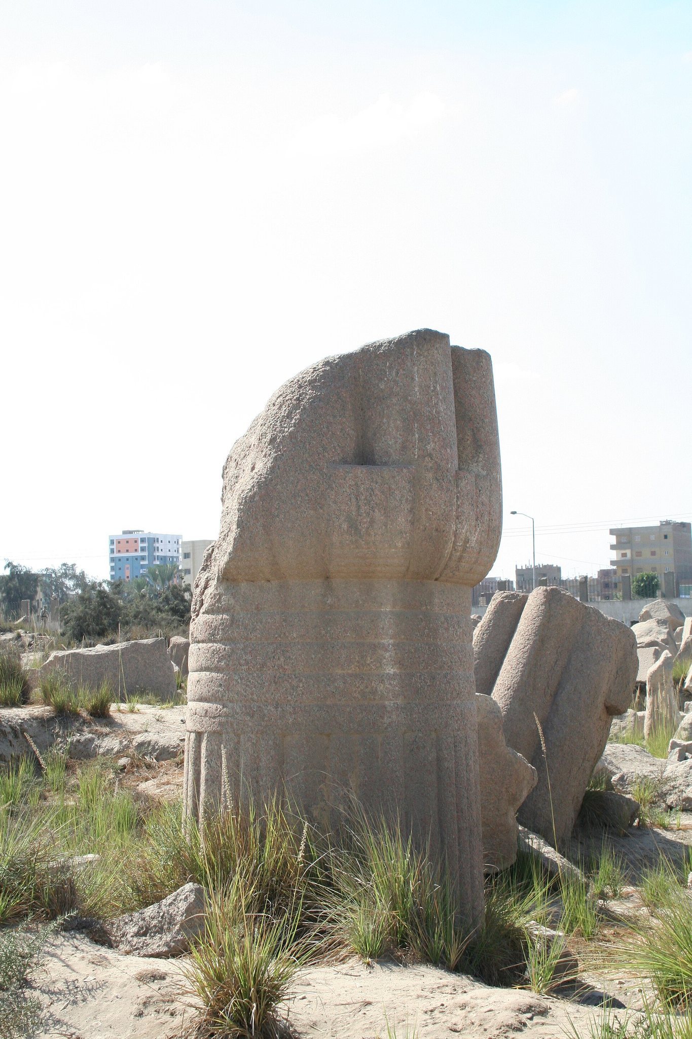
Large palmiform granite columns stood in the temple courts. Some bear the name of Ramesses II and may have been reused from Old Kingdom monuments. Their smooth shafts and palm-shaped capitals reached approximately 10 meters in height. The great hypostyle hall contained closed papyriform granite columns whose shafts exceeded 1.5 meters in diameter. Their capitals exceeded 3 meters in height, and the columns may have reached nearly 15 meters with their architraves. More than thirty columns may originally have stood in the hall, with many now represented by broken blocks and fragments.
Reliefs, ceiling decorations, statues, and colossi were found among the ruins of the hypostyle halls. Several broken statues bear the name of Ramesses II, including a dyad showing the king beside a lioness-headed goddess, possibly Bastet or Sekhmet. A colossal statue nearly 10 meters high was found broken into several pieces in a court among fragments of palmiform columns. It may represent Isis-Nefert, the second wife of Ramesses II, or Meritamen, his daughter and later wife.
Sanctuary and canals
The latest form of the sanctuary belonged to Nectanebo II, the last native Egyptian pharaoh of the Thirtieth Dynasty. Herodotus described an open area containing seven shrine structures, enclosed by a high wall and surrounded by sacred trees. An outer sandstone enclosure attributed to Osorkon II formed a long corridor around the temple. Nectanebo II also added a small sanctuary or shrine to the wider complex.
Herodotus described the main sanctuary as remaining at its original lower level while the surrounding city rose around it. Two canals reportedly approached the entrance from the Nile and ran along opposite sides of the sanctuary. Each was about 100 ancient feet, or approximately 30.8 meters, wide and lined with trees. A stone-paved road about three stadia, or approximately 534 meters, long led eastward through the market toward a sanctuary of Hermes. The entrance was described as approximately 18.5 meters high and decorated with statues about 2.8 meters high.
Other temples
Temples of Teti II and Pepi I
The Temple of Teti II lay northwest of the Temple of Bastet. The Temple of Pepi I stood west of it and was enclosed by a mud-brick wall measuring approximately 87.5 by 64 meters. Two rows of columns remain from its sanctuary. Reused blocks bearing the names of Khufu and Khafre were incorporated into the building, linking the structure materially with earlier royal monuments without establishing a Fourth-Dynasty foundation for Bubastis’s importance.
Ramesses II, Atum, and Mahes
A chapel of Amenhotep III, dating to the fourteenth century BC, survives in fragments. The Temple of Ramesses II stood several hundred meters from the main temple and was later usurped by Osorkon I. Its colonnade yielded a 1992 cache containing small gold and faience figurines in two bowls. A separate head of a statue of Ramesses II was found in 2008.
A temple of Atum stood southwest or south of the main temple. It probably dates to the transition between the tenth and ninth centuries BC and may have been built under Osorkon I. A temple of Mahes stood north of the Temple of Bastet and probably dates to the eighth century BC. Its construction may belong to the reign of Osorkon III.
Palaces and administrative buildings
The Middle Kingdom palace complex covered at least 4,800 square meters, while a broader estimate gives approximately 16,000 square meters for the wider complex. Built mainly of mud brick, it had a complex plan that included a forecourt, a possible gateway, a peristyle reception court, a hypostyle hall with at least six columns, administrative or service buildings, and enclosed areas that may have served audience, storage, and palace functions. The palace may have been associated with Amenemhat III and remained in use until the Second Intermediate Period. Its position and facilities may have supported royal administration, military activity, and expeditions toward Sinai and Punt.
Sixth-Dynasty palace remains were found near the Temple of Pepi I. Other palatial remains and mastabas date to the Middle Kingdom, and a limestone structure found in 1964 may have been another palace associated with Amenemhat III.
Cemeteries and industrial areas
Burial grounds
The cemeteries include a Predynastic burial area north of the Temple of Bastet, Old Kingdom mastabas, Middle Kingdom burials, a New Kingdom cemetery, the tombs of the Nubian viceroys Hori I and Hori II, the tomb of the vizier Iuty, and extensive cat and ichneumon cemeteries.
Old Kingdom mastabas were built of mud brick, often with vaulted burial chambers. Some elite tombs had limestone-faced and painted funerary rooms with inscriptions and prayers to Osiris and Anubis. Other burials placed bodies in contracted positions with heads oriented west and offerings deposited in ceramic vessels. The cat cemetery contained large numbers of mummified cats and bronze images of Bastet in feline form. German archaeologists identified cremation ovens for cats, while other excavations found ichneumon burials. Approximately 400 human mummies are associated with the cemetery area.
Industrial quarter and finds
A late-period industrial quarter produced votive objects for the city’s sanctuaries. Excavations recovered numerous bronze objects, including a goat head possibly associated with Banebdjedet, along with other offerings that may have been deposited by pilgrims in the temples or later buried in caches.
A stone statue approximately 11 meters high and covered with inscriptions was discovered in the Temple of Bastet area in 2002 and 2003. A large limestone statue of Kakar, the high priest of Amun-Ra, was found in 2003 near fallen columns that may once have stood in an open court. The Canopus Decree stele found in 2004 is written in Greek, Egyptian hieroglyphs, and demotic. Dated to 238 BC under Ptolemy III, it records decisions concerning the Egyptian calendar and preserves parallel forms of an official royal decree.
The discoveries made during railway construction in 1906 included two caches of New Kingdom treasures, with gold objects, jewelry, cult vessels, and two bracelets bearing the name of Ramesses II. These movable finds are now divided among museums in Cairo, Berlin, France, and New York. Together with the remaining columns, blocks, statues, excavation depressions, and architectural fragments, they represent the surviving physical record of Bubastis’s temples, palaces, cemeteries, and religious industries.