Bebristsikhe: A Fortress Guarding Mtskheta’s Northern Approach
Site at a Glance
- Country
- Georgia
- Primary era
- Medieval
- Eras represented
- Medieval, Early Modern
- Civilizations
- Unclassified
- Site type
- Military
- Remains
- Fort
On this page9 sections
History
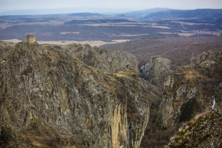
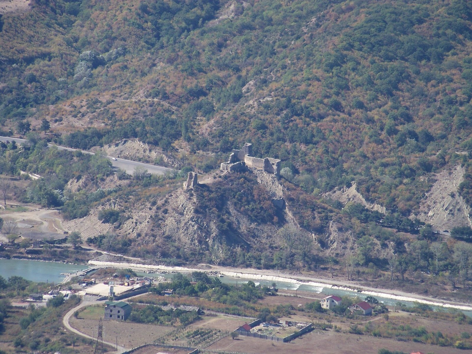
Bebristsikhe is a fortress north of Mtskheta in Georgia, above the narrow Aragvi valley. Evidence suggests a fortress may have stood here as early as the first century BC, while surviving construction is generally dated to the ninth century, with alterations continuing through the eighteenth. The stronghold guarded Mtskheta’s northern approach against possible attacks from the mountains and was also described as defending the northern approach to Tbilisi.
Early history and ancient identifications
The fortress was known in antiquity as Belti. Vakhushti of Kartli used the name Beltistsikhe; Bebris Tsikhe and Natsikhvari are other names for the site. Some interpretations identify it with Sevsamora, a fortified settlement described by the ancient Greek geographer Strabo. Another places Sevsamora on the Aragvi’s right bank, at or near Bebristsikhe, and suggests that Tsitsamuri, on the opposite bank, later took the name. This view compares Strabo’s distance of 16 stadia between Sevsamora and Harmozica, or Armaztsikhe, with the 25 stadia between present-day Tsitsamuri and Armaztsikhe. A stadion was an ancient Greek unit of distance whose length varied by region.
Medieval use and later changes
An eighteenth-century historian, Vakhushti of Kartli, credited the fortress’s construction to Ardam, an eristavi, or noble who governed a territory. Ardam’s tenure was thought to coincide with the formation of the Kingdom of Kartli. Excavations conducted from 2006 to 2008 indicated that the fortress remained in use from the fourth through the eighteenth century.
The earliest written mention of the fortress appears in a chronicle from the time of George IV, also known as Lasha-Giorgi, a medieval Georgian monarch. It recounts that Demetre I, a king of Georgia who reigned from 1125 to 1156, died at Beltistsikhe in 1156. He was taken to Gelati, a medieval monastic complex in western Georgia, for burial in a church he had consecrated.
Road, legend, and recognition
For centuries, the road ran beside the river east of the fortress. In the nineteenth century, a new route was cut through the mountain to the west, passing the stronghold on its opposite side. The Georgian Military Road, a historic route across the Greater Caucasus between Tbilisi and Vladikavkaz, runs above the fortress.
A local legend connects the name Bebristsikhe, meaning “Fortress of the Old Man,” with Simon and his children, Mamuka and Makrine. In the tale, Mamuka mistreats peasants and imprisons Makrine. A miraculous episode involving a snake and the siblings’ prayers precedes Makrine’s funeral, where an old man calls her his sister and says their vow has been fulfilled. He then dies, and the story associates him with the fortress’s name. Bebristsikhe received national cultural-monument recognition in 2004 and national-importance monument status in 2014.
Remains
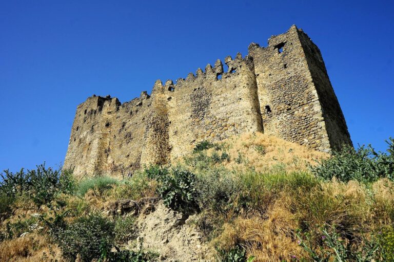
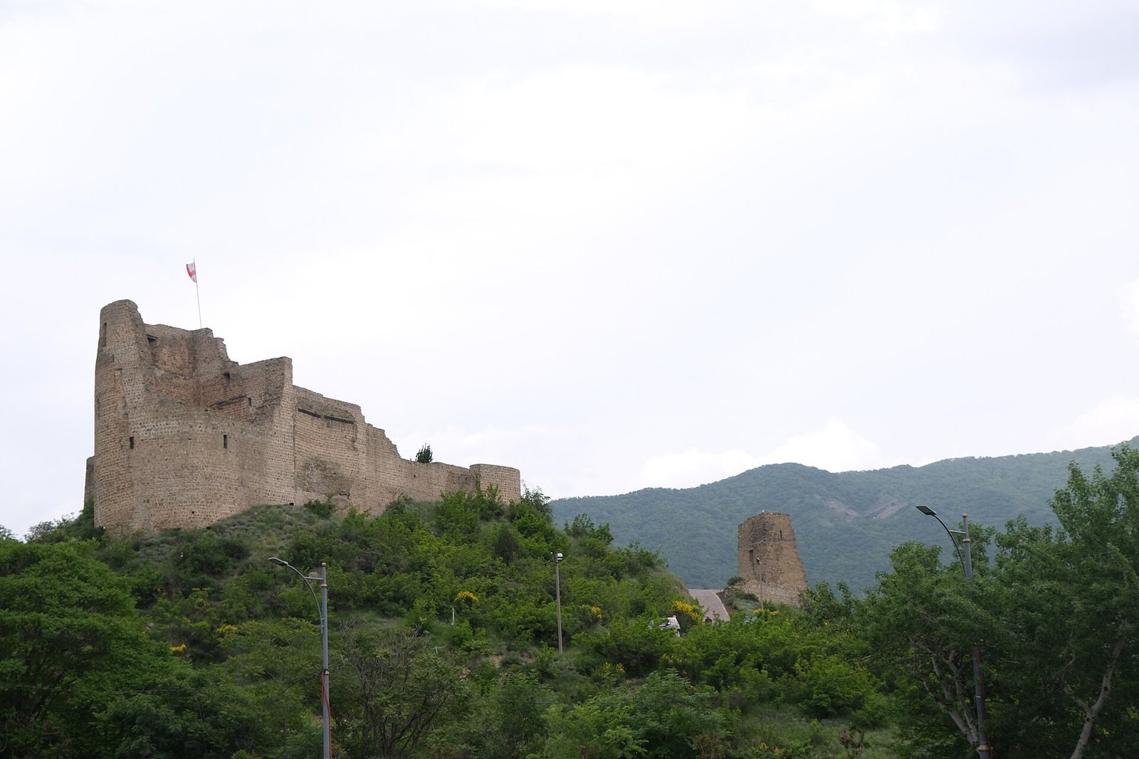
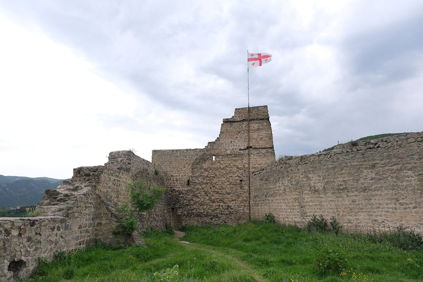
The fortress occupies a steep rocky promontory on the Aragvi’s right bank, about 1.5 kilometres from the river’s confluence with the Kura. Its position above the Georgian Military Road, where the valley narrows, shaped the defences. The complex covers about 1,500 square metres, including an inner courtyard of roughly 600 square metres. Its overall plan is approximately triangular, with a main citadel and a lower courtyard to the south. Stone walls, built from blocks of nearly uniform size, are about two to three metres thick and follow the mountain’s contours.
Fortress structures
Citadel
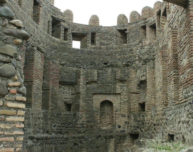
The citadel is triangular, with towers once standing at its three corners. The largest, on the southern side, had four storeys and served defensive and residential purposes as well as functioning as a dungeon. A smaller tower on the northern side was of a similar general type. Deep recesses in the thick tower walls held narrow openings for shooting arrows. The eastern tower was originally square and was later destroyed. A cylindrical watchtower was subsequently built on its site, with this construction dated to the eighteenth century.
Lower courtyard
South of the citadel, the lower courtyard followed the uneven terrain in an irregular, many-sided shape. Its walls are largely ruined. The courtyard’s only tower stood on the eastern side, facing the former riverside road, and part of its wall survives.
Surviving fabric and archaeological layers
A landslide severely damaged the fortress. The remains include part of a citadel tower, the western wall, and fragments of other defensive works. Archaeological layers from ancient and medieval periods have been identified in the surrounding area.