Dzalisa Archaeological Museum Reserve: An Ancient Iberian Settlement in Georgia


Site at a Glance
- Rating
- 4.5
- Popularity
- Low
- Country
- Georgia
- Primary era
- Classical
- External website
- Open
- Eras represented
- Classical
- Civilizations
- Iberian
- Site type
- Civic
- Remains
- Palace
On this page19 sections
History
Dzalisa Archaeological Museum Reserve in Georgia preserves the remains of an ancient settlement identified with Zalissa, a city of Iberia that developed from the second century BCE to the eighth century CE. Iberia was the ancient Georgian kingdom that occupied much of eastern Georgia, rather than the Iberian Peninsula in western Europe. The settlement reached its greatest development between the first and third centuries CE and is regarded as the most significant Roman-period archaeological site east of the Surami Range.
Formation and urban expansion
The settlement stood in the Mukhrani Valley around the modern village of Dzalisa, on both banks of the Narekvavi River, about 20 kilometres northwest of Mtskheta. Claudius Ptolemy, a second-century Greek geographer and astronomer, included Zalissa among the principal cities of Iberia in his Geographia, a work that recorded places and geographic coordinates known in the ancient world.
Early occupation was concentrated on Dzalisa Hill on the river’s right bank. Around the transition between the old and new eras, part of the population expanded onto the left bank, where a large settlement developed and apparently included an aristocratic district. The town covered approximately 70 hectares, including an artificial hill of about 6 hectares that is considered to have been its acropolis. Its growth reflects the development of urban and rural life in ancient Iberia.
Destruction and abandonment
Urban activity was interrupted after major destruction in late antiquity. Settlement resumed on a limited scale during the sixth and seventh centuries, but the town was finally destroyed in the eighth century during the campaign of Marwan II, the last Umayyad caliph, whose military campaigns affected parts of the Caucasus between 744 and 750 CE. Dzalisa was abandoned around the eighth century.
Excavation and preservation
Excavations began in 1971 under Alexi Bokhochadze and the Natsakisi Archaeological Expedition of the Ivane Javakhishvili Institute of History, Archaeology and Ethnography. Work continued from 1975 to 1985 through the Archaeological Research Center’s Natsakisi expedition, again under his direction, and research continued through 1990. Archaeological campaigns at the reserve have continued during subsequent summers.
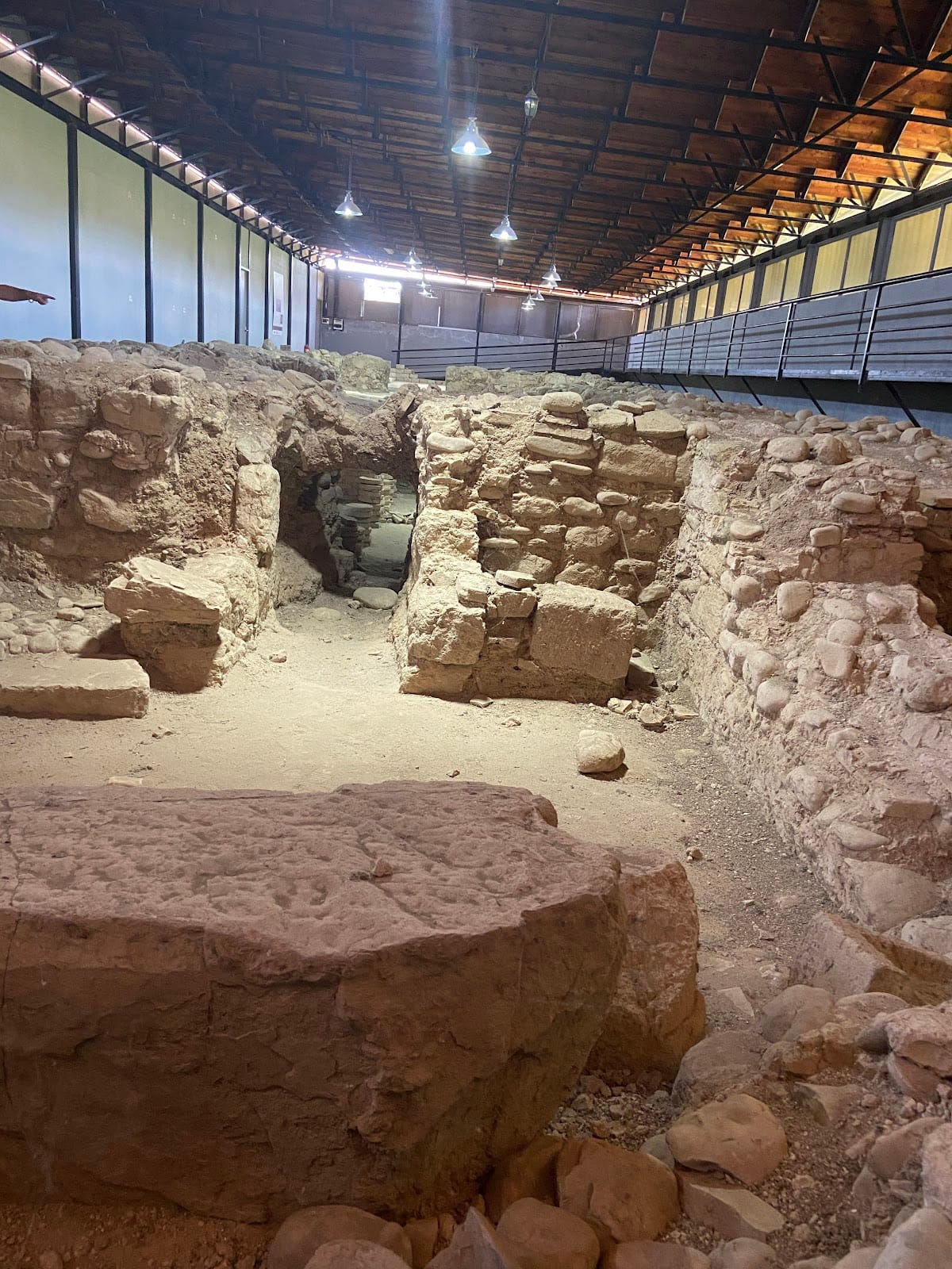
The investigations revealed palaces, temples, baths, houses, paved streets, squares, water-supply and drainage systems, an administrative building, barracks, an acropolis, swimming facilities, and burial grounds. Finds are held at the Georgian State Museum, the Mtskheta Museum, and the Natsakisi expedition base. During the first half of the 1980s, a glass pavilion was built over the temple and its mosaic was consolidated. The settlement’s mosaics are among only four known examples of ancient floor mosaics in Georgian territory and are the only such example identified east of the Surami Range.
Remains
The excavated settlement extends across both banks of the Narekvavi River and includes an artificial acropolis on Dzalisa Hill. Buildings were generally constructed from river stone, mortar, mud brick, and roof tiles. Baths commonly used river stone and mortar, while temple and palace interiors were finished with gypsum plaster or lime mortar. Streets were paved with brick or ceramic tiles, and a water network used both lead and ceramic pipes. Column bases and capitals, pottery, glass vessels, window glass, metal objects, and other archaeological materials were recovered from the town.
Temple and mosaic
Temple building
The rectangular temple consists of a main hall and several large chambers. Its ceremonial entrance lay on the south, before a forecourt made from dressed tuff and sandstone that measured 4.9 by 2.75 metres. The main hall covered 48.6 square metres. Internal walls were plastered, and the building was roofed with tiles.
Dionysus mosaic
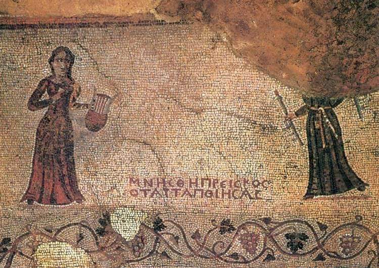
A multicoloured pebble mosaic covered the temple hall. It used twelve colours and included a band of larger pebbles, 0.45 to 0.70 metres wide, along the walls. The central design resembles a broad isosceles cross, while the principal figural scene shows Dionysus and Ariadne at a banquet. Dionysus was the Greek god associated with wine, festivity, theatre, and ecstatic worship, while Ariadne was traditionally associated with him. The floor is dated to the second century CE, and its imagery and style have been linked with the Antiochene school of mosaic art and placed in the first half of the third century CE. The building has therefore been interpreted, though not certainly, as a possible “House of Dionysus.”
Palace complex
Largest palace
The largest palace covers approximately 2,500 square metres and contains about thirty rooms and halls arranged around an atrium, an open interior court around which rooms were organized. The atrium measured 8.35 by 8.35 metres and contained a rectangular fountain basin bordered by a curb, with columns at its corners. A dressed-stone temple stood west of the court and probably supported an image of a deity.
The palace’s northwest sector held bedrooms, two-part private toilets, and separate water-supply and sewage systems. Halls occupied the northern side of the atrium, while rooms and a vestibule lay to the south. The building had a river-stone foundation, a course of dressed stone slabs above it, and mud-brick walls with painted interior plaster.
Heating installation
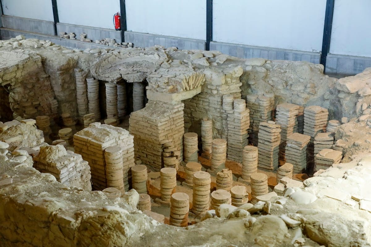
A central hypocaust occupied the palace’s southeastern section near the atrium. A hypocaust was an ancient heating system in which hot air circulated beneath floors or through channels in walls. Here, a walled heating room sent hot air through channels and cavities. The square installation measured 11.8 by 11.8 metres and heated approximately 139.2 square metres. Clay tubes acted as radiators and contained specially formed rectangular openings.
Apsidal administrative building
South of the palace stood a later apsidal building covering approximately 703 square metres. It contained three halls and intervening rooms arranged in an enfilade, a sequence of rooms opening one into another. Each hall ended to the south in an apse, with semicircular apses at the sides and a polygonal apse in the centre. Narrow openings and arches probably formed heating channels. The building has been interpreted as an administrative complex containing meeting halls and smaller rooms for record-keeping and official business. Its construction used river stone, mud brick, lime mortar, and roof tiles.
Baths and swimming complex
Bath-complex atrium
One bath complex included a rectangular atrium measuring 7.75 by 6.95 metres, with a floor of dressed tuff and sandstone. A fountain basin at the centre measured 2 by 1.8 metres and was 17 centimetres deep. It was surrounded by a curb 51 to 52 centimetres wide, with columns at the corners. On the west, a rectangular temple section with an altar stood 15 centimetres above the atrium floor. It measured 9.95 by 2.6 metres and contained a northern pedestal that probably supported a deity. A changing room was attached on the east.
Palace bath
The palace bath was a Roman-type complex with cold, warm, and hot rooms of approximately equal size. Each room measured about 5 by 2.5 metres and had semicircular apses to the north and south. The stone walls were plastered inside and out. Hypocaust heating in the warm and hot rooms rested on flat, square, and circular bricks.
The cold room had a mosaic floor with a vegetal border and marine imagery. An eight-rayed star formed part of the decoration, while surviving fragments of an ocean scene include Tethys, shell forms, dolphins, and fishing nets. The rectangular changing room measured 4.9 by 4.7 metres and had a floor covered with symmetrical geometric patterns. A mosaic also decorated the warm room. Fragments of a peacock sculpture and geometric ornament were found there, while a monumental but poorly preserved mosaic floor came from a palace dining room.
Swimming pool
The rectangular swimming-pool complex dates from the first to third centuries CE and covers approximately 800 square metres. A nine-step staircase with benches at its corners stood at the northern end. Hydraulic mortar coated the floor and outer walls. Two pairs of water-supply pipes connected the pool to a bath, showing that the two facilities formed a single complex. It is the only swimming-pool complex of this type identified in Georgia.
Acropolis and burial grounds
Dzalisa Hill
Dzalisa Hill formed the settlement’s former inner fortress. Excavations revealed a mud-brick enclosure and mud-brick buildings with roofs covered in red-painted tiles. The hill is also associated with a stone-built vaulted burial chamber on its southern side. The chamber measures approximately 4 by 4.7 by 4 metres, follows an east-west orientation, and has an entrance on the east. Its entrance passage and floor were made from dressed stone.
Burial chamber
Two burial benches inside the chamber accommodated three deceased individuals. Associated objects included three bronze fibulae, a cylindrical gold frame, and a clay lamp. The grave goods date from the second to fourth centuries CE, while the chamber itself dates from the fourth or fifth century CE.
Three cemeteries were associated with the ancient settlement. One on the right bank of the Narekvavi contained rich grave goods associated with aristocratic residents, while the burial chamber on Dzalisa Hill formed part of the funerary evidence connected with the fortified area.