Al-Azraq Castle: A Roman and Medieval Fortress in Jordan


Site at a Glance
- Rating
- 4.3
- Popularity
- Medium
- Country
- Jordan
- Primary era
- Classical
- External website
- Open
- Eras represented
- Classical, Medieval, Modern
- Civilizations
- Ayyubid, British, Byzantine, Roman
- Site type
- Military
- Remains
- Castle
On this page18 sections
History
Al-Azraq Castle is a basalt fortress in Jordan, near Al-Azraq Al-Shamaly, whose surviving form developed from Roman military installations established at the Azraq oasis. The late Roman fort belongs broadly to the late second or early third century, with later rebuilding in the Byzantine, Islamic, and Ottoman periods. The oasis mattered because its permanent freshwater sources supplied travelers and armies in the surrounding desert and controlled the northwestern end of the Wadi Sirhan route toward northern Arabia, Syria, and Damascus.
Before and during Roman rule
The oasis and its surroundings were used from prehistoric times. Middle Paleolithic stone tools were recovered at the castle, and pottery from the surface indicates activity from the Iron Age through the Ottoman period. The region was inhabited by the Nabataeans, an Arab kingdom whose capital was Petra and whose territory was annexed by Rome in 105–106, although excavations beneath the Roman fort have not revealed a substantial Nabataean settlement.
After the annexation, Azraq became part of the Roman military landscape of the province of Arabia. A road reached the oasis from the north during the reign of Septimius Severus, probably in 208–210. Other roads later linked it with Bostra, Deir el-Kahf, Umm el-Quttein, Damascus, and Dumata, the ancient settlement at modern Al-Jawf. These routes connected the oasis with the Roman frontier and with travel across the desert toward northern Arabia.
The first Roman fort may have been founded soon after the annexation, although many archaeologists associate it with the Severan road-building program or with the late second and early third centuries. Its garrison is unknown. The installation protected the water sources and helped control movement through the oasis and along the Wadi Sirhan.
The late Roman fortress
A smaller late Roman enclosure, known as a quadriburgus, was built over the earlier fort. A quadriburgus was a compact fortified enclosure dominated by projecting corner towers. Its construction is usually associated with the Tetrarchy, the system of imperial government established by Diocletian in 293, although a date during the reign of Aurelian, around 270–275, has also been proposed.
The ancient name of the station remains uncertain. Fragmentary inscriptions preserve forms including Amatha, Basianis, Basienis, Basie, and Dasianis, but the surviving evidence does not establish a single identification. A Latin military inscription refers to several Roman legions, including Legio III Cyrenaica and units from the lower Danube. It names a route between Bostra, Azraq, Amata, and Dumata. The phrase praetensione coligata is unclear and has been understood either as evidence for linked military outposts or as part of an operation to secure the Wadi Sirhan under Diocletian or Aurelian.
A fragmentary altar inscription dedicated to the Tetrarchs combines Latin and Greek text and calls the emperors the Jovian and Herculean rulers. Its precise date remains uncertain within the periods 293–305 or 305–311. Three other fragmentary inscriptions describe the restoration of the station after it had fallen into ruin through age and neglect. Flavius Severinus, the dux Orientis, a senior commander responsible for forces in the eastern Roman Empire, ordered the work, which was carried out by the imperial military officer Vincentius. Consular names date the restoration to 333. A related inscription from 334 records the construction of a reservoir at the nearby station of Basie.
Byzantine and early Islamic changes
Byzantine authorities adapted the fortress as military conditions changed. After the Islamic conquest of the Levant, the Umayyads made limited use of the site, although material from this phase is sparse. The castle appears to have lost much of its earlier military importance, and substantial occupation is not indicated between the late fourth and early seventh centuries.
Ayyubid, Mamluk, and Ottoman periods
Transjordan became strategically more important during the Ayyubid and Mamluk periods because of conflicts involving the Crusader states and threats to communications between Egypt, Syria, and the pilgrimage route from Damascus to Mecca. In 1237, Izz ad-Din Aybak, a Mamluk emir serving the Ayyubid regime, restored, reorganized, and fortified the castle. An Arabic building inscription above the entrance records this intervention.
An Ottoman garrison occupied the castle in the sixteenth century. During the Arab Revolt against the Ottoman Empire, T. E. Lawrence, the British officer and writer widely known as Lawrence of Arabia, used the fortress as a headquarters in the winter of 1917–1918 with the Hashemite prince Ali bin Hussein. Lawrence occupied the southern gate tower, while Ali used the southeastern corner tower.
Modern investigation and conservation
After the First World War, the oasis became part of Transjordan. Druze refugees from Syria settled in the castle during the 1920s after the failure and suppression of the Syrian Revolt. Their alterations, including the conversion of rooms and the insertion of windows, damaged parts of the Roman fabric. The Royal Air Force also established an air base in the oasis during this period.
Nineteenth-century accounts brought the castle to the attention of Western travelers. In 1928, O. G. S. Crawford identified traces of the earlier Roman fort through visible remains and aerial evidence. Aerial photographs taken in 1922 had revealed the larger early fort surrounding the later stone castle, but modern construction subsequently covered much of it. Aurel Stein surveyed the Roman frontier in Transjordan from the air and on the ground in 1938–1939 and recorded inscriptions at Al-Azraq. Later investigations included Samuel Thomas Parker’s 1976 survey, which collected about 150 pottery fragments, and David L. Kennedy’s 1978 study, which produced a new plan, examined inscriptions, and collected surface material. Broader archaeological work continued from 1977.
Jordanian archaeological teams undertook restoration and limited excavation in the twenty-first century. A bath installation was found west of the courtyard in 2003, the architecture was documented and numbered in 2006, and excavations in 2008 exposed Roman, Byzantine, Umayyad, Ayyubid, and Ottoman layers together with Paleolithic tools. During the same campaign, a threatened section of wall was dismantled and rebuilt from its foundations.
A multidisciplinary mortar study in 2017 sampled sixty-four locations in the fort and central mosque to clarify the building sequence. The only securely dated mortar type belongs to the Ayyubid rebuilding of 1237. Other mortars indicate Roman, early Islamic, and possibly Sasanian construction traditions, although they cannot be dated precisely. Jordan’s Department of Antiquities declared the castle a cultural-heritage site in 1953. Since 2007, it and the wider Azraq area have formed part of Jordan’s proposed UNESCO World Heritage area, with the oasis and its archaeological remains on the Tentative List.
Remains
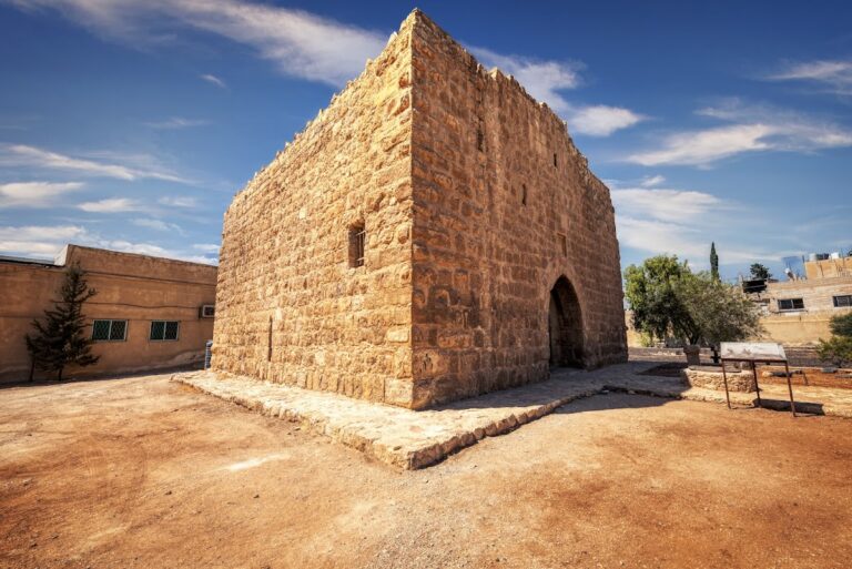
Al-Azraq Castle is a nearly square basalt fort measuring approximately 79 by 72 metres, or about 0.57 hectares. Locally quarried black volcanic basalt forms the walls, which enclose a rectangular courtyard measuring about 65 by 60 metres. The visible fortress retains much of the original Roman arrangement, although later rebuilding, modern repairs, and changes to the internal rooms have altered parts of the structure. Lower courses of the enclosure and sections of the interior remain preserved below the modern walking level.
Earlier and late Roman fortifications
Earlier Roman fort
The first Roman installation had a rounded-corner, playing-card-shaped plan associated with Roman forts of the Principate. Its visible dimensions were at least 100 by 125 metres, while its full extent may have reached approximately 190 by 130 metres. Aerial photographs from 1922 showed the larger enclosure around the later castle. Much of this earlier fort was subsequently covered by modern construction in the 1970s.
Basalt enclosure and towers
The later Roman fortress has four rectangular corner towers aligned approximately with the cardinal directions. Each measures about 6–6.5 by 8–9.5 metres and projects roughly one metre beyond the main defensive wall, or curtain wall. A fifth rectangular tower divides the north wall at its centre. The original wall was built from partly rough and partly dressed stone blocks. In Room 45, a surviving section extends for more than 11.40 metres, is about 1.40 metres thick, and stands between 1.80 and 2.25 metres high. The northwestern curtain wall, identified as Wall 22, measures 22.85 metres.
Entrances on the east and southwest sides were protected by pairs of gate towers, with the eastern entrance probably serving as the principal Roman approach. A smaller postern, or secondary gate, lay south of the northern corner tower in the area identified as Room 19c. Roman roofs included arches supported by basalt corbels and projecting basalt bars, a construction method also used elsewhere in the region.
Interior buildings and water supply
Headquarters building
A large apsidal building was inserted between the northwestern curtain walls. It has often been called a praetorium, normally a commander’s residence, but its form is more accurately interpreted as a principia, the headquarters building of a Roman fort where administrative and command functions were carried out. Its western rear wall projects well beyond the fortifications, and two storeys survive. A third storey or a flat roof is possible, while some of the towers may also have reached three storeys.
Courtyard ranges and stables
Rooms were built continuously against the inner faces of the walls around the courtyard. At least the western range probably had two storeys, with stairs or stairwells connecting the upper levels of the towers and the headquarters building. Large rooms along the northern side served as stables, although they may have replaced earlier barracks. Carefully built foundations in the centre of the courtyard may belong to a prestigious former building, but their function remains uncertain.
Well and reservoir system
A stairway in Room 27 descends along the inner eastern side to a well. The well was supplied from a reservoir a short distance east of the castle. This water system formed part of the fortress’s physical relationship with the permanent springs of the Azraq oasis.
Medieval and later features
Central mosque
A small mosque occupies the centre of the courtyard. Its date is uncertain. It may belong to the Umayyad period, while mortar analysis indicates that its construction was not necessarily contemporary with the Ayyubid restoration of 1237. The mosque’s mortar differs from the other sampled types in the fort.
Medieval entrance tower
The present entrance passes through a medieval tower added at the centre of the southern wall. Its two-leaved stone door consists of massive pivoting slabs, with the individual leaves reported to weigh approximately one and three tonnes. The entrance leads into a vestibule where the remains of a Roman board game are carved into the pavement. The tower carries an Arabic inscription dated to 1237 and includes a machicolation, a projecting defensive structure through which objects or missiles could be dropped onto attackers.
Lawrence later altered parts of the castle for military use. Some entrances were blocked, a large arch was opened through the wall, a ramp was created for camels, and machine-gun positions were installed on the towers. These changes form part of the later physical history of the fortress, whose present fabric combines Roman construction with medieval rebuilding and modern military alterations.
Inscriptions and archaeological material
The military route inscription discovered in 1949, lost and recovered in 1983, is displayed at the castle entrance. It lists Roman military units and stations along the route between Bostra and Dumata. Several milestone inscriptions were also found at the fort, although they had been moved and grouped in one area. Together with the altar dedicated to the Tetrarchs and the restoration inscriptions, these texts preserve evidence for the fortress’s military administration, road connections, and later repair.
Archaeological material from the castle ranges from the Middle Paleolithic to the Ottoman period. The excavated and surveyed remains include Paleolithic stone tools, late Roman and Byzantine pottery, limited Umayyad material, and Ayyubid and Ottoman pottery. Mortars include Roman-style hydraulic lime mortar containing volcanic or pozzolanic aggregate, lime mortar with rounded volcanic aggregate securely associated with the rebuilding of 1237, and gypsum-and-lime mortar reflecting a tradition also known from Sasanian contexts. The castle is partially ruined, while portions of the earlier fort and the surrounding Roman road system remain buried beneath the modern town and roads.