Akita Castle: A Nara-Period Frontier Administrative and Military Stronghold in Japan
Site at a Glance
- Rating
- 3.9
- Popularity
- Low
- Country
- Japan
- Primary era
- Medieval
- External website
- Open
- Eras represented
- Medieval
- Civilizations
- Yamato
- Site type
- Military
- Remains
- Fort
On this page12 sections
History
Akita Castle is an ancient fortified administrative settlement in Japan, built by the Ritsuryo government in 733 during the Nara period as a northern military and administrative stronghold. Known initially as the Dewa Stockade, it was transferred about 100 kilometers north from the Shonai region to Takashimizu Hill in a sparsely populated frontier. The site served as a jōsaku, a fortified administrative settlement combining defensive works with government and military functions, rather than as a later medieval-style Japanese castle.
Foundation and frontier administration
The stockade formed part of the court’s expansion into Dewa Province. Dewa District had been created from northern Echigo Province in 708 and elevated to provincial status in 712. At Akita, communities known as Emishi, who were progressively brought into, resisted, or remained outside the court’s political system, lived alongside settlers relocated under state authority. Around 760, the installation was probably renamed Akita Castle. From its foundation until approximately the middle of the tenth century, it functioned as the political, military, administrative, diplomatic, and cultural center of northern Dewa.
Akita Castle was the northernmost of the court’s jōsaku fortifications. It supported the extension of Ritsuryo rule, the centralized legal and administrative order governing provinces, officials, taxation, military obligations, and frontier control, while also serving as a point of contact with Emishi communities in Tsugaru and Watarishima. In 737, a direct route to Taga Stockade on the Pacific coast was planned. Fortifications at Okachi in Dewa and Monofu in Mutsu followed over the next fifty years, involving more than 5,000 men. Resistance to the route contributed to an uprising in 767 and to further pacification expeditions in 776, 778, 794, 801, and 811.
Diplomacy and changing frontier policy
Akita Castle also occupied an important place in Japan’s relations with Balhae, a state in Manchuria and the northern Korean Peninsula that maintained diplomatic and maritime contact with ancient Japan. Repeated contact with Balhae is reflected in the site’s remains, and facilities outside the enclosure may have received foreign envoys. Their reception at Akita is considered highly probable because most eighth-century Balhae missions that did not travel on Japanese ships arrived in Dewa. The northern maritime route was expected to run along the Russian Far East, Sakhalin, and Hokkaido before reaching the Sea of Japan coast, but technical difficulties meant that missions arrived less often and by routes different from those anticipated, limiting the castle’s diplomatic usefulness.
In 780, after Chinteki-shogun Abe no Iemaro proposed abandoning the installation, the court decided to retain it. Troops were sent for its protection, and a military or provincial official received specific responsibility for its defense. The deputy governor of Dewa consequently became a permanent administrator known as the Akita Castle Deputy, an office responsible for governing northern Dewa from the site.
Akita Castle was formally discontinued in 804, when Akita District was established and its functions were said to have moved to Kawabe Government Office. This decision followed changes in frontier policy after the court’s victory over the Emishi leader Aterui in 802 and the construction of new fortifications in Mutsu and Dewa. The change in terminology did not immediately end the castle’s regional role. Major rebuilding took place at the same time, and the site continued as a strengthened military and administrative center while the surrounding system of rule was reorganized. For roughly seventy years between the stockade’s transfer to Akita and the creation of Akita District, the castle itself exercised territorial control in the area without a separate district administration.
Damage, revolt, and decline
An earthquake in 830 damaged the castle’s enclosure and government buildings. The same account confirms that religious facilities, including Shitennōji and a Four Kings Hall, were attached to the installation. In 878, during the Gangyō Disturbance, a large uprising by subordinated Emishi groups, Akita Castle was temporarily occupied and burned. Its weak defense has been associated with the absence of the regular military force intended to be stationed there, leaving only a small body of mounted guards. Provincial exploitation and the flight of about one-third of Dewa’s registered population toward the interior also contributed to the unrest.
Acting Governor of Dewa Fujiwara no Yasunori led troops drawn mainly from Kozuke and Shimotsuke Provinces, while Chinju-shogun Ono no Harukaze pursued conciliatory measures. Their combined military and diplomatic response brought the revolt toward an end, after which Akita Castle was recovered and rebuilt. The installation was attacked again during the Tengyō Disturbance in 939. Its basic structure and functions probably disappeared during the latter half of the tenth century. Remains in the Unoki area continued into the first half of the eleventh century, but the site declined and was abandoned by about that time. The title Akita Castle Deputy survived as an honorific office for warriors during the Kamakura period, although no securely identified medieval castle remains have been found.
The question of the provincial capital
Whether Akita Castle housed the provincial government of Dewa between 733 and the Enryaku period remains unsettled. One interpretation places the provincial administration at the castle from 733 until its formal discontinuation in 804. It points to the planned road to Taga Stockade, documents bearing the signatures of Dewa’s governor and deputy governor, and the character of the remains. In this view, provincial functions moved to Kawabe in 804 and then to Iguchi between 815 and 819.
The opposing interpretation places the provincial government continuously within Dewa District and regards Akita as a frontier military and diplomatic installation rather than a provincial capital. It separates the 804 notice of the castle’s discontinuation from the notice concerning relocation of the provincial government, identifies Kawabe Government Office as a district center, and emphasizes the site’s remote, vulnerable position and poor communications before Ogachi Castle was completed in 761. The meaning of the documents signed by provincial officials remains central to the debate.
Rediscovery and preservation
After the site had largely faded from historical memory, investigation began in the middle of the Edo period. The herbalist and writer Sugae Masumi stayed in the Teranai area, interviewed local people, and carried out fieldwork that led him to identify Takashimizu Hill as the castle’s location. Local historian Oyama Hiroshi later helped establish the basis for excavation and designation, while historian Ando Wafu campaigned for national protection.
An official field investigation in 1924 identified earthworks in the Obata area and narrowed the estimated limits of the castle. A further investigation in 1935 preceded designation of the Akita Castle ruins as a National Historic Site in 1939. Construction work at the Akita Prefecture Gokoku Shrine exposed numerous artifacts in 1958, prompting the first large-scale excavation. Nationally directed excavations from 1959 to 1962 revealed the outer enclosure, government compound, and Unoki remains, establishing the site’s double enclosure and suggesting an affiliated temple. Continuous excavations by the Akita City Board of Education began in 1972.
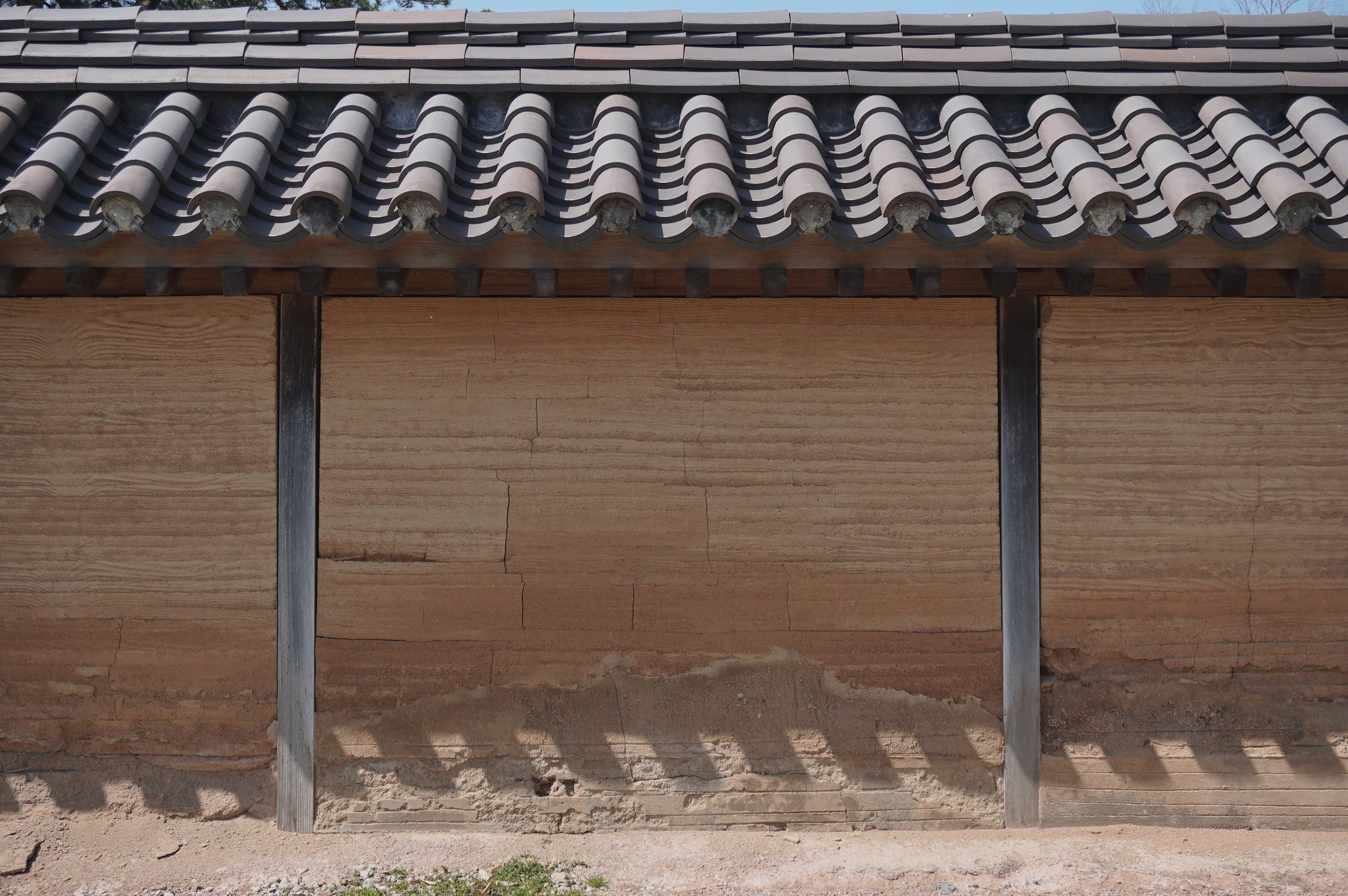
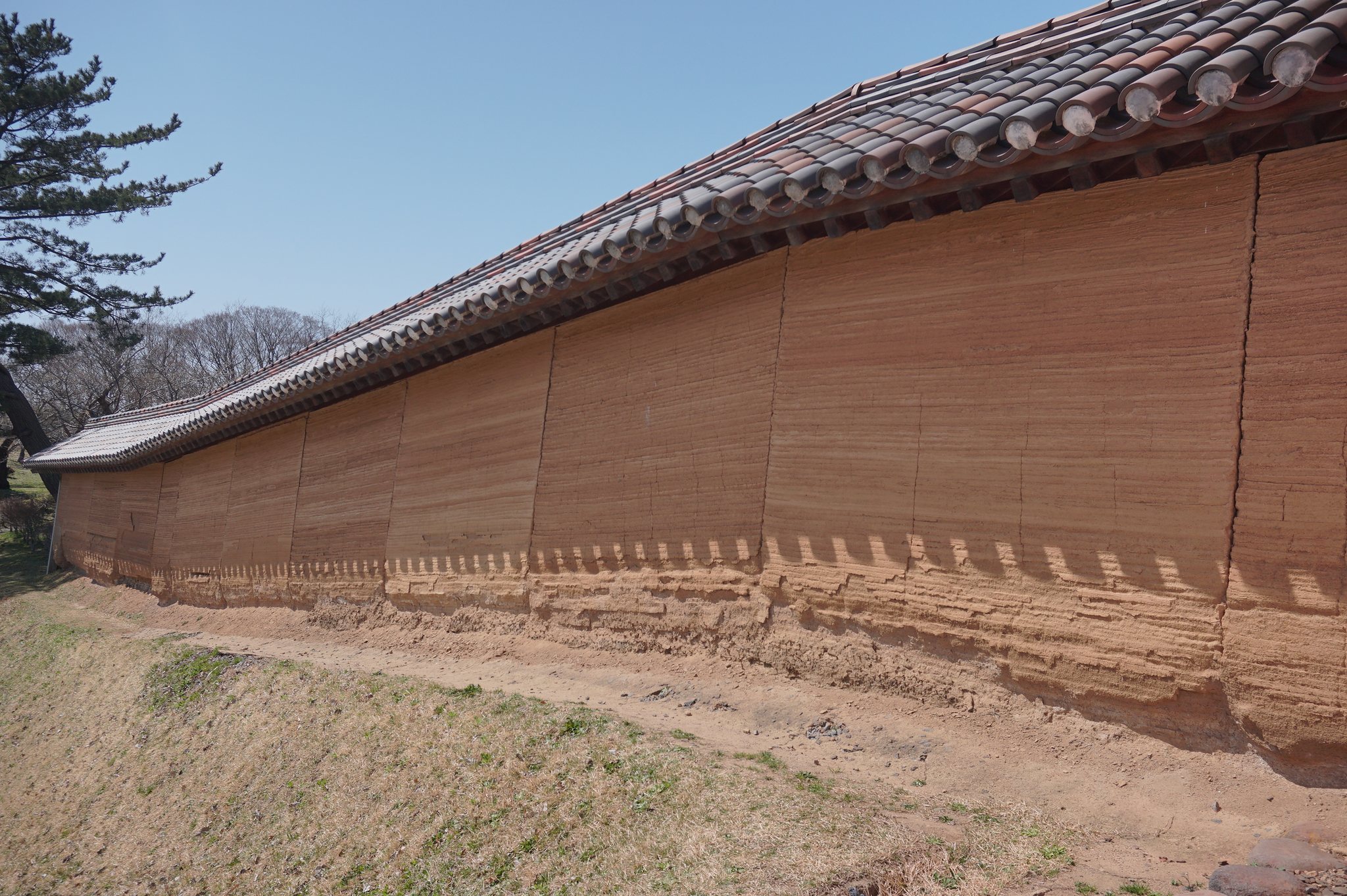
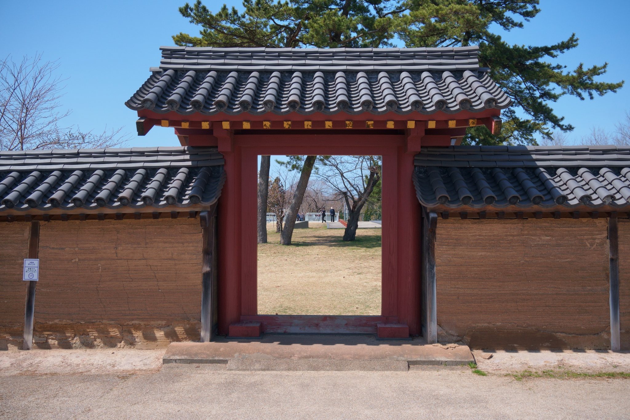
Preservation work included land acquisition from 1966, a basic development plan adopted in 1987, and a site-improvement program begun in 1989. The Unoki area was developed first, including reconstruction of an ancient pond. The East Gate and an adjoining section of wall were reconstructed in 1998, and the surrounding historic park was designated Takashimizu Park that year. The Akita Castle Historical Materials Museum opened in 2016 to display excavated materials and support protection and research. In 2017, Akita Castle was selected as site number 107 in Japan’s Continued Top 100 Castles list.
Remains
Enclosures and entrances
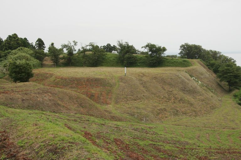
Akita Castle occupied a hill about 40 meters above sea level in the western Akita Plain, near the mouth of the Omono River, also known as the Akita Canal. Its layout consisted of an outer enclosure surrounded by defensive structures and an inner enclosure containing the central government compound. The outer enclosure was an irregular, roughly square area with a notch at its northwest corner. It measured about 550 meters from east to west and from north to south, covering approximately 30 hectares.
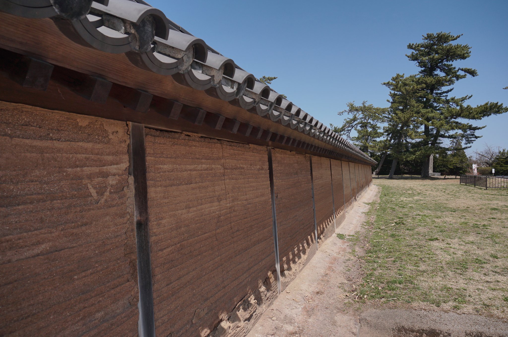
The outer boundary developed through five phases while remaining in nearly the same position. The first Nara-period phase used a tiled earthen wall, followed by a second phase with an untiled earthen wall. In the Heian period, the boundary became a palisade of posts, then a palisade of timbers. The fifth phase appears to have incorporated a ditch more than 1 meter deep and more than 3 meters wide, identified along the eastern and western sides. From the third phase onward, towers were probably placed at intervals of about 80 to 90 meters.
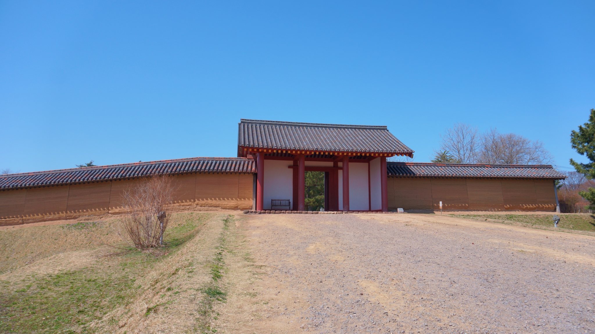
Gates stood on the east, west, south, and north sides. Excavation located the West Gate in 2008 and the South Gate in 2012, while the North Gate had not been found by 2013. The East Gate has been reconstructed with 45 meters of adjacent earthen wall and a 12-meter-wide East Avenue. The avenue was rebuilt from successive layers of rammed earth, incorporating drainage and water-permeability techniques associated with ancient road construction.
Government compound
The inner enclosure and government compound lay slightly southwest of the castle’s center. In its foundation-period form, the compound measured about 94 meters east to west and 77 meters north to south. Its basic position and plan remained largely stable through six phases, although the sixth phase had two subphases.
The compound followed a U-shaped arrangement. A main hall stood at the north, a forecourt extended to the south, and side halls occupied the east and west. This layout followed the formal arrangement of court halls in the capital and provincial government offices. It accommodated administrative work, receptions for local Emishi groups, and ceremonies connected with the arrival and departure of foreign envoys. The buildings were mainly post-built structures until the final phase, when stone foundations were introduced for reasons that remain unknown. An earlier alignment of National Highway 7 cut through the southwest portion of the compound, damaging about one-third of it and leaving the west side hall and south gate unclear.
The foundation-period main and side halls broadly resembled the first-phase design at Taga Castle. Akita’s main hall had a projecting aisle on its south side rather than aisles on all four sides. This difference has been interpreted in relation to the heavier snowfall on the Sea of Japan side compared with the Pacific side. The buildings were approximately equal in size, although Akita Castle’s inner enclosure was considerably smaller.
Obata production area
The Obata area in the eastern part of the castle contained groups of post-built buildings, pit dwellings, blacksmith workshops, and iron-production facilities. The finds include small-lamellar armor made from nonferrous material, documents preserved on lacquered paper, and a facility connected with the burial of an afterbirth jar. The area was residential during some periods, but especially from the Heian period it operated as a production zone supporting the castle. Activity reached its height from the early to middle ninth century, when the concentration and continued operation of workshops within a defined enclosure area gave the sector an unusual character.
Unoki remains and toilet facility
Outside the enclosure, the Unoki area contained regularly arranged groups of large post-built buildings and a water-flush toilet facility. Four phases of development have been identified. The first two belong to the Nara period, while the third and fourth date from the Heian period and later. Structures in the first phase, dating between the stockade’s foundation in 733 and its probable renaming around 760, included a large post-built building larger than the main hall in the government compound.
National investigations have interpreted the Unoki remains as Shitennōji, an affiliated temple. The Nara-period buildings, however, used neither stone foundations nor tiled roofs, leaving that interpretation uncertain. They may instead have formed a reception complex for court guests and Balhae envoys. Later phases were enclosed and assumed a more clearly temple-like form. Pottery with ink inscriptions translated as “temple” and “Tama Temple” supports the possibility of an affiliated temple.
The toilet consisted of a post-built structure, toilet tanks, a settling tank, a wooden conduit, and a privacy screen. Its arrangement probably included a waiting-room-like space entered from the eaved side, followed by three individual rooms. Waste collected beneath each room passed through the wooden conduit toward a pond. The settling tank allowed cleaner surface water to flow out while reducing pollution. Water was probably stored in jars inside the rooms and poured after use, producing a mechanism broadly comparable to a simple modern flush toilet. Parasite-egg analysis has been used to suggest either use by officials from western Japan, whose diet did not regularly include salmon and trout, or use by a facility receiving foreigners who regularly ate pork.
Excavated materials and later use
Excavations have yielded ceramic roof tiles, wooden boards, lacquered-paper documents, armor fragments, production debris, pottery with ink inscriptions, and other materials. One lacquered-paper document bears the signatures of Dewa’s governor and deputy governor. Because a lacquered-paper document is a written record preserved when discarded paper was coated with lacquer and reused, this object has particular importance for interpreting the castle’s administrative role and the question of whether the provincial government operated there.
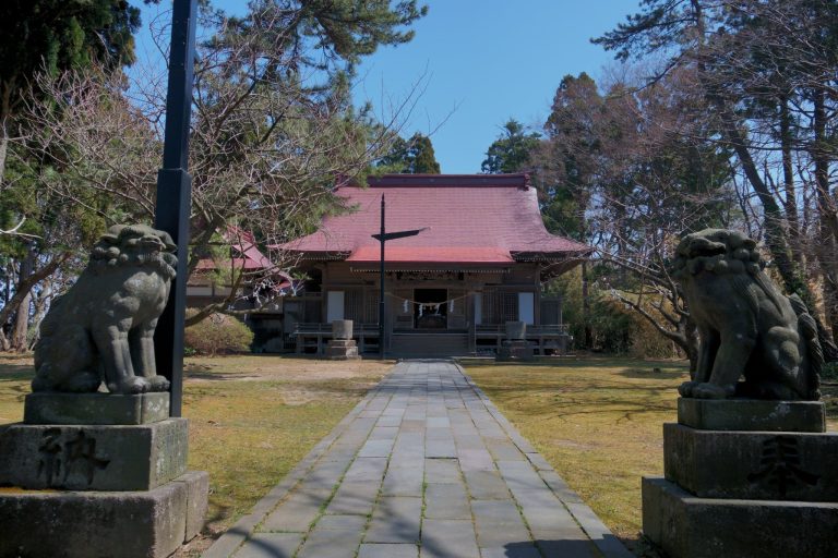
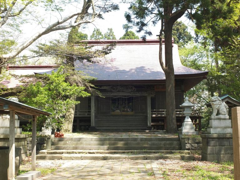
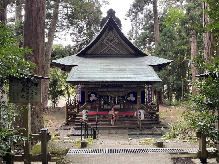
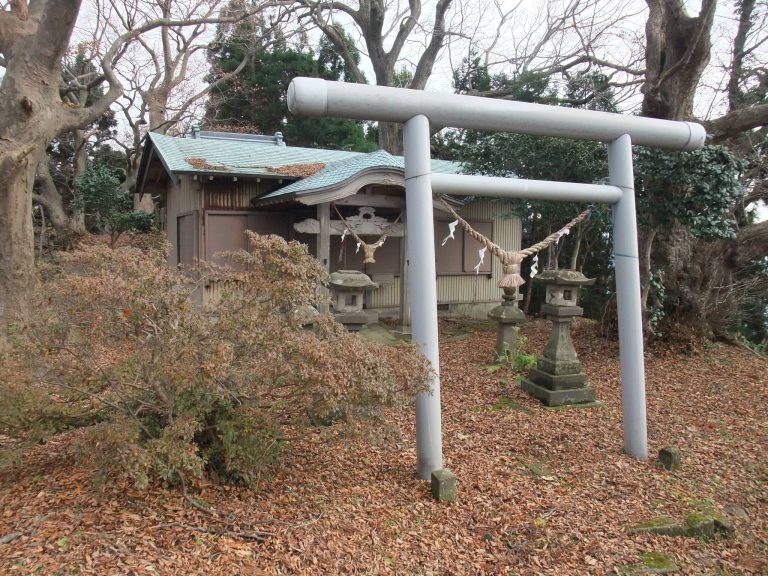
The East Gate, parts of the enclosing wall, the East Avenue, and a toilet building have been reconstructed. Part of the former castle area now forms Takashimizu Park. The Akita Prefecture Gokoku Shrine was relocated onto the ruins, adding a later religious use within the historic site.