Historic Sites in Pakistan: Explore Ancient Cities, Forts and Tombs
Pakistan’s historic sites preserve several distinct urban and architectural traditions. Brick-built Indus cities predate the streets and religious monuments of ancient Taxila, while later fortresses and funerary complexes record the ambitions of regional and imperial rulers. The collection brings these places together geographically while keeping their different dates and cultural settings clear.
Primary Function: All
Type: All
Civilization: All
Popularity: All
Rating: All
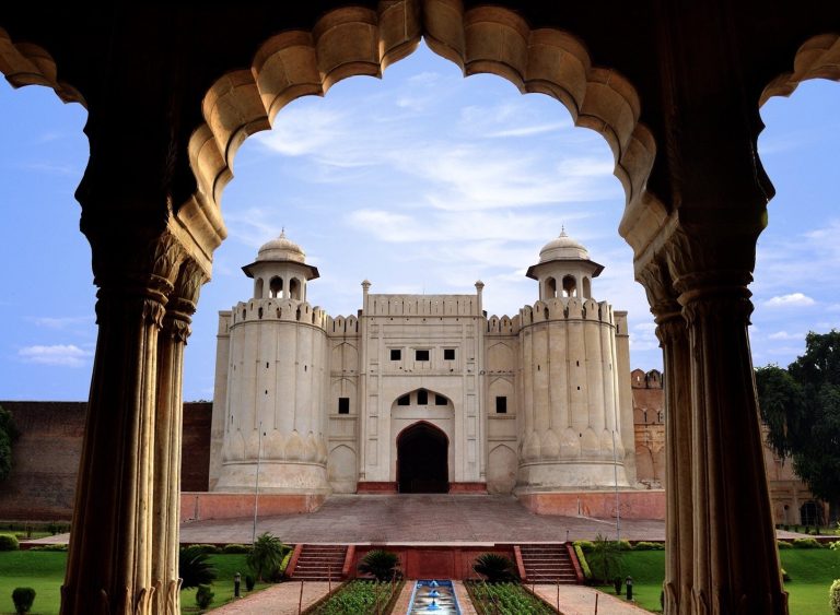
Lahore Fort is a major fortified complex in Lahore, Pakistan, shaped by Mughal, Sikh, and British rule. Its palaces, mosques, gardens, defensive…
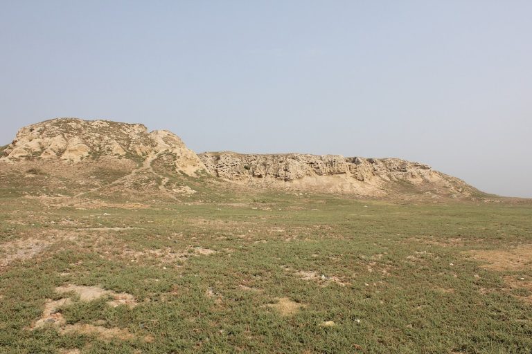
Pushkalavati was the capital of ancient Gandhara, with archaeological remains at Bala Hisar and Shaikhan Dheri near the Swat and Kabul rivers. Its…
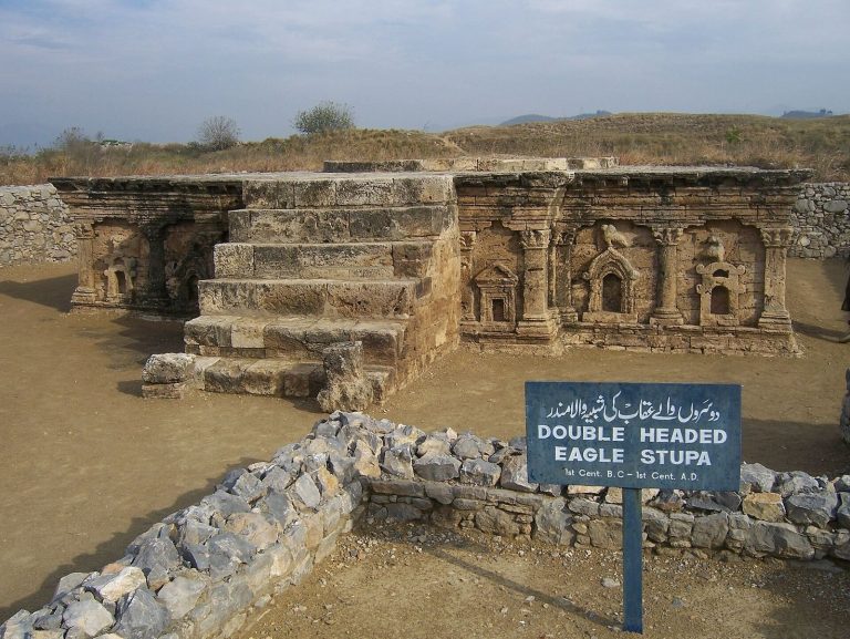
Taxila developed from prehistoric settlements into a capital of Gandhara and a centre of learning, trade and Buddhist activity. Its archaeological…
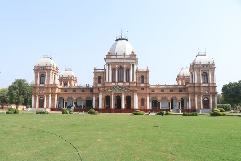
Noor Mahal is a nineteenth-century royal palace built by the princely state of Bahawalpur during the British Raj. It later served as a guest house,…
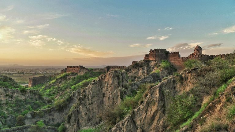
Rohtas Fort is a sixteenth-century fortress built under Sher Shah Suri near Dina in Pakistan. Its massive walls, twelve monumental gates, stepwells,…
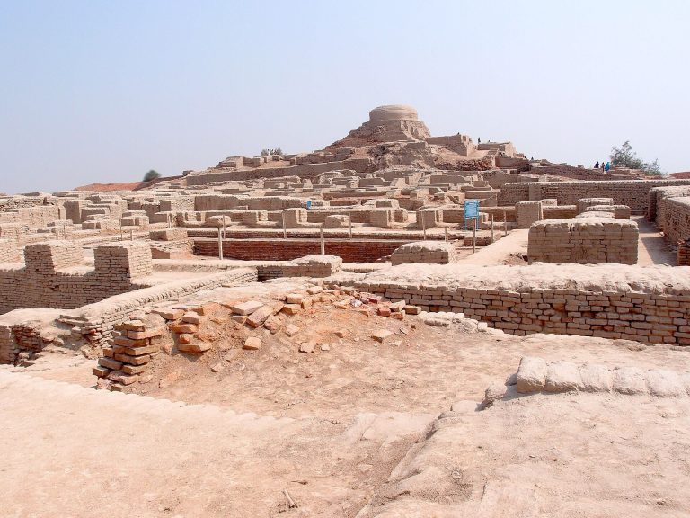
Mohenjo-daro was a major Bronze Age city of the Indus Valley Civilisation, built around 2500 BCE and abandoned by about 1700 BCE. Its planned…
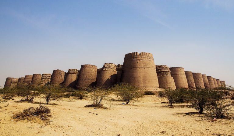
Derawar Fort is a major fortified complex in Pakistan’s Cholistan Desert, founded in the ninth century and later reshaped under the rulers of…
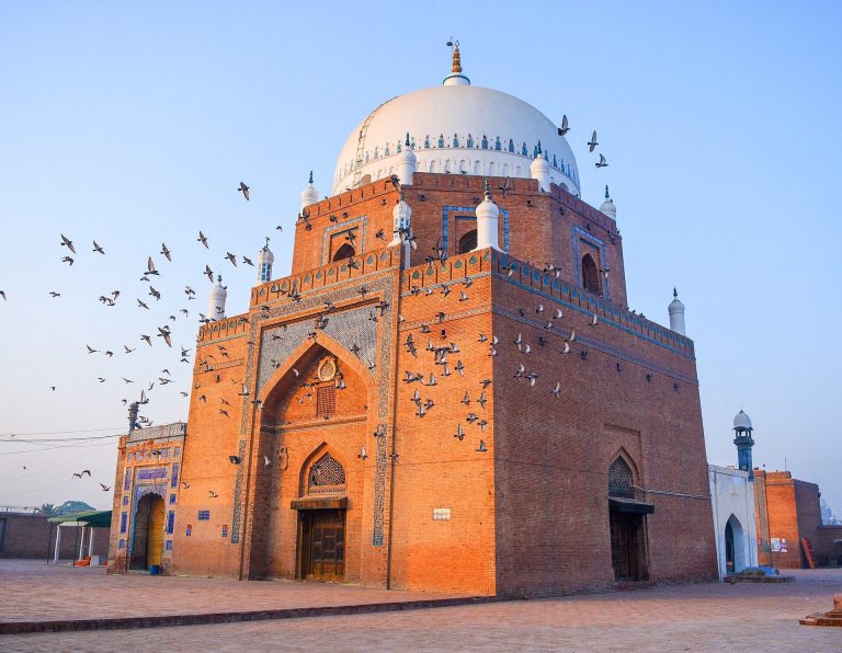
The Shrine of Bahauddin Zakariya is a 13th-century Sufi mausoleum in Multan, Pakistan, built in 1262 and regarded as a model for early shrine…
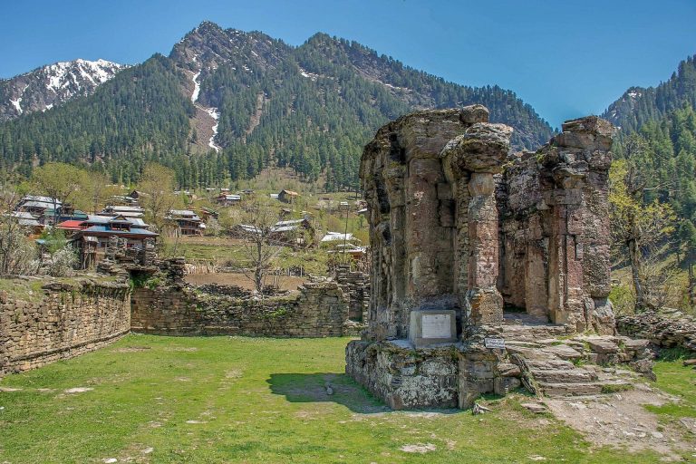
Sharada Peeth is a ruined Hindu temple and former centre of learning on the Neelum River in Pakistan-administered Kashmir. It is associated with the…
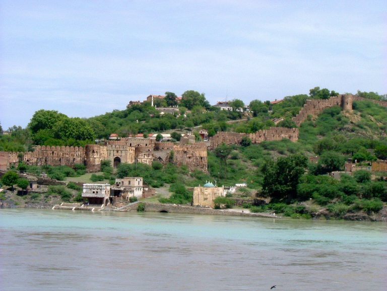
Attock Fort is a sixteenth-century Mughal stronghold built to protect the Indus crossing and the western frontier. It later passed through Maratha,…
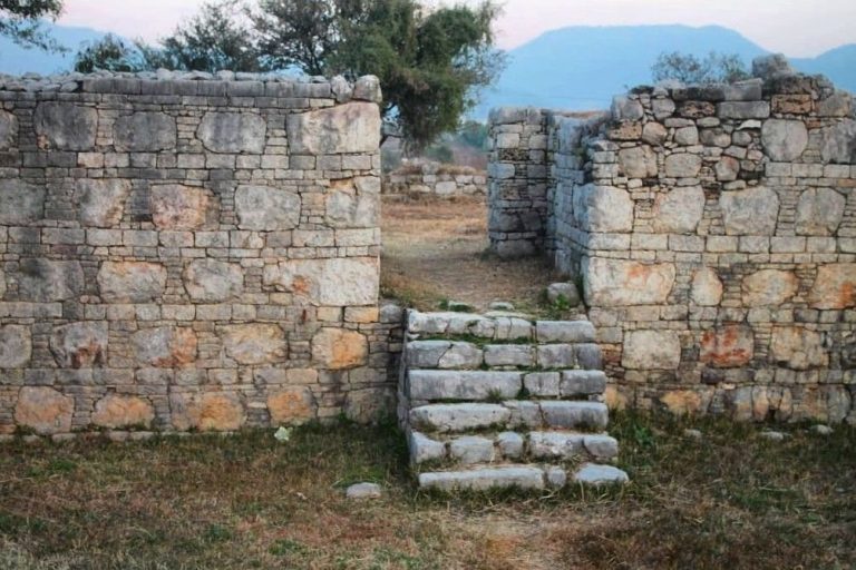
Dharmarajika Stupa, near ancient Sirkap in Taxila, developed from an early Buddhist monument into a major Kushan-period stupa and monastic complex.…
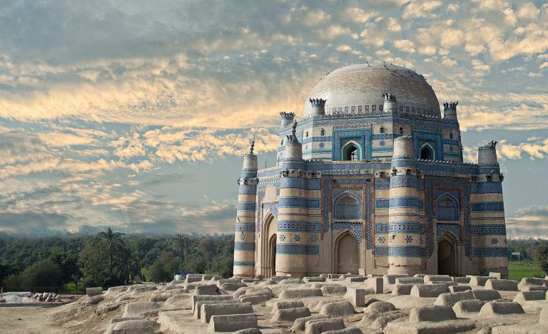
The tomb of Bibi Jawindi in Uch Sharif is a fifteenth-century mausoleum associated with the Suhrawardiyyah Sufi order. Damaged by floods and…
For details on how to use the maps, which sites are included, how popularity and ratings are determined, and how sites are classified, see the help page.
On this page4 sections
Planned streets and buildings at Mohenjo-daro
Mohenjo-daro was a major city of the Indus Valley civilization during the third millennium BC. Excavated streets and lanes divide blocks of buildings, with fired brick used extensively in their walls and drainage systems. Wells and bathing areas formed part of the built environment of residential neighbourhoods.
The elevated area conventionally called the Citadel includes larger structures, while the Lower City preserves substantial domestic remains. Those modern descriptive names do not establish the precise political organization of the settlement. Its physical plan is much better known than the institutions that governed it.
Sirkap: an ancient city in the Taxila region
Sirkap preserves a different urban layout within the historic Taxila region. A main street and intersecting lanes organized the settlement inside its defensive circuit. The city developed through Indo-Greek and subsequent periods, with repeated rebuilding leaving several phases of occupation.
Religious monuments stood among its houses and streets. Surviving Buddhist structures incorporated decorative forms drawn from different architectural traditions. The juxtaposition is useful evidence for the city’s cultural contacts, but the buildings cannot all be assigned to its earliest foundation simply because the street plan has Hellenistic associations.
Fortresses controlling routes and river crossings
Rohtas Fort was commissioned by Sher Shah Suri in the sixteenth century. Its walls follow an irregular hilltop circuit reinforced by numerous bastions and substantial gates. A separate internal wall divided the citadel from the larger enclosure.
The fort’s scale and gateways reflect its role in controlling the surrounding region and routes. Its origin belongs to the Sur dynasty, even though the fortress continued to have a history under later rulers.
Attock Fort was built under the Mughal emperor Akbar beside the Indus. Its walls descend toward the river, enclosing a position intended to secure an important crossing. Later additions, including Sikh-period works, form part of the surviving complex. Its article explains the different phases without treating every wall and tower as part of the original Mughal construction.
Tiled mausoleums and carved burial monuments
The tomb of Bibi Jawindi at Uch Sharif preserves part of a late fifteenth-century brick mausoleum. Its octagonal form, corner turrets and blue-and-white tilework remain legible despite the loss of much of the building. Flood damage is central to explaining its present appearance: the surviving portion belongs to a once more complete domed structure.
Makli Necropolis, near Thatta, contains a much larger funerary landscape developed under successive dynasties. Enclosed mausoleums, open-sided canopies, family compounds and carved graves preserve different ways of marking burial places.
Stone carving and brick-and-tile construction appear across the necropolis. Reading the monuments by date and patron makes their variety clearer than treating the entire cemetery as the work of one ruling house.
Use the map to find sites across the country, then open the individual articles for their surviving architecture, chronology and later alterations.