Fort bij Kudelstaart: A Dutch Water-Line Fortification


Site at a Glance
- Rating
- 4.2
- Popularity
- Low
- Country
- Netherlands
- Primary era
- Modern
- External website
- Open
- Eras represented
- Modern
- Civilizations
- Dutch
- Site type
- Military
- Remains
- Fort
On this page7 sections
History
Fort bij Kudelstaart is a Dutch fortification in the Netherlands, built in 1905–1906 as a Model A fort within the Stelling van Amsterdam. This defensive system used forts and controlled flooding to protect Amsterdam, and the fort was intended to block movement along the Kudelstaartseweg and the navigable Westeinderplassen.
Construction within the Stelling van Amsterdam
Earthworks began in 1890, followed by the construction of a sluice in 1893. In 1894, the site was classified as a defensible earthwork, and a royal decree made it a first-class fortification in 1897. The fort itself was built in 1905–1906, while its bombproof buildings, fortified structures protected by massive construction and earth cover, were added in 1906–1907.
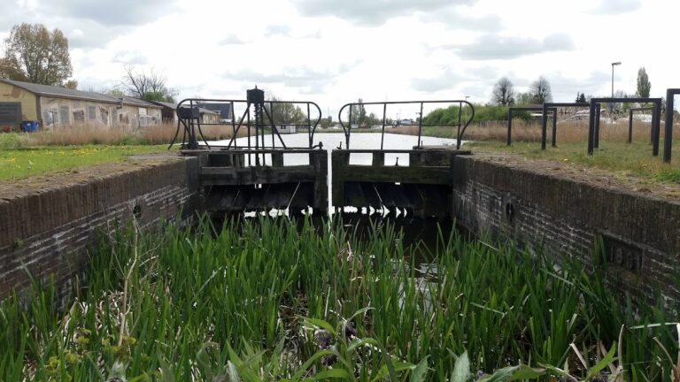
The fort’s position slightly in front of the firing line provided a relatively unobstructed field of fire and kept the installation clear of existing buildings. Its defensive role depended partly on the surrounding water system. The sluice on the rear, or gorge, side controlled flooding in the Zuidelijke Legmeerpolder, making the low-lying land more difficult for attacking forces to cross.
Military storage and wartime use
In 1924, Fort bij Kudelstaart was used to store ammunition and equipment. It was reclassified as a third-class fortification in 1926. During 1944–1945, when the Netherlands was occupied during the Second World War, the fort formed part of the German Vordere Wasserstellung, a defensive line that relied partly on water obstacles and inundation.
The fort became a fortification without a class in 1951 and ceased to be a fortification in 1959. From 1958 to 1960, various services used it as a storage site. In 1960, it received a peacetime function as a marina.
Marina use and redevelopment
The Vafamil foundation, established in 1963 to provide holiday and leisure facilities for defence personnel, used the grounds as a marina for military holidaymakers from 1972. In 2009, the disposal of the grounds was decided, and Vafamil was required to clear and return them to the Ministry of Defence by 1 January 2015. The fort was offered for sale in October 2014. The municipality of Aalsmeer announced its purchase in early 2015 for 270,000 euros, although the property required extensive restoration.
After Vafamil left, management passed to ESA, the organization responsible for indoor sports facilities in Aalsmeer. From early 2016, the municipality sought a new user through a tender. Sebalt International BV won with a proposal for a watersports complex including a hotel, conference rooms, a restaurant, maritime café, marina, events venue, further hotel and conference capacity, and an underground car park.
The proposed redevelopment was judged too large-scale. UNESCO, the United Nations Educational, Scientific and Cultural Organization, rejected the plan in its heritage review, while the Council of State annulled the zoning plan. The tender winner’s financial partner then disappeared. After years of efforts by a residents’ foundation, Aalsmeer recognized that the proposal was unrealistic and unfeasible and ended the redevelopment in 2023. The municipality terminated its cooperation with Zeilfort Kudelstaart BV in December 2023. Fort bij Kudelstaart remains owned by the municipality of Aalsmeer and is listed as a national monument.
Remains
Fortification and layout
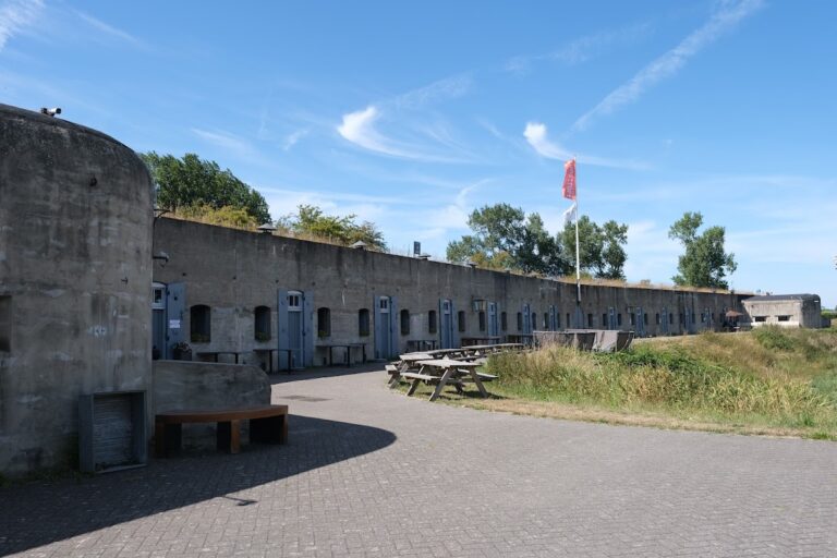
Fort bij Kudelstaart stands near Kudelstaart in North Holland, close to the hamlet of Vrouwentroost. It is a concrete Model A fort, a standardized fortification design used within the Stelling van Amsterdam. Its front rampart, the fortified embankment facing the expected enemy approach, contains two double gun emplacements. Each emplacement includes a concrete shelter for its crew. The combination of two double positions with their crew shelters is described as unique among the forts of the Stelling van Amsterdam.
A bridge formerly stood behind the fort. After the Second World War, it was replaced by a dam, allowing vehicles to transport goods to and from the installation. The fort’s surviving arrangement therefore includes both its defensive concrete works and later changes associated with its postwar use.
Water control and present function
On the gorge side, the sluice controlled inundation of the Zuidelijke Legmeerpolder. Its purpose was to regulate the flooding that formed part of the wider defensive system around Amsterdam. The sluice was restored in 2007. The fort’s listed current function is a marina.