Fort Blauwkapel: A New Dutch Waterline Fort near Utrecht


Site at a Glance
- Rating
- 4.3
- Popularity
- Low
- Country
- Netherlands
- Primary era
- Modern
- Eras represented
- Modern
- Civilizations
- Dutch
- Site type
- Military
- Remains
- Fort
On this page13 sections
History
Fort Blauwkapel is a Dutch fort near Utrecht, Netherlands, built between 1818 and 1821 as part of the New Dutch Waterline, a defensive system that combined controlled flooding with forts and other military works to protect approaches to the country’s political center. One of the largest forts in the line, it enclosed the existing village of Blauwkapel and guarded the road to Hilversum.
Earlier Fortification and New Earthworks
An earlier fortification was established at the site in 1787. After it fell into disrepair, the location retained its strategic value, and a new earthwork was constructed there in 1818. The fort was enclosed by ramparts and a moat. The road to Hilversum continued through the fortified area, but a bypass was also created, allowing the passage through the fort to be closed when danger threatened.
Expansion in the Nineteenth Century
The first brick building was added around 1850. Guardhouse A was constructed between 1849 and 1852, followed in 1874 by Barracks C and several storage buildings designed to withstand artillery bombardment. These additions strengthened the fort’s facilities for housing troops and storing military supplies.
Mobilization and Later Military Change
During the mobilization before the First World War, more than 300 men formed the garrison. Fort Blauwkapel then operated as an infantry support position with trenches, military emplacements, and observation posts. Further trenches and barbed-wire obstacles were built outside the fort.
In 1921, the southeastern ramparts and moat were removed and realigned to make room for a new railway line. The fort ceased to function as a defensive work in 1960. Utrecht’s municipality purchased it in 1997 and developed plans combining housing, work, and recreation.
Restoration and Current Protection
Between 2003 and 2009, the moat was restored, while Guardhouse A, the military shed, and the bombproof barracks were repaired. New housing was built between the church and the bombproof barracks, as well as along Kapelweg and Huis te Veenweg. Fort Blauwkapel is protected as a national monument. Seventeen components within the fort are listed in the national monuments register, together with three associated New Dutch Waterline components in its immediate surroundings.
Remains
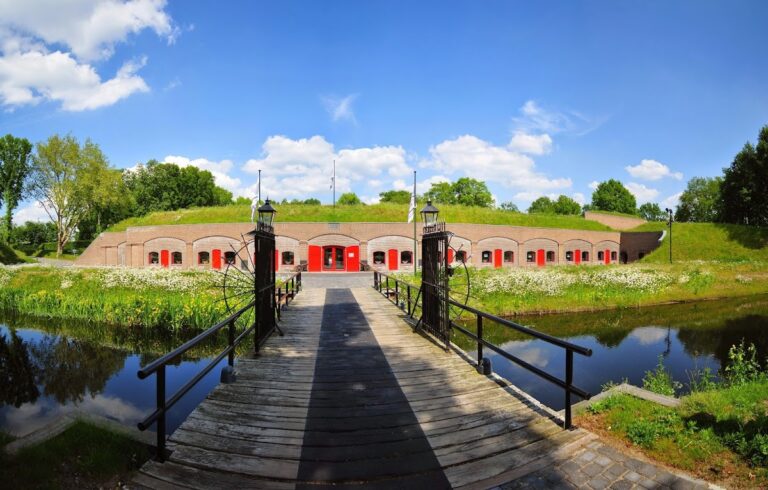
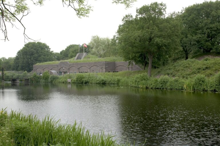
Fort Blauwkapel remains an earthwork enclosed by ramparts and a moat. Its layout incorporates the village of Blauwkapel within the fortified area, an unusual arrangement among forts of the New Dutch Waterline. The restored moat forms part of the surviving defensive landscape, while housing and recreational uses occupy parts of the former military site.
Brick Military Buildings
Guardhouse A
Guardhouse A is a brick building measuring 30 metres long and 20 metres wide, with its own moat. It contains three vaulted rooms for troop accommodation and storage, a water cellar, and a stairwell. Around 1870, protective earth was added along three sides and across the roof, creating additional shielding against artillery fire.
Bombproof Barracks and Storage Buildings
Barracks C and several bombproof storage buildings stand in the eastern part of the fort. Their heavy construction and earth protection reflect their military purpose. The buildings were restored between 2003 and 2009 as part of the wider repair of the fort.
Other Fort Structures
Military Shed
A wooden shed was converted into accommodation for soldiers. The large rectangular building measures 47 metres by 11 metres and has a chalet-like half-timbered design with brick infill. The year 1883 appears on its front facade. A fort keeper’s house also survives on the site.
Redoubt
The fort’s redoubt, a fortified inner enclosure intended as a defensible refuge, contains the premises of Scouting group Willem de Zwijger. This inner stronghold forms part of the surviving military layout, alongside the ramparts, moat, and other fort buildings.
Later Alterations and Reuse
The southeastern ramparts and moat were altered in 1921 for the railway line, and the moat was later restored between 2003 and 2009. New housing now stands between the church and the bombproof barracks and along Kapelweg and Huis te Veenweg. These changes form part of the fort’s present combination of residential and recreational use.