Cales: An Ancient Roman City in Italy


Site at a Glance
- Rating
- 4.1
- Popularity
- Very Low
- Country
- Italy
- Primary era
- Classical
- Eras represented
- Iron Age, Classical, Medieval
- Civilizations
- Etruscan, Roman
- Site type
- City
On this page18 sections
History
Cales was an ancient city in Italy, located at Calvi Risorta in the Province of Caserta, whose history developed through Ausoni or Aurunci, Etruscan, and Roman phases. Positioned along the Via Latina, the Roman road linking Rome with central and southern Italy, it became an important trading city and later a major Roman center in Campania.
Early settlement and traditions
Cales was associated originally with the Ausoni or Aurunci, an ancient Italic people connected with Campania before and during Roman expansion. An earlier Etruscan phase dates to the seventh century BC. The city occupied an important position between Rome and Casilinum near Capua, and stood a few kilometres south of Teanum Sidicinum. Its fertile territory supported agriculture, while its position on the road encouraged trade.
Ancient traditions supplied several legendary explanations for the city’s origins. One connected its name with Kalais, son of Boreas, the wind god. Another associated it with Ausonia, said to have been named for Auson, the son of Ulysses and Calypso. Virgil described Cales as older than the Trojan War and said that its people supported Turnus against Aeneas. Of the proposed explanations for the name, the derivation from the ancient Greek word for “beautiful” is regarded as the most credible.
Roman conquest and colony
Rome conquered Cales in 335 BC under the consul Marcus Valerius Corvus. The following year, Rome established a colony with Latin rights there, settling 2,500 Roman colonists. A colony with Latin rights was a Roman settlement whose inhabitants held a defined but limited form of Roman civic status. Cales became Rome’s first colony in the area and an important base for controlling Campania.
The colony retained the right to issue its own money. Silver and bronze coins associated with Cales carried the inscription “Caleno.” Its strategic role also brought military obligations. The Samnites devastated the surrounding territory in 296 BC. During the Second Punic War, Rome’s major conflict with Carthage, Cales supported the Roman campaign against Capua, which was allied with Hannibal. In 209 BC, after severe wartime losses, the city declared that it could provide no more money or troops. Rome responded by imposing heavier contributions.
Before 184 BC, Publius Claudius Pulcher strengthened the colony by sending additional settlers. Cales continued, together with Teanum Sidicinum, to rank among the important cities of inland Campania. Its prosperity rested on fertile land and trade in wine, agricultural tools, and pottery. Calenian wine was associated with the neighboring Falernian wine district, while Calenian pottery reached Etruria. Livy described the booty taken when Rome conquered Cales as exceptionally large, and Strabo later confirmed the city’s prosperity.
Municipium and late antiquity
After the Social War, the Roman conflict of 91–88 BC in which Rome’s Italian allies revolted while seeking Roman citizenship, Cales became a municipium in 90 BC. A municipium was a community incorporated into the Roman state with municipal self-government and, in this case, Roman citizenship. Cales belonged to the Publilia voting tribe, an administrative classification used for Roman citizens, and retained its municipal status during the imperial period.
During Roman rule, the city’s urban plan was extensively revised. Its public life included an amphitheater, theater, baths, forum, and a gladiatorial school. In the fifth century AD, Cales became an episcopal see, meaning that it served as the seat of a bishop, and a basilica was built for its Christian community. Vandals under their king Genseric plundered the city during the same century. Cales was subsequently abandoned and was not rebuilt as an urban center.
Medieval transformation
In the early Middle Ages, Cales became the seat of a gastaldate within the Lombard principality of Capua. A gastaldate was a Lombard administrative district governed by a gastald, an official responsible for royal or princely administration. The settlement then declined gradually. The cathedral and an ancient castle near the Rio Lanzi became the principal surviving elements. The castle was restored under Angevin and Aragonese rule, and a Bourbon customs house later arose beside it.
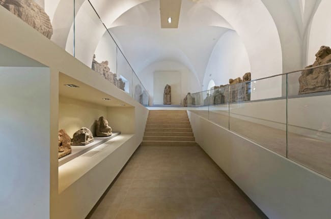
Archaeological investigations have clarified the long sequence of occupation. An Etruscan-period necropolis was recorded in 1965, and votive statues from the same period were excavated. Roman tombs were found along the Via Latina and in the city’s necropoleis, including a group discovered in 1883. Important finds from Cales are preserved in the Museo Campano in nearby Capua. The archaeological site is managed by the Campanian archaeological authorities within the municipality of Calvi Risorta.
Remains
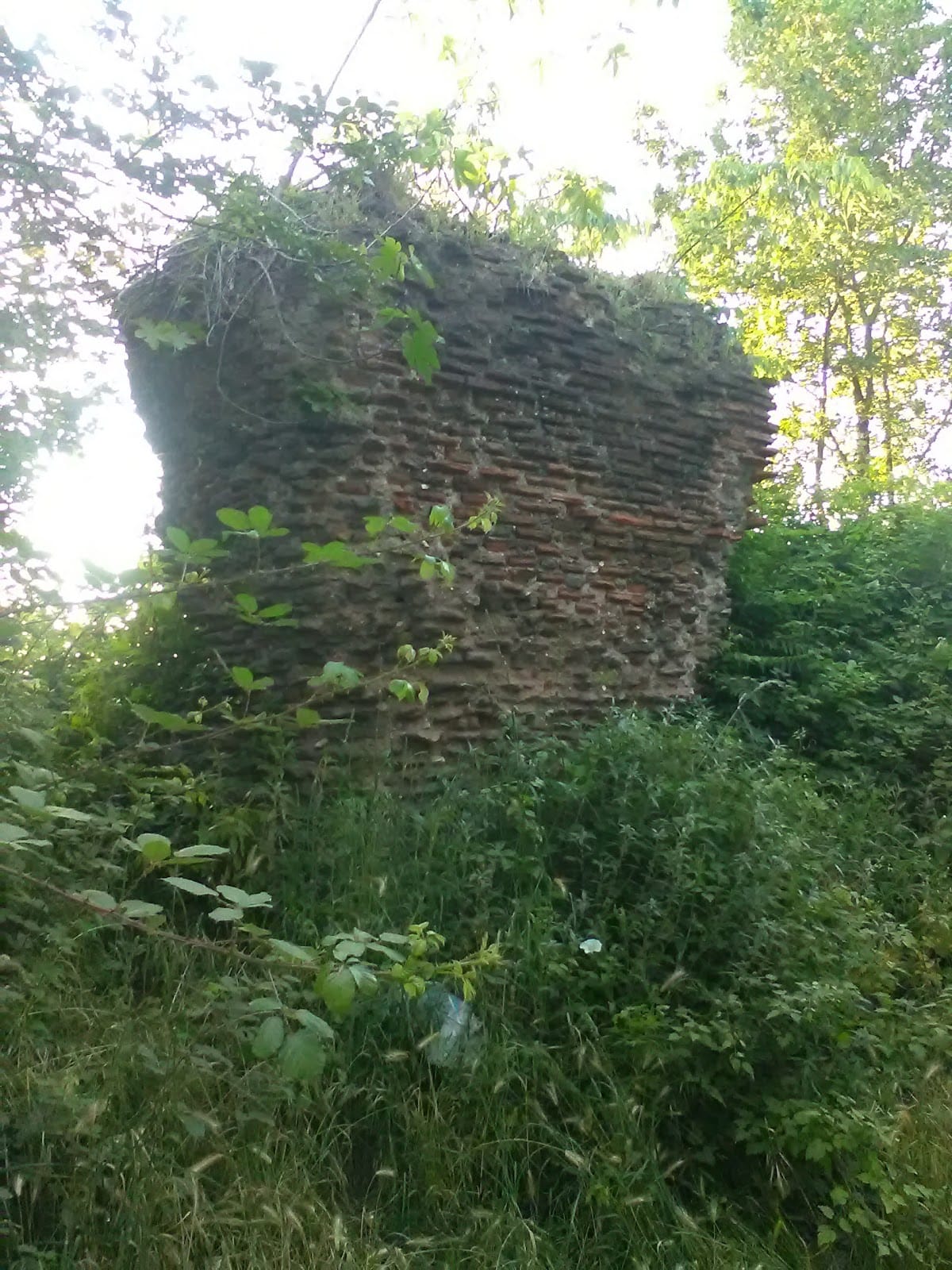
Cales occupied a plateau beside the Via Latina, while the surrounding hills contain remains of villas from the Roman Republican period. The urban area included commercial streets, a forum, terraces, a palaestra, or exercise and training ground, and access gates. Inscriptions identify six gates. Substantial remains of the amphitheater, theater, a supposed temple, baths, and facilities connected with the gladiatorial school survive across the ancient city.
Public buildings and urban spaces
Amphitheater
The amphitheater formed part of the Roman city’s public architecture. This type of building was a large arena for public spectacles. Its surviving remains belong to the substantial group of ancient structures preserved at Cales and are associated with the city’s Roman period.
Theater
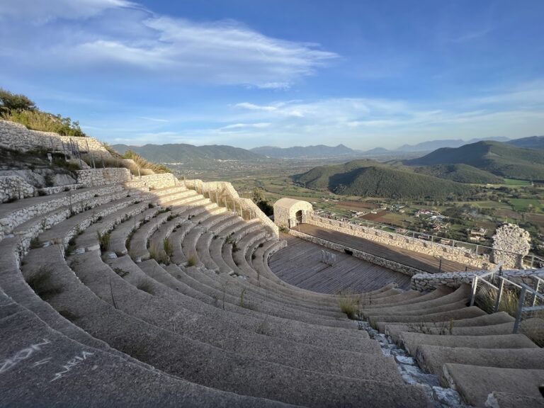
The theater began in the first century BC and was extensively rebuilt in the second century AD. As a semicircular performance building, it belonged to the revised Roman urban plan and reflects the city’s continued development under Roman rule.
Forum, baths, and training facilities
The forum served as the city’s central civic and commercial space. Commercial streets, terraces, and the city gates organized movement through the urban area, while Roman baths provided public bathing complexes. A palaestra and facilities linked to the gladiatorial school formed part of the city’s exercise, training, and spectacle-related architecture.
Burial grounds and material remains
Etruscan necropolis
The Etruscan necropolis dates to the seventh or sixth century BC and represents the earliest phase of the site’s known archaeological remains. Votive statues excavated from the same period provide material evidence of Etruscan religious practice at Cales.
Roman necropoleis
Roman burial areas extended along the Via Latina and included numerous tombs and funerary monuments. A group of Roman tombs was discovered in 1883, while further Roman-period tombs were found in the necropolis and along the road. Together, these burial grounds mark the relationship between the urban settlement and its principal route.
Coins and pottery
Numerous copper and silver coins belong to the Roman period, including pieces with Latin legends and the inscription “Caleno.” Calenian pottery was black-glazed and relief-molded, with decoration designed to imitate bronze tableware. Its production formed part of the city’s distinctive material culture and its wider commercial connections.
Medieval buildings near the Rio Lanzi
Cathedral
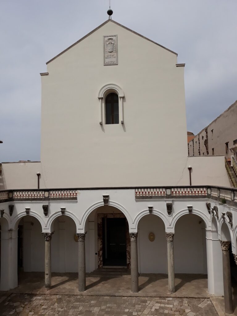
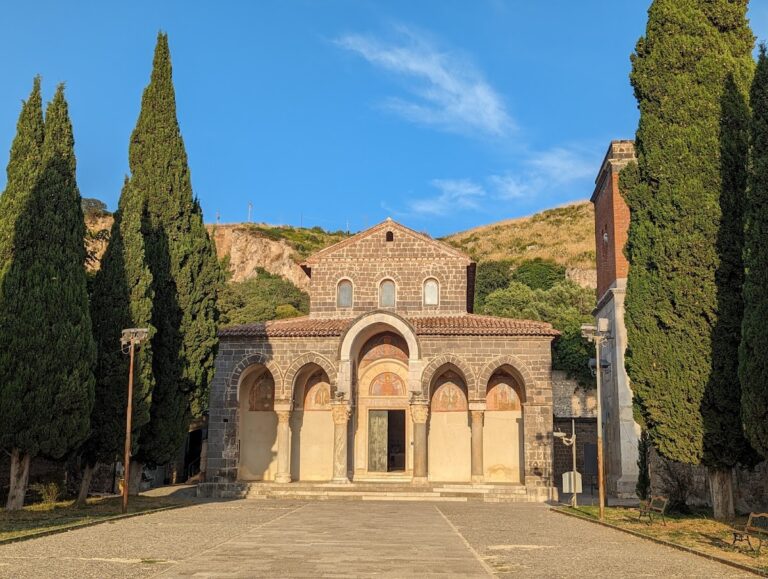
The medieval cathedral is a Romanesque building dating to the twelfth century. Its surviving features include a carved portal, three apses decorated with small arches and pilasters, a marble-mosaic pulpit, and a marble-mosaic episcopal throne.
Christian grottos
Two grottos near the cathedral were used for Christian worship. Their interiors contain frescoes dating to the tenth and eleventh centuries, preserving evidence of the religious use of the medieval settlement.
Castle and customs house
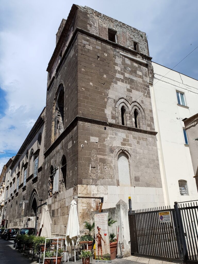
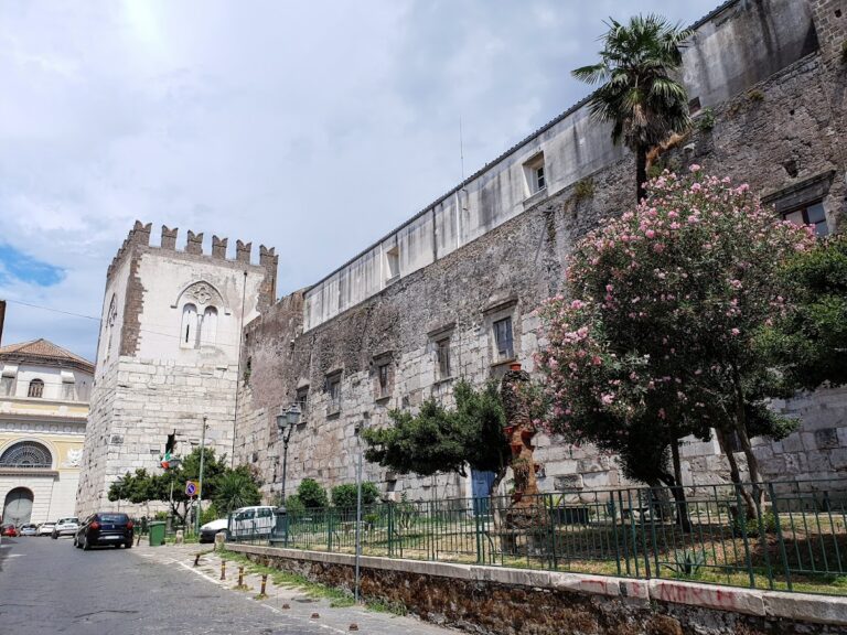
The ancient castle stands near the Rio Lanzi and incorporates later restorations associated with Angevin and Aragonese rule. A Bourbon customs house was built beside it, adding a later administrative structure to the surviving medieval landscape.