Corycus: An Ancient Coastal City and Its Fortresses
Site at a Glance
- Popularity
- High
- Country
- Turkey
- Primary era
- Medieval
- Eras represented
- Classical, Medieval
- Civilizations
- Byzantine, Crusader, Kingdom of Cilicia, Kingdom of Cyprus, Roman, Seleucid
- Site type
- Settlement
- Remains
- City
On this page31 sections
History
Corycus was a coastal city in Rough Cilicia, the mountainous western part of ancient Cilicia along the southern Anatolian coast, in present-day Turkey. It stood near the mouth of the Şeytan Deresi valley. A place called Kudupa in a Hittite-period treaty may have been Corycus, but the identification is uncertain. The city is securely mentioned in 197 BC, when the Seleucid king Antiochus III brought Cilicia under his control.
Hellenistic and Roman rule
Alexander the Great conquered Cilicia in 333 BC, bringing the region into the expanding Greek-influenced world. After his death, Cilicia changed hands during conflicts among his successors. Rome displaced Seleucid power in the second century BC. In 191 BC, a Roman fleet defeated Antiochus III’s fleet in a naval battle associated with Corycus.
As Roman control of the coast weakened, pirates established bases in Cilicia. Rome sent the praetor Antonius, a senior magistrate with military authority, against them in 102 BC. Pompey’s victory over the pirates in 67 BC ended the threat. Corycus became an important Roman town, with the right to mint coins and retain its ancient laws. Emperors also kept a fleet there to monitor piracy.
The city competed with nearby Elaiussa Sebaste, but by the third century AD it had contracted from a polis (city) to a kome (small town). In 260, the Sasanian ruler Shapur I besieged both settlements. Further conflict and unrest, including revolts among Isaurian highland communities, troubled the region.
The second-century poet Oppian called Corycus the “city of Hermes.” Hermes was associated with commerce and travel, and the name also reflected a wider Cilician identification of the Greek god with the earlier Luwian deity Runtiya. The phrase does not establish that Corycus itself had a cult of Hermes. Greek mythology also connected the nearby Corycian Caves with Zeus’s battle against the monster Typhon.
Christian and Byzantine periods
Christianity had followers in Cilicia before the reign of Constantine I, under whom it gained imperial recognition, and later became the Roman state religion. From the fourth century, Corycus regained prosperity and regional standing. The revival accompanied rebuilding at nearby Korasion, expansion of the water supply shared with Elaiussa Sebaste and extensive church construction in Corycus.
Corycus was a bishopric subordinate to the metropolitan see of Tarsus. Its bishops or representatives took part in church councils and synods over several centuries. Germanus attended the Council of Constantinople in 381. Sallustius was present at Ephesus in 431 and a synod at Tarsus in 434; the metropolitan Theodorus represented him at Chalcedon in 451. Later representatives included Archelaus at Constantinople in 536, Cyprianus in 553, and Ioannes at Constantinople in 680 and the Trullan Council in 692. Around 500, a decree requested by Bishop Indakos limited provincial officials’ involvement in choosing the city’s defensor, an intermediary with central government, and curator, a civic administrator.
After the Roman Empire divided in 395, Corycus belonged to its eastern, Byzantine half. A Persian incursion into Cilicia in 540 brought renewed instability. Fighting did not reach Corycus directly, but building activity there diminished. In 698 the city belonged to the Byzantine naval province of the Cibyrrhaeots, and later to the province of Seleukeia. Corycus declined during the tenth and eleventh centuries; a tenth-century Arabic itinerary listed it among ruined Greek sites on the Cilician coast.
Armenian and Cypriot rule
In 1099, Byzantine emperor Alexios I ordered the naval commander Eustathios to build a fortress on the mainland at Corycus and another at Seleukeia. Together, the strongholds were intended to protect a Byzantine sea route via Cyprus toward the Holy Land. The island fortress’s early history is less certain. It may have been refortified on Alexios’s orders in the early twelfth century. A now-lost inscription published in 1861 attributed its construction to the Armenian king Leon II, who ruled from 1187 to 1219. A later interpretation accepted that attribution and rejected the idea of an earlier Byzantine fortress.
Corycus passed into Armenian hands in the early twelfth century, probably under Constantine I. Byzantium briefly recovered it before it became part of the Armenian Kingdom of Cilicia. Under Leon II, the island stronghold was built or substantially developed, and churches and other buildings were added. Armenian nobles held authority in the area, with interruptions, into the fourteenth century. Simon of Corycus attended Leon I’s coronation in 1198 or 1199. Simon’s successors included Gottfried and Gottfried’s son Vahram. Later lords included Oshin, founder of the Hethumid dynasty, his son Gregory, and Gregory’s son Hetum, a historian.
Corycus traded with Venice and Genoa, although the Armenian port of Lajazzo was the more important commercial centre. Goods associated with Corycus included carpets and saffron from the Corycian Caves. After the Mamluks, a military ruling elite based in Egypt, captured Lajazzo in 1322, many of its inhabitants moved to Corycus. Oshin, the last Hethumid prince of Corycus, was murdered in 1329, and the city returned to the Armenian crown.
In 1361, facing Karamanid pressure and weakening Armenian power, the inhabitants appealed to Peter I, king of Cyprus. Peter sent the English knight Robert of Lusignan, whose successful defence of the city was followed by an oath of fealty to the king, probably in the cathedral. A Karamanid assault was repelled again in 1367. Peter also brought iron gates from Tripoli and Tortosa to the fortress after his campaigns. In 1375, Thibald Belfarage unsuccessfully sought Corycus’s customs revenue as a fief. The customs house was estimated to yield 3,000 to 4,000 ducats a year. After the Mamluks captured Sis and the remaining Armenian possessions in Cilicia that year, Corycus was the only Christian-held place in Cilicia under the Lusignan kings of Cyprus.
The Karamanids took Corycus in 1448, followed by the Ottoman Empire in 1482. The town thereafter largely disappears from historical accounts, although it continued to appear on late-medieval nautical charts.
Community and modern study
Corycus had a substantial Jewish community from at least the Roman period. Its members included traders in wine and oil, textile workers, a goldsmith, stonemason, potter and harbour workers. Interpretations of the community’s funerary evidence suggest stronger integration into wider Roman society in the earlier period, followed by more explicit expressions of communal identity during Christian times. Jewish and other graves occurred among one another, and tombs were sometimes reused by people of different faiths.
Western travellers began surveying Rough Cilicia in the nineteenth century. Francis Beaufort charted the coast in 1811–12, Léon de Laborde published engravings in 1838, and Victor Langlois produced an early scientific description of the region and site in 1861. Later investigators copied inscriptions and studied the city’s remains. Herzfeld and Samuel Guyer published the first study focused specifically on Corycus in 1930, followed by a near-comprehensive record of its funerary and other inscriptions by Josef Keil and Adolf Wilhelm in 1931. Later work included repeated visits by Friedrich Hild and Hansgerd Hellenkemper from 1968 to 1989, harbour investigations in 1995, and a survey of the city and hinterland led by Serra Durugönül from 2004 to 2011.
Remains
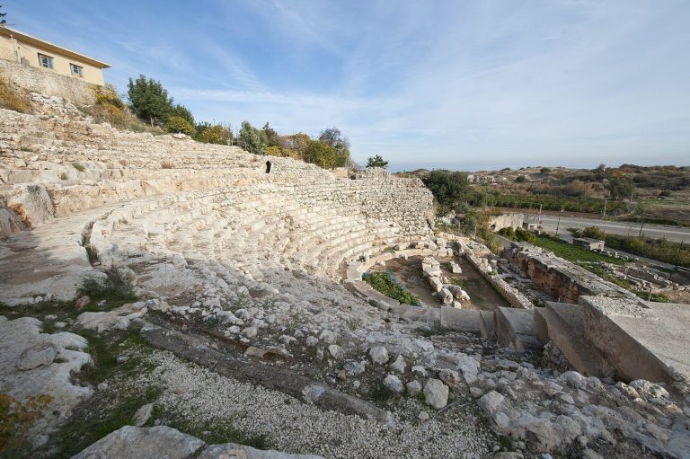
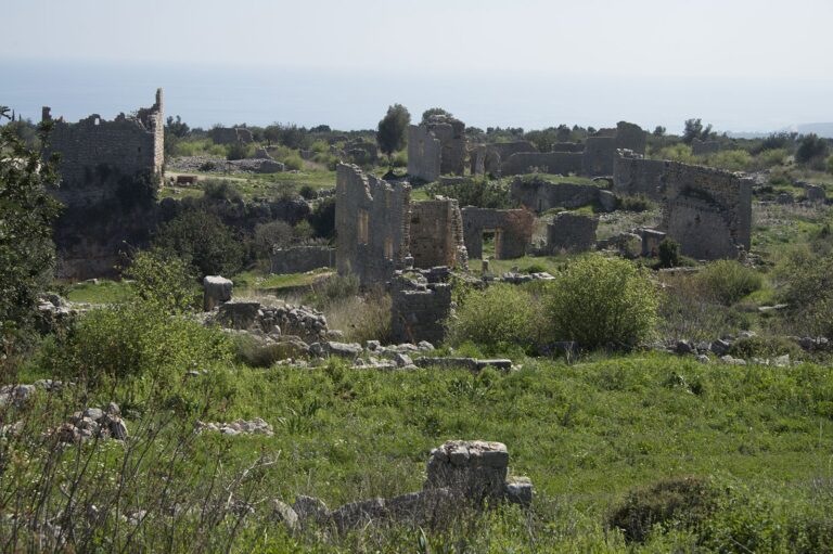
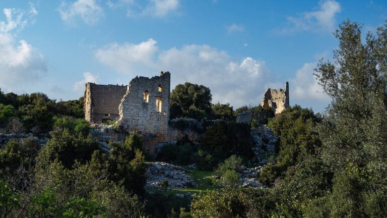
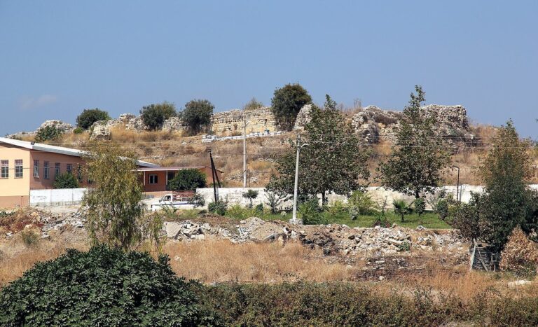
The extensive, partly overgrown remains lie east of modern Kızkalesi, on both sides of the modern road and extending south to the sea. The city wall began in the now built-over western part of the settlement, curved northeast and then south, and reached the coast about a kilometre farther east. The surviving remains include sections of the walls, Roman civic features, churches, two fortresses and three large burial areas.
City layout and infrastructure
Walls and roads
The surviving city walls date from the fourth century and formed a broad arc beginning at the harbour west of the mainland fortress. The Roman coastal road connecting Side with Seleucia Pieria passed through Corycus, while a northern branch led toward Cambazlı and Olba. After the province of Cilicia was established under Vespasian, roads in the region were renewed. On the route toward Korasion, workers cut passages into the bedrock. Sections of that road and the northern route were stepped, suited to pedestrians, riders and pack animals rather than wheeled traffic.
Water supply and harbour
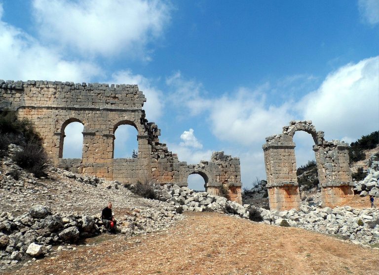
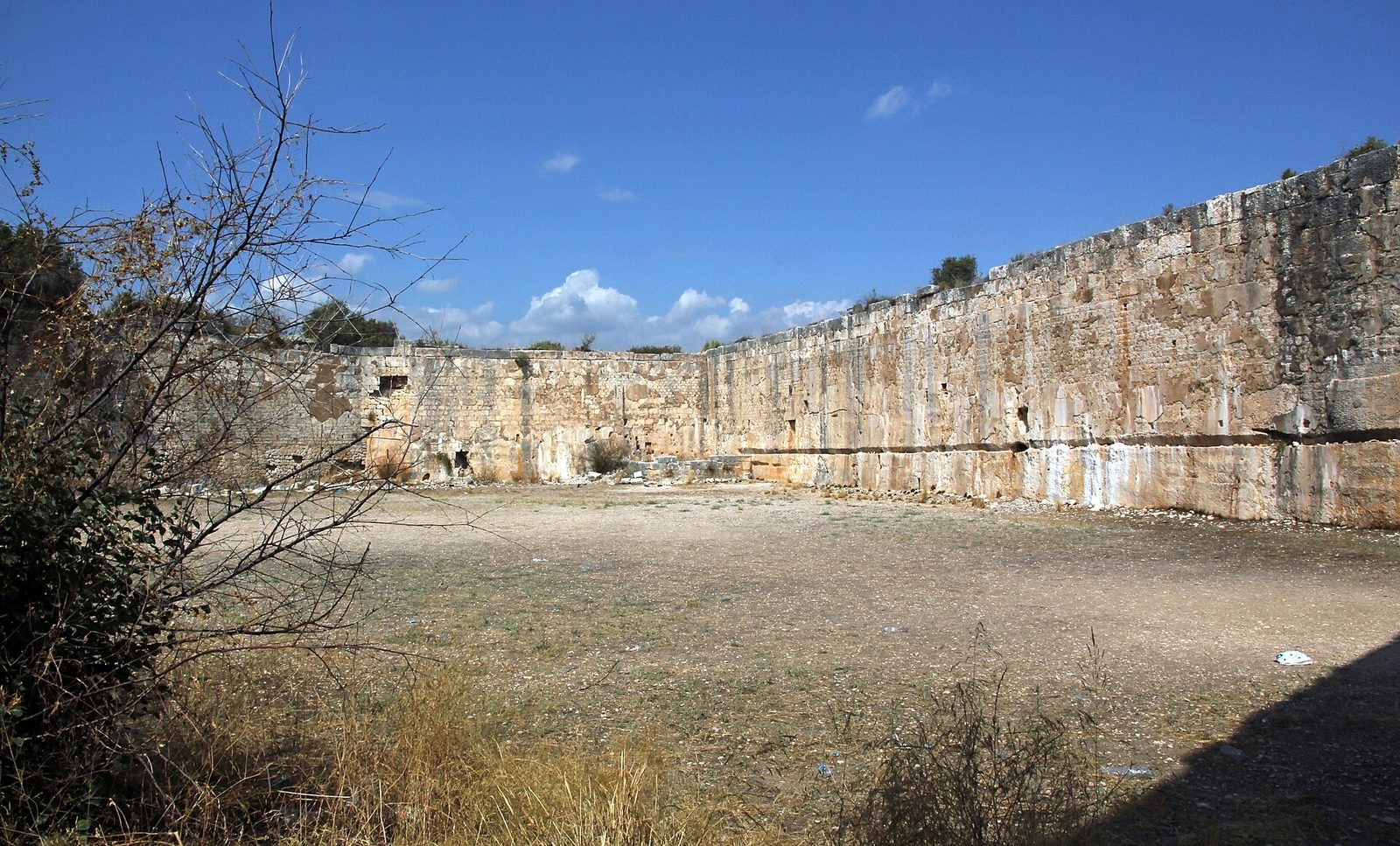
An aqueduct first built in the imperial period brought water from the Lamos River to Corycus and Elaiussa Sebaste. It was later renewed and greatly expanded, approaching the city walls from the east along a line roughly followed by the modern road. Corycus also had numerous cisterns. The large eastern cistern, dating to the fifth or sixth century, has a polygonal plan and measures about 60 by 40 metres.
A stone breakwater extending from the rocky promontory toward the offshore island may also belong to this period, perhaps reflecting the silting of the harbour. The harbour later shifted to the larger bay west of the mainland fortress. East of the fortress, harbour installations include rock-cut boat landings and nearby wall remains. Steps in this area have an uncertain date.
Roman civic remains
Promontory and monumental gate
The rocky promontory later occupied by the mainland fortress is thought to have held the Roman city centre, including a proposed forum. A monumental Roman gate was built into the fortress’s western wall. It may have marked the start of a colonnaded street and has also been identified as the beginning of the city’s main axis. Dated to the late second or third century AD, the gate has an arch 5.90 metres wide and a carefully laid façade of dressed stone, distinct from the adjoining medieval masonry.
Four flat, wall-attached columns with acanthus-leaf capitals divide the façade into three sections. The central section contains the arch; each side section has a pedimented niche, probably intended for a statue. Carved bands above the columns include an architrave and frieze, egg-and-dart and dentil patterns, and an upper cornice carried on acanthus-decorated supports. The masonry has been restored.
Temples, fountain and streets
Only limited foundations survive from two temples east of the fortress. Other remains attributed to Roman Corycus include parts of a monumental fountain, or nymphaeum, in the tomb valley and traces of colonnaded streets. Later buildings incorporated earlier masonry and architectural pieces, helping explain why Roman structures are sparsely preserved.
Coastal tower
A round tower beside the sea, about 600 metres east of the mainland fortress, measures roughly 3.5 metres across and survives to a height of 5 to 6 metres. It may have served as an end tower for a sea wall that turned west in this area. The nearby boat landings and wall remains form part of the coastal archaeological landscape.
Christian buildings
Cathedral
The cathedral stands near the centre of the walled city. It is a three-aisled basilica (a long church with aisles), measuring 19.5 by 32.2 metres. At its western end, an entrance hall 4.6 metres deep spans the building’s width. It has a three-part entrance and an apse (a rounded recess) on its north side. Two rows of columns divide the main interior; the central aisle is 9 metres wide and each side aisle 4.5 metres. At the east end, a semicircular apse contains a matching curved priest’s bench.
A later, six-sided casing of smaller, more roughly laid blocks surrounds the apse. It is considered Armenian-period work and may have been added to stabilise deteriorating masonry. Excavations uncovered floor mosaics with geometric borders and images of plants and animals, including a lion, leopard and goat. A donor inscription names Theognost and includes a biblical passage. Three letters at its edge were read as the Seleucid year 741, equivalent to AD 429. Near the altar, fitted pieces of stone formed geometric floor patterns, a technique known as opus sectile.
Fragments of a screen that separated the altar from the congregation also survive. Holes for fastening suggest that coloured marble may have lined the apse. Its cornice supports the half-dome, and surviving carved column tops show acanthus leaves, rams’ heads and peacocks. Chambers beside the sanctuary connected with both the side aisles and choir. A proposal for a lean-to roof is based on the building’s surviving form.
Church over the cistern
A church stood just south of the cathedral and was removed during construction of the road to Erdemli in the late twentieth century. Its semicircular apse had three arched windows. Beneath it lay a roughly rectangular cistern section measuring 3 by 4 metres, with rounded eastern corners. The main chamber extended west for 9 metres, narrowing from 7.5 metres wide at the east to about 6.75 metres at the west. Piers divided it into two aisles, and arches between the piers and long walls supported the church floor. A narrower water chamber lay to the south. The church’s date is uncertain.
Transept basilica
The transept basilica stands outside the city walls at the eastern end of the Sacred Way, facing east. It measures about 58.5 by 18 metres and widens around the rooms behind its apse. At the west, a courtyard forecourt 13.35 metres long has columns on three sides and doors in its outer walls. Two square rooms occupy its western corners; their purpose and height are uncertain. An entrance hall 4.7 metres deep leads into the nave through three openings. Holes for beams and traces of a stair at its north end indicate an upper floor.
Arches resting on seven columns and an eastern pier on each side divide the nave into three aisles. The south wall retains two doorways, a triple window and three pairs of windows. At the eastern end, piers and connecting arches form a transverse space. Screens separated the choir from the side spaces and nave. One surviving fragment bears a cross. Two marble blocks found in place have niches, one with a cross and the other with a relief of the Lamb of God and a Greek inscription whose funerary wording led excavators to associate the blocks with martyr burials. Fragments of the semicircular apse remain, and earlier investigators described three round-arched windows. Large chambers flank the apse and end in smaller eastern apses. A wall of small blocks later enclosed a space behind the main apse during the Armenian period. Architectural and stylistic features place the church in the late sixth century.
Church of the Tomb
About 250 metres west of the transept basilica, the Church of the Tomb is the largest church at Corycus, measuring almost 80 by 30 metres. Its plan incorporates an earlier square central shrine, or martyrion (a shrine associated with a martyr’s burial or memory), with interior dimensions of 12 by 12 metres. Large blocks and fastening holes point to rich marble inlay, while arched openings pierced all four walls. Surviving corner piers have Corinthian-style carved column tops and the beginnings of arches. Bases for two sarcophagi inside the shrine have been interpreted as evidence that it commemorated two martyrs. Features of a semicircular eastern platform and curved structure indicate apsidal projections. The shrine dates to the early sixth century.
The surrounding basilica had a western courtyard measuring 27 by 30.5 metres, with central doors through each of its three outer walls. Several canopies over the doors survive; paired supports carry short barrel-shaped vaults. Wall projections indicate columned galleries, and five arches supported on columns connect the 4.7-metre-deep entrance hall to the courtyard. The entrance hall has a small apse to the south and traces of a northern stair to an upper level. Three doorways lead into a church organised around the central shrine rather than conventional long aisles. Its transverse and shorter lengthwise spaces had geometric floors of fitted stone pieces. At first, the shrine’s eastern apse served as the church’s main sanctuary.
The church was altered after its first construction, probably not long afterward. The choir was extended east, a new semicircular main apse with two arched windows was added, and the space between the sanctuary chambers was roofed. Joints and fittings show these changes. A cistern was probably installed beneath the altar at the same time. Partly cut into bedrock, it was plastered and covered by a barrel vault, with an access shaft in the southern sanctuary chamber. A nearby water pipe has an uncertain function, and the possibility that water served healing or bathing rites has been suggested. The sanctuary chambers probably gained upper floors linked by a surviving passage. In an Armenian-period alteration, a substantial wall was inserted between the choir and shrine, using reused Byzantine column tops. The basilica dates to about 550.
Monastery church
About 300 metres farther west along the Sacred Way, the monastery church forms a complex of buildings developed in successive phases. Its seven apses are conventionally labelled A to G from north to south. The earliest, A and G, belonged to small single-aisled chapels. A basilica was built later around central apse C and flanking rooms; side aisles were added afterward, and apses B and D replaced the side rooms. Excavated remains include column bases, geometric floors made from fitted stone and part of a sanctuary screen.
An entrance hall opened into a longer outer vestibule, which also provided access to other buildings. A later group around apses D to F has a horseshoe-shaped central apse, E, with a similarly shaped window. In front were a roughly square choir and nave; side chapels D and F connected to the choir through pairs of arches. The southern room, F, has a triangular plan, probably because the Sacred Way runs alongside it. Simple carved column tops and cornices suggest a late Byzantine or possibly Armenian date. Nearby western buildings may have been residences, supporting the interpretation of the complex as a monastery. The basilica dates to the seventh century.
Great Armenian Church
Between the Church of the Tomb and the monastery church, the Great Armenian Church survives at its eastern end. Its central apse is 6.2 metres across and flanked by two apses about 2.5 metres wide. A structure behind it had two more apses, each about 3.3 metres across, and beam holes indicate an upper floor. The walls use small, roughly dressed blocks. Simple slabs support the arches, and the building has little carved ornament. Its plain masonry supports a thirteenth-century date.
Other churches and burial chapel
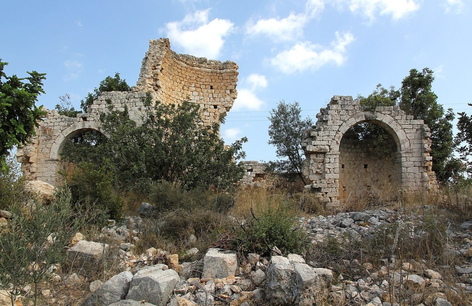
Two small church remains lie just inside the southwestern city wall and are considered likely to have been simple Armenian-period basilicas. Another three-aisled church, identified in 2005 about 200 metres northwest of the monastery church, survives chiefly as foundations and part of its apse. Its north wall, cut into the rock, rises higher. Scattered columns and carved column tops support a fifth-century date. The church was built over earlier graves after substantial rock was removed. A nearby rock-cut tomb was incorporated into the building, enlarged, given a domed ceiling and fitted with a water basin supplied from a nearby cistern. It may have belonged to a prominent martyr.
A burial chapel about 1.6 kilometres east of the mainland fortress was probably a single-aisled building measuring 16 by 9.5 metres. Parts of its apse and limited wall remains survive. Foundations at the west suggest an entrance hall, possibly with an open arch at the end and a doorway into the nave. Limestone slabs paved the floor; small blocks formed the walls, while larger blocks were used in the apse vault. Plaster and beam holes remain on the north wall. The chapel stood over an underground tomb with a barrel-shaped vault.
Fortifications
Mainland fortress
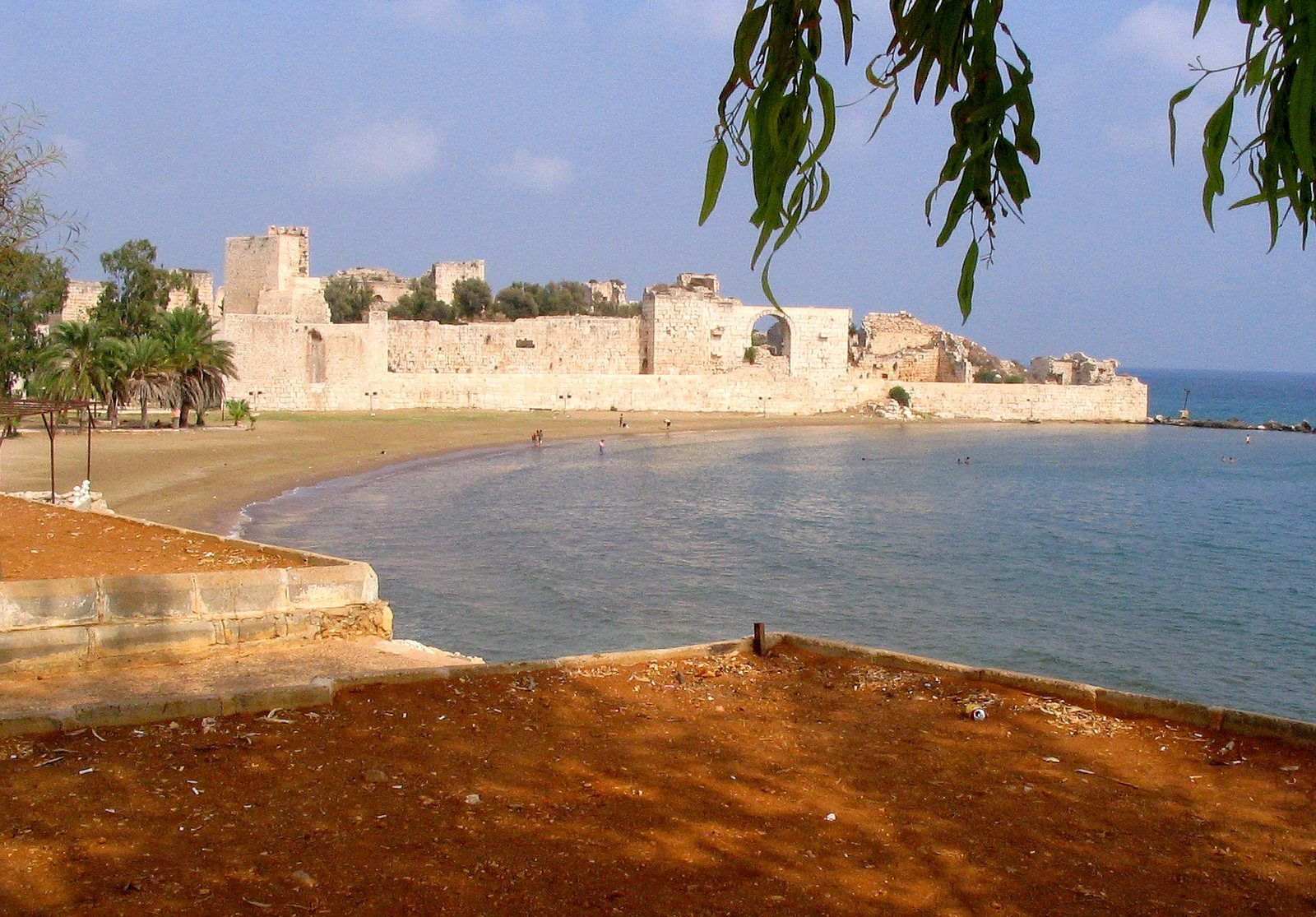
The mainland fortress stands on the shore, on the promontory thought to have held the Roman forum. Its irregular double circuit of walls incorporates reused Roman masonry. The sea borders it to the south and west, while marshy ground protected it to the north; its eastern side has the strongest defences. Economic buildings and remains of three probably Armenian-period churches lie inside.
The fortress was enlarged and strengthened under Armenian and Cypriot rule. Its underlying arrangement has been interpreted as a Byzantine plan of rectangular double walls, square towers and two chapels, built largely with masonry taken from the nearby late-antique city. One small chapel is identified as the fortress’s only wholly original Armenian construction.
Island fortress
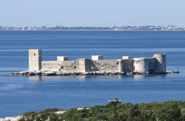
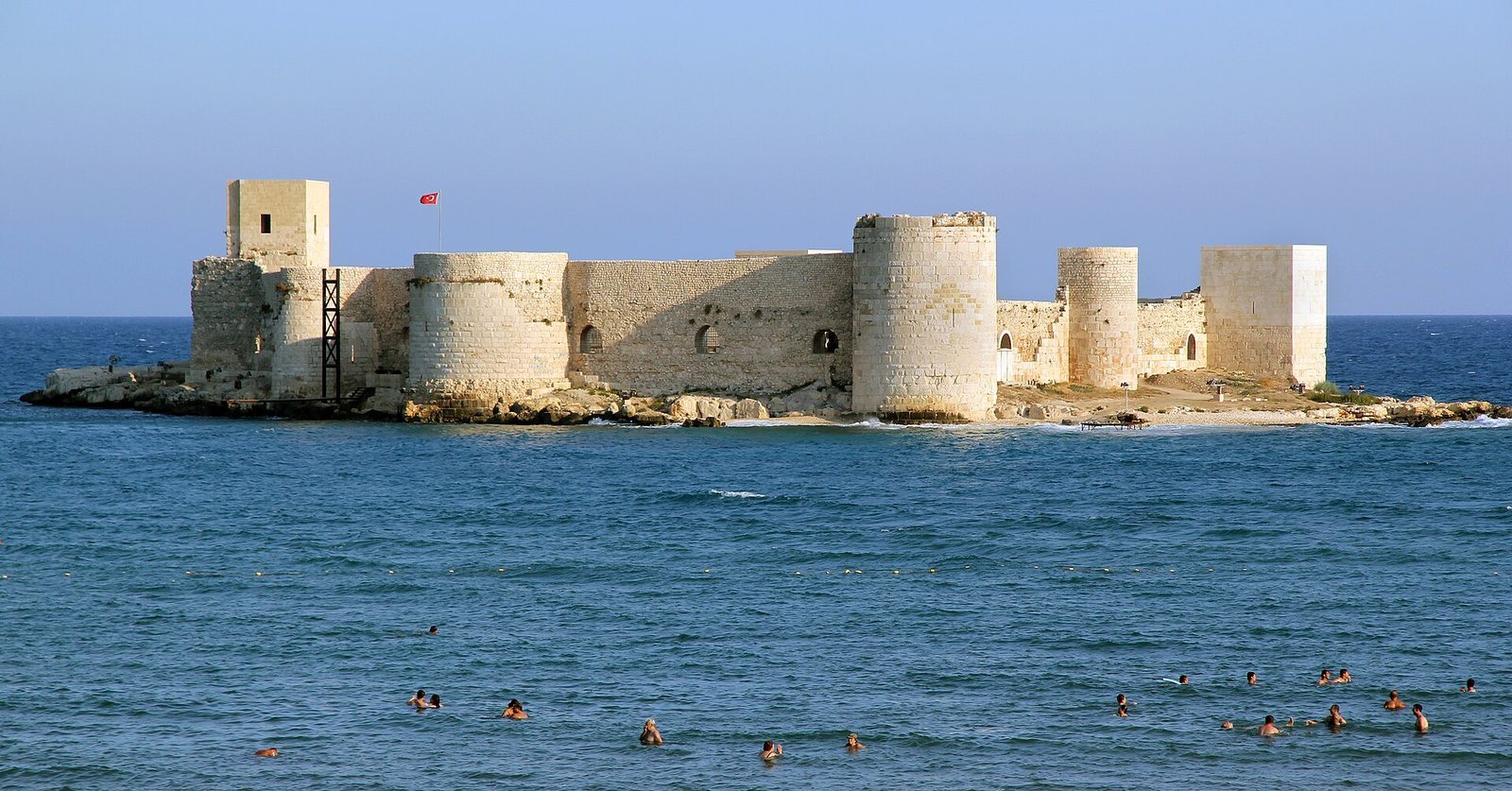
The island fortress lies about 600 metres southwest of its mainland counterpart. Its polygonal wall circuit is about 192 metres long. The south and west sides meet at right angles, while the northeastern walls join in a broad curve. Eight square, round or semicircular towers and projecting defensive structures punctuate the circuit; the entrance is in a semicircular tower on the north. A partly restored keep survives at the southeastern corner.
Inside the walls are a western defensive walkway, a cistern, a small single-aisled chapel and a few other building remains. A breakwater probably connected the island with the mainland, and traces survive in front of the mainland fortress. Admiral Francis Beaufort described a platform near the breakwater’s end, about 100 metres from the mainland fortress, which may have supported a lighthouse.
Burial grounds and funerary remains
Three large burial areas extend around Corycus. Their use spanned roughly the beginning of the Common Era to the seventh century. Rock-cut tombs were especially common in the first and second centuries, while tomb houses were used in the second and third. Later Christian burials used sarcophagi and coffin-like chambers cut into bedrock.
Northwestern necropolis
The first burial area begins northwest of the mainland fortress and climbs a terraced slope along both sides of the city wall. It contains 20 to 30 rock-cut tombs, many sarcophagi and several hundred bedrock-cut coffin chambers. The sloping ground before many tombs forms a three-sided court, sometimes with benches or traces of a roof. These courts provided space for funerary meals and other rites. Tomb façades were generally smoothed over a width of 3 to 4 metres. Entrances sit within niches, usually rectangular and sometimes semicircular in this area.
Four elaborately carved garland sarcophagi and one sarcophagus depicting winged Erotes stand out among the simpler burials. The garlands show fruit, leaves and grapes suspended over bull heads, with Gorgon heads below. The Erotes sarcophagus depicts figures drinking, dancing and playing music around a central mixing bowl, alongside a drunken figure and Pan playing panpipes. Other carved lids include damaged busts of a couple and a reclining lion.
Valley necropolis
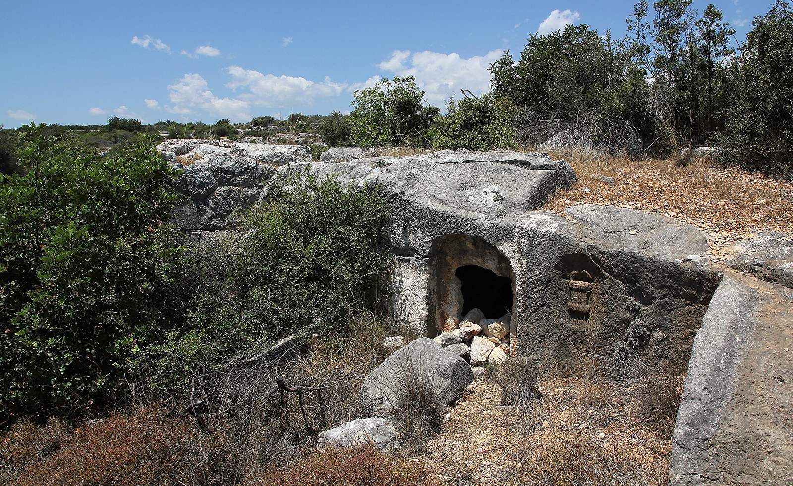
The second burial area occupies a valley extending as far as 500 metres inland. It contains sarcophagi, bedrock-cut coffin chambers and 60 to 70 rock-cut tombs. These tombs usually have a central façade entrance, 0.6 to 0.7 metres wide and 1 to 1.2 metres high, once closed by stone blocks weighing up to 700 kilograms. Their mostly square chambers measure 2 to 3 metres per side. Many contain arched burial niches 1.8 to 2.1 metres long and 0.8 to 1 metre deep; others have benches around the walls. Raised headrests appear in both forms.
Many tombs in this valley have two tiers of side niches, sometimes including deeper spaces for two people. Small niches could hold offerings. The sloping ground before some entrances forms courts, and doorways often sit in semicircular niches. The only surviving tomb house stands at the eastern end of the burial area. Its lower chamber and surrounding bench are cut into bedrock, while its upper part uses bossed polygonal masonry with blocks about 60 to 80 centimetres across and deep. A later Christian-period lintel names Paul and his wife Georgia. The older wall technique and a relief of a funerary altar indicate that the building itself predates the inscription.
Sacred Way necropolis
The third burial area follows both sides of the Sacred Way for about 200 metres between the monastery church and the Church of the Tomb. It consists mainly of sarcophagi. Corycus’s sarcophagi include free-standing and fixed examples, alongside coffin chambers cut into bedrock. The stone sarcophagi are generally about twice as long as they are wide or high, measuring 2.1 to 2.7 metres long, 0.9 to 1.4 metres wide and 0.9 to 1.5 metres high. Large gabled lids weigh two to three tonnes.
The bedrock-cut coffins are usually smaller, about 1.5 to 1.85 metres long and 0.45 to 0.65 metres wide. Their burial spaces descend 0.6 to 1 metre into the rock and widen below the opening. Some held two burials; the smallest, 0.8 to 0.9 metres long, were evidently for children. A few were enlarged into chambers with niches for three people.
Inscriptions and tomb decoration
More than 700 funerary inscriptions are recorded at Corycus, over 500 of them Christian. Most are in Greek and worn; they usually give names and occupations rather than dates. Some include curses against the desecration of graves and specify penalties. Occupational references include merchants dealing in oil and wine, textile workers, dyers and cleaners, money changers, shipowners, sail menders, sailors, harbour workers, shipwrights and makers of linen for sails.
Many sarcophagi and bedrock-cut coffins have simple decoration on three visible sides, with moulded borders and inscriptions, often set within a frame. Motifs include leaves and grapes, crosses and Jewish seven-branched menorahs; some tombs combine symbols associated with different faiths. Rock-cut tomb façades also bear inscriptions, small altars with niches for lamps or offerings, grapes, ivy, baskets, wreaths, torches and paired hands thought to ward off harm. Crosses occur on some tombs reused during the Christian period.
Other carved remains
Soldier relief
A rock relief about 100 metres northwest of the mainland fortress depicts a frontal soldier, 1.8 metres high, holding a spear in his right hand and wearing a sword at his belt. His short tunic is carved with diagonal folds. Its style has been used to propose a first-century AD date.