Krak des Chevaliers: A Medieval Hospitaller Fortress in Syria


Site at a Glance
- Rating
- 4.6
- Popularity
- Low
- Country
- Syria
- Primary era
- Medieval
- Eras represented
- Medieval
- Civilizations
- Crusader, Knights Hospitaller, Mamluk
- Site type
- Military
- Remains
- Castle
On this page16 sections
History
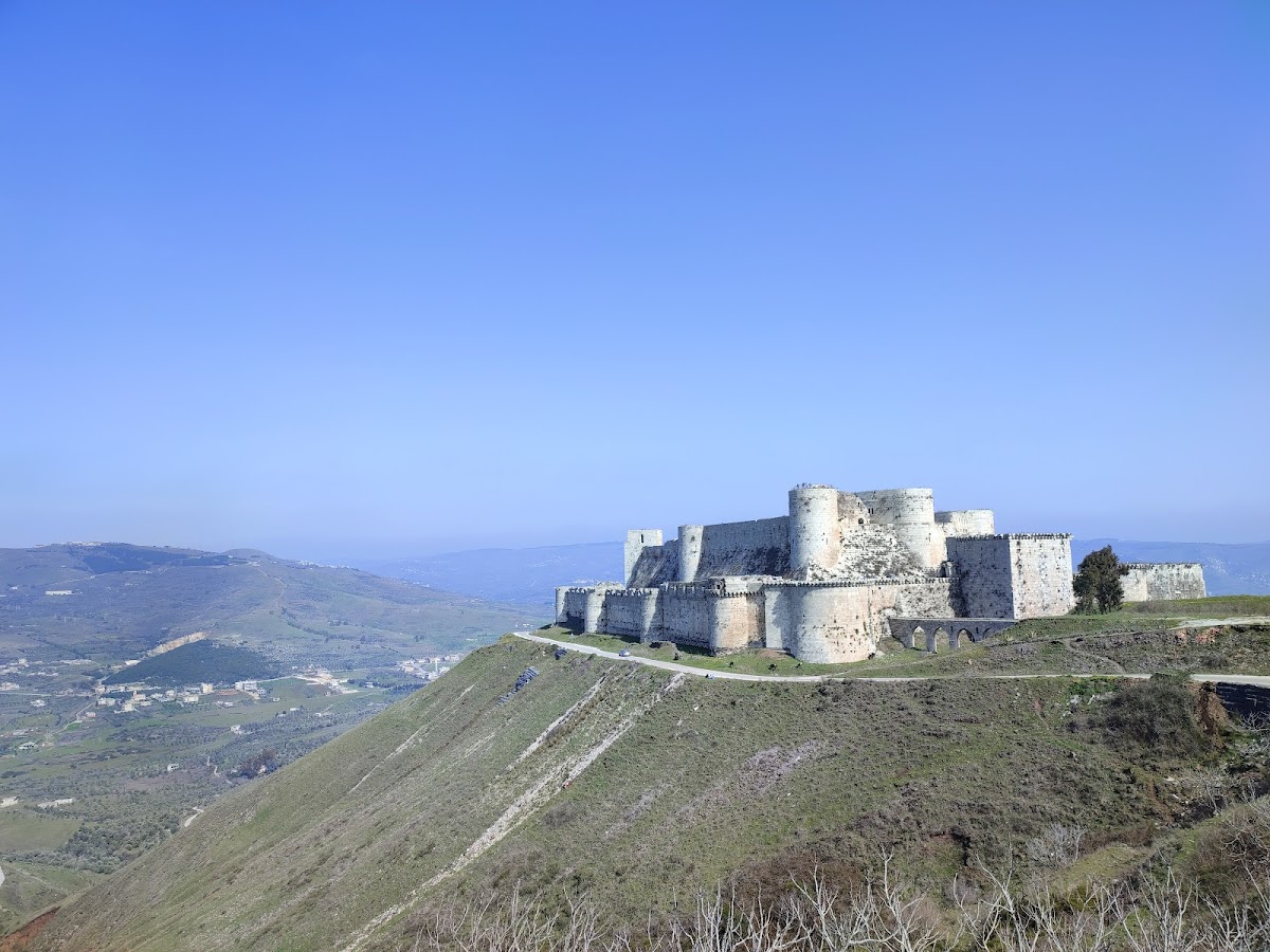
Krak des Chevaliers is a medieval mountain fortress in Syria, developed from an earlier Kurdish garrison into a major stronghold of the Knights Hospitaller during the twelfth and thirteenth centuries. About 40 kilometres west of Homs and near the Lebanese border, it overlooks the Homs Gap, the route linking Homs with Tripoli and the Mediterranean. Its position made it important for controlling movement between Muslim-held Homs and the crusader County of Tripoli.
The Kurdish garrison and the First Crusade
In 1031, Shibl al-Dawla Nasr, the Mirdasid emir of Aleppo and Homs, established a Kurdish garrison at an earlier fortification on the hill. The Mirdasids were an Arab dynasty that ruled Aleppo and parts of northern Syria during the eleventh century. The fortress was then called Hisn al-Safh and later became known as Hisn al-Akrad, meaning “Fortress of the Kurds.”
Raymond IV of Toulouse captured the fortress in January 1099 during the First Crusade, the Western European military expedition that sought to conquer Jerusalem and establish crusader states in the eastern Mediterranean. The crusaders soon abandoned the site as they continued toward Jerusalem. Permanent Frankish occupation began in 1110, when Tancred, regent of the Principality of Antioch, took control and repaired the fortress. It subsequently became associated with the County of Tripoli.
The Hospitaller fortress
Between 1142 and 1144, Raymond II, Count of Tripoli, transferred Krak des Chevaliers and other frontier properties to the Knights Hospitaller. Also known as the Order of the Hospital of Saint John of Jerusalem, the Hospitallers had begun as a religious institution caring for sick people and pilgrims in Jerusalem before becoming a military order during the Crusades. At Krak des Chevaliers, they received extensive authority over the surrounding frontier and made the castle the administrative and military centre of their possessions in the County of Tripoli.
The Hospitallers replaced the earlier fortification with a much larger castle. Their main construction campaign lasted from the 1140s until about 1170, while later thirteenth-century expansions created the concentric fortress largely visible today. A concentric castle uses successive defensive circuits around an inner stronghold or courtyard, so that attackers breaching the outer wall face another fortified line.
Earthquakes damaged the fortress in 1157, 1170, 1196, and 1202, prompting repeated repairs and rebuilding. An Arabic account identifies the earthquake of 1170 as the destruction of the earlier chapel, which was replaced by the present chapel. The castle’s military role remained central. Its garrison watched movements around Lake Homs, conducted raids into neighbouring territories, and demanded tribute from settlements around Hama and Homs.
Frontier warfare and the Hospitaller golden age
Krak des Chevaliers resisted an attack associated with Nur al-Din, the prominent Zengid ruler, in 1163 and survived the Battle of al-Buqaia. The Zengids ruled parts of Syria and northern Iraq during the period. The fortress also survived Saladin’s campaign in the County of Tripoli in 1180 and his unsuccessful siege in May 1188. A further attack in 1207–1208, associated with Homs and al-Adil, Saladin’s brother and an Ayyubid ruler, failed to capture it.
During the first half of the thirteenth century, the fortress reached what was described as its “golden age.” It served as the principal Hospitaller base in the region and maintained a garrison reported at approximately 2,000 men. A record from 1212 describes continuous surveillance by day and night. The castle also supported Hospitaller expeditions against Montferrand and Hama in 1203 and against Homs in 1207–1208. Expeditions to Hama followed in 1230 and 1233 after its amir refused to pay tribute.
Andrew II of Hungary visited the castle during the Fifth Crusade in 1217 or 1218 and called it the “key of the Christian lands.” He granted annual revenues of 60 marks to the master and 40 marks to the brothers, while also supporting the strengthening of the walls and garrison.
The Hospitallers’ position weakened during the 1250s. In 1252, a Muslim army of about 10,000 men plundered the countryside around the castle, and the order’s revenues declined sharply. In 1260, Baibars became sultan of Egypt and united Egypt and Syria under Mamluk rule. The Mamluks were a military ruling elite who established the Mamluk Sultanate in those lands. Their expansion reduced the willingness of Muslim settlements to continue paying tribute to the Hospitallers.
Baibars’s conquest and Mamluk use
Baibars began his campaign against Krak des Chevaliers in 1271 after capturing smaller castles in the surrounding region, including Chastel Blanc. His forces reached the fortress on 3 March. The siege lasted 36 days and included attacks on the outer defenses, mining beneath the southwestern tower, and assaults through the resulting breach.
When the outer ward fell, the crusader defenders withdrew into the stronger inner ward. Baibars then used a forged letter supposedly written by the Hospitaller grand master, ordering the garrison to surrender because relief was impossible. The garrison capitulated in April 1271, and Baibars granted its members safe conduct to Tripoli.
Baibars repaired and refortified the castle, particularly its outer defenses, and converted the Hospitaller chapel into a mosque. The fortress later served as a Mamluk base during campaigns against Tripoli and the conquest of the County of Tripoli in 1289. It was also used in connection with the fall of Acre in 1291 and eventually became a residence of the Mamluk viceroy.
Ottoman rule and modern conservation
Under Ottoman rule from 1516 to 1918, Krak des Chevaliers lost its major military function. A local force of approximately 40 men guarded it in the seventeenth century. The surrounding district was administered as Hisn al-Akrad and later became associated with Talkalakh. An Ottoman attempt to station a larger military unit at the castle in 1844 was abandoned after the fortress was judged unsuitable.
European interest revived during the nineteenth century. Guillaume Rey studied the castle and published plans and drawings in 1871, some of which preserve features that later disappeared. By the late nineteenth or early twentieth century, a village of roughly 500 to 530 inhabitants had developed inside the fortress and damaged its fabric. The residents were removed in 1933–1934, while the settlement at the foot of the hill developed into al-Husn.
Paul Deschamps and the architect François Anus began systematic cleaning and restoration in 1927. Approximately 60 Alawite soldiers and later about 120 labourers helped clear debris, repair damaged fabric, and prepare detailed architectural plans published in 1934. The French transferred the castle to their control on 16 November 1933, and the Académie des Beaux-Arts administered it. Syria assumed control after independence in 1946.
Krak des Chevaliers and Qal’at Salah El-Din were inscribed together as a UNESCO World Heritage property in 2006 under criteria (ii) and (iv). The property was placed on the List of World Heritage in Danger in 2013 because of the Syrian civil war, which began in 2011. Opposition forces used the castle as a base. Syrian government shelling in 2012 damaged the outer walls and chapel, while airstrikes in 2013 caused further damage to towers and ceilings. The Syrian army retook the castle and al-Husn on 20 March 2014. UNESCO and the Syrian authorities subsequently monitored the site, and repair work began in September 2018. The first phase of a restoration campaign was completed in June 2022.
Remains
Hilltop setting and defensive circuits
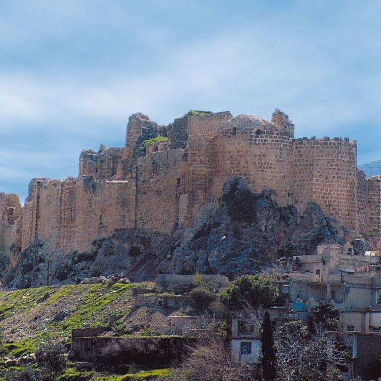
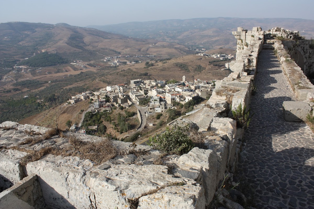
The fortress occupies a limestone and volcanic-rock hill about 650 metres above sea level, on a spur overlooking the Homs Gap. The landscape includes the Ansariyah Mountains to the north and Lebanon to the south. The region is fertile and receives abundant rainfall and surface water. The castle covers approximately 2.38 hectares and combines the form of a spur castle, shaped by the steep hill, with a fully developed thirteenth-century concentric plan.
Limestone is the principal building material. Finely laid ashlar facing gives the walls exceptionally narrow mortar joints. The inner and outer defenses surround a central courtyard and a series of vaulted chambers. The Hospitaller fortress built between 1142 and 1170 forms the inner ward of the later castle, while the outer circuit was added and enlarged in subsequent phases.
Outer ward
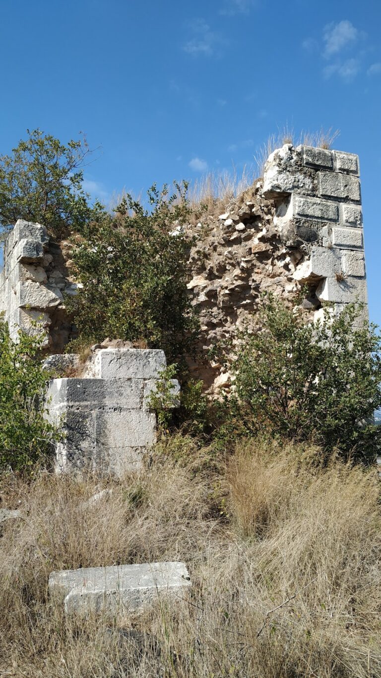
The outer ward has walls approximately 9 metres high and about 3 metres thick, with towers projecting from the curtain wall. Several broad semicircular towers stand along the western side, including five facing a deep valley. Square and rounded towers from different construction phases form the rest of the outer circuit. A walled suburb, or burgus, stood beyond the main entrance, and a triangular outwork lay south of the outer ward. During the siege of 1271, the outwork may have been surrounded by a wooden palisade.
The exposed southern side was defended by a masonry wall, three large towers, and a massive parapet that reached approximately 25 metres in thickness in some places. The slope and glacis, a fortified embankment rising toward the wall, helped protect the fortress from siege engines and earthquakes. Arrow slits and box-shaped machicolations, projecting openings for dropping stones and other missiles, allowed defenders to attack assailants at the foot of the walls. Their form has parallels in Muslim fortifications, including the citadel of Aleppo, although the direction of influence remains uncertain.
Entrance defenses and service spaces
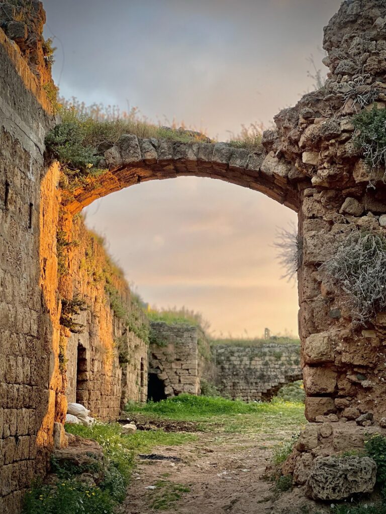
The entrance was designed as a long, controlled approach rather than a direct passage. A vaulted corridor approximately 130 to 137 metres long rises through the outer defenses in a zigzag or hairpin route, repeatedly exposing attackers to fire from the walls. Openings in the corridor allowed defenders to drop stones, projectiles, and possibly heated oil. The original entrance included a drawbridge. The main gate was built after about 1170 and repaired by Baibars in 1271, as stated by an Arabic inscription. A rear gate, or postern, was probably added around the 1250s.
The outer ward contains guard rooms, storage areas, stables, defensive towers, and the vaulted entrance corridor. One arched room approximately 60 metres long and 9 metres wide has rings for tethering animals and probably served as a stable. The southern stable has an arched roof. A southern square bastion was built under the Mamluk sultan Qalawun, probably in 1285. It measures approximately 17 metres wide and 20 metres deep, and its broad vaulted interior is supported by a massive central pier.
The southeastern corner preserves an Arab bath, or hammam. An aqueduct supplied the outer ward’s water system, which also included large cisterns. Some storage chambers were cut into the cliff. Together, the water and food reserves were considered capable of sustaining a garrison of about 2,000 men during a prolonged siege, possibly for several years.
Inner ward and residential buildings
The inner ward is an irregular enclosure formed by a curtain wall and square towers. Its eastern entrance lay between two towers, while a postern occupied the northwestern tower. The later outer walls follow the earlier inner circuit, leaving a narrow defensive space between the two lines. Four large round towers project from the inner glacis and provided accommodation for approximately 60 knights when the castle was at its height.
Towers and courtyard
The southwestern tower contained the grand master’s quarters and was connected to the central tower by a terrace. The southern central tower is a heavy, three-storey rectangular structure with a rounded southern face and formerly had battlements. The southeastern tower is also rectangular with a rounded southern face; its upper chamber is supported by a central column about 6 metres in diameter.
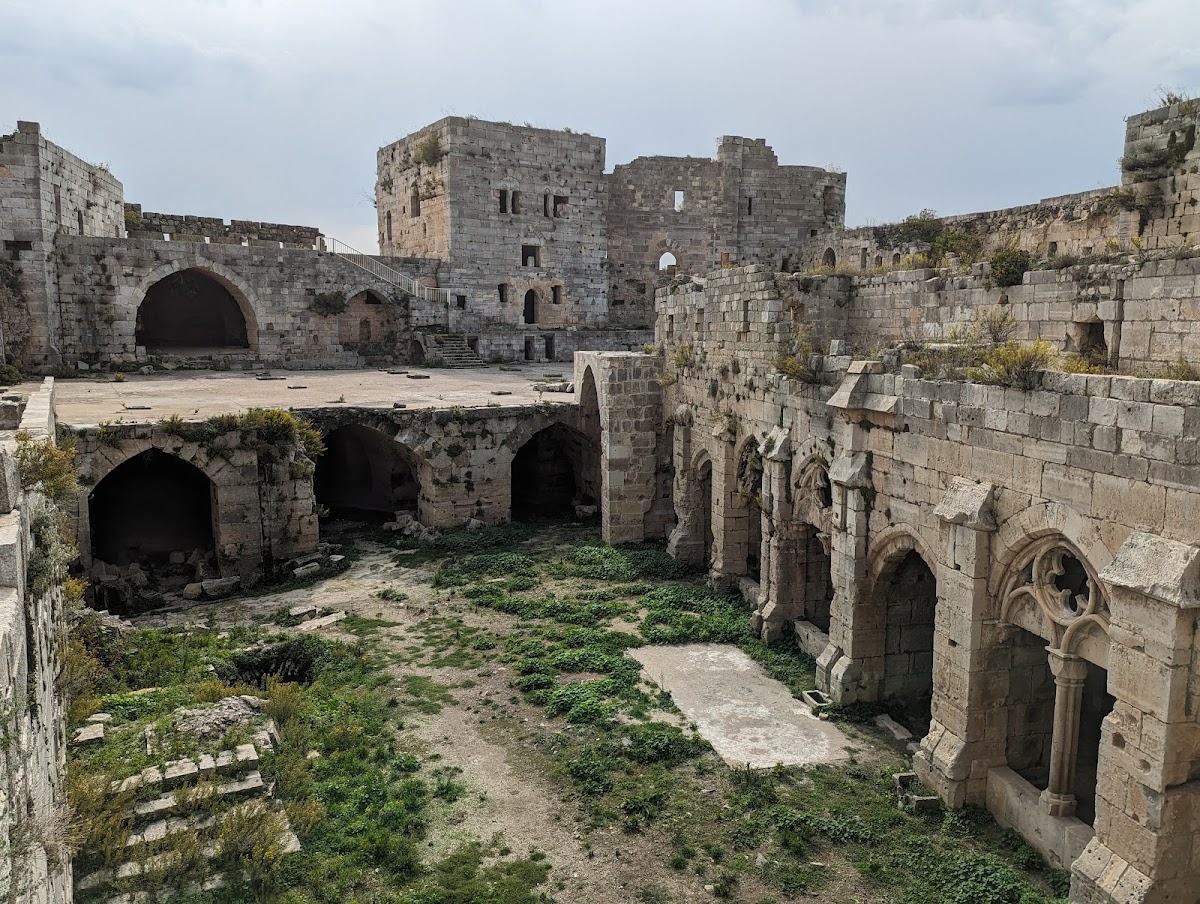
The inner courtyard contains vaulted chambers, a hall, storage spaces, the chapel, and a raised southern esplanade. The space beneath the esplanade was suitable for storage and may also have served as stables or shelter for projectiles. Additional storage areas held an oil press and oil jars, and wells supplied the complex. A colonnaded room south of the courtyard probably served at different times as a kitchen, refectory, food store, or barracks.
Hall of the Knights and service arcade
The Hall of the Knights extends along the western side of the courtyard. Approximately 27 metres long and 7.5 metres wide, it was used for meetings and banquets. Its ceiling is divided into three sections with basket-like ribbed cross-vaulting, and a Gothic loggia opens toward the courtyard.
Behind the hall is an arcade-like vaulted room approximately 120 metres long, 8 metres wide, and 10 metres high. Its uses included a kitchen, storage area, accommodation, dining space, and barracks. Toward the south are a large bread oven approximately 5 metres in diameter and a well. Twelve latrines line the northern outer wall.
Princess Tower
The northern square tower of the inner ward is known as the Princess Tower. It dates to the late twelfth century, and its upper machicolations were added during the Mamluk period. The tower forms part of the inner defensive enclosure and reflects the continuing adaptation of the castle after its conquest.
Chapels and surviving decoration
The present chapel was built around 1170, probably after an earthquake damaged an earlier chapel. The eastern end of the earlier building, including its apse, and a small section of its southern wall remain incorporated into the complex. The later chapel measures approximately 21.5 metres long and 8.5 metres wide. It is divided into three roughly equal compartments, covered by a barrel vault, and ends in a simple eastern apse. Its architecture shows Romanesque influences and has similarities to the chapel built at Margat around 1186.
The chapel is oriented approximately east to west. Its principal entrance was originally in the west wall, with a smaller entrance to the north. After thirteenth-century remodelling, the entrance moved to the south wall. Windows were placed above the cornice, and the apse had a large eastern window. Following the Mamluk conquest, the building became a mosque, with two mihrabs, prayer niches indicating the direction of Mecca, and a minbar on the southern side.
Fragmentary Crusader frescoes survive inside the main chapel. Paintings were found beneath later plaster and whitewash in 1935, 1955, and 1978. The chapel decoration was applied to masonry associated with rebuilding between 1170 and 1202. Red and blue paintings remain in damaged condition because of mould, smoke, and moisture. The external chapel once included a representation of the Presentation of Jesus at the Temple.
Integrated siege defenses
The castle’s defenses combine wall-walks, murder-holes, arrow slits, machicolations, vaulted passageways, cisterns, wells, stables, storage rooms, a bath, and a concealed underground passage. These elements allowed defenders to operate from several levels, delay attackers, restrict the use of siege engines, and maintain the garrison through stored food and water. The arrangement of the inner and outer circuits, together with the steep hill and fortified slope, produced a layered defensive system adapted to the site’s terrain.