Areimeh Castle: A Crusader Fortress in Syria
Site at a Glance
- Rating
- 4.7
- Popularity
- Very Low
- Country
- Syria
- Primary era
- Medieval
- External website
- Open
- Eras represented
- Medieval
- Civilizations
- County of Tripoli, Crusader, Knights Templar
- Site type
- Military
- Remains
- Castle
On this page15 sections
History
Areimeh Castle is a Crusader fortress in Syria, built during the twelfth century as part of the County of Tripoli. Its position above the entrance to the Abrash River valley allowed it to oversee routes toward the coast, the Beqaa Plain, Tripoli, and Tartus. The County of Tripoli was one of the Crusader states established in the Levant after the First Crusade, and its fortifications guarded important coastal and inland routes.
Origins and Crusader foundation
The site’s earlier history remains uncertain. It has been associated with an ancient fortress belonging to the kingdom of Simyra, while pottery and architectural comparisons have also prompted suggestions of Roman or Byzantine occupation. Surveys have identified no visible settlement evidence earlier than the twelfth century, and the site’s early phases have not been settled by systematic excavation.
The Crusader fortress was constructed from the ground up, probably during the early decades of the twelfth century, under Raymond II, Count of Tripoli. It was later held by Bertrand of Toulouse, the son of Alphonse Jourdain. After his father’s death, Bertrand fortified himself at Areimeh, placing the castle at the center of a conflict between the County of Tripoli and Nur al-Din Zengi, the Muslim ruler of Syria who fought the Crusader states.
Capture, rebuilding, and repeated attacks
Raymond II sought Nur al-Din’s assistance, and Nur al-Din besieged Areimeh in autumn 1148. He captured the fortress and imprisoned Bertrand for approximately eleven years. The Byzantine emperor Manuel I Komnenos later intervened in Bertrand’s release.
After the first capture, Muslim forces dismantled the fortress rather than keeping a permanent garrison there. Areimeh subsequently returned to Crusader control and was rebuilt, but Nur al-Din captured it again around 1166 or 1167. An earthquake in 1170 caused extensive damage, and a Muslim raid in 1171 indicates that Christians had reoccupied the castle by that time.
Templar control and abandonment
The castle passed to the Knights Templar during the later twelfth century or possibly the early thirteenth century. The Templars were a military-religious order that maintained fortified establishments in the Crusader states. Areimeh may have been repaired during the period when Louis IX of France was in the Crusader states and strengthening their fortifications.
The later sequence of events is uncertain, but Muslim forces took the fortress for the final time sometime in the late thirteenth century. Areimeh was then abandoned completely, and its history contains no known Ottoman-period use. Repeated captures, dismantling, earthquake damage, and the absence of systematic conservation shaped the surviving archaeological site.
A coastal warning station
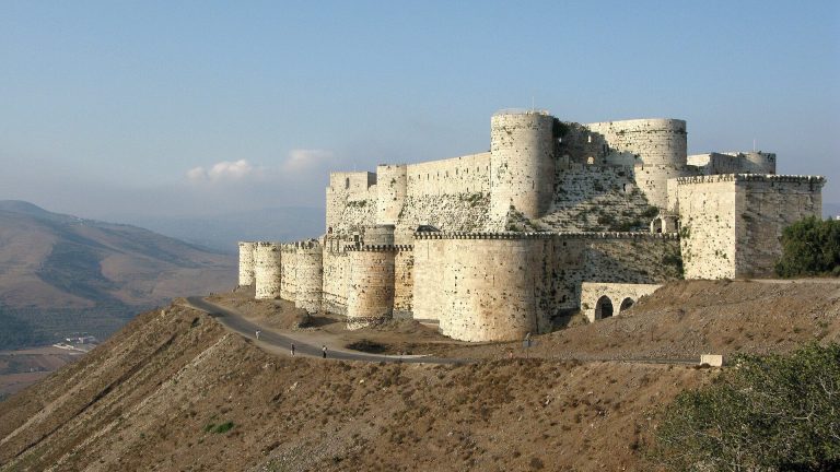
Areimeh formed part of the coastal defensive network as a monitoring and warning station. Lines of sight connected it with Akkar Castle to the south, Chastel Blanc near Safita to the north, and other Crusader strongholds, including Arwad, Tartus, Chastel Rouge, and Krak des Chevaliers. Its elevated position allowed signals made with smoke and fire to pass between towers and helped surveillance extend across the surrounding routes and coastline.
Modern surveys
The abandoned fortress has been examined through several limited surveys. Thomas Edward Lawrence, the British archaeologist and later Arabist, surveyed Areimeh in 1909. Paul Deschamps carried out another survey around 1928, and the architect and archaeologist Müller-Wiener surveyed the site in the early 1960s, publishing his work in 1966. The resulting plans differ substantially, reflecting the difficulty of interpreting a damaged and unrestored complex.
Remains
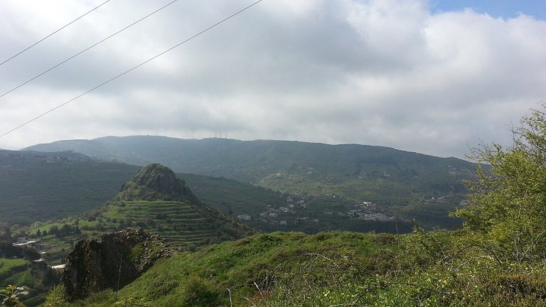
Areimeh occupies an isolated rocky ridge or plateau about 170 to 180 metres above sea level, overlooking the Abrash River valley, the Akkar Plain, and routes leading toward the coast. The fortified complex extends approximately 300 metres along the ridge and reaches up to 80 metres in width. It has been understood as three adjoining compounds running from west to east, with rock-cut ditches separating them. The western and central compounds appear to have been mainly courtyard areas, while the eastern compound contains the principal fortified castle.
Principal enclosure
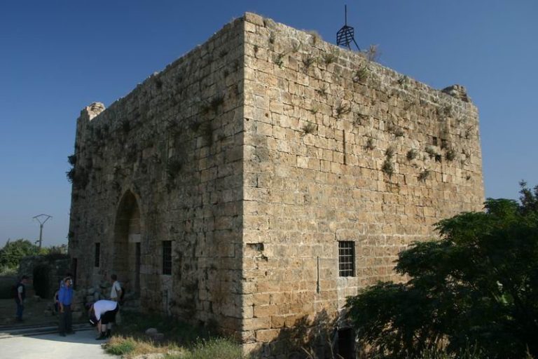
The eastern compound forms a castrum, a fortified enclosure organized around strong walls and towers. It measures about 76 metres from west to east and approximately 45 metres from north to south. Projecting towers, including towers at the corners, reinforce its enclosing walls. The castle survives on two principal levels, described as upper and lower, although sections of the walls have collapsed.
Towers and defensive works
Western entrance tower
A large tower near the middle of the western front dominated the entrance to the complex. A square tower also survives at the northwestern corner of the central compound. Together, these structures formed part of the approach and defensive arrangement along the ridge.
Surveillance towers
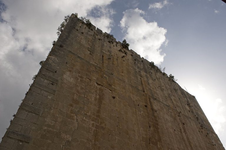
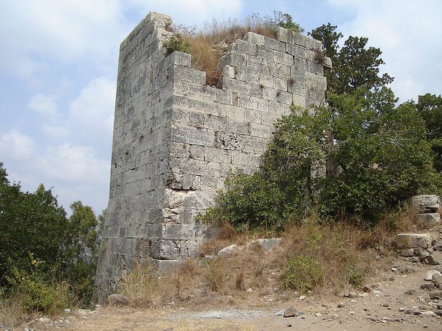
The complex includes a southwestern tower and a northern tower, each rising to about 30 metres. Both are broad at the base and narrower toward the top, while the southwestern tower is damaged on its northern side. Built with very large stone blocks and substantially solid interiors, the towers were intended for observation and surveillance rather than habitation. Access for climbing ran along one wall. From them, observers could see toward Safita, Tripoli, the castles of Hisn and Yahmur, wide areas around the ridge, and parts of the coastline.
Walls and openings
The walls are broad and massive, with interlocking masonry forming the main defensive fabric. Entrance doors have arched openings. Defensive openings are narrow on the outside and wider within, a design that allowed defenders to observe and shoot arrows while making them harder to see from beyond the wall.
Buildings and underground spaces
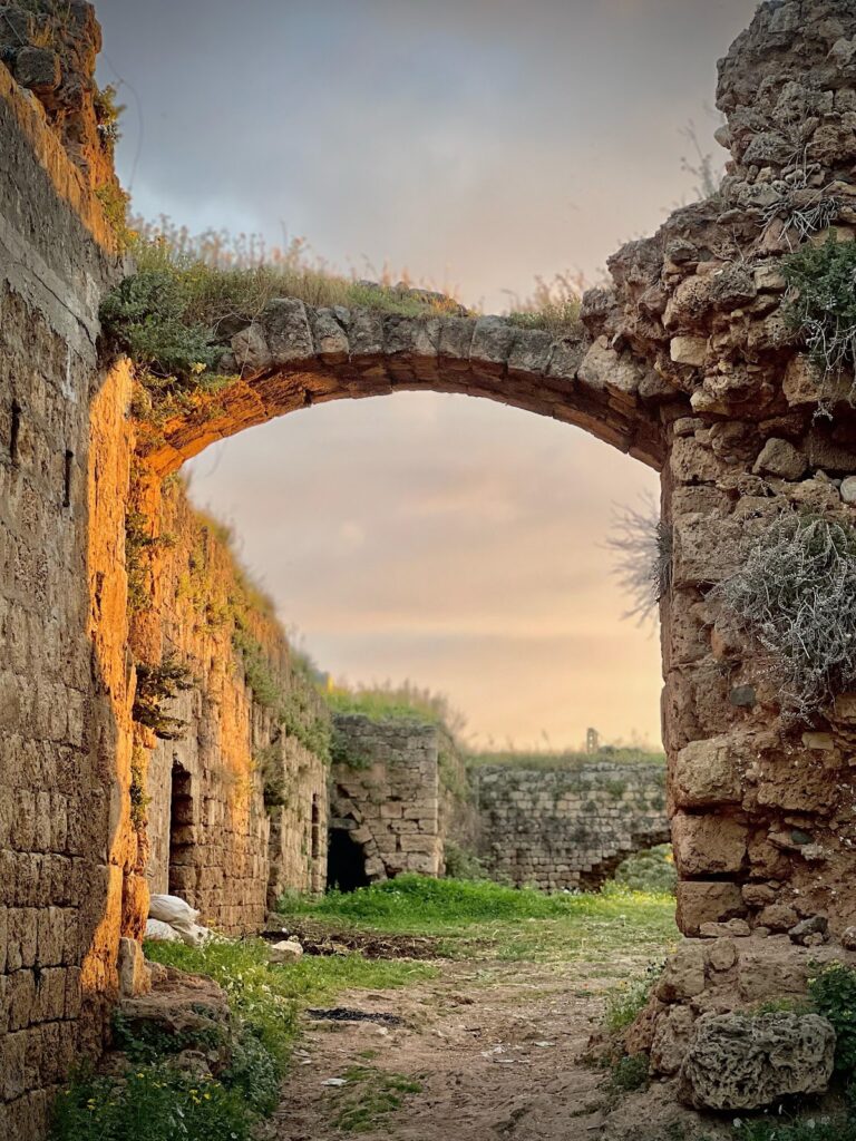
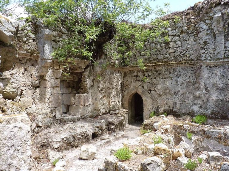
Buildings along the northern wall include covered spaces roofed with barrel vaults. A barrel vault is a continuous curved vault used to cover elongated rooms or passages. Other surviving features include underground chambers, broad vaulted passageways, tunnels of uncertain extent, and a castle prison. These spaces belong to the complex’s internal defensive and functional arrangement rather than to a decorative architectural program.
Construction phases and materials
Areimeh was built chiefly from basalt and limestone. Two construction phases have been identified. The earlier phase, attributed to the beginning of the twelfth century, is characterized by basalt. The later phase, dated to the late twelfth or early thirteenth century, is characterized by limestone and may represent modifications made after the Knights Templar acquired the castle. The architecture is austere and defensive, with the walls and openings carrying no carved decoration, columns, or paintings.
Cistern and local tradition
A cistern approximately five metres deep survives within the fortress and is partly blocked by large stones. A popular but unverified tradition says that it was linked by a tunnel to the seashore near al-Mintar village and that Crusaders used the passage to escape danger. The alleged connection has not been confirmed.