Château de Kaysersberg: An Imperial Fortress in Alsace


Site at a Glance
- Rating
- 4.5
- Popularity
- Medium
- Country
- France
- Primary era
- Medieval
- External website
- Open
- Eras represented
- Medieval, Early Modern, Modern
- Civilizations
- Holy Roman Empire
- Site type
- Military
- Remains
- Castle
On this page13 sections
History
Château de Kaysersberg is an early thirteenth-century imperial fortress above Kaysersberg in France, founded around 1220 under the Staufen dynasty. Its creation is associated with Emperor Frederick II, a ruler of the Staufen dynasty and Holy Roman Emperor, and his imperial bailiff Woelfelin. The castle controlled the trade route from Colmar through the Diedolshausen Pass toward Lorraine and helped close a major crossing of the Vosges. A settlement grew beside it, reportedly including residences for 40 castle knights, and became the historic core of Kaysersberg.
Foundation and Imperial Control
The castle first appears in a record from 1227, when King Henry VII, Frederick II’s son and a medieval king of Germany, acquired all rights to the fortification built by Woelfelin. The transaction involved Conrad of Horbourg and Anselm of Ribeaupierre and cost 250 marks of silver. The land itself belonged to other parties, making the agreement a formal consolidation of imperial rights over the stronghold.
The belief that the castle already existed in the twelfth century comes from a translation error in the chronicle of Richer of Senones. Its foundation instead belongs to the early thirteenth century. The fortress and its associated settlement formed part of the imperial effort to secure movement through the Vosges and to protect an important route between Alsace and Lorraine.
Sieges, Occupation, and Stone Construction
During the conflict between Frederick II and Pope Innocent IV, Henry III of Stahleck, Bishop of Strasbourg, besieged Kaysersberg Castle and town in 1246–1247. The wider struggle had already led him to destroy other Staufen fortifications in Alsace, but the attack on Kaysersberg ended only after the inhabitants were threatened with excommunication. The defenders then surrendered. In 1248, Duke Matthew II of Lorraine occupied the castle and promised to transfer it to William of Holland, a medieval king of Germany, five years later.
By 1261 the castle belonged to Walter of Geroldseck, Bishop of Strasbourg, during his conflict with the city. Rudolf of Habsburg captured Kaysersberg as Strasbourg’s ally. After becoming king in 1273, Rudolf replaced the wooden buildings with stone structures and granted the castle as a fief to castle knights. This transformation established much of the durable masonry whose remains survive on the site.
The castle and town continued to change hands through pledges and recoveries. In 1330, Louis the Bavarian, Holy Roman Emperor Louis IV, pawned them to John, King of Bohemia. The imperial bailiff and the imperial estates recovered both after a short siege on 9 August 1336, after which an imperial bailiff administered the castle. It was later pledged several times, including to Wenceslas I of Luxembourg and to Konrad Stürtzel, chancellor of Emperor Maximilian I.
Late Medieval Alterations and Warfare
The fortifications resisted a siege by the Armagnacs in 1444. During the fifteenth century, the lower castle was probably abandoned while the upper castle was altered. The dividing wall was moved southward, a round building was constructed, and a new eastern entrance led directly into the core castle. These changes reduced the lower area and concentrated the defensible functions of the site on the higher ground.
During the German Peasants’ War, a major uprising in the German-speaking lands in 1524–1525, insurgents brought cannon against the fortress. After several hours of bombardment, the Kaysersberg garrison capitulated on 18 May 1525. In 1583, Lazarus von Schwendi, an imperial councillor to Charles V and a sixteenth-century military commander, strengthened the castle for firearms.
The fortress was already regarded as structurally dilapidated around 1600. It nevertheless withstood sieges in 1635 and 1636 during the Thirty Years’ War, the European conflict of 1618–1648 that devastated many fortified sites. The fighting accelerated Kaysersberg’s decline. By 1648 the castle was completely ruined and uninhabited. Through the Peace of Westphalia, King Louis XIV acquired the castle and town, and he prohibited reconstruction because he considered it pointless.
Destruction, Preservation, and Investigation
The ruin was confiscated during the French Revolution and sold in 1796 to Francois Joseph Boecklin de Boecklinsau. He demolished every building except the massive keep and blasted and levelled parts of the site to create a vineyard. The property later passed to the Bastard family and then to Charles-Sylvestre Rieff, president of the Court of Appeal in Colmar.
Rieff transferred the core-castle area to the Society for the Preservation of Historic Monuments of Alsace. Between 1865 and 1869, the society secured the ruins, opened two paths across the site, reopened the eastern entrance, which had been blocked, and created a ground-level entrance into the keep. The core castle has been protected as a French historic monument since 1 October 1841. The surviving curtain walls connecting the castle with the town fortifications were added to the national heritage list on 18 September 1995.
The Reichsland of Alsace-Lorraine acquired the castle in 1899. After the First World War, ownership passed to the French state. During the Second World War, an American tank crew shelled the keep after German soldiers barricaded themselves inside it, and the resulting damage was repaired in 1955. Archaeological excavations and building investigations from 1995 to 1998 exposed the foundations of the former residential building and used dendrochronology, the study of annual tree rings to date timber, to investigate the construction history of the curtain wall. Volunteers also carried out restoration work in 1999. The French state owned the ruin until the end of 2007, the municipality of Kaysersberg from January 2008, and the commune nouvelle of Kaysersberg Vignoble from early 2016.
Remains
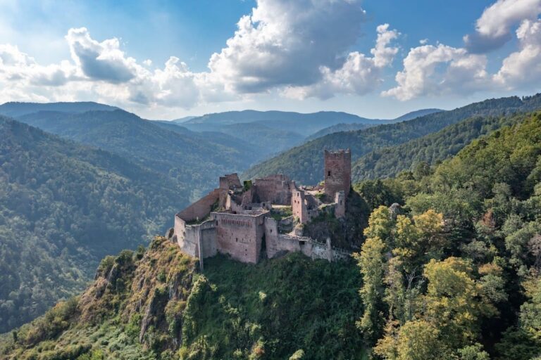
Château de Kaysersberg stands at about 295 metres above sea level on the western slope of the Schlossberg, roughly 50 metres above Kaysersberg. It occupies the northern end of the former town wall, whose masonry was built using the same technique as the castle. The site overlooks the wooded Weiss valley where it emerges from the Vosges. About 2.8 hectares in area, the fortress is divided between a small upper castle, or core castle, on the highest ground and a much larger lower castle to the south. A dividing wall separates the two areas.
Greywacke, a locally available sandstone, forms most of the masonry and was probably obtained from a rudimentary quarry north of the shield wall. Large blocks were used in the keep, while smaller rubble formed much of the other construction. Granite appears in some corners and around door and window openings. The interior walls were probably covered with plaster.
Lower Castle
The lower castle retains its polygonal curtain wall, a defensive wall enclosing the fortress, together with minimal traces of peripheral buildings. The wall has few openings, although several tall slit loopholes survive on its eastern side. Its eastern side contains a thirteenth-century entrance, while a second contemporary gate on the western side is blocked. Corbel stones on the inner face preserve evidence of a former wooden wall-walk, a passage along the top of a fortification.
Upper Castle Defences
Shield Wall and Ditches
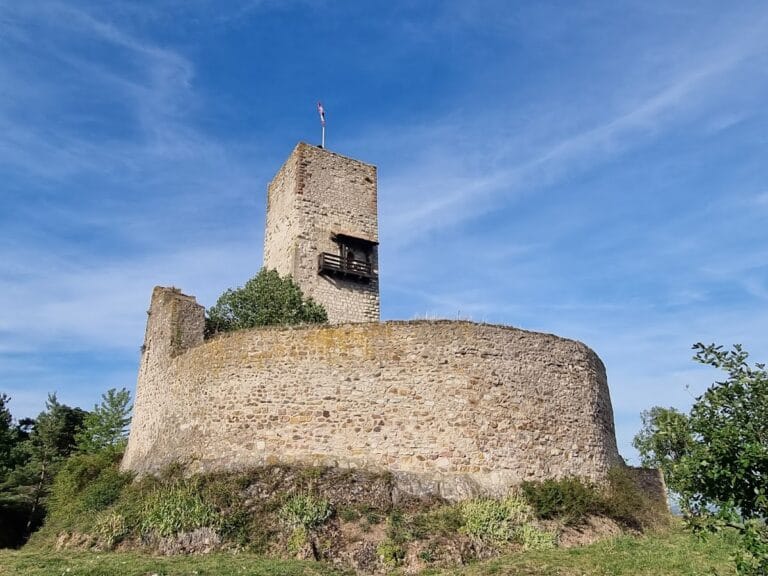
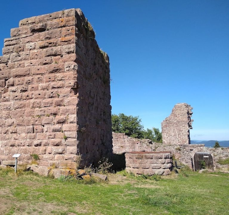
The upper castle has an approximately triangular plan and covers 276 square metres. Its northern point, facing the direction of attack, is formed by a shield wall, the especially strong section of a fortification protecting its most vulnerable side. Built of bossed ashlar, or carefully squared stone with raised central faces, it remains 14 metres high on the eastern side and is about 1.26 metres thick. The surrounding curtain wall is approximately 7.5 metres high. Corbels mark the former wall-walk, whose parapet was 2.4 metres high.
A small outer neck ditch protected the castle from the rising ridge to the north. A second neck ditch on the eastern side was formerly about eight metres wide and is now very shallow. From the fifteenth century, the eastern approach passed through a gate protected by a barbican, an outer defensive work guarding an entrance. After 1415, a drawbridge was required to reach the barbican. A large fifteenth-century cruciform loophole beside the gate added protection for firearms.
Keep
The circular keep stands only about 30 centimetres behind the shield wall and helped defend the attack-facing side. It is among the earliest round keeps in the Upper Rhine region and resembles the main tower of Pflixburg. Designed solely as a military tower, it was not habitable and had no latrines. The masonry was probably once plastered.
About 24.8 metres high and approximately 11 metres in external diameter, the keep has walls more than four metres thick. These leave an interior only about 2.4 metres across. Four storeys divided the interior. The dark ground floor served as a prison, while the storey above was about nine metres high and received little light through a single slit. An upper storey provided storage and access to the roof platform. Some corbels that supported wooden floors remain.
A modern concrete spiral staircase now connects the ground floor with the roof. In the late Middle Ages, the parapet was adapted for arquebuses and culverins, early firearms and artillery weapons. Only up to 0.55 metres of the original crenellated parapet survives, while the remainder is reconstructed.
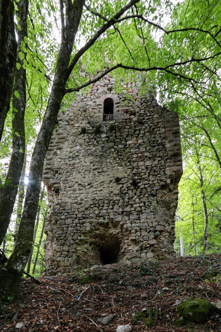
The present ground-level entrance was created in the nineteenth century in place of the original high entrance on the keep’s southern side. The original round-arched doorway is 10.6 metres above ground, 1.8 metres high, and 0.73 metres wide. Its surround uses flat bossed ashlar. A projecting wooden balcony once provided access, and three of its supporting corbels remain.
Residential Buildings
Eastern Residential Building
A three-storey residential building measuring 9.2 by 7.7 metres stood against the inner eastern curtain wall from 1380. Excavations and building investigations exposed its foundations, providing physical evidence for the upper castle’s later residential phase.
Western Building and Round Structure
A second large building on the western side of the upper castle measured 8.4 by 11.3 metres. It had a cellar and two upper storeys. Between the keep and the eastern residential building, a round structure was added in the fifteenth century. Its interior diameter was about five metres, but its function remains unknown.