Gaujiena Castle: A Livonian Order Stronghold in Latvia



Site at a Glance
- Rating
- 4.6
- Popularity
- Low
- Country
- Latvia
- Primary era
- Medieval
- Eras represented
- Medieval
- Civilizations
- Crusader, Livonian Order
- Site type
- Military
- Remains
- Castle
On this page15 sections
History
Gaujiena Castle is a medieval Livonian Order stronghold in Gaujiena, Latvia, built in the historical district of Atzele, also known by its German name, Adsel. The German military-religious Livonian Order established the stone castle most likely at the end of the thirteenth century, although proposed foundation dates of 1236 and 1238 have no documentary confirmation. It became the administrative center of its castle district and initially served as a commandery residence, linking the Order’s authority to an important network of waterways and roads.
Atzele before the stone castle
The district of Atzele was first mentioned in the Novgorod Chronicle in 1111, and Novgorodian forces campaigned there in 1179 and 1180. In 1223, crusaders attacked an earlier wooden hillfort in the region but failed to take it. Reinforcements arrived in early 1224, enabling the crusaders to capture, destroy, and burn the settlement. Excavations in 1911 investigated the earlier hillfort but did not locate timber remains.
After Tālava was divided in 1224, the northern third of Atzele passed to the Livonian Order. The southern two-thirds went to the Archbishopric of Riga, which assigned its northern part to the Bishopric of Tartu. The Order later established two strongholds in its territory, Atzele and Aluksne. Gaujiena occupied a strategically useful position where the Gauja waterway, the Riga to Pskov military road, and the Trikata to Tartu road intersected.
The commandery and border conflicts
Atzele functioned as a commandery, an Order administrative and territorial unit governed by a commander, for 104 years. This period ended when Aluksne Castle was completed in 1342. Approximately eight to ten commanders governed at Atzele, the last being Arnold von Vietinghoff, who became Aluksne’s first commander. A seal from the early fourteenth century carries the inscription “S[IGILLUM] COMENDATORIS IN ADZELE,” confirming the commander’s presence.
A church probably founded as the castle chapel stood in the settlement and was associated with five medieval parsonage farms. Atzele was mentioned in a Russian chronicle in 1285 in connection with a nearby battle. In 1340, a dispute between the Order and Pskov over earlier boundaries and spheres of influence led to armed conflict. A later Russian attack on Gaujiena encouraged the Order to develop the stronger border fortress at Aluksne and to strengthen its position at Vastseliina.
During construction at Aluksne in 1341 and 1342, Livonian Order Master Burchard von Dreileben stayed at Atzele several times. When the commandery center moved to Aluksne in 1342, Gaujiena became an auxiliary castle. In 1384, the Order granted its vassal V. Pallam land, a tavern site, and fishing rights beside the Gauja River near the castle. The tax exemption attached to the grant indicated that Pallam had fulfilled his military duties. The tavern became one of the oldest rural inns recorded in Latvia.
Late medieval strengthening
Documents from 1465 and 1517 refer to a heated room with a chimney, a gate, and a forecourt. During the later medieval period, the Order strengthened the forecourt and added a semicircular artillery tower. The works reflected the changing requirements of warfare, as defensive positions had to accommodate firearms as well as older forms of fortification.
From July 1556 to 1557, the castle held Wilhelm von Brandenburg, Archbishop of Riga, captive after he was seized during the war between the Livonian Order and the archbishop. In September 1558, during the Livonian War, the garrison abandoned Gaujiena because it considered the castle too weak to withstand an expected Russian attack. Russian troops found it empty, burned the gates, and set the castle on fire. A letter dated 6 July 1560 described the castle as plundered and burned.
Polish and Swedish rule
After Russian forces were expelled from Livonia, Polish forces occupied the castle in 1582. The Osobliński family controlled it from 1582 to 1600 and restored it. During the Polish and Swedish wars, the castle capitulated to Swedish forces in early January 1601, was recovered by Polish forces in 1602, and was occupied by Swedish troops again in 1621.
In the 1620s, King Gustav II Adolf of Sweden granted the castle district to Axel Baner, a Swedish state marshal. The associated estate included Gaujiena Castle Manor, Hummelzeem Manor, and several other estates. These holdings later returned to the Swedish state through the reduction, a process by which the crown recovered granted estates.
A 1627 inventory described the castle as still strong and usable, although the upper floor of the convent building had collapsed. Its lower vaulted floor remained habitable. The castle had two drawbridges and seven cannon, while the outer forecourt contained gunpowder and ammunition. The settlement church had been completely destroyed, so services were held in a chapel behind the castle. Gaujiena may still have taken part in military events in 1633.
Destruction and abandonment
Russian troops occupied Gaujiena during the Second Northern War, a conflict involving Sweden, Russia, and other powers in the struggle for control of the Baltic region, from 1656 to 1661. In March 1657, Swedish forces counterattacked and besieged the Russian troops at Gaujiena. The siege was lifted in June after the Russian commander Matvey Sheremetyev lost the Battle of Walk.
A plan prepared by the Swedish military engineer Paul von Essen in 1697 showed the main castle in good condition. During the Great Northern War, another struggle for Baltic territories, Russian forces under Peter I captured and severely destroyed Gaujiena in 1702. The castle could no longer be restored, lost its military role as an eastern Livonian border fortress, and was abandoned to decay.
Manor development and archaeological investigation
By the middle of the eighteenth century, the castle was unusable. In 1745, Empress Elizabeth of Russia leased the castle district with Luttershof Manor to Bernhard Reinhold von Delwig. The castle was described as ruined in 1776 and as plundered in 1786. A granary built in 1788 became the oldest building of the later Gaujiena manor complex. The manor’s central area occupied the site of the medieval castle’s second forecourt, which had been demolished late in the eighteenth century.
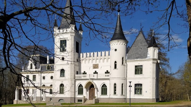
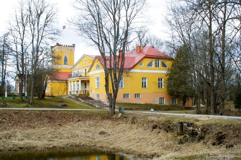
Between 1848 and 1850, manor owner Johann von Wulf built a manor house on the former second-forecourt area, probably using material from the medieval ruins. During about a century of Wulf family ownership, more than fifteen buildings were erected and a park was laid out. Latvia’s land reform later expropriated the manor from its last owner, Waldemar von Wulf.
Archaeological excavations on the castle hill began in 1911 under Karl von Löwis of Menar and continued until the beginning of the First World War. The work sought evidence of the earlier wooden hillfort and revealed underground passages, foundations of the main castle walls, the foundation of a tower at the northwestern corner of the forecourt, and a plan of the castle. The castle ruins and the ground beneath them are protected as national monuments in Latvia.
Remains
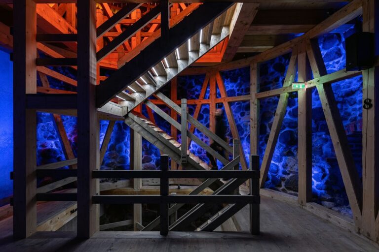
Gaujiena Castle occupied a high, steep-sided, wedge-shaped promontory on the right bank of the Gauja River, southwest of the present settlement. The steep dolomite bank of the Gauja bounded the site to the west, while a deep ravine formed by the Dzirnavupite stream protected it to the north and northwest. A defensive ditch guarded the southern and southeastern sides of the main castle. The complex consisted of a convent-type main castle, an inner forecourt, and a later outer forecourt. The convent building was the central residential and administrative block of the military-religious community, arranged around an internal courtyard.
The main castle
The main castle was a compact quadrangular building measuring approximately 29 by 27 metres, with an internal courtyard measuring 11 by 9 metres. Two principal wings stood to the northeast and southwest and were joined by additional building blocks. First-floor walls reached approximately 1.8 metres in thickness. The main entrance, 2.8 metres wide, was in the northeastern wing, and its passage had a barrel-vaulted ceiling. A smaller southern arch and gate provided a pedestrian passage. Corner towers are not certain, although a rectangular foundation at the southwestern corner may have belonged to one.
The first floor contained a kitchen, sleeping rooms, and living or rest rooms. The second floor held a chapel, dining hall, and convent hall. A small room above the main gate had a ribbed vault, while the chapel probably stood east of it, near traces of a depositary. An old drawing shows the chapel’s eastern window as a three-part opening resembling the arcade of Riga Cathedral’s cloister.
A basement extended beneath the main castle. It contained storage rooms, a mill, and a bakery, with a brewery added in a later period. The commander, his assistants, and the Order’s knights lived in the convent building under strict monastic discipline. The surviving remains include fragments of the convent building and the main gate passage, while most of the other walls survive at foundation level beneath the ground.
Inner forecourt defenses
Defensive wall and entrance
The inner forecourt followed the natural slopes of the promontory. Its original defensive wall was built from limestone or dolomite masonry approximately 1.5 metres thick and included small loopholes and a parapet. In the fifteenth century, the wall was raised with brickwork, finished with split dolomite slabs, and fitted with broader gun openings.
The approach from the northeastern side crossed two drawbridges, bridges that could be raised to obstruct a ditch, before reaching the 2.8-metre-wide main gate. The inner forecourt extended to the northwest and southeast of the main castle as an open area enclosed by the surrounding wall. A structure resembling a zwinger, an enclosed defensive zone between fortification lines, probably stood southeast of the main castle between it and the complex entrance to the inner forecourt. Buildings near the main gate probably housed the defensive garrison.
Northwestern artillery tower
A semicircular artillery tower was added at the northwestern corner of the inner forecourt, probably during the fifteenth-century strengthening works. It measured approximately 12.4 metres across and rose more than 16 metres high. Its star vault had ribs with unusually thick profiles. In 1911, the tower’s inner wall still stood approximately 16 metres high. The upper floors probably contained guard rooms, while the ground floor may have served as a prison.
Outer forecourt and underground passages
Outer forecourt
The outer forecourt lay southeast of the main castle beyond a narrower defensive ditch. Its circuit wall was built of dolomite and later raised with brick to approximately 12 metres. Two watchtowers reinforced the enclosure, and a drawbridge at the northeastern corner led east toward the settlement. Another interpretation holds that the broad outer forecourt was protected only by an earth rampart. Stone buildings, including stables and animal sheds, may have been added there during the disorder of the final century of the Middle Ages.
Underground routes
Excavations in 1911 revealed two underground passages. One ran westward beneath the Gauja River, and the other extended southward toward Raate Forest. They were probably intended for use during a prolonged siege and as escape routes if the castle fell.
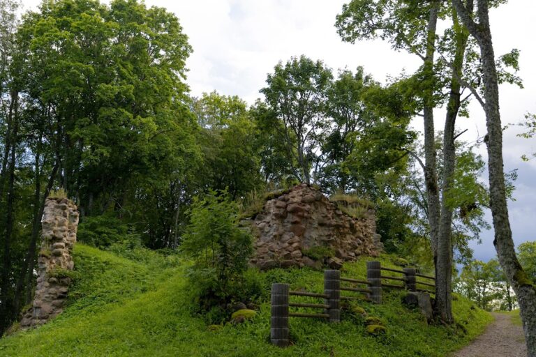
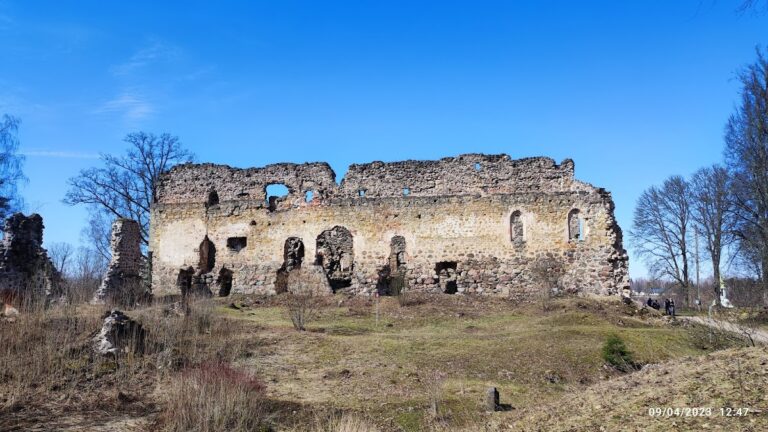
The surviving fabric consists of dolomite, limestone, and brick masonry. A northwestern tower of the inner forecourt remains to approximately the height of its first and second stories. A wall section extending south from it is approximately 20 metres long and 12 metres high, while another surviving dolomite wall of the outer forecourt is more than 10 metres high and approximately 1.5 metres thick. The ruins are fragmentary, and plans from 1634 and 1697 preserve evidence of the historical relationship between the compact inner castle and the broad outer forecourt.
Nearby sites