Ponte di Tiberio: The Roman Bridge at Rimini
Site at a Glance
- Popularity
- High
- Country
- Italy
- Primary era
- Classical
- Eras represented
- Classical, Medieval, Modern
- Civilizations
- Italian, Roman
- Site type
- Infrastructure
- Remains
- Bridge
On this page19 sections
History
The Ponte di Tiberio, formerly known as Ponte d’Augusto, is a Roman stone bridge in Rimini, Italy. Construction began in AD 14 under Augustus and ended in AD 21 under his successor Tiberius. It carried important roads across the Marecchia and formed part of a wider building program in the Roman colony of Ariminum.
Roman construction and roads
Ariminum, founded on the Marecchia in 268 BC by 6,000 settlers, was the Roman name for modern Rimini. Augustus ordered a stone bridge shortly before his death. Its construction accompanied other changes to the colony, including work on the Arch of Augustus, improvements to roads, and the adoption of the name Colonia Augusta Ariminensis.
The bridge connected the end of Ariminum’s main east-west street with the settlement on the river’s left bank. It also carried routes linking the Via Aemilia, which ran northwest toward Placentia, and the Via Popilia, which followed the Adriatic coast and joined the Via Annia. Its position suggests that it may have replaced a wooden bridge about 500 metres upstream.
Medieval use and damage
In 552, during the Gothic War between the Ostrogoths and the Eastern Roman, or Byzantine, Empire, the Gothic commander Usdrila damaged the bridge to hinder the Byzantine army led by Narses on its advance from Ravenna toward Rome. The extent of the damage is uncertain: either the last arch at the San Giuliano end or both approach ramps may have been destroyed. Usdrila died in the fighting that followed, while Narses crossed the river using ships that accompanied his army along the coast.
A major Marecchia flood damaged the bridge in 1391. The Malatesta rulers arranged repairs at the expense of the bishop and clergy. A tower stood at the San Giuliano end during the Middle Ages and was mentioned in a papal bull of 1078. It was reportedly straightened in 1473 and had disappeared by 1617. From the later fourteenth century, merchants set up wooden stalls on the bridge for the annual Fair of San Giuliano. At the city end, it faced the medieval gate of Porta Bologna.
The bridge also became part of Rimini’s civic identity. Between the tenth and thirteenth centuries, it appeared alongside the Arch of Augustus on city seals and in the city arms.
Renaissance and early modern repairs
In 1528, fire during the retreat of Pandolfo IV, the last of Rimini’s Malatesta rulers, damaged the bridge’s final arch. Pandolfo planned to destroy additional arches, but abandoned the scheme after the French commander Odet de Foix assured him that his troops could enter Rimini by another route. Stones from the collapsed arch were later recovered in 1680, 1807, and the 1970s.
Inscriptions record repairs in 1582, 1592, and 1603. Rimini’s municipal council described the final arch as badly damaged in 1612, and an earthquake caused further harm in 1672. In 1680, restoration under Agostino Martinelli used stone taken from the ruined Ponte di San Vito and new stone brought from Venice. Giulio Alberoni ordered further work in 1735, using stone from the San Vito quarry. Spanish troops damaged the bridge during eighteenth-century fighting. An earthquake in 1786 was followed by restoration in 1792.
Artistic reception and modern history
The bridge attracted artistic and architectural attention over several centuries. A fourteenth-century jug, probably made from local majolica and paste, depicts it and was recovered from Borgo San Giuliano. Giovanni Bellini included the bridge in St Jerome in the Desert, painted around 1480. Drawings survive from the fifteenth century, and Antonio da Sangallo the Younger sketched part of it in 1526.
Andrea Palladio described the bridge in his 1570 architectural treatise and published drawings and measurements that regularized its proportions. These studies later influenced George Smith’s Green’s Bridge in Kilkenny, completed in 1766. Giovan Battista Piranesi’s 1748 engraving helped establish the downstream view in later images, while Richard Wilson painted the bridge from several viewpoints in the eighteenth century. In the nineteenth century, artists increasingly showed it from upstream, often with Santa Maria dei Servi behind it. Florent Fidèle Constant Bourgeois used this view in an unpublished sketch of 1806; the oldest published example is attributed to Robert Wallis after a design by Samuel Prout in 1830.
Italy designated the bridge a national monument in 1885. A municipal note in 1894 recorded that the riverbed had risen 2.5 metres since 1876. Around 1930, the Marecchia was diverted north, leaving the bridge above its former channel, now called the Portocanale.
During the 1944 Battle of Rimini, retreating German troops tried to destroy the bridge but failed. It was the only bridge over the Marecchia left standing during their retreat. Marshal Willi Trageser of the 2nd Parachute Division later said that poor-quality ammonal and failed detonations caused only minor damage. Of 100 kilograms placed at the bridge’s base and 160 kilograms set in eight charges beneath the road, only two charges exploded. Trageser blamed crossed wires along the bridge gutter, while rain may also have weakened the explosives. Colonel Horst Pretzell and Lieutenant Colonel Rudolf Rennecke later said German high command had ordered the bridge spared, but that the order had not reached the retreating troops. Trageser may have deliberately arranged the faulty wiring. Heavy rain flooded the Marecchia during the retreat on 20 and 21 September. Unexploded ammonal sticks were found during maintenance in January 1957 and removed.
Remains
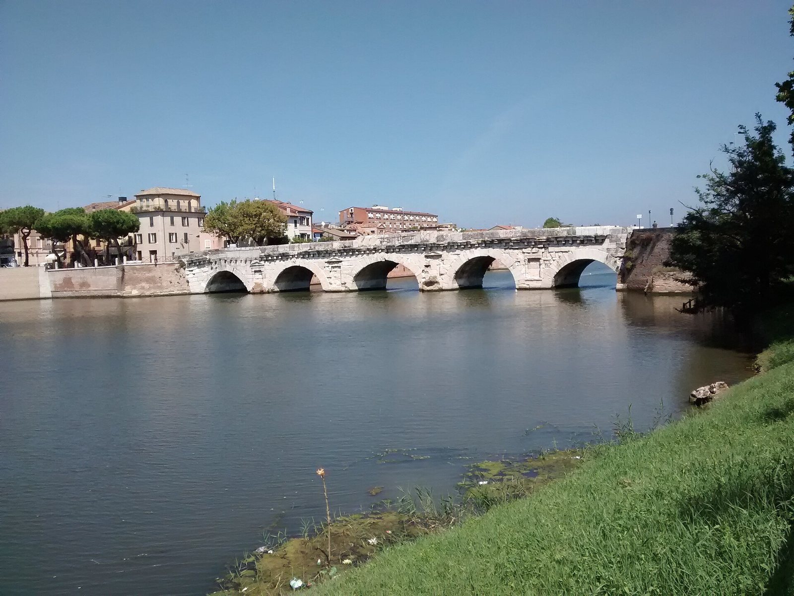
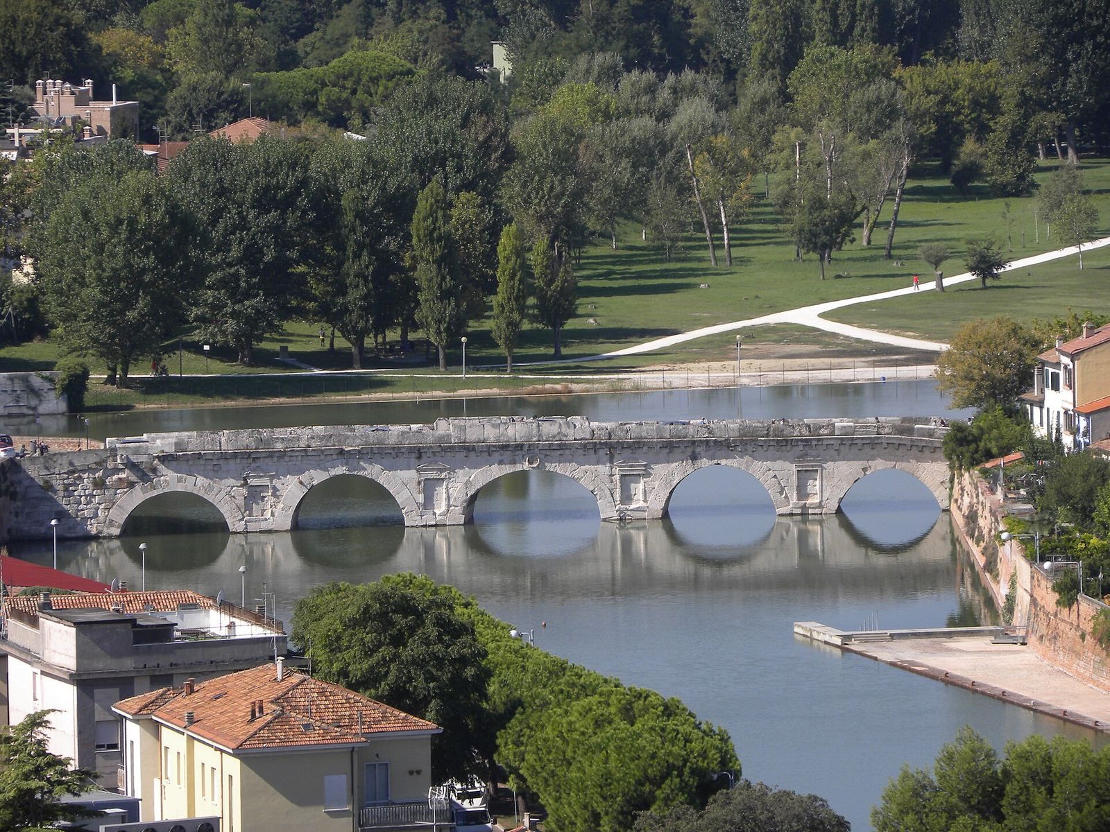
The bridge crosses the former Marecchia channel, now the Portocanale, between Corso d’Augusto on the city side and Viale Tiberio in San Giuliano. It has a slight rise and five arches of differing sizes and profiles, with the largest at the centre. Built chiefly of pale stone, the surviving structure includes its roadway, parapets, arch decoration, and the city-side approach. The bridge measures about 62.6 metres between its abutments and about 8.6 metres wide; its present overall length is approximately 74 metres.
Form and construction
Bridge form and stonework
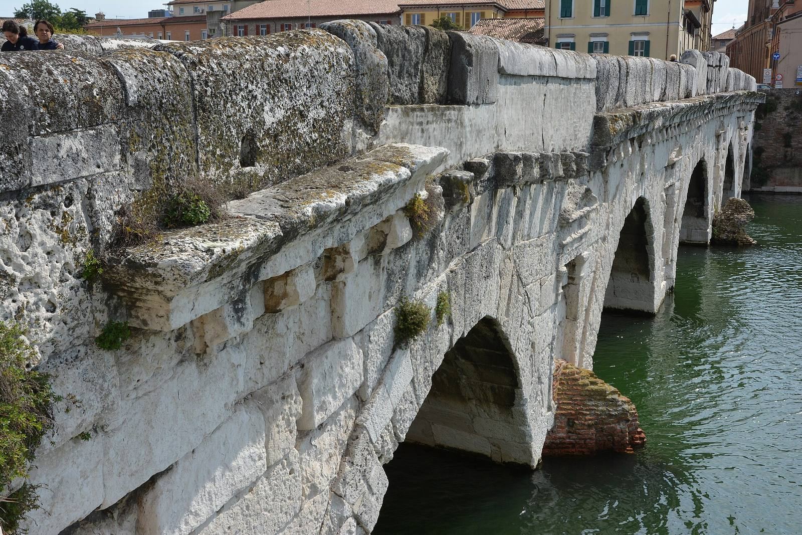
The arch openings range from 7.14 to 8.17 metres across, while the roadway is about 4.8 metres wide. The arches include semicircular, multi-centred, raised, and nearly pointed profiles. The bridge is regarded as the oldest surviving Roman bridge decorated with Greek orders, classical systems of architectural design. Doric features appear in its upper design, while its lower parts recall Republican Roman and Etruscan building traditions. The combination has been interpreted as a transitional style or as a provincial designer’s deliberate counterpoint to the bridge’s monumental purpose.
The exterior facing is white limestone from quarries near Aurisina, probably brought to Ariminum by sea. Later repairs also used Istrian stone. The facing averages about 40 centimetres thick and consists of squared blocks laid in regular courses, a Roman method known as opus quadratum. Iron clamps and lead helped close the joints, and marks from lifting tongs remain on some concealed stones. Workers finished the blocks after placing them. The interiors of the piers and arches consist of stone fragments held together with mortar.
Piers and foundations
The substantial piers, the supports between the arches, widen at their bases and sit at about 102 degrees to the road axis to meet the river current. Below the waterline, they include carefully cut stone blocks and more resistant igneous rock. Rather than resting on conventional foundations, the piers stand on wooden rafts supported by oak piles about 35 centimetres in diameter and 3 to 5 metres long. The piles have hardened over time.
The foundations were shaped to reduce the force of the water. Each pier support has a boat-like form, with a point facing upstream and a rounded end downstream; projecting spurs also helped break the current and limit whirlpools. In the 1970s, removal of nearly 3 metres of gravel exposed the piles. They were later encased in concrete, and cracks that appeared after the gravel was removed led to the addition of reinforcing tie-rods at about two-thirds of the piers’ height.
Architectural decoration
Reliefs and arch frames
Five carved emblems remain on the central stones at the tops of the arches. On the downstream side, the central arch bears a corona civica, or Roman civic crown. The arch to its left carries a patera, a shallow ritual dish, and the one to its right an amphora associated with sacred offerings. On the upstream side, the central arch bears the clipeum virtutis, a shield of honor associated with Augustus. An adjoining arch carries a lituus, the curved wand used by a Roman religious official called an augur. The religious imagery was intended to make the crossing a quasi-religious act, sanctifying travel between central Italy and Cispadania, the Roman region south of the Po River.
The spaces between the arches have shallow frames resembling small Doric shrines. Each is about 20 centimetres deep and combines a projecting top with a triangular pediment. They may have been intended to hold statues, left unfinished, or designed to avoid representational religious images.
Cornices and inscriptions
Projecting stone brackets above the arches support continuous cornices, which are capped by protective top stones. Two deep recesses in an upstream coping stone probably held pulleys for lifting materials from boats. Their resemblance to hoof or horn marks helped inspire the nickname Devil’s Bridge and related legends.
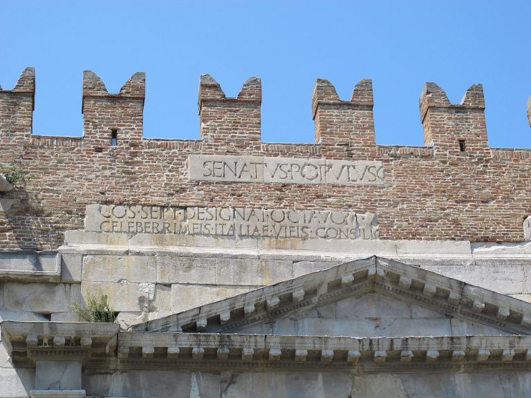
Inscriptions on the coping stones above the central arch, on both sides of the bridge, name Augustus and Tiberius as its builders and give their titles. The upstream inscription was restored by order of the Italian government between 1851 and 1853. Because its surface was badly damaged, restorers supported it with an iron cage and filled damaged areas with a resin mixture instead of recutting the text. The downstream inscription was cut in 1743 to make room for a gate beam. At the midpoint, large, partly damaged plaques on both parapets also bear the emperors’ names and titles.
Roadway and approaches
Road surface and parapets
The parapets consist of large blocks with rounded upper surfaces. Granite paving slabs from Alzo in Piedmont have covered the roadway since the 1880s. Earlier hard flint squares set in cement were probably not Roman, and their poor condition was noted in 1810. The paving was renewed in 1883, then lifted and returned to its original positions during a 1995 repair after the layer beneath it had been levelled.
The original sidewalks were made from trachyte, a volcanic rock, possibly from the Euganean Hills. They were about 60 centimetres wide and stood 30 centimetres above the roadway. Some of these slabs remain, while others have been replaced with Istrian stone blocks.
Approach ramps
The bridge originally had approach ramps at both ends. The ancient ground level in the city was about 4 metres lower than it is today, and the bridge has also subsided. Together, these changes and the ramps gave the structure a distinctive trapezoidal outline. An angled cornice on the final city-side arch indicates the position of a ramp. Excavation there in 1881 found a Greek marble base belonging to it. A second ramp at the San Giuliano end was found in 2007. The city-side ramp wall contains a small arch uncovered in 2022 to let floodwater pass. The surviving approach structure is on the city side.
Medieval fabric and archaeological remains
Structures at the city end
Brickwork on the downstream side at the city end is attributed to the medieval San Pietro gate, which was demolished in the nineteenth century. A relief of a four-petalled rose at the base of a structure belongs to the medieval tower. Its stone came from a Roman cemetery on the Via Aemilia. A nearby row of stones may consist of Roman blocks reused in a medieval fortification.
San Giuliano end and recovered stones
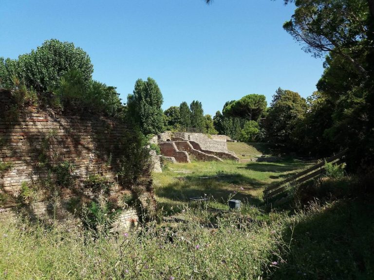
Archaeological surveys suggest that the bridge once extended more than 10 metres farther at the San Giuliano end. Its surviving fabric is in poorer condition there, a state attributed to its military history. Stones recovered from the river during work in 1989–91 were catalogued in 2005. In 2016, 155 were assembled in an archaeological park near this end of the bridge. Most are Roman, while some carry later inscriptions that may relate to restoration work.
Possible port remains
An underwater wall crossing the bridge on the right bank was uncovered in the 1970s and then submerged in concrete. Local historian Giovanni Rimondini proposed that it formed part of a Roman port, although the wall may date from after Roman Ariminum.