Montréal Castle: A Crusader Fortress in Jordan
Site at a Glance
- Rating
- 4.2
- Popularity
- Medium
- Country
- Jordan
- Primary era
- Medieval
- Eras represented
- Medieval
- Civilizations
- Ayyubid, Crusader, Kingdom of Jerusalem, Mamluk
- Site type
- Military
- Remains
- Castle
On this page17 sections
History
Montréal Castle, also called Saubak, is a Crusader fortress in Jordan, founded by the Latin Kingdom of Jerusalem in 1115 during the reign of Baldwin I. Known in Latin and French as Mons Regalis, Mont Réal, and Krak de Montréal, names meaning “Royal Mountain,” it guarded the southern frontier of the kingdom and controlled important roads through Edom.
Foundation and the lordship of Oultrejourdain
Baldwin I began building Montréal during a campaign to strengthen the kingdom’s southern Transjordanian frontier. The same campaign led to the capture of Aqaba in 1116. The fortress overlooked routes linking the Dead Sea with the Gulf of Aqaba and the Red Sea, as well as roads between Egypt and Damascus. Syrian pilgrims traveling to Mecca also used this network. Montréal and Kerak consequently formed part of a chain of strongholds controlling movement through Edom and Moab and between Egypt, western Arabia, and Syria.
In 1107, before the fortress was founded, the hill and its slopes were held by al-Asfahid al-Turkmani, who owed gifts to Baldwin I. Crusader accounts describe Montréal as an entirely new foundation, while an Arabic chronicle may refer to an earlier ruined fortification on the hill. Christian settlers established a burgus, a small fortified watchtower or outpost, alongside the new stronghold. Baldwin placed a heavily armed garrison there and settled Frankish farmers in the surrounding countryside. Local Christians also lived in the area, together with possibly some Muslims.
For about its first thirty years, Montréal was the center of Oultrejourdain, the lordship of the Kingdom of Jerusalem east of the Jordan River. The fortress’s ownership during this period remains uncertain. William of Tyre wrote that Baldwin I granted it to Romain du Puy, but Romain’s involvement in the baronial revolt of about 1133–1134 led King Fulk to remove the du Puy family and grant the lordship to his cupbearer, Paganus. Charters from 1126 and 1132, however, mention a “Paganus of Montréal,” raising the possibility that Romain never controlled the fortress or that it remained royal property until the early 1140s.
An inscription dated to 1118 names Hugo as sub-count of the region, while a castellan appointed by the king administered the fortress. In 1142, Paganus received permission to build Kerak. Once Kerak was completed, it replaced Montréal as the regional center, although Montréal continued to command the surrounding routes and settlements.
Conflict and Crusader rebuilding
Montréal faced repeated attacks from Egypt and Syria. Fatimid forces raided the area in 1157 and carried away captives. An Egyptian army began an assault in 1158, but abandoned its nearly year-long siege after the king of Jerusalem sent gifts and sought peace.
In 1161, Philip of Milly received Oultrejourdain and Montréal as a fief from Baldwin III. After a short interval, the lordship passed to Philip’s second daughter, Stephanie of Milly. Accounts that Montréal and Kerak were built or extensively strengthened after the failed Egyptian campaigns of 1163–1169 probably refer to major rebuilding and reinforcement of earlier defenses.
Saladin, the Ayyubid ruler who united major Muslim territories in Egypt and Syria and recovered Jerusalem in 1187, besieged Montréal in September 1171. He withdrew when the approach of his political rival Nur al-Din Zangi threatened his position. Egyptian forces ravaged the countryside and agricultural lands around the fortress in 1171, 1182, and 1187, although the siege of Montréal in 1187 was unsuccessful.
After Jerusalem fell in October 1187, Stephanie of Milly secured her release from Muslim captivity, while her son remained a prisoner. Saladin demanded the surrender of Kerak and Montréal in exchange for the young man’s freedom. Their garrisons rejected her order to capitulate, leaving the fortresses without military or logistical support. At Montréal, the defenders endured a prolonged famine. Accounts describe people selling family members for bread and suffering blindness because of the lack of salt. The fortress finally surrendered in April or May 1189, after approximately two years of siege.
Life and administration under the Crusaders
Montréal’s direct commander was its castellan. A court for the settled bourgeois population operated there, one of thirty-seven such courts listed among the legal institutions of the Kingdom of Jerusalem. This institution points to a permanent Frankish community involved in farming and trade. The lord of Montréal could levy tolls on caravans, while Montréal and Kerak together were required to provide sixty knights for the royal army. The garrison also worked with nomadic Bedouins during raids into hostile territory.
Ecclesiastical institutions held land around the fortress. The Monastery of Saint Catherine on Mount Sinai possessed houses and farmland, while the Templum Domini, the Latin Christian institution established in the former Dome of the Rock in Jerusalem, held vineyards and houses. The settlement around Montréal included mills, vineyards, and olive groves associated with the monastery. These properties formed part of a cultivated landscape supported by springs and connected to the fortress’s military role.
Ayyubid and Mamluk rule
Following the 1189 conquest, Montréal was granted to Saladin’s brother al-Adil as an iqta, a grant of land revenues in return for service. It remained under his personal supervision after he became sultan in 1200. A substantial Christian population continued to live around the fortress. Christians were still reported to form a majority in 1321, although a later estimate of 7,000 Christians is considered excessive.
Montréal and Kerak retained enough military and strategic value that Muslim negotiators in talks with the Crusaders in 1218–1219 were willing to discuss Jerusalem but would not surrender either fortress. The negotiations failed. Montréal continued to function as a garrison under the Ayyubids, Mamluks, and Ottomans.
Al-Kamil bought the fortress and its lands from his cousin al-Nasir Dawud for 16,000 dinars in 1229. He strengthened the defenses and ruled Saubak from 1229 to 1238. During the rule of his son al-Salih Ayyub, from 1240 to 1249, additional towers were built. Montréal was held by the last Transjordanian Ayyubid prince, al-Mughith Umar, from 1250 to 1261. The Mamluks took Saubak in 1261 after Baybars unsuccessfully tried to persuade its defenders to change allegiance.
Under Mamluk rule, Saubak became an amal, or subprovince, under the governor of the Kerak district. A sultan-appointed mutawalli, or custodian, directed it under the governor’s authority. The citadel contained a postal station and sometimes served as the seat of a qadi, an Islamic judge. The surrounding population was predominantly Melkite Christian, belonging to the Byzantine Christian tradition, and was active in trade.
Kerak remained the principal military and administrative center of the region, but Montréal received substantial investment because of the pilgrimage route. Most of the visible ruins belong to the Mamluk period. In 1292, a report stated that the citadel had been demolished except for its keep, although the surviving Frankish remains show that this description overstated the destruction.
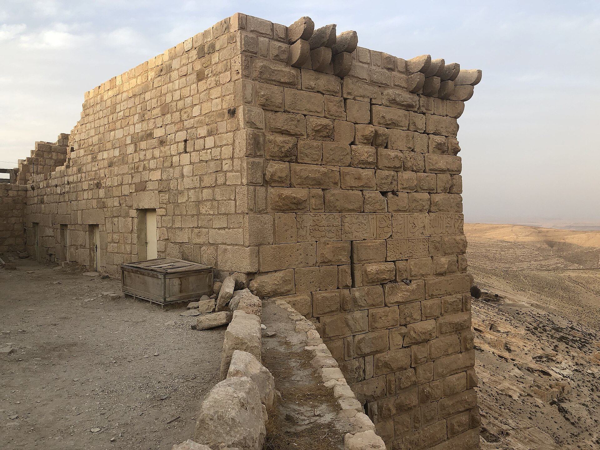
In 1297–1298, Sultan al-Mansur Lajin ordered the fortress rebuilt. Mamluk builders enlarged the outer wall, added new towers, and fitted the defenses with a covered wall-walk. They reinforced and enclosed the earlier Frankish fortifications rather than replacing them completely. A stone inscription set into the wall commemorates the sultan who ordered the work.
Later Ottoman history and archaeological study
No major building campaign is known from the fourteenth or fifteenth centuries. As the Crusader threat declined, the need for a large military presence diminished. By the 1340s, the historian Shihab al-Umari stated that Saubak had no soldiers and that its gates were closed. A major flood and earthquake in 1318 may also have contributed to this decline. The settlement nevertheless remained known in the later fourteenth century for carpet production.
The Ottomans took Saubak in 1516–1517, after which it became the center of a nahiya, a smaller administrative subdivision, within the Ajlun sanjak, an Ottoman district. Deteriorating security caused the Christian population to leave, and Bedouin nomads came to outnumber the townspeople. The garrison was strengthened to protect the pilgrimage route from Bedouin raids.
Under Sultan Suleiman I, the pilgrimage route moved eastward toward the edge of the Transjordanian desert, but Saubak was still renovated and janissaries, elite Ottoman infantry, were stationed there. This was the last major Ottoman investment in the former Oultrejourdain region. Ottoman garrisons in the area were eventually abolished in the late seventeenth century.
Saubak retained occasional importance in Ottoman attempts to pacify the tribes of Transjordan. In 1895, local inhabitants rebelled against the Ottoman garrison. The governor of the Kerak district suppressed the revolt, which caused the deaths of 200 civilians and 20 soldiers. The fortress remained inhabited into the twentieth century.
The site was studied and photographed by the architect-archaeologist Christophe Edouard Mauss and the photographer Henry Sauvaire in 1864–1866. Rudolf-Ernst Brünnow and Adolf von Domaszewski published a further study of Montréal-Saubak in 1904. Jordanian development and investigation began in the 1970s and 1980s. Jean-Jacques Langendorf and Gerard Zimmermann examined the two Crusader churches, Denys Pringle studied them in 1981–1982, and Robin M. Brown excavated areas associated with the late Islamic period in 1986. From 1999, the University of Florence expanded research on twelfth-century western and Ayyubid Transjordan at Montréal-Saubak, while French researchers mapped the ruins with a three-dimensional geographic information system during the 2000s. Montréal-Saubak has been on Jordan’s World Heritage tentative list since 2001 and is presented as an archaeological and open-air museum site.
Remains
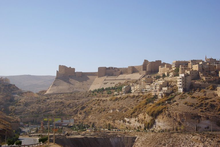
Montréal occupies a rocky, steep-sided hill on the eastern edge of Wadi Araba, overlooking the present town of Saubak. The hill rises about 1,330–1,382 meters above sea level, approximately 35 kilometers north of Petra and 120 kilometers south of Kerak. A broad valley surrounds it, while the ground falls sharply from the hill and remains lower than the nearby plateau. The position made siege-engine attacks difficult and enabled the fortress to control the caravan road below. The earlier Frankish plan was oval, while repeated rebuilding produced the irregular outline seen in later descriptions. The overall dimensions are given as about 175 by 90 meters.
Defenses and water system
Walls, moat, and towers
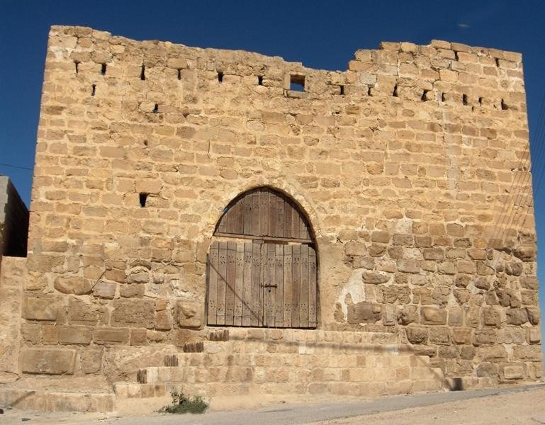
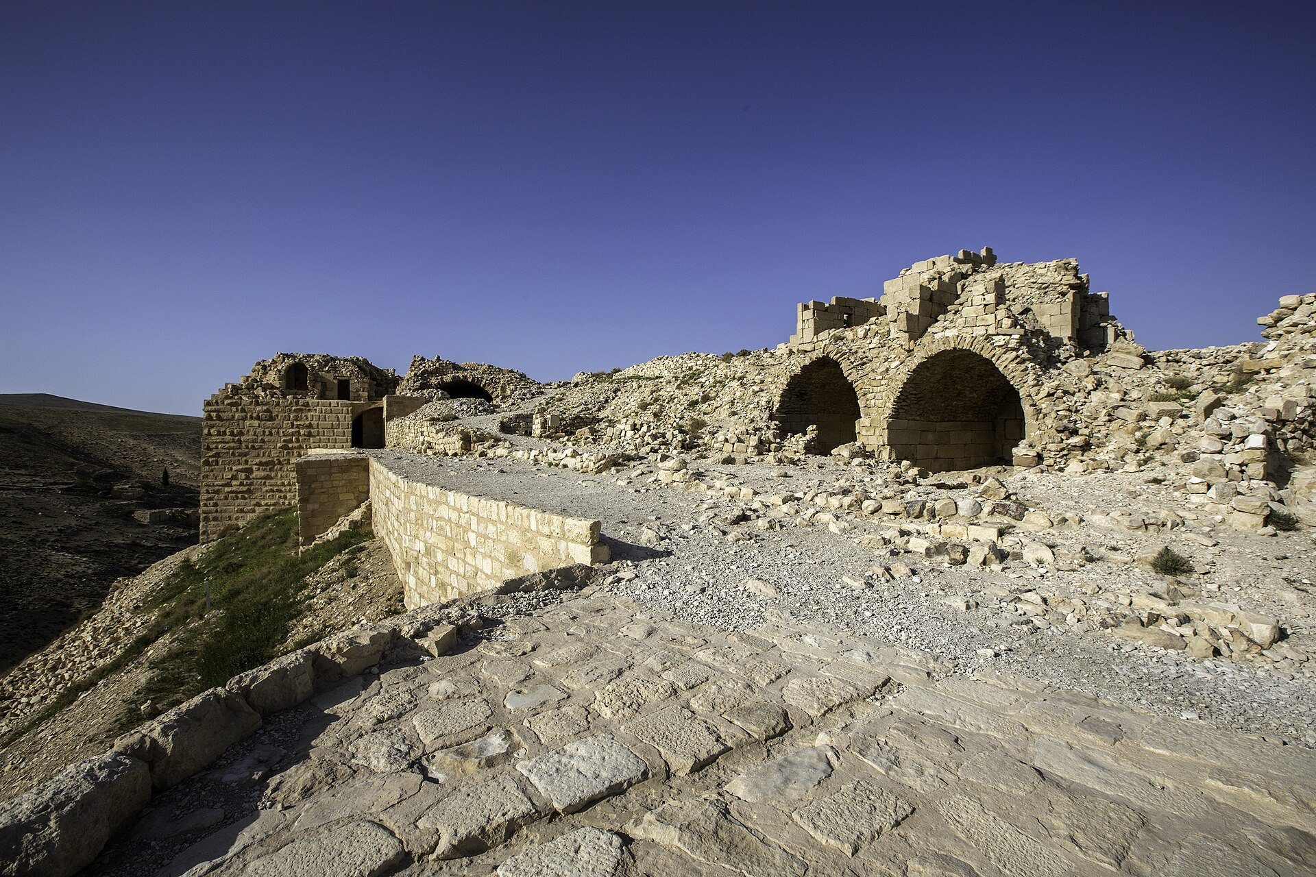
The hill provided a natural defense, supplemented by an encircling moat and a single winding approach from the northeast. Descriptions by Thietmar and William of Tyre refer to three walls, an inner wall, towers, an outer wall, and the moat. The surviving defenses include rectangular and circular towers, with one corner tower specifically described as round. Other descriptions count nine circular, rectangular, and square towers, each with three levels and several rooms. Mamluk work expanded the outer wall, added towers, and created covered wall-walks around the defenses. Hard gray stone from nearby quarries formed most of the construction, with some yellow limestone also used. Frankish outer stone faces were left unworked, while later defenses used dressed stone and sloping supporting walls that made climbing more difficult and increased resistance to earthquakes and explosions.
Water installations
Montréal’s water system combined underground channels, cisterns, wells, pipes, and reservoirs. A tunnel descends through approximately 350–365 steps, including a winding or spiral section, to two cisterns cut into the mountain and supplied by a spring. Other tanks were excavated within the fortress. A well in the southwestern area was reached through a spiral passage. The walls and interior also preserve water pipes and additional service structures, showing how the garrison secured supplies within a hilltop stronghold.
Inner fortress and religious buildings
Central defenses and gate
The center of the fortress contained the quarters of the Frankish soldiers and an inner church. These buildings stood within a double defensive wall strengthened by projecting towers. The principal gate opened to the east. From the gate, the route curved clockwise around the southern side toward the passage leading to the inner courtyard. Rooms for soldiers, kitchens, laundry areas, stairs, gates, arches, internal roads, and underground passages formed part of the surviving or excavated interior.
Churches and chapel
Montréal had two churches. The larger inner church was a three-aisled building, closer in form to a parish church than to a small castle chapel. It may have been the Church of Saint Mary mentioned in a charter issued by Maurice, lord of Montréal, in 1152. A smaller chapel stood between the inner and outer walls. It may have served Eastern Christian settlers living around the fortress or functioned as a baptistery. An Arabic description also refers to an additional chapel or prayer space and to two churches. The church remains were examined during modern archaeological work.
Ayyubid and Mamluk buildings
Ayyubid palace
An Ayyubid palace, probably dating to the reign of al-Muazzam Isa, occupied part of the complex. It was a four-iwan princely residence, using a form associated with Syrian Zangid and Ayyubid architecture. An iwan is a large vaulted or arcaded hall open on one side. The palace’s reception hall collapsed in the mid-thirteenth century, after which the residence was rebuilt several times. The palace is among the Ayyubid structures incorporated into the later fortress.
Northeastern hall and later defenses
An iwan in the northeastern part of the fortress measured approximately 13 by 6 meters and contained three bays or arcades. Mamluk repairs and rebuilding shaped much of the visible complex. Inscriptions and carved Kufic script on the walls record the names and building works of several sultans, including Baybars, al-Salih Ayyub, and al-Mansur Lajin. The interior spaces are extensively ruined, while Frankish defensive and ecclesiastical elements survive within the later structure.
Valley settlement and agricultural features
The eastern side of the fortress overlooked a town in the valley below. Two springs rising at the foot of the hill irrigated its gardens. Houses and vineyards associated with the Templum Domini formed part of the lower settlement, while the Monastery of Saint Catherine possessed houses, mills, vineyards, and olive gardens. The fortress complex also preserves or has yielded olive presses or millstones, wells, and other service features.
A water mill in the valley may have processed sugar cane. Archaeological evidence also indicates that fruit trees were planted below the fortress during the Ayyubid period. Together with the springs, gardens, vineyards, olive groves, and cultivated land, these features show the relationship between the hilltop garrison and the productive settlement around it.