Mamshit: A Nabataean Caravan City in Israel
Site at a Glance
- Rating
- 4.5
- Popularity
- Medium
- Country
- Israel
- Primary era
- Classical
- Eras represented
- Classical, Medieval, Modern
- Civilizations
- British, Byzantine, Nabataean, Roman
- Site type
- City
On this page17 sections
History
Mamshit is a Nabataean city at Dimona in Israel, founded during the second half of the 1st century BCE as a caravan station in the Negev. The Nabataeans, an Arabian people whose kingdom was centered on Petra, built a network of desert routes linking Arabia with the Levant and the Mediterranean. Mamshit stood on routes toward Gaza and the coast, and on roads through the Arabah and Maale Akrabim toward Beersheba, Hebron, and Jerusalem.
Nabataean foundation and development
The settlement was more than a stopping place for caravans. Because the surrounding land had little natural water and limited arable soil, its inhabitants constructed dams, reservoirs, and irrigation works. Cultivation extended into an area reaching approximately 25 kilometers from the city. During the later Nabataean period, horse breeding and horse trading supplemented, and perhaps partly replaced, the earlier emphasis on caravan commerce. A possible building workshop or architectural school may also have supported the local economy, although this interpretation remains indirect.
Mamshit was probably devastated by nomads around AD 50. It was later rebuilt and resettled under Rabbel II, the Nabataean king whose reign preceded the Roman annexation of the kingdom. After its recovery, the city continued to operate as a caravan station. Its later prosperity was reflected in substantial residences, horse facilities, water installations, and other construction associated especially with the 2nd century.
Roman frontier settlement
On 22 March AD 106, Rome incorporated the Nabataean kingdom into the province of Arabia. Mamshit then acquired a permanent Roman garrison, which defended the southern imperial frontier and the desert routes against nomadic attacks. Units associated with the occupation included the Third Cyrene Legion and cavalry from the First Thracian Cohort. The city continued to develop after annexation, and by the late Roman period it was enclosed by defensive walls. The garrison was still active in the late 3rd century.
Economic pressures later weakened the settlement. Long-distance trade declined, while demand for racing horses also fell during the 3rd century. Earlier structures were altered or replaced as the city changed. Buildings from the 1st century were deliberately demolished during the second half of the 2nd century to make room for new construction, while other structures were adapted within the existing urban boundaries.
Byzantine occupation and destruction
During the Byzantine period, Mamshit’s population became Christian. The city retained importance as a frontier settlement and received support at least until the reign of Justinian I. Two churches were erected, probably in the late 4th or early 5th century, but the settlement was not completely replanned. Christian buildings were inserted into the earlier Nabataean urban framework, sometimes using existing houses or sections of the city wall.
Mamshit was probably destroyed in the middle of the 6th century, possibly during an Arab raid. Coins later than approximately AD 550 have not been found in the ruins. The churches were burned, graffiti was added in one church apse, and the city was not rebuilt. Early Arabic inscriptions refer to its conquest during the first period of Arab expansion. Earlier written references include Ptolemy’s listing of Mampsis among the cities of Idumea, Eusebius’s description of Tamar as about a day’s march away on the route from Hebron to Elat, Byzantine references, the Madaba map’s image of a walled city with a gateway, and tax records in the Nessana papyri.
Modern investigation and preservation
Ulrich Jasper Seetzen first reported Mamshit in the modern period during the first decade of the 19th century. Edward Robinson described the ruins in 1838, and Edward Palmer visited later in the century. Alois Musil produced the first city plan in 1901 or 1902, identifying the wall, two churches, and several buildings. In 1914, Leonard Woolley and T. E. Lawrence prepared another plan that also included the water-supply system.
John Henry Iliffe found Nabataean and early Roman pottery in 1934. A 1937 expedition led by Philip Langstaffe Ord Guy and George Kirk made a detailed plan and located cemeteries. Avraham Negev investigated two cemeteries in 1965–1967 on behalf of the Hebrew University, followed by further expeditions in 1971–1972 and 1990. Excavations by the Hebrew University and the National Parks Authority took place in 1956–1957, while work by the Israel Antiquities Authority in 1993–1994 exposed an earlier building that had remained in use until the earthquake of AD 363. A British police station was later built over its ruins.
During the British Mandate, a mounted desert-police station occupied part of Mamshit. Constructed in 1936 beside the fortress, it stood partly over a Nabataean building and remains visible at the site. Mamshit is preserved as a national park and archaeological site and forms part of the UNESCO World Heritage property “Incense Route—Desert Cities in the Negev,” inscribed in 2005 with Haluza, Avdat, and Shivta.
Remains
Urban setting and construction
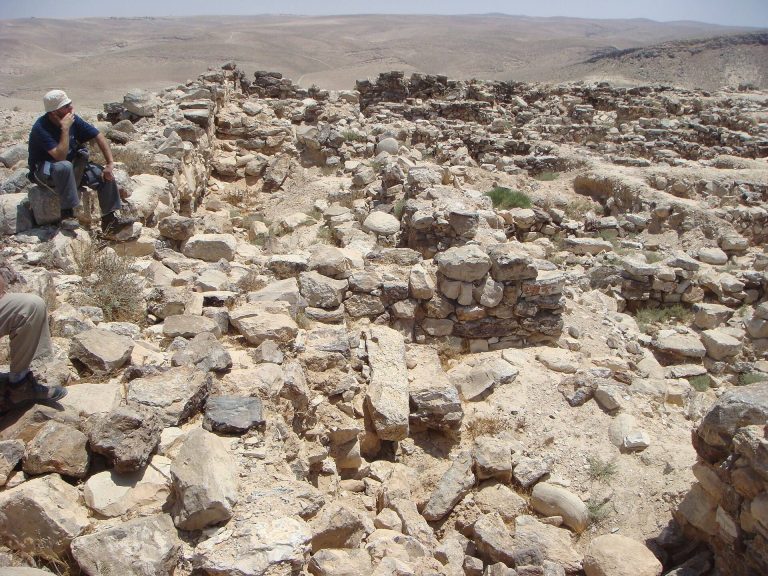
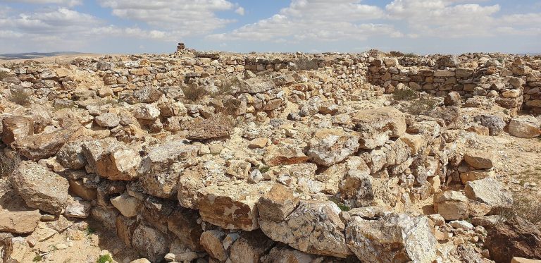
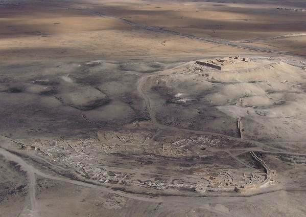
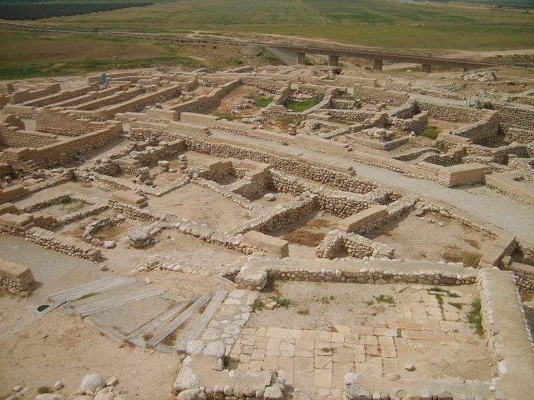
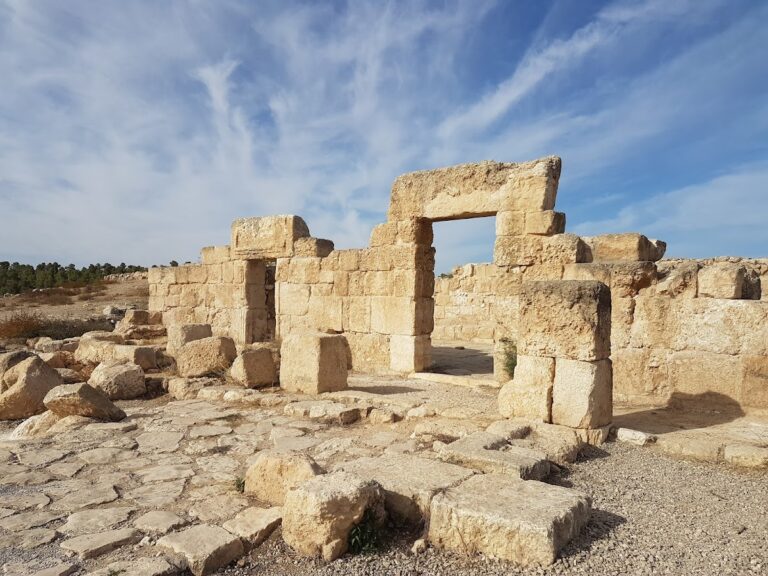
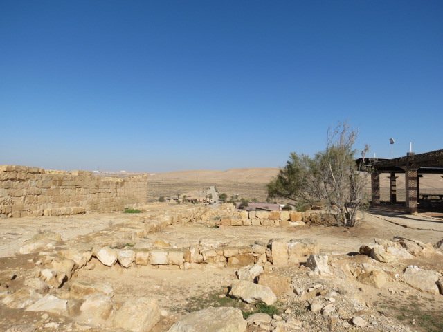
Mamshit covered approximately 40,000 square meters, or about 4 hectares. A narrow, flat valley divided it into eastern and western sectors. The western area stood on a small rise beside the Mamshit stream and contained the acropolis and elite residential quarter, with the palace near its center. The city had a principal street and dispersed construction rather than a tightly packed plan. Surviving streets, courtyards, terraces, open rooms, carefully cut stonework, and well-built arches preserve the form of a settlement whose later buildings continued to occupy much of the earlier Nabataean layout.
Most visible remains belong to the later Nabataean period, especially the 2nd century. Houses commonly formed fortified compounds arranged around internal courtyards. Their outer façades were windowless and usually had a single entrance, while galleries rested on pillars and separate stairways served different wings. Service rooms opened from the connected galleries, and some compounds combined storage spaces, living quarters, and stable yards. The durable construction allowed many buildings to remain in use, with repairs and adaptations, into the Byzantine period.
Residential compounds and palace
The Nabataean House
The building known as the Nabataean House covered approximately 2,000 square meters. Its complex included courtyards, staircases, internal rooms, and stables that could hold 16 horses. Two basilica-shaped stables beside houses had square central courtyards, narrow side aisles with arched windows, stone troughs, and arched entrances. These arrangements reflect the importance of horse keeping within the later Nabataean economy.
The Palace
The so-called Palace was an elite residence of approximately 1,000 square meters. Its southern entrance opened into a vestibule measuring 6 by 2.8 meters and then into a courtyard measuring 13 by 8.5 meters. Around the courtyard were a reception room, archive, kitchen, servants’ rooms, two storerooms, service rooms, and residential apartments. A guardroom and defensive tower adjoined the western side.
Fortifications and water management
Fortress and city walls
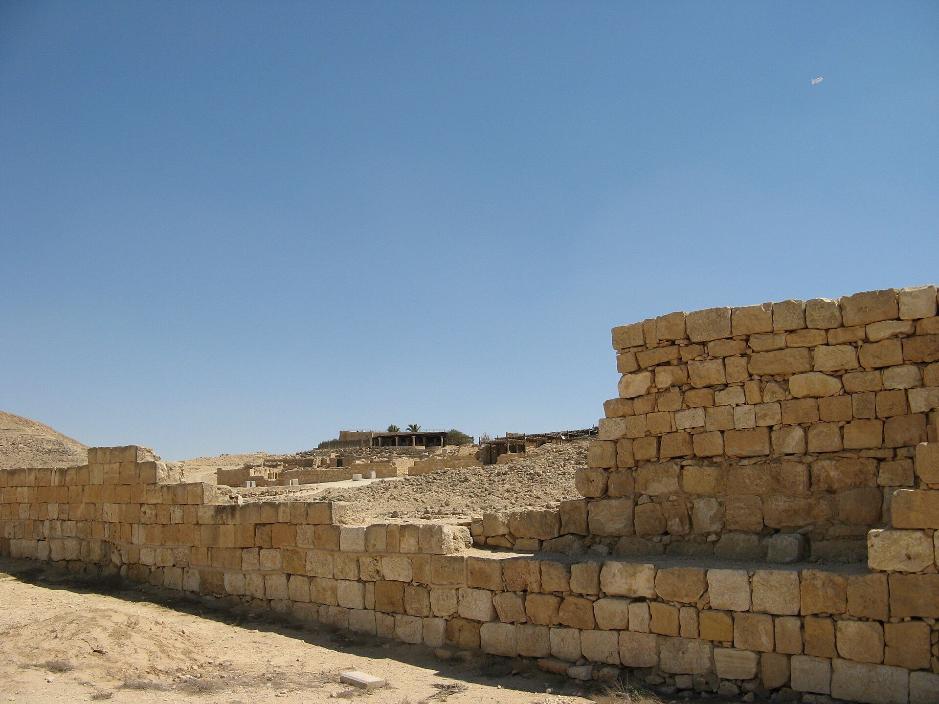
The Nabataean fortress occupied the city’s highest point. It had a square plan with sides of approximately 10 meters. An observation tower and a caravanserai stood outside the walls. The fortress was partly dismantled in the 1930s, and some of its stones were reused in the British mounted-police station. In the late Roman period, walls enclosed about 4 hectares of urban space. The circuit extended for roughly 900 meters, with an eastern gate opening toward the main road and a western gate leading toward the reservoirs. The wall was strengthened after the earthquake of AD 363. The Madaba map depicts a covered gate protected by two towers, which was later burned and destroyed, probably in the 7th century.
Dams and reservoirs
Fortifications extended across the level ground north and northwest of the city, apparently creating a barrier against nomadic groups. Water control was equally important. Three Nabataean dams were built in nearby wadis and ravines, and a fourth was added by the British; two of the Nabataean dams survive. Seasonal streams, wells, pools, and springs fed water behind the dams. Channels carried it to open reservoirs, from which it was transferred to rock-cut cisterns beneath houses.
A covered reservoir supported by arcades measured 18 by 10 by 3 meters and held approximately 400 cubic meters. The city pool is described as having a capacity of about 1,500 cubic meters. An inscription found during excavation records the completion of compulsory labor connected with the pool. Mamshit also contained a Roman-style bathhouse with cold, warm, and hot rooms, the hottest space being heated by wood burned beneath a specially constructed floor.
Churches and Christian buildings
Eastern church
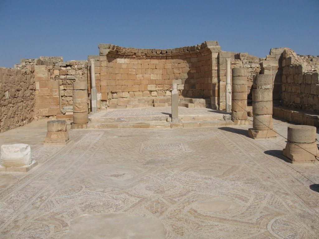
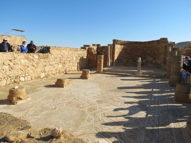
The larger church stood in the southeastern part of the city. It was a three-aisled basilica measuring approximately 27.5 by 15 meters, with a central nave ending in an apse and side aisles containing pastophoria, side chambers associated with the sanctuary. Mosaic decoration covered the nave and presbytery. A bell tower and baptistery stood beside the building, while an atrium, or entrance courtyard, measured approximately 18 by 15 meters and was surrounded by a portico.
This church is also known as the Church of the Saints and Martyrs because human bones were found inside it, possibly reflecting an early Christian cult of saints. It formed part of a monastery and had steps leading to its atrium. The floor mosaic includes two crosses, a feature considered earlier than AD 427, when crosses in church floors were prohibited. The baptistery contained a cross-shaped basin for adults and a smaller square basin for infants.
Western church
The smaller church occupied the southwestern part of Mamshit and measured approximately 17.5 by 10 meters. It was built partly over the foundations of an earlier Nabataean house. Its mosaics combine geometric patterns with flowers, fruit, birds, and fish. The building is also identified as the Church of Saint Nilus. Greek dedicatory inscriptions in the floor include an appeal for God to save Nilus, described as a lover of Jesus and founder of the church, while another possible reading refers to a church guardian.
A large quantity of ash inside the western church indicates that it was probably burned during an Arab attack. A Byzantine-period market stood beside it. Together with other religious buildings, the church demonstrates how Christian construction was fitted into the older urban plan.
Cemeteries and archaeological finds
The Nabataean cemetery lay approximately 1 kilometer north of the city and contained about 20 to 25 shaft graves, each 1 to 4 meters deep. Stepped-pyramid tombstones on square bases marked the graves, although only one such tombstone survives. The shafts were filled with tightly packed stones to depths of 1.8 to 2.3 meters. Beneath them, burial chambers held the deceased on their backs, sometimes in cedar coffins, with the head facing west. Semi-precious stones accompanied some bodies, and several graves contained a denarius of Trajan.
A second cemetery, about 200 meters northeast of the city, dates to the 2nd century and served soldiers from the Roman garrison. The dead were cremated on prepared stone platforms marked by stepped-pyramid tombstones or stone heaps. Two Latin inscriptions identify legionaries buried there.
Other finds illuminate the city’s wealth and activities. A late Roman house had plastered walls decorated with geometric designs and mythological scenes. A staircase led to a painted room where approximately 10,500 silver coins were discovered in a hoard weighing about 72 kilograms. The youngest coin dates to approximately AD 220, and the hoard is the largest coin hoard ever found in Israel. Excavations also produced a lead ingot weighing 158 Roman librae, bearing foundry marks, along with Greek papyri, Nabataean vessels, coins, and other objects.