Rheinfelden-Pferrichgraben: A Late Roman Watchtower on the Rhine Frontier
Site at a Glance
- Popularity
- Very Low
- Country
- Switzerland
- Primary era
- Classical
- Eras represented
- Classical
- Civilizations
- Roman
- Site type
- Military
- Remains
- Tower
On this page17 sections
History
Rheinfelden-Pferrichgraben was a late Roman watchtower in Switzerland, built by the Romans between AD 369 and 374. It belonged to the Donau-Iller-Rhine Limes, a Roman frontier zone and defense system rather than a continuous wall, and stood within its High Rhine section. The tower was constructed during Emperor Valentinian I’s Rhine fortification program, which ran from AD 369 to 375.
The Roman Rhine frontier
From about AD 260, after Rome gave up the Upper Germanic-Rhaetian frontier, the Rhine, Danube, and Iller formed a new imperial boundary. It separated Roman territory from lands of the Alamanni, Juthungi, and Franks. The defenses protected Maxima Sequanorum, a late Roman province in the upper Rhine and Jura region.
The High Rhine defenses extended roughly 150 km from Basel to Lake Constance. They included about 50 towers and forts, of which around 20 retain masonry remains, seven in the canton of Aargau. The towers and forts could pass warnings by flags, lights, or horn calls. Signals could alert the Roman military centers at Castrum Rauracense, at Kaiseraugst, and Tenedone, at Bad Zurzach, allowing troops to move toward threatened stretches of the river. The network marked Roman control and helped monitor the frontier, but its towers were probably not strong enough to prevent crossings. Their placement in areas considered less immediately threatened is consistent with a primary role in observation and communication.
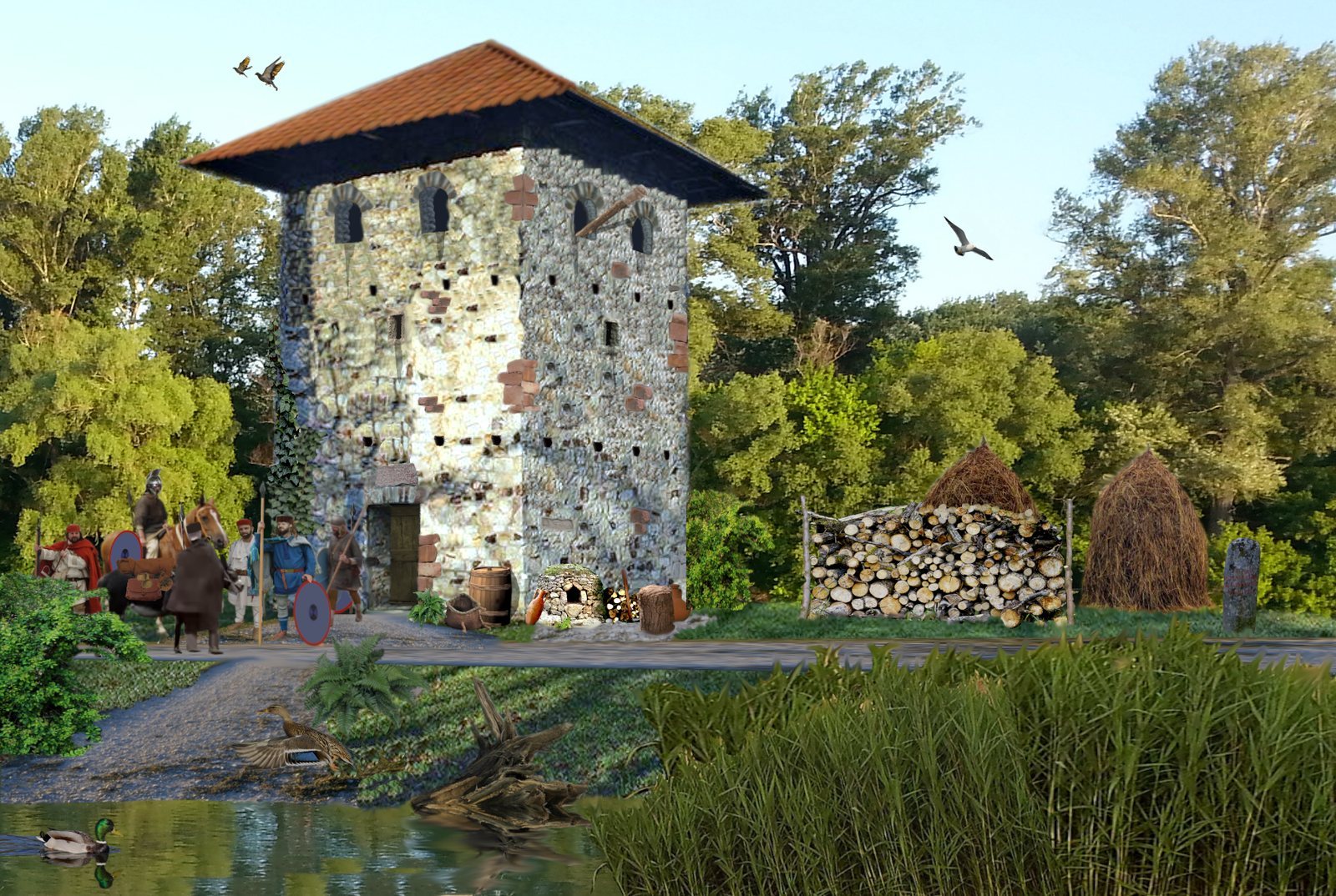
The tower is associated with the Riparenses, a Roman unit of river-frontier troops. It may have held six to eight soldiers, probably supplied by Castrum Rauracense. The small quantity of finds has prompted the suggestion that watchtowers in the region were not always continuously staffed. Soldiers may also have prepared timber for transport by river. This possibility draws partly on watchtowers shown on Trajan’s Column, a Roman monument in Rome whose reliefs depict military campaigns, but it is not a confirmed activity at Pferrichgraben.
Abandonment and later use
In the winter of AD 401 to 402, the Roman commander Stilicho withdrew much of the Rhine army to counter the Visigothic king Alaric in Italy. Frontier towers were then abandoned, destroyed, or left to decay. The Pferrichgraben area may subsequently have been used as pasture.
Rediscovery and conservation
The remains came to attention around 1900, when a large mound south of the Rheinfelden-Heimenholz cemetery was reported to Pastor Sebastian Burkart. Clearing the vegetation revealed a tower buried beneath rubble, not the burial mound it had first been thought to be. Burkart, Theophil Burkhardt-Biedermann, and Guido Hunziker-Habich excavated the site in 1902; Karl Stehlin directed a further excavation in 1910.
Anton Senti and Albert Matter led a full exposure, recording, restoration, and conservation project in 1938–39 for the Fricktal-Baden Association for Local History. Further work on Aargau’s late Roman Rhine towers began in 2014 with local communities and the University of Basel’s Vindonissa Professorship in Roman provincial archaeology. University of Basel students documented and repaired the Pferrichgraben remains in 2016–17, with local residents also assisting. Core samples taken near the entrance were analyzed by ETH Zurich, the Swiss Federal Institute of Technology Zurich, using a newly developed dating method. The results supported a late fourth-century date; archaeologist Peter-Andrew Schwarz places construction specifically in AD 369 to 374.
Remains
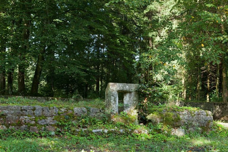
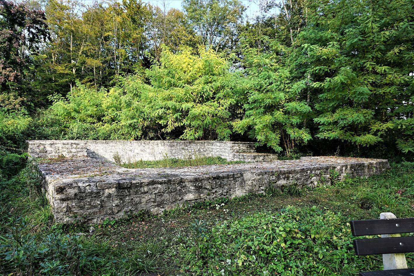
The surviving site centers on a square tower, built with rubble-stone wall faces around a core of Roman concrete. Its position above the Rhine and the exposed foundations provide evidence of both its layout and construction.
Setting and position
The ruin stands northeast of Rheinfelden, on the edge of a steep slope above the Rhine. The river terrace rises about 25 m and is capped by thick deposits of windblown silt, cut by deep ravines. The Pferrichgraben ravine, which gives the site its name, lies just under 100 m upriver. The tower occupied a bend in the Rhine between Wallbach and Rheinfelden, a stretch where nine late Roman watchtowers were built.
From this position, the tower had sight lines toward the Black Forest foothills, the plain on the opposite bank, and the southern slope of the Dinkelberg uplands. It could communicate directly with Rheinfelden-Heimenholz, about 1.4 km upriver, and Rheinfelden-Insel Stein, about 3 km downriver. Rheinfelden and the island could also be seen downriver.
Tower construction
Plan and foundation
The tower measured about 11.5 m on each side, with walls approximately 2.10 m thick. Its plan was slightly rhomboid, with angles of about 93 and 87 degrees, and its original height was around 7 m. The lowest foundation course consisted of loosely laid river cobbles, topped by a course of Roman concrete. The rising walls were slightly offset from the foundation. This may reflect roughly marked or brick-lined foundation trenches, or the possibility that the precise alignment of the inner and outer wall faces was settled just before the walls were raised.
Walls and materials
The wall faces were made chiefly of roughly dressed limestone rubble laid in courses of varying-sized stones. Coarse gravel mixed into the Roman-concrete core produced hard, pale-beige material, distinguishable from mortar used in later repairs. The upper walling included blocks of calcareous tufa, a porous stone deposited by mineral-rich spring water. The blocks measure about 30 × 15 × 11 cm or 30 × 20 × 15 cm.
Two pale-red quartz sandstone fragments found in the masonry came from a geological formation exposed at Degerfelden/Warmbach or Nettenberg. They may have originated in a Roman quarry at nearby Nettenberg, or been reused from an earlier Roman-period building. Remnants of a rough mortar coating that left the stones visible survive in places. Later conservation filled gaps to the original height using demolition material from an old slaughterhouse and Roman building methods; sheets mark the boundary between ancient and rebuilt masonry. A protective layer of macadam and asphalt, 6 cm thick, covers the wall tops.
Concrete, mortar, and construction sequence
The mortar is white to pale beige, rich in binding material, and remains hard with good adhesion. Its aggregate came from gravel on the local terrace and was probably sieved. The mixture also contains lumps of quicklime, small brick fragments, and impressions of wood shavings. These materials were deliberately included to retain moisture, slowing the mortar’s drying and reducing cracking.
The foundation contains about 20 m³ of Roman concrete. Its estimated requirement of roughly 4 m³ of quicklime, produced by heating limestone, would have used about 6 to 12 m³ of wood, preferably oak or beech. Estimates for the whole tower place its quicklime requirement at about 79 to 105 m³ and the necessary fuelwood at roughly 119 to 317 m³.
A smooth, continuous mortar layer over sloping limestone slabs may mark a pause in building, perhaps over winter or while the concrete hardened. This evidence complicates the suggestion that Rhine towers and small fortified posts could be built in only 48 days, a duration indicated by an inscription from the Pannonian post at Crumerum.
Timber in the foundation
Excavation in 1938 revealed circular cavities left by decayed round timbers in the foundation. Timbers along the outer edge had left a pronounced groove rather than a cavity. Karl Stehlin proposed that beams were inserted into unset concrete and joined with interlocking joints. Sebastian Burkart suggested they were removed after the mortar hardened to help air circulate through it. They may instead have reinforced the masonry against impact, although their restriction to the foundation makes that an unlikely primary purpose. Another possibility is that they helped guide the even placement and drying of concrete, limiting settlement or shrinkage cracks.
Openings and interior evidence
Entrance and windows
The entrance was probably in the east wall, away from the Rhine and slightly south of the wall’s midpoint. It may have been raised rather than set at ground level. Narrow openings likely lit the ground floor, while windows served the upper floor. Calcareous tufa may have formed the surrounds of the doorway and light openings. Wedge-shaped tufa fragments found in the rubble have curves with radii of about 0.5 to 1 m and may have come from windows or window niches.
Hearth and burning
A hearth and a patch of burning about 1 m² in area and 10 cm thick were uncovered in the southwest corner. A large sandstone block was found against the south wall.
Finds and nearby construction
Objects and animal remains
Numerous architectural fragments, mostly recovered from the wall rubble, and roof tiles came from the site. Other finds included a small number of pottery sherds, a bronze bowl, cattle and pig bones, and a soldier’s brooch. The brooch was probably a Roman clothing fastener of a type with bulb-shaped knobs or a crossbow-shaped form.
Lime kiln and extraction pit
A late Roman lime kiln and a gravel or sand pit were identified near the tower. The pit was probably filled after construction with building waste and material rejected during lime production.