Stelli: A Late Roman Rhine Frontier Fortification in Switzerland
Site at a Glance
- Popularity
- Very Low
- Country
- Switzerland
- Primary era
- Classical
- Eras represented
- Classical
- Civilizations
- Roman
- Site type
- Military
- Remains
- Fort
On this page15 sections
History
Stelli is a late Roman burgus, a compact fortified installation centered on a substantial tower, at Wallbach, Switzerland. The Romans built it in the late fourth century as part of the Danube–Iller–Rhine frontier system, which followed those rivers along the empire’s northern boundary.
The Rhine frontier
From about AD 260, after the earlier Upper Germanic–Raetian Limes frontier was abandoned, Roman defenses shifted to the Rhine, Danube, and Iller. The Rhine section protected the province of Maxima Sequanorum. In the late fourth century, Emperor Valentinian I, who ruled in the West from AD 364 to 375, ordered about 50 frontier towers, forts, and other military installations built or repaired between Basel and Lake Constance. Stelli belongs to this building phase.
Three Roman defensive installations, probably dating to the fourth century, guarded about 1.9 km of riverbank at Wallbach. Stelli was the largest; neighboring towers stood about 800 m downstream and 280 m upstream. Möhlin-Untere Wehren lay about 1.8 km downstream, while a small fort or supply station stood upstream at Mumpf-Burg. The close spacing helped maintain clear sightlines for passing signals.
Upper Rhine frontier troops answered to the dux provinciae Sequanicae, the province’s senior military commander. The unit associated with Stelli was the Riparenses, river-frontier troops. Its garrison could relay warnings by fire and smoke to nearby towers and forts, including Castrum Rauracense. Stelli may also have stored provisions and housed a larger force that supplied and staffed the neighboring towers. A Roman ship bridge at the site is possible, but remains unproven.
Roman settlement in Wallbach began in the middle Imperial period, earlier than the fortification. About 1.5 km from Stelli, Karl Stehlin excavated part of a villa rustica, or rural Roman estate, in 1911. Further remains of its walls came to light in later decades, most recently in 2016.
Withdrawal and later use
In the winter of AD 401–402, most troops were withdrawn from the Rhine frontier. This was not a response to a Germanic invasion: Stilicho, a senior commander in the Western Roman Empire, needed them to oppose the Visigothic army of Alaric I, which had entered Italy. A fire destroyed the Stelli burgus in the early fifth century. Whether its garrison deliberately cleared and burned the building or a later accidental fire caused its destruction is uncertain.
The site continued in use after the tower’s destruction, and people probably quarried it for building stone from the Middle Ages onward. Local timber rafting also altered the remains: much of the east wall was dismantled to make space for stacking logs. The area within the defensive ditch was probably used to enclose livestock, an activity associated with the place-name Stelli.
Discovery and conservation
A notice from 1866 records that August Wunderlin, Wallbach’s priest, dug a trench beside a small mound and found an iron axe, an iron billhook, pottery fragments, and substantial masonry. Stelli was identified as a late Roman fortification toward the end of the nineteenth century. In 1871, Ferdinand Keller reported that only three low, narrow masonry blocks remained and that local people had taken dressed stones for building. In 1904, Sebastian Burkart described the foundations of a once-powerful tower whose sides had measured 9–10 m and whose walls had been 1.8 m thick.
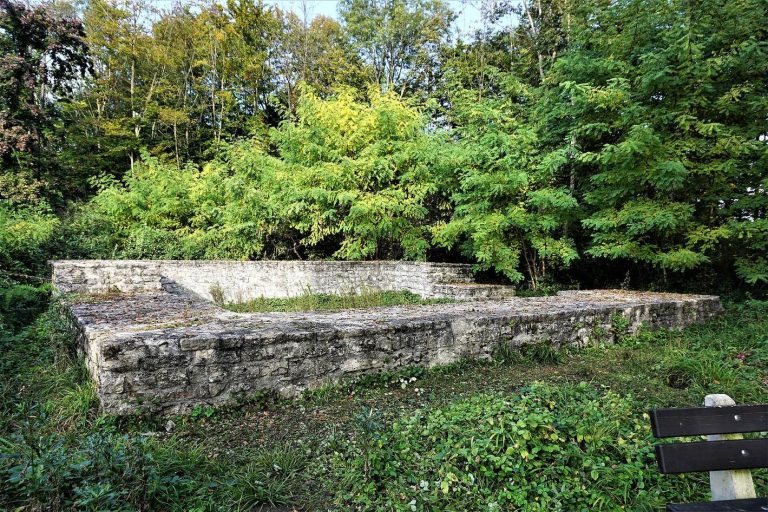
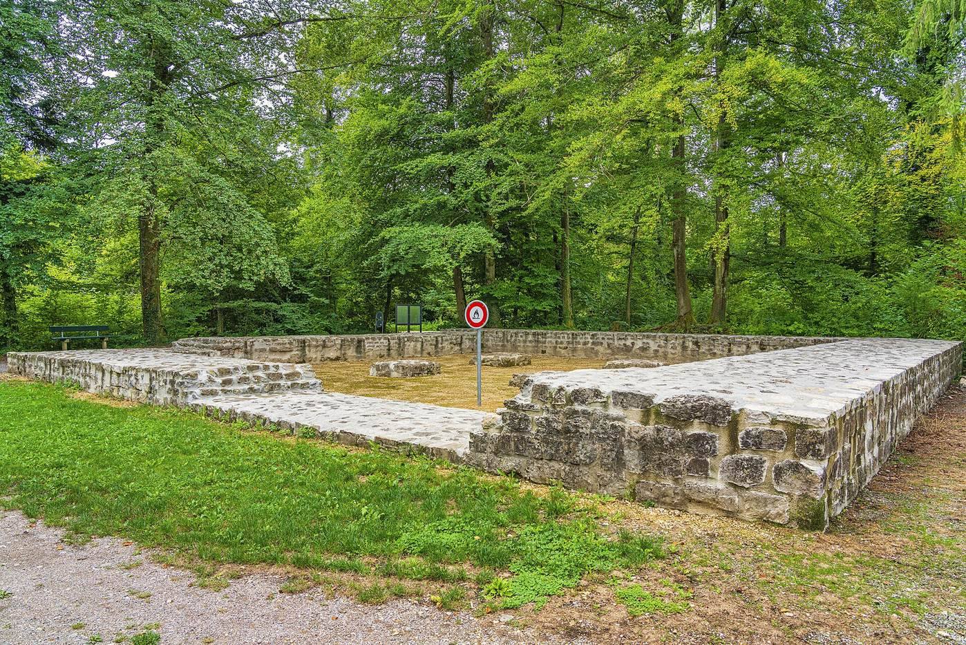
Karl Stehlin commissioned an investigation by Wallbach postmaster R. Kaufmann in 1913 and also carried out the first archaeological excavations at the site that year. Hans Rudolf Burkart directed a full excavation and conservation program from 1949 to 1955, with scientific oversight from Rudolf Laur-Belart. Further conservation work took place from 1972 to 1976, followed by comprehensive conservation and scientific investigation in 2019. Repairs rebuilt only enough masonry to protect the ancient fabric. Ancient building material was reused, and fiber-cement plates marked reconstructed wall bases. Gravel was spread inside the tower and the surrounding area was cleared and leveled. A hearth installed between the four point foundations during later works was removed in 2019. Stelli is protected as a cantonal monument.
Remains
Stelli stands on a terrace above a bend in the Rhine, where the river flows north. The site occupies a terminal moraine, a ridge of sediment deposited at the farthest advance of a glacier, which projects into the plain and drops steeply toward the water. Before the Ryburg-Schwörstadt hydroelectric plant was built in 1926–1931, the bank below the tower sloped more gently and could be reached by shallow-draft boats. The position provided views of the opposite bank and the Wehra valley, factors that probably influenced the choice of location.
The main structure was a square stone tower measuring 17.5 m on each side, with a small interior courtyard. It was larger than other known watchtowers on this stretch of the Rhine frontier, and its height may have reached 10 m. The walls enclosed a compact interior, while four substantial supports helped carry the roof and upper floors.
Tower fabric and openings
Foundations and walls
Measurements made in 1913 found wall thicknesses of 2.30–2.38 m. At that time, the walls stood 0.80–1.10 m high on foundations that averaged 0.80 m in height. The foundations were slightly wider than the walls above, projecting by as much as 25 cm on each side. Four parallel beams formed a timber reinforcement at the step between foundation and wall. Masonry at the northwest and southwest corners survives in part.
The walls had stone outer faces and a core of rubble bound with mortar. Lower facing courses used limestone rubble and spring tufa, a porous limestone deposited by mineral-rich spring water. Above the timber reinforcement, the facing was made from spring-tufa blocks. Rounded stones and limestone rubble filled the core. The surviving mortar is pale beige and rich in binder, with lime fragments about 2 cm across and rounded gravel apparently screened to a fairly regular size of no more than 3 cm. Some sandstone may have come from quarries south of Mumpf, near the mouth of the Fischingen valley, and from the Rhine’s north bank.
Entrance and upper openings
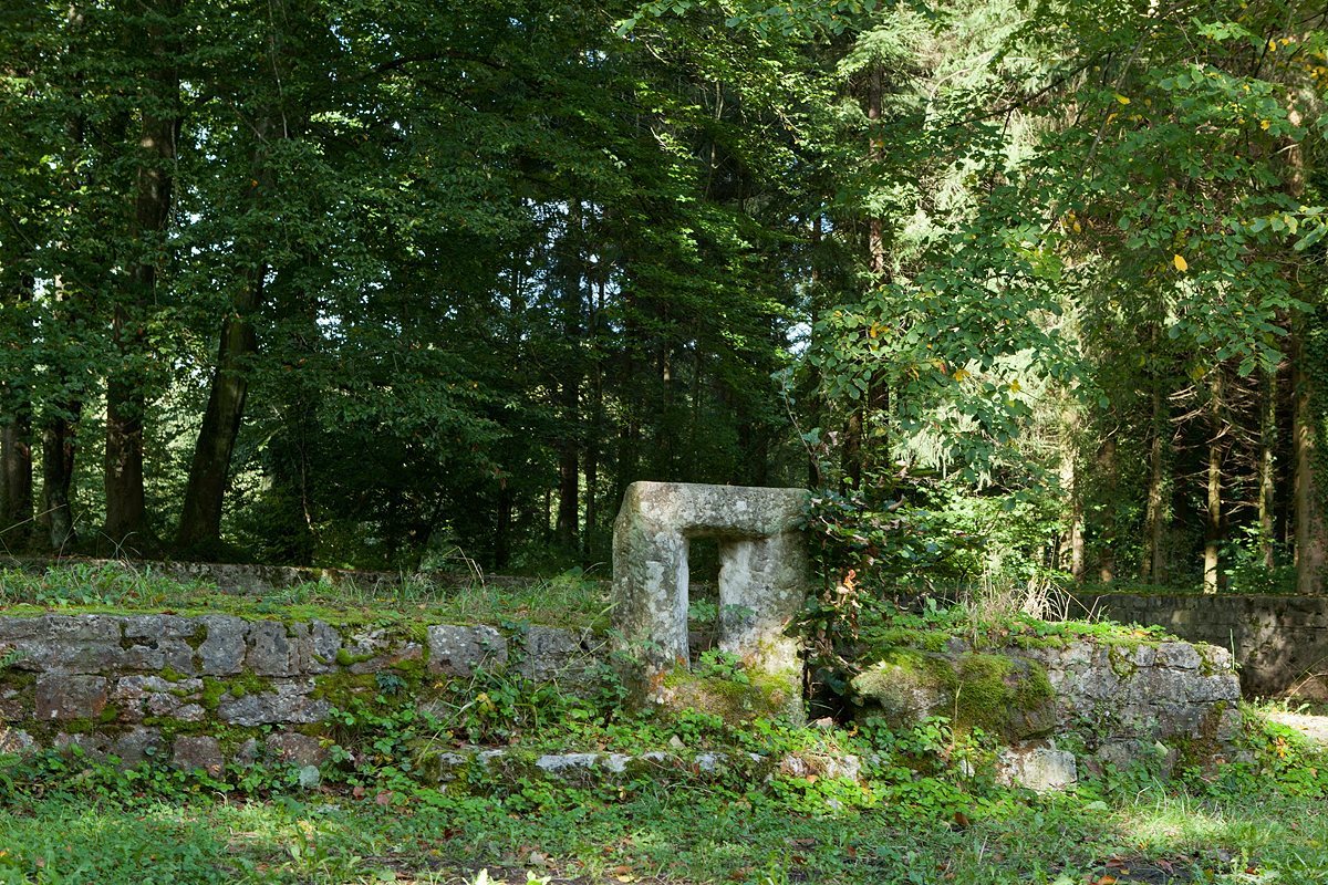
The entrance’s position and width remain uncertain. It was probably in the east wall, facing the Rhine, although evidence has also been noted in the west wall. Traces point to a doorway about 1.2 m wide or possibly wider, perhaps just north of the east wall’s midpoint. Red sandstone pieces were interpreted as threshold stones. A sandstone block with a square recess about 15 by 15 cm probably held a timber post in place; a broken piece of similar form was later incorporated into the entrance paving.
An intact narrow opening for light and ventilation was recovered from debris of the south wall. It was made from grey sandstone. Wedge-shaped spring-tufa blocks may have formed semicircular openings or relieving arches, structures that redirect weight around an opening, above the gate and perhaps above the light openings. A setback in the walls at second-storey level is possible but unconfirmed. The thick walls could have supported a walkway and a crenellated parapet, with alternating raised sections and openings. A curved-backed red sandstone fragment found in the rubble was interpreted as a parapet capstone.
Interior and defensive features
Upper floors and hearths
Four square point foundations, individual bases for upright supports, were sunk as much as 0.70 m into the ground. They carried posts supporting the roof and upper-floor structure. The tower probably had at least two storeys arranged around a roofed inner court or light well. Timber partitions may have divided the rooms. One possible arrangement placed soldiers on the first upper floor and a watch room, with access to the wall-top walkway, on the second. Another possibility is that upper floors included balcony-like galleries.
Four rectangular patches of reddened ground near the north, south, and west walls were interpreted as regularly or intensively used hearths. The hearths by the north and south walls were associated with stone-lined pits about 1 m wide and 0.5 m deep, thought to have collected ash. Excavators also found twelve postholes, 20–40 cm in diameter, some with wedge stones. One, about 45 cm deep, contained a roof-tile fragment that probably helped stabilize a post. The posts may have supported cooking equipment; some could instead have belonged to a partition or building scaffolding.
Roof and ditch
The roof may have been covered with thatch or wooden shingles; roof tiles could also have been taken away for reuse. A defensive ditch was identified in two of four test trenches as deep, trough-shaped cuts into the Rhine gravel, interpreted as a ditch later filled by sediment. Geophysical work looked for defensive walls extending from the tower to the river, which would support an interpretation of the site as a fortified landing place or bridgehead, but the results were inconclusive.
Excavated finds
Pottery and domestic remains
Pottery included Alzey types 27 and 30, categories for classifying Roman vessel forms that are characteristic of the late fourth century. The raised, sickle-shaped profile of one type 27 vessel suggests an early fifth-century date. Soapstone fragments came from vessels with sloping sides and from lids; soot marks show that these objects were used for cooking. Animal bones included cattle, pigs, and smaller animals. Late medieval pottery and iron nails were also recovered.
Coins and fire deposits
Two copper coins found in 2019 beneath gravel spread in 1951 lay in the late Roman walking-surface layer. Both were issued during the reign of Constantius II, emperor from AD 337 to 361: one dates to AD 347–348 and the other to AD 352–354. Excavations in 1950–1951 also uncovered hearth and vessel remains. A layer of fire debris, 0.20–0.40 m thick, covered the late Roman walking surface.
Reused building material
One foundation contained two circular hypocaust pillar plates, components that supported raised floors above channels for circulating hot air, along with fragments of flanged roof tiles. It also held a 0.40 m-long piece of red sandstone architecture. These materials probably came from the Roman estate at Wallbach-Bündten.