Dvin: An Ancient Armenian Royal Capital and Trade City
Site at a Glance
- Popularity
- Very High
- Country
- Armenia
- Primary era
- Medieval
- Eras represented
- Iron Age, Classical, Medieval, Modern
- Civilizations
- Armenian, Sassanid, Urartian
- Site type
- City
On this page32 sections
History
Early settlements and royal foundation
Dvin was an ancient city in Armenia, about 30 kilometres south of Yerevan, whose inhabited hill became an Armenian royal center in the first half of the fourth century. Human activity in the area reaches back nearly five millennia. Early Bronze Age settlement was followed by a fortified settlement in the Late Bronze Age, then an Iron Age fortress and trading post that the Urartians enlarged. A smaller settlement shaped by Greek influence was present by the second century BC.
King Khosrov III Kotak of the Armenian Arsacid dynasty chose the already occupied hill for a new royal center. The move offered an alternative to Artaxata, whose natural defenses had been weakened after the Araxes changed course and left marshes that threatened residents’ health. Dvin was considered safer, healthier, and more centrally placed. Its earlier settlement, fortress remains, and royal hunting grounds provided a foundation for the new capital. Around 335, Dvin became an Arsacid royal residence.
Persian rule and the rise of the church
In 387, Armenia was divided between Rome and the Sasanian Empire, the Persian empire that ruled from the third to the seventh century. Dvin fell within Persian Armenia. When the Armenian Arsacid monarchy ended in 428, the city became the capital of the Sasanian-governed Armenian province. The provincial governor, known as a marzpan, and his administration, including a state archive, were based there.
A Zoroastrian fire temple, a place for worship in which fire had an important ritual role, stood in the citadel during Sasanian rule. In the fifth century, Vardan Mamikonian was associated with restoring Christian worship in Dvin, and a church was later built on the temple site. The Armenian Church’s senior leader, the Catholicos, moved his headquarters to Dvin from Vagharshapat, also called Echmiadzin, during the later fifth century. Ashtishat, an earlier religious center, had been abandoned in favor of Dvin by 484. The transfer strengthened the city’s religious role and encouraged the growth of a larger church and administrative complex.
Dvin hosted several formal assemblies of church leaders, called synods, that shaped Armenian Christianity. The meeting of 505–506 adopted a compromise formula. Synods in 552–553 and 555 rejected the Council of Chalcedon, a 451 gathering that addressed Christ’s divine and human natures, and condemned Nestorian teaching. These decisions helped consolidate a distinct Armenian church position. In 719, another synod condemned the Paulicians, a medieval Christian movement rejected as heretical by established churches.
After the Roman and Persian territories were divided again in 591, Dvin stood near a political and religious frontier. With Byzantine support, a rival Armenian church leadership that accepted the Council of Chalcedon was established at nearby Awan. Dvin remained the seat of the Armenian Catholicos.
Arab administration, trade, and earthquakes
Byzantine forces briefly occupied Dvin in 623 and again in 652–653. Arab forces captured the city in 640, making it the administrative center of Arminiya, an Arab province that included eastern Georgia and Aghvank, the medieval Armenian name for a region in the eastern Caucasus. The assault of 642 was said to have killed 12,000 people and enslaved 35,000. Dvin’s position as the province’s capital diminished when the administrative center moved to Partaw in 789, but it remained a secondary provincial capital and a major trading city.
The Armenian scholar Anania Shirakatsi described six routes leading from Dvin toward different regions. Trade links connected Armenia with places including Iran, Iraq, Assyria, Byzantium, and Georgia. Crafts and commerce supported the city’s prosperity. Artisans worked in glass, metal, jewelry, pottery, glazed ceramics, and textiles; exports included silverwork, wool and silk cloth, carpets, and red Armenian cochineal dye. Taxation under Arab rule and repeated earthquakes affected the economy.
Dvin’s population included Armenians, Persians, Syrians, Greeks, Arabs, and Jews. Armenians remained the majority, and Armenian was widely spoken. Estimates place the population at about 45,000 in 361 and 47,000 in 622, rising to around 100,000 in the eighth and ninth centuries. A proposed estimate for its peak is between 100,000 and 150,000.
The Bagratids, an Armenian royal dynasty, took Dvin in the ninth century under Ashot I. A series of earthquakes struck in 851, 858, 863, 869, and 893. The last caused catastrophic destruction across the city, including the cathedral, palaces, city wall, and much of the residential area. Estimates place the death toll at about 70,000 out of a population of roughly 100,000. Catholicos George subsequently transferred the church headquarters to Zvartnots.
Later rulers and the end of urban life
Dvin recovered as an economic center after the earthquake of 893, even as its political importance declined. Shaddadid rulers, from a Kurdish dynasty, controlled the city from the tenth century. In 961, Ashot III moved the Armenian royal capital to Ani. Byzantine forces took Dvin in 1045, and the Seljuks, a Turkic Muslim dynasty, took the region in 1064. Shaddadid rulers governed the city intermittently afterward.
Georgian rulers briefly held Dvin under George III and Queen Tamar. Tamar used it as a winter residence in 1201–1203, while Armenian princes of the Zakarian house regained control after 1200. Jalal al-Din, ruler of the Khwarazmian Empire, captured the city in 1225. In 1236, Mongol forces led by Chormaqan besieged and destroyed it. Many residents were killed, surviving artisans and young people were enslaved, and the city’s wealth and major buildings were destroyed. Urban life did not return. Small rural settlements later occupied the area, while evidence from the fortress hill indicates a semi-nomadic phase in the mid-thirteenth century.
Excavation and modern intervention
The first scientific description of Dvin’s ruins appeared in 1850, and Nikolai Marr began excavations in 1899. Fieldwork followed under Khachik Dadyan in 1907–1908, S. Ter-Avetisyan in 1936–1939, K. Ghafadaryan from 1946 to 1976, and A. Kalantaryan from 1976. H. Melkonyan’s investigations in 2010–2019 examined defenses, ditches, and agricultural suburbs. An Armenian-Italian expedition led by H. Petrosyan has worked at Dvin since 2019, including in the market and Lower Fortress areas.
Excavations have exposed parts of the central quarter, the Catholicosate complex, citadel occupation layers, workshops, and the market. In 2021, investigators found hearths and ash beneath river-deposited sediment in the Lower Fortress, evidence of activity after the city’s destruction. A 2023 excavation in the museum area uncovered earthquake traces and ninth-century unglazed pottery. Most excavated materials are held at the History Museum of Armenia.
Work to restore and improve the site in 2021–2023 drew criticism for replacing or covering fourth- and fifth-century rough-stone walls with uniform modern-cut stonework. Rebuilding the cathedral foundations also removed traces of changes to the building’s original design, evidence relevant to the development of Armenian church architecture. Two proposed reconstructions remain disputed: the attribution to Tiridates I of a temple supposedly founded in the first century, and the identification of a columned citadel hall as Khosrov III’s Great Throne Hall. Excavated layers place that hall in the fifth or sixth century.
Remains
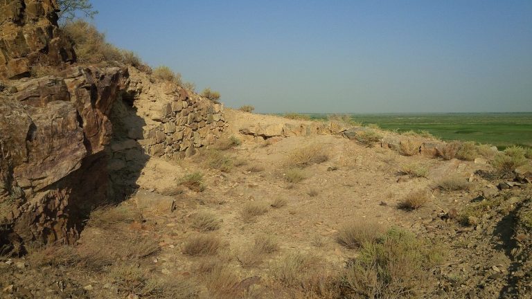
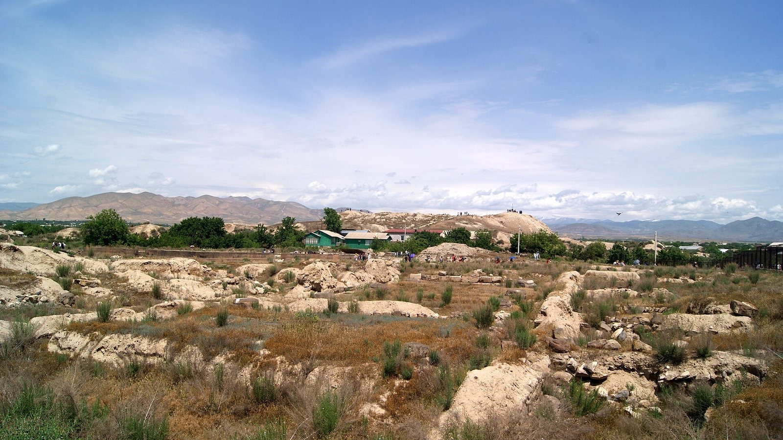
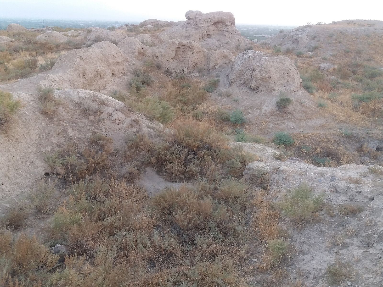
The ruins extend across the territories of Verin Dvin, Hnaberd, Verin Artashat, Norashen, and Aygestan. The medieval city spread around a hill rising about 30 metres above the plain, with its religious and central districts distinct from the fortified citadel. Its surviving and excavated buildings include stone and tuff construction, fired brick, and unfired mud brick, set among residential, defensive, and commercial areas.
Citadel and defenses
Walls, ditch, and gates
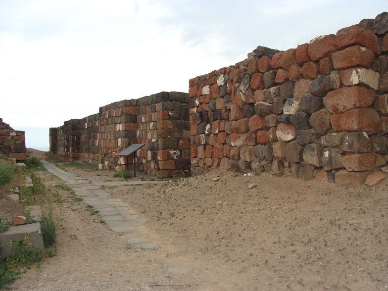
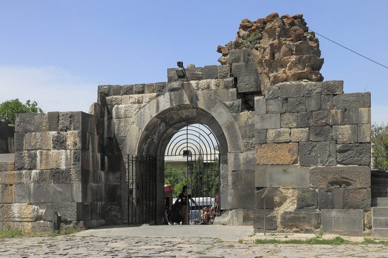
The citadel occupied the hilltop and slopes. Its massive fortifications included walls as much as 16 metres thick and as high as a six- or seven-storey building, arranged in a double defensive system. The medieval city also had double walls, with 44 towers; the citadel ramparts included more than 40 round towers. A ditch around the defenses measured about 30–50 metres across and 5–6 metres deep. An artificial channel brought water from the Azat River to the ditch.
Four gates in the medieval city wall led toward Ani, Tiflis, southern Armenia, and eastern regions. Separate forts defended approaches to Dvin, including one identified as Tiknuni. An artificial defensive woodland known as Khosrov’s Forest was planted near the approaches, and traces of it survive.
Bridges over the ditch
Single-span and two-span arched bridges linked the citadel with the city across the ditch. Remains of two bridges survive.
Royal palace
Palace platforms and rooms
The upper platform of the citadel held the two-storey Arsacid royal palace, later used by provincial governors under Sasanian and Arab administration. Its throne hall covered 272 square metres. Four pairs of columns divided the hall into three aisles running east to west, with a central aisle twice the width of either side aisle. The palace walls used two layers of tuff slabs around a filling of sand, clay, and stone.
Service rooms and a kitchen occupied the ground floor, while the ruler’s living quarters and reception hall were above. A separate bath had areas for men and women. Residences for senior court officials stood on the citadel’s lower platform, beside a large open space used for military exercises and competitions. A later conversion of the palace into a three-aisled church has been proposed, but remains uncertain.
Cathedral and nearby church
First Cathedral of St. Grigor
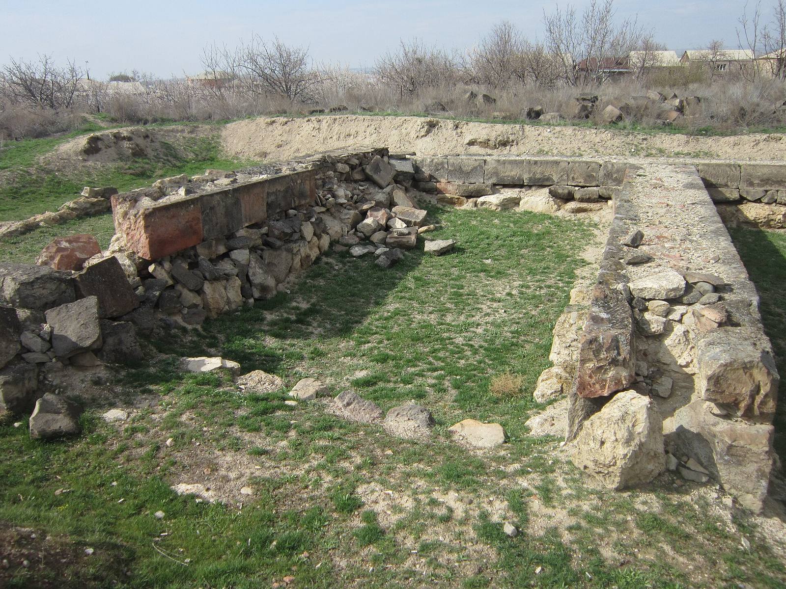
The first Cathedral of St. Grigor was built as a Christian church on the site of the fire temple, probably between about 450 and 485. It was a three-aisled basilica, a long church with a central aisle and two side aisles, measuring about 30.4 by 58.1 metres. It was the largest church in Armenia at the time. Its east end had a projecting apse, a recessed space that contained the altar, and the building stood on a base of three steps. An outer row of columns was added in the late fifth or early sixth century.
Later cathedral
After the first cathedral was destroyed in 572, a second church was built over its foundations and completed in the early seventh century. This domed, cross-shaped church had projecting apses on its sides and measured about 48.3 metres from its interior entrance to the apse. Four central supports carried the dome and its drum, the structure beneath the dome. Parts of the earlier church’s long walls and western wall were incorporated, although the later building was shorter. Its foundations and other excavated remains survive.
Carved capitals on the cathedral columns carried fern-like reliefs, and cornices bore interwoven designs. Floors included geometric patterns made with coloured stone and glass. A seventh-century image of the Virgin and Child in the apse is the oldest known mosaic depiction of the Virgin in Armenia.
Small church north of the cathedral
A small, single-aisled church stood north of the cathedral, above a temple dedicated to an ancient Armenian deity. It measured about 24.5 by 10.7 metres, with walls about two metres thick, and had a barrel vault, a continuous arched roof, divided by three arches. The altar apse was set within its straight eastern wall; entrances opened in the north and west walls. A rectangular room adjoined its north side.
The church may have served as a martyrion, a Christian building associated with a martyr or the martyr’s remains, for the Persian Christian Iazdbuzib after his death in 553. Excavated in 1937 and 1988, its remains are partly covered.
Catholicosate and central quarter
Fifth-century palace
A fifth-century Catholicos palace stood southwest of the cathedral. Its columned hall had four pairs of columns, five smaller rooms along each long side, and a raised platform for a throne at the eastern end. Unfired mud brick formed the walls, and stone columns supported a wooden roof. The palace burned.
Later palace
A second palace, probably built in the seventh century west of the small church, had a central hall measuring 11.4 by 26.7 metres, with smaller rooms along both sides. The hall is reconstructed with three aisles and four columns in each row. Stone capitals and bases supported wooden columns and roofing.
Central quarter buildings
The central quarter included a small church and buildings connected with the Catholicos, among them a chancery, schools, a library, a museum, and a treasury. Their remains are difficult to distinguish from one another.
Market and other large complexes
Columned complex southeast of the citadel
Southeast of the citadel stood a large complex built of tuff, covering about 3,000–3,500 square metres. Four rows contained 36 columns in total. Its purpose remains uncertain.
Central market
The central market is described as having three internal streets and six rows of shops and inns where traveling merchants and their caravans could lodge. Its earlier construction used stone and lime and included rows of columns. After the earthquake of 893, it was rebuilt with square fired bricks. Some walls used the same bricks set in lime mortar.
Excavations in 2021 exposed clay and stone drainage channels with a sanitary function. The northern channel measured 2.20 metres long. The southern channel was 6.45 metres long, 14 centimetres wide, and 6–8 centimetres deep.
Housing and water systems
Water supply
Clay pipes brought drinking water from the surrounding hills to the city’s districts. The water network formed part of the infrastructure serving the residential and central areas.
Houses and wells
Houses had pyramidal openings in their roofs and wells, sometimes positioned in the middle of a room. The wells helped absorb moisture or keep water and food cool. Narrow-necked wells that widened below could also be used as hiding places or dungeons.
Prehistoric remains and craftwork
Prehistoric finds
Prehistoric remains include a burial ground with fragments of stone statues and sculptures. Upright tuff figures about a metre long, shaped as phallic idols and associated with fertility, were also found; their precise role in burial practices is uncertain. A Late Bronze Age cult vessel depicts mountains, a starry sky, solar symbols, hunting animals, mounted hunters, and a figure interpreted as a forest spirit or hunting deity. A cave southeast of the city yielded pottery, flint tools, and organic remains. Imported pottery shaped by Greek influence and locally made ceramics have also been found at Dvin.
Stone decoration and memorial columns
Sculpted decoration appeared on house entrances, portals, and prominent wall surfaces. Fifth- to seventh-century memorial columns served as funerary monuments. Their capitals carried images of the Virgin, saints, harvest scenes, and hunting scenes. Two capitals attributed to these columns show reliefs of the Virgin.
Metalworking and jewelry
Ironworking remains include slag from a smelting furnace. Iron products included arrowheads, spears, javelins, daggers, and swords, as well as chains, adzes, axes, scissors, and pipes for baths. Copperworkers made pots, pitchers, bowls, lamps, and decorative nails, often incised with patterns and fitted with animal-shaped feet or handles. Jewelry finds include chain necklaces, snake-headed bracelets, crosses worn on the chest, silver belts, rings, earrings, bracelets, and beads.
Ceramics and faience
Pottery ranged from unglazed household vessels to glazed dishes. Large storage jars, found in house cellars and palace storerooms, could hold up to 1,000 litres. Some had red outer surfaces, ornamental bands, and short Armenian inscriptions. Unglazed pottery and rejected kiln pieces came from workshops and the central district. Glazed plates, bowls, and cups from the ninth to thirteenth centuries used green, yellow, and brown finishes, sometimes with sgraffito, a design scratched through a surface layer to expose another beneath it.
Fine faience, a glazed ceramic made from a silica-rich body, was also produced between the ninth and thirteenth centuries. It used quartz paste and an opaque tin glaze, with lustre or cobalt decoration.
Glass and other excavated objects
Glass workshops made flasks, bottles, bowls, cups, plates, jewelry, laboratory tubes, and flat window glass. Artisans used coloured glass, engraving, and applied ornament. One excavated glass vessel depicts a seated musician playing a bowed string instrument.
Other finds include coins bearing the image of the Sasanian king Bahram V, and coins issued by Abbasid, Samanid, and other eastern dynasties. A two-metre cross was also found at Dvin. Building and household materials included local sandstone, tuff, quartzite, marble, river pebbles, flint, and millstone. Quartzite served for hand-operated grain grinders, millstones, and projectiles; hard stone used to engrave seal gems was also exported. Bone objects included flutes, backgammon pieces, and furniture handles.