Makimuku Ruins: An Archaeological Complex of the Yayoi and Kofun Periods
Site at a Glance
- Rating
- 3.8
- Popularity
- Very Low
- Country
- Japan
- Primary era
- Classical
- External website
- Open
- Eras represented
- Classical, Medieval
- Civilizations
- Yayoi
- Site type
- City
On this page22 sections
History
The Makimuku ruins are an archaeological complex in Sakurai, Nara Prefecture, Japan, created by communities of the late Yayoi and early Kofun periods. The site emerged in the late second or early third century, with one chronology placing its initial phase around AD 180 to 210, and continued through the first half of the fourth century. Its planned waterways, ritual facilities, monumental tombs, and large buildings have led some researchers to regard it as an early political center connected with the formation of the Yamato kingship, the early centralized authority associated with the Nara Basin.
Formation and changing names
Makimuku developed at the northwest foot of Mount Miwa on an alluvial fan formed by the Makimukugawa River. The settlement appears to have arisen rapidly during the late second or early third century and to have ended just as abruptly in the middle of the fourth century. The name Makimuku was assigned by archaeologist Hironobu Ishino after the former Makimuku Village. That village name reflected traditions linking the area with the palaces of Emperor Suinin and Emperor Keiko.
Minoru Doi brought the area to academic attention in 1937, calling it the Ota Site. Before the name Makimuku became established, the area was also known as the Ota Site and Katsuyama Site and was treated as a group of relatively small sites. Archaeological investigations began in 1971, ahead of plans for prefectural housing and a primary school. The discovery of a canal-like feature extending for more than 200 meters prompted a broader understanding of the area. Researchers proposed that it might represent the ancient Makimukugawa River mentioned in the Man’yoshu.
Excavation and interpretation
The Archaeological Institute of Kashihara initially led the investigations. After the fifteenth investigation in 1977, responsibility passed to the Sakurai City Board of Education. By 2011, 170 investigations had taken place, although only about 5 percent of the site had been excavated by December 2008. Evidence from the 2009 investigations included several buildings and suggested that at least part of Makimuku was an artificially planned center enclosed by fences, ditches, or fortifications.
More than 100 postholes discovered in 2013 belonged to a building thought to date from the third century. Repeated construction and demolition have been proposed for this structure. Although Makimuku is conventionally described as a large settlement, relatively few remains have been securely identified as ordinary residential occupation. Many scholars therefore interpret it as a place where people and goods gathered repeatedly for political, ritual, and ceremonial activities, including ceremonies associated with Mount Miwa and the surrounding tombs.
A large third-century pit containing approximately 2,000 peach stones provides particularly strong evidence for ritual activity. Peach fruit was used as an offering in ancient rituals, and the concentration at Makimuku was the largest excavated at one location in Japan. Fish remains include red sea bream, horse mackerel, mackerel, and carp. More than a thousand animal bones, including wild boar, deer, and duck, also indicate the range of activities carried out at the site, although these finds alone do not establish its precise function.
Political theories and later use
Makimuku is regarded by some researchers as the birthplace of the standardized keyhole-shaped burial mound and as a possible early center of the Yamato kingship. A keyhole-shaped mound has a rounded rear section joined to a projecting rectangular or trapezoidal front section, a form that became a major elite burial monument during the Kofun period. Other interpretations identify Makimuku with Yamataikoku, the polity described in the third-century Chinese Records of Wei, and connect it with Himiko, that polity’s female ruler. The proposed identification remains unproven.
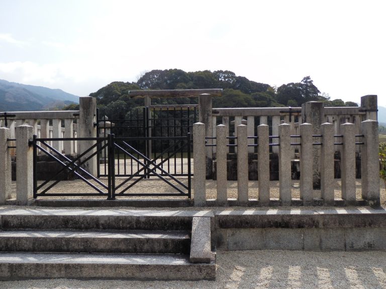
Hashihaka Kofun, within or immediately beside the site, is traditionally associated with Himiko in some interpretations. Earlier Makimuku-type mounds, including Makimuku Ishizuka and Katsuyama, are considered by some scholars to represent an early stage in the development of the later standardized tomb form. The political interpretation draws on the concentration of planned waterways, ritual facilities, monumental tombs, imported pottery, and buildings thought possibly to have had royal or palace-related functions. Pottery from eastern, western, northern, and southern parts of the Japanese archipelago shows extensive regional interaction. At the same time, the small quantity of Kyushu or Korean pottery and the limited number of continental-style iron objects indicate that direct exchange with the continent was comparatively limited.
Makimuku continued to be used after the Kofun period. A market called Oichi developed in the area during the Asuka and Nara periods. Wells, pits, former river channels, and a vessel bearing the inscription “Oichi” belong to remains dating from the Nara through early Heian periods. The ruins were designated a National Historic Site of Japan in 2013. Excavated objects, including an arc-band stone, an arc-pattern board, a wooden mask, a wooden sickle handle, and a wooden shield, are held by the Sakurai Municipal Archaeological Heritage Center. These objects became municipal cultural properties in 2000 or 2016.
Remains
The ruins occupy approximately 3 square kilometers on the Makimukugawa River’s alluvial fan, at elevations of roughly 60 to 90 meters. The mapped area extends about 2 kilometers from east to west and 1.5 kilometers from north to south, across Ota, Tsuji, Higashida, Makinochi, Anashi, Hashinaka, and neighboring districts. The ground rises toward the east and descends toward the west. The Karasudagawa River broadly bounds the site to the north, the Gomiharagawa River to the south, the Yamanobe road to the east, and the Higashida area to the west.
Waterways and settlement organization
Six settlement and tomb groups were connected by a single water system. More than 40 prehistoric storage pits and linear waterways occur around the settlement margins, and the bottoms of some pits reached the spring-water layer. Two large straight waterways, the North Ditch and South Ditch, were each approximately 5 meters wide and 1 meter deep. Their banks were strengthened with driven wooden sheet piles made from timber including cypress and cedar. The waterways appear to have supported transport and water distribution before joining downstream in the Higashida area.
South Ditch
The South Ditch ran northwest from the Makimukugawa River near the projecting end of Hashihaka Kofun toward the present Makimuku Elementary School. Its water source was the outer moat of Hashihaka Kofun. The course continued past the area behind Kunizu Shrine before reaching the Makimukugawa River.
North Ditch
The North Ditch extended southwest from the former Anashigawa River in the northeast, drawing water from the former Makimukugawa River. Water-collection basins, weirs, and other installations directed water through the system. One of these installations may have drained a palace-like complex.
Storage pits and water installations
Approximately 150 irregular circular pits, each about 3 meters across and 1.5 meters deep, were found in the water-system area. Each had one projecting side. Their deposits formed three principal layers and contained pottery, wooden objects, agricultural implements, weaving tools, winnowing baskets, burnt wood, and large quantities of rice husks. Some of the rice husks may have been connected with agricultural rituals.
Buildings and enclosed areas
The settlement contains post-built structures, pit dwellings, collapsed houses, and associated buildings. A post-built building from the first half of the early Kofun period measured two by three bays and covered approximately 23 square meters. Other remains include a one-by-one-bay small building, a two-by-two-bay post-built structure, and 17 additional post-built buildings in the Ota Meguri area. A post-built building is supported by upright wooden posts set into the ground rather than by continuous foundation walls, while a pit dwelling is partly sunk into the ground and is identified by a floor depression and postholes.
Tsuji-Torii-mae building
In the Tsuji-Torii-mae area, a roughly north to south two-by-three-bay post-built building stood beside an east to west fence line. Its position formed part of an area where buildings and boundary features were arranged together.
Ota Minami-Tobizuka house
A collapsed house was found in the Ota Minami-Tobizuka area. The remains provide evidence for a building that had fallen or been dismantled within the settlement’s changing architectural landscape.
Makinochi Ietsura buildings
The Makinochi Ietsura area contained a one-by-one-bay small house and a two-by-two-bay building with closely spaced supporting posts.
Higashida Kakinoki and Ota Tobizuka dwellings
Pit-dwelling remains were found in the Higashida Kakinoki and Ota Tobizuka areas. These structures form part of the settlement evidence alongside the larger post-built buildings and associated enclosures.
Ditches, embankments, and fences
A V-shaped partition ditch was associated with arc-pattern boards, an earthen embankment, and rows of fences. Fences also surrounded sections of the settlement. Together, the ditches, embankments, and fences have been interpreted as evidence for planned urban construction or fortification, although the complete arrangement remains uncertain because only a small part of Makimuku has been excavated.
Ritual, elite, and industrial areas
Anashi Doyodo ritual area
The Anashi Doyodo district contains a ritual area traditionally identified with Emperor Keiko’s Makimuku Hishiro Palace. Finds include a jasper magatama, a stone bracelet, tubular beads, small glass beads, and pottery from the latter half of the fourth century. Several large buildings have been suspected of representing a palace or elite residence, but that interpretation is not certain.
Metalworking area
A small ironworking or smithing area contained a Tsukushi-type tuyere, one bellows tuyere, 24 pieces of iron slag, and four stones interpreted as whetstones or their raw material. A tuyere is a heat-resistant nozzle that directs air into a furnace or forge. Activity in this area probably began in the late third century and continued until about the middle of the sixth century.
Burial mounds and funerary remains
Makimuku Kofun Cluster
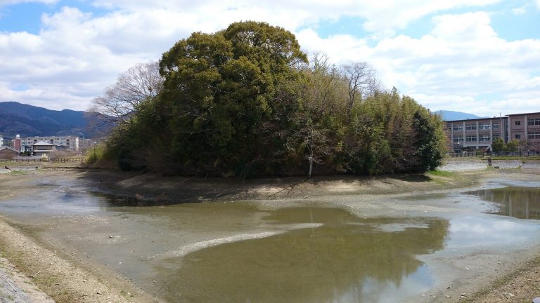
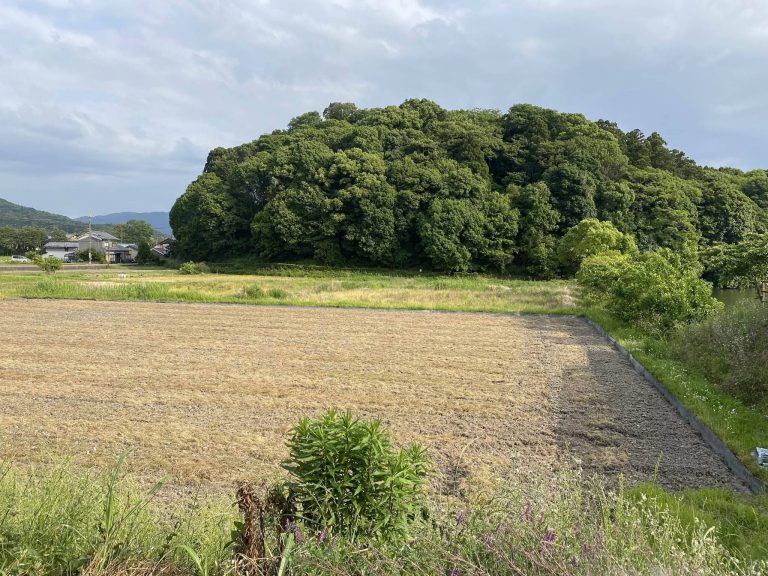
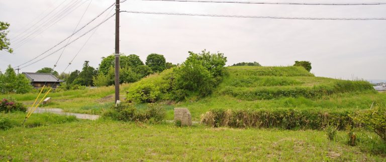
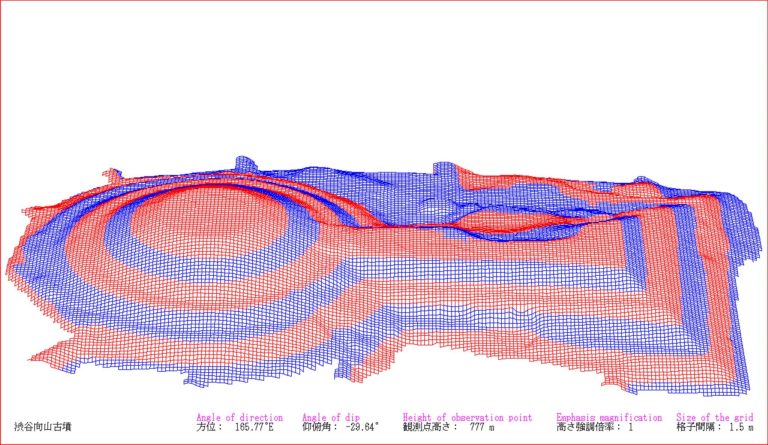
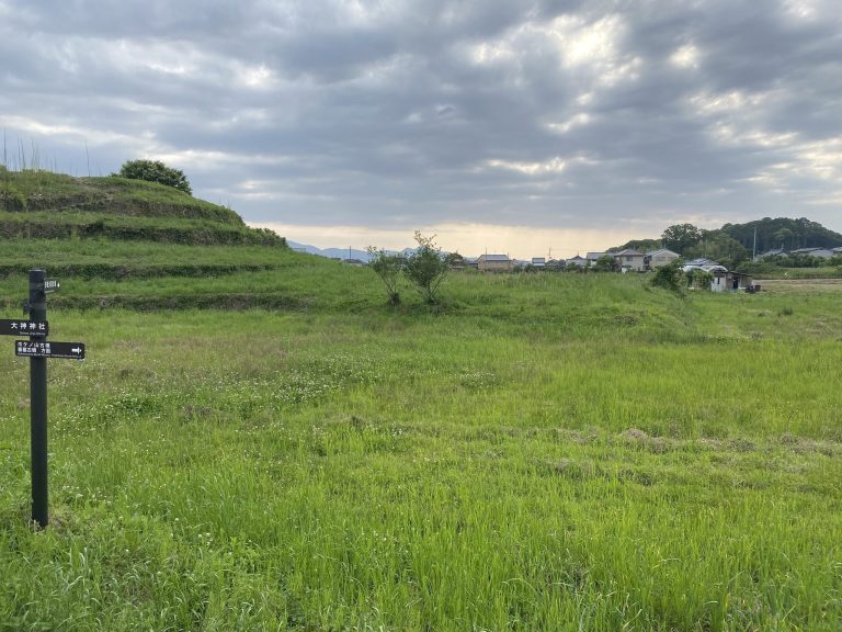
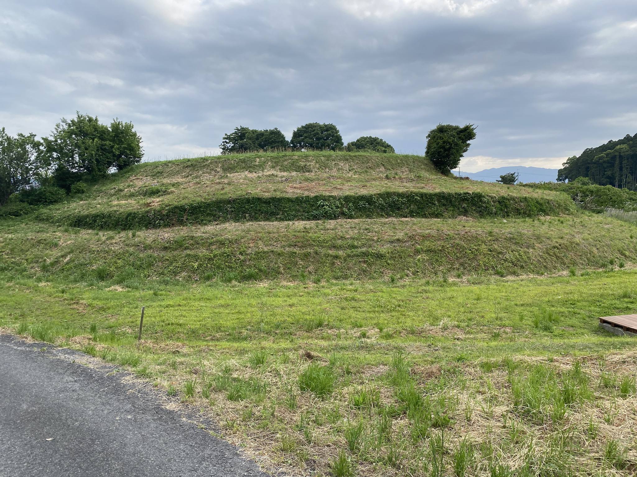
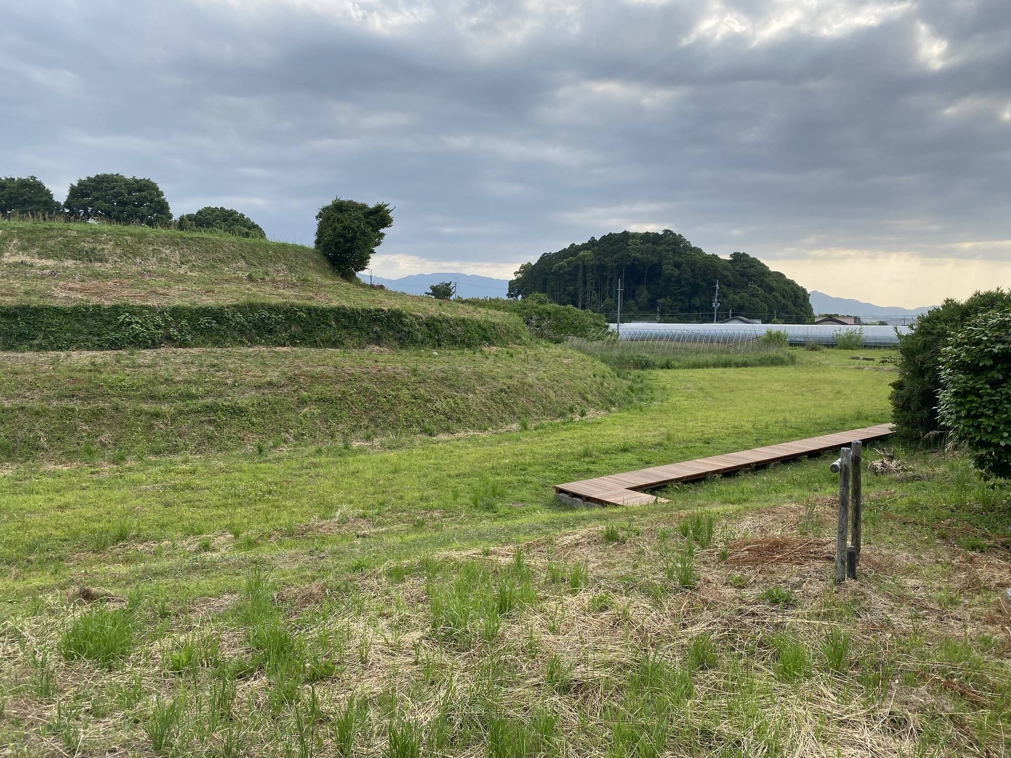
The Makimuku Kofun Cluster includes Hashihaka Kofun, an approximately 280-meter-long keyhole-shaped mound. Earlier Makimuku-type mounds, including Makimuku Ishizuka and Katsuyama, are about 90 meters long. Katsuyama Kofun has a scallop-shaped plan that is regarded as transitional toward the later standardized keyhole form.
Makimuku Ishizuka finds
The moat of Makimuku Ishizuka Kofun produced three unpainted wooden posts, a peeled wooden pole about 3 meters long, a vermilion-painted chicken-shaped wooden object, and an arc-pattern circular board used in funerary rites. Excavators also found a round mat about 30 centimeters across, made from rolled and bound hinoki bark, together with a spade associated with mound construction.
Pottery, wooden objects, and ritual materials
Pottery from the terminal Yayoi through early Kofun periods forms the basis of the Makimuku chronological sequence. Makimuku 1 corresponds to Yayoi pottery Style V, Makimuku 2 through 4 to Shonai-style pottery, and Makimuku 5 to Furu I-style pottery. Some radiocarbon dates are more than a century older than the associated archaeological chronology.
The excavated objects include a vermilion-painted chicken-shaped wooden object, circular wooden boards bearing patterns of straight and curved lines, a silk drawstring bag, a miniature boat, wooden arrowheads, Iwami-type shield-shaped wooden objects, and large quantities of pottery brought from other regions. Clay analysis identified a unique tile-like earthenware as having been made with techniques associated with the Korean Peninsula.
Material from Ise, Owari, Suruga, Omi, Hokuriku, Sanin, Kibi, and other regions of Japan occurs across the site. Regionally distinctive or imported pottery formed as much as 25 to 30 percent of assemblages in some locations and about 30 percent of pottery in certain ritual contexts. Two special vessel stands associated with Kibi were found at Makimuku. Other discoveries include pottery fragments, bronze-bell fragments, ritual ceramics, and funerary or ritual objects.
Fragments of molded clay figures include two morning-glory-shaped pieces, a chicken-shaped piece, and a crown-shaped piece. These objects may have been used in rituals before being incorporated into tomb contexts. The site has yielded very little pottery from Kyushu or Korea and no conclusive combination of continental-style objects, such as bronze mirrors, swords, jade beads, and substantial iron weaponry, has established Makimuku as Yamataikoku. The limited excavation means that the relationships among residential, administrative, ritual, industrial, and funerary areas remain uncertain.