Asaina Pass: A Medieval Road Cut-through in Japan


Site at a Glance
- Rating
- 4.4
- Popularity
- Low
- Country
- Japan
- Primary era
- Medieval
- External website
- Open
- Eras represented
- Medieval, Early Modern
- Civilizations
- Kamakura shogunate, Tokugawa
- Site type
- Infrastructure
- Remains
- Road
On this page7 sections
History
Asaina Pass in Japan preserves the Asaina Cut-through, a medieval road built during the Kamakura period through the hills between Kamakura and present-day Yokohama. It formed part of the Mutsura Road, which connected Kamakura with Mutsura Port and routes toward Tokyo Bay and the Boso Peninsula.
The Kamakura-period road
The Asaina Cut-through was one of the Kamakura Seven Entrances, the principal road cuttings through the hills around medieval Kamakura. These routes connected the city with neighboring regions and helped control movement through its natural defenses. The Azuma Kagami, a chronicle of the Kamakura shogunate, records that Hojo Yasutoki, a shikken or regent who exercised effective authority on behalf of the shogun, discussed improvements to the Mutsura Road in November 1240.
Work began in April 1241, when Yasutoki assigned sections of the project to military commanders. Repairs followed in June 1250. The road provided an important land connection between Kamakura and Mutsura Port, whose maritime links extended around Tokyo Bay to the Boso Peninsula and other areas. A local tradition says that construction proceeded slowly enough for Yasutoki to visit the work and help carry earth and stones with his horse.
It remains uncertain whether an earlier route followed the same alignment. One interpretation considers the cut-through a bypass for roads that climbed from the ravine called Seven Turns, near the Twelve Places Fruit Orchard, over the ridge and past Kumano Shrine. The ridge route also belonged to an older network of local roads and followed a former boundary between Musashi and Sagami.
Traditions and later alterations
The name appears in historical records in variant forms, including Asahina Cut-through. Tradition links it with Asahina Saburo Yoshihide, the renownedly powerful third son of Wada Yoshimori, who was said to have cut through the mountain in a single night. Place-names near Mutsura, including Wada and Wada Valley, have also been interpreted as possible traces of Wada clan influence. These areas may have served as bases for controlling Mutsura.
Kumano Shrine stands along the route and is traditionally said to have been established to guard Kamakura’s northeast direction. The Kumano tradition connects the shrine with the religious network and pilgrimage practices associated with the sacred Kumano region of Japan.
Successive improvements altered the road, including substantial work during the Edo period. A roadside memorial connected with road construction, together with the positions of medieval rock-cut tombs, indicates that the present surface was lowered during these modifications. The cut-through stopped serving as a main road after Prefectural Route 204 opened to its north in 1956. That newer route is now called Asahina Pass, while the historic cut-through became a pedestrian route. Heavy rain and typhoon damage caused a landslide in the Yokohama section in September 2019, temporarily closing the passage.
Protection and archaeological extent
Asaina Cut-through became a National Historic Site on June 5, 1969. The protected area was expanded in 2003 to include a charnel-house ruin near the western entrance, and again in 2007 and 2008 to cover qualifying archaeological areas in Kamakura and Yokohama. The expanded archaeological zone extends across an east-west area about 1.4 kilometers long and a north-south area about 100 to 150 meters wide. The Kamakura portion became a component cultural property of Japan Heritage in 2016.
Remains
The Asaina Cut-through links Jujusho in Kamakura with Asahina Town in Yokohama’s Kanazawa Ward, an area formerly within Kamakura District. It was excavated directly through the surrounding rocky hills, producing a route about 4 meters wide and cut sections more than 10 meters deep. Drainage channels approximately 30 centimeters wide run along both sides, and the alignment is notably straight.
The principal cuttings and western approach
Near the summit, around the present Kamakura-Yokohama boundary, the main excavation is known as the Great Cut-through. Farther toward Kanazawa, the route is called the Small Cut-through. On the Kamakura side, the exposed ground consists of tuffaceous mudstone, or silt, and sandstone. During rain, parts of the road carry flowing water.
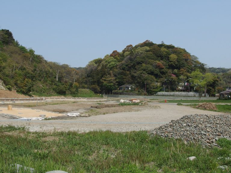
The western entrance lies near a waterfall formed by the Seven Turns stream. From this ravine, the route climbs toward the ridge and passes Kumano Shrine before continuing toward the Kanazawa side. The surrounding archaeological area includes cut slopes, levelled ground, and numerous groups of rock-cut tombs. In the Kamakura region, a yagura is a chamber or recess cut into rock, particularly for medieval funerary or memorial use.
Connected routes and boundary features
A route north of the cut-through descends near a Jizo landmark known variously as Boundary Jizo, Hanatate Jizo, or Nose-Missing Jizo. Jizo is a Buddhist bodhisattva associated with protection, travelers, and the dead, and such landmarks commonly mark roads, boundaries, or passes. The route continues along the eastern boundary of present-day Asahina Town on a road also called Shirayama Road, joins a road from Kamariya, and follows a ridge near the Sobu Tunnel.
Other ridge routes from the cut-through continue toward Numama and Urago. Ravines and place-names in the surrounding landscape preserve associations with former local roads. Near the western entrance, the remains of a charnel house form part of the protected archaeological area added in 2003.