Karlino Castle of the Kamień Bishops: An Episcopal Residence in Poland


Site at a Glance
- Rating
- 3.6
- Popularity
- Very Low
- Country
- Poland
- Primary era
- Medieval
- Eras represented
- Medieval, Modern
- Civilizations
- Holy Roman Empire
- Site type
- Military
- Remains
- Castle
On this page8 sections
History
Karlino Castle of the Kamień Bishops in Poland was a medieval fortified residence developed by the Bishops of Kamień, with construction of a fortified castle undertaken in 1370. Its Gothic remains and later Renaissance transformation reflect Karlino’s rise as an episcopal centre at the fork of the Parsęta and Radew rivers.
Episcopal possession and the fortified castle
The area around Karlino belonged to the Bishops of Kamień from about 1280, reportedly as an inheritance from Warcisław III, a medieval Duke of Pomerania. In 1308, Bishop Henry von Wacholz referred to a castle there as castrum nostrum Corlin, meaning “our castle at Corlin.” Bishop Filip von Rehberg later emphasized the site’s advantageous position in the Church Statutes of 1330, noting its location at the junction of the two rivers.
In 1370, the episcopal seat moved from Kamień to Karlino, and work began on a fortified castle. Karlino received Lübeck law, a medieval urban legal system used by many towns around the Baltic, in 1385 and became an episcopal residence. From the 1380s, most of the Bishops of Kamień lived there, giving the castle an administrative and residential role within the bishopric.
Burning, rebuilding, and Renaissance expansion
Karlino was burned in 1409, but the castle was partly protected by the water surrounding the complex and by its effective defenses. In 1481, burghers from Kołobrzeg and Koszalin burned both the town and the castle. Reconstruction began after compensation had been paid, and expansion continued until 1575.
Successive bishops reshaped the stronghold into a Renaissance residence. Renaissance architecture developed from classical forms and favoured more regular planning. Bishop Francis I enlarged and embellished the castle between 1602 and 1618, completing its transformation from a fortified seat into a more elaborate episcopal residence.
Destruction and later building
During the Seven Years’ War, a major European conflict fought from 1756 to 1763, the castle complex fell into ruin and was burned in 1761. The ruins were dismantled down to ground level, the moat separating the castle from the town was filled, and the former ancillary buildings were destroyed.
A royal brewery was later built over the castle cellars. Nineteenth-century construction further obscured traces of the formerly rich episcopal residence, while building activity associated with the site is dated to the 1830s. The castle ruins were entered on 19 March 1960 in the register of protected monuments under designation A-428.
Remains
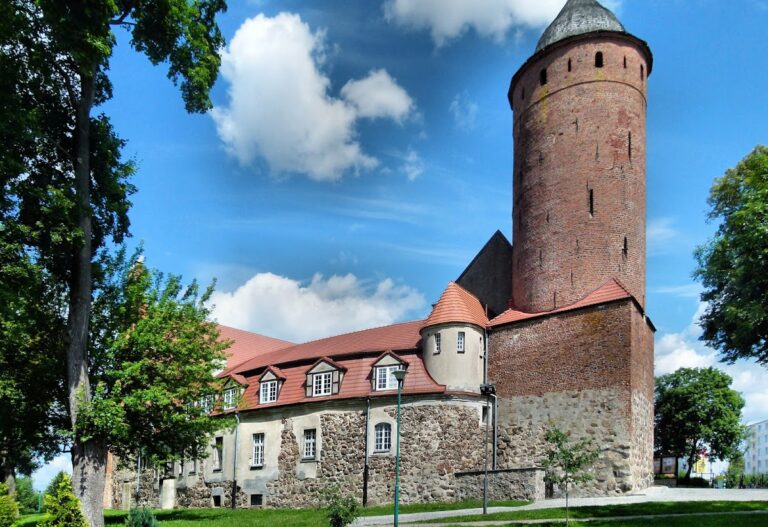
The surviving remains occupy the site of a castle built at the fork of the Parsęta and Radew rivers, where surrounding water contributed to the complex’s defense. The earlier castle had a quadrilateral plan measuring approximately 11 by 35 metres and was enclosed by surrounding walls. The date of its earliest surviving fabric is uncertain: the ground-level section is described as Gothic, a medieval architectural tradition associated with pointed arches and ribbed vaults, and dated to the late twelfth century, while the documented decision to build a fortified castle belongs to 1370.
Surviving Gothic rooms
Four rooms survive at ground level. Two retain star-ribbed vaults, whose ribs form a star-like geometric pattern, and the partition walls preserve door openings. A passage between the large rooms has a decorated surround and a double-sided Gothic fireplace. Traces of window openings and two portals remain in the northeastern elevation. These elements form part of the lowest surviving storey of the main wing.
Renaissance castle complex
The castle was probably reorganized during the Renaissance as a regular three-wing complex with three storeys. The side wings were crowned by gables, the triangular upper ends of walls beneath pitched roofs. The presumed dimensions of the main complex were approximately 50 by 50 metres, while the outer ward, the area adjoining the principal buildings and defenses, measured approximately 50 by 100 metres. The castle’s appearance in this period is shown on a map by Eilert Lübbens, a cartographer who depicted the building and its surrounding area.
Later survival
After the destruction of the eighteenth century, only the lowest storey of the main wing remained, including the rooms with star-ribbed vaults. This surviving fabric was incorporated into later construction, including the brewery built over the castle cellars. The later buildings therefore preserve parts of the medieval castle within the altered remains of the former episcopal complex.
Nearby sites