Yasuda Castle: A Late Sengoku Flatland Castle in Toyama, Japan


Site at a Glance
- Rating
- 3.6
- Popularity
- Low
- Country
- Japan
- Primary era
- Early Modern
- External website
- Open
- Eras represented
- Early Modern
- Civilizations
- Toyotomi regime
- Site type
- Military
- Remains
- Castle
On this page8 sections
History
Yasuda Castle is a late Sengoku-period flatland castle in Toyama, Japan, traditionally associated with Maeda Toshiie and dated to 1585. The Sengoku period was an era of prolonged political and military conflict that lasted from the fifteenth to the late sixteenth century. The castle stood in former Etchu Province, a strategically contested area, and served first as a field headquarters and later as a Maeda frontier base.
The 1585 Toyama campaign
The castle first appears in historical records in 1585, during Toyotomi Hideyoshi’s campaign against Sassa Narimasa at Toyama Castle. Hideyoshi was the military ruler who unified much of Japan in the late sixteenth century. Yasuda functioned as a branch castle of Shiratori Castle, alongside another branch castle, and was expanded to support Hideyoshi’s forces. Okajima Kazuyoshi, a retainer of Maeda Toshiie, became its castellan.
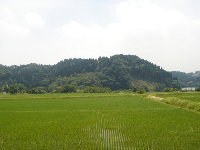
Narimasa surrendered Toyama after approximately one week, so Yasuda Castle was not used in battle. Eastern Etchu, including Niikawa District, remained under Narimasa after the surrender, however, and Yasuda continued as a Maeda frontier base. The surrounding area had long been contested by the Jinbo and Uesugi clans and by the Ikkō-ikki, militant leagues associated with the Jodo Shinshu Buddhist tradition that challenged warrior and political authorities. Shiratori Castle, about five kilometres north of Yasuda, formed part of Toyama’s outer defenses while the region was controlled by Narimasa.
Changing administration and abandonment
In 1587, after Narimasa was transferred elsewhere, Niikawa became territory directly administered by Hideyoshi. It later passed to the Uesugi clan and eventually became Maeda territory after a redistribution of lands involving the Gamo clan. These changes brought Yasuda’s original frontier role to an end.
In 1597, after Maeda Toshinaga moved his residence from Moriyama Castle to Toyama Castle, Okajima Kazuyoshi and another Maeda official first entered Shiratori Castle as its branch-castle commanders and then moved to Yasuda. Following Maeda Toshiie’s death in 1599, Toshinaga returned to Kanazawa, and Okajima followed him. An appointed magistrate, an administrative official responsible for overseeing a territory, occupied Yasuda for a time. The castle was later abandoned during the Keicho period.
Archaeology and preservation
Yasuda Castle was used for only a short period and underwent little later alteration. The Yasuda Old Castle Plan, produced around 1813 and preserved in the Kanazawa City Library, shows that much of the castle’s form remained visible in the late Edo period. In modern times, the moats were filled and the land was converted to rice fields, obscuring the remains. A field-reorganization plan in the late 1960s threatened the site, but excavations in 1977 and 1978 confirmed the layout shown on the old map.
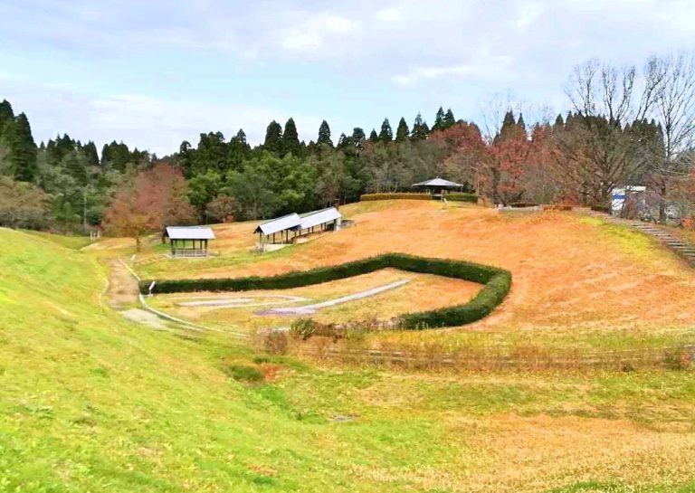
Yasuda Castle Ruins became a National Historic Site on February 23, 1981. Restoration and site-improvement works during the 1990s reconstructed the moats and earthworks. The restored site opened in 1993 as Yasuda Castle Ruins History Plaza and was later renamed Toyama City Fuchu Yasuda Castle Ruins History Plaza after municipal amalgamation. An associated museum displays excavated items.
Remains
Layout and setting
Yasuda Castle occupied approximately 34,000 square metres, extending about 150 metres from east to west and 240 metres from north to south. It was a flatland castle, meaning a castle built on relatively level ground, formed from linked fortified enclosures. The castle stood on the western bank of the Ida River in the Kureha Hills area, which divides the Toyama and Takaoka regions of former Etchu Province. Water from the river formed moats around the castle. The surviving remains principally comprise reconstructed earthworks and moats.
The inner bailey
The enclosure conventionally called the inner bailey measured about 90 metres east to west and 80 metres north to south, creating an almost square area. Its four sides were enclosed by broad clay ramparts with basal widths of approximately 14 metres and heights of about two metres. A tower may have occupied the northeastern corner. The inner bailey is interpreted as the commander’s residence because its compact size and protected position suited that function. It was connected to the secondary bailey, which is interpreted as a storage area for military supplies. Part of the northeastern corner was lost when a levee was built along the Ida River, while most of the other remains retain their historical form.
The secondary and right enclosures
The secondary bailey and the enclosure conventionally called the right enclosure appear to have been built before the inner bailey, based on the misalignment of their axes. Their original historical names are unknown. The castle faced west toward its anticipated enemy, and the right enclosure provided additional protection on that side. Together, the three enclosures form the linked arrangement characteristic of Yasuda’s flatland castle plan.