Wari-Bateshwar Ruins: An Ancient Urban Settlement in Bangladesh
Site at a Glance
- Popularity
- High
- Country
- Bangladesh
- Primary era
- Classical
- Eras represented
- Bronze Age, Iron Age, Classical, Medieval
- Civilizations
- Unclassified
- Site type
- City
On this page18 sections
History
The Wari-Bateshwar ruins are the remains of an ancient urban settlement spread across Wari and Bateshwar in Bangladesh. Its earliest urban occupation dates to about 1100 BCE, while its principal urban phase is placed broadly between 400 and 100 BCE. Its nearly millennium-long occupation makes it an important record of early urban life in the region.
Urban growth and exchange
A pottery sample recovered at Wari in 2000 was radiocarbon-dated to about 450 BCE, within the period of the settlement’s main activity. Wari-Bateshwar has been interpreted as a planned market and center of external trade, connected by river routes to Southeast Asia and the Roman world. Archaeologist Sufi Mostafizur Rahman proposed identifying it with Sounagora, a trading center named by the Greek geographer Ptolemy in his Geographia, a work on geography. Archaeologist Dilip Kumar Chakrabarti suggested that the settlement served as a river entry port or depot for collecting and distributing goods from Southeast Asia and the Roman Empire. Rahman supported this interpretation. The proposed identification with Sounagora remains uncertain.
River change and abandonment
Before the settlement developed, around 2500 BCE, the Brahmaputra’s main channel shifted toward the Brahmaputra-Jamuna branch. Peatlands formed in the area after this change. Around 200 BCE, the river’s main channel moved back toward the Old Brahmaputra. Sediments dating to about that time interrupt deposits associated with the site’s bead culture, suggesting that inhabitants were displaced. Flooding may have contributed to the urban center’s abandonment around 100 BCE. The 1762 Arakan earthquake later shifted the main channel again, toward the Brahmaputra-Jamuna branch.
Local discoveries and archaeological work
Residents knew of finds in the area before formal excavations began. In the 1930s, schoolteacher Hanif Pathan collected artifacts and publicized discoveries in newspapers; his son, Habibullah Pathan, continued this work through collecting and publications. In December 1933, laborers uncovered a pot of coins at Wari, and Hanif collected about 20 to 30 of them. In 1955, two heavy, pointed triangular iron objects found at Bateshwar prompted him to publish an article on prehistoric civilization in East Pakistan.
In March 1956, farmer Jaru Mia uncovered a hoard of at least 4,000 punch-marked silver coins. He sold them to a silversmith, who melted them down. Habibullah donated coins, stone beads, axes, and spears to the Dhaka Museum in 1974-1975. Hanif established a family museum and library at his home in 1974, later overseen by his son. Excavations led by Rahman began in 2000 and continued intermittently over the next two decades. Bangladesh’s Department of Archaeology also worked in the area, including an excavation in 2017.
Remains
The site occupies a river-formed terrace of the Pleistocene, the geological epoch before the present one, about 15 m above sea level and 6-8 m above the current river level. It lies on elevated, flood-prone reddish ground along the southern side of the dry Koyra riverbed, about 17 km northwest of the Old Brahmaputra-Meghna confluence. The soil consists chiefly of brownish-red clay layered with sand, locally known as Madhupur clay. The excavated layout includes a fortified square, an outer earthen defense, roads, domestic remains, and religious buildings.
Fortifications and settlement layout
Central fortified enclosure
The central enclosure is square, about 600 m on each side, and was surrounded by a moat roughly 30 m wide. The eastern stretch of the moat remains visible as a feature of the enclosure.
Outer earthen defense
A second defensive line extends west and southwest of the central fort. This earthen bank, locally called Asam Raja’s Fort, is about 5.8 km long, 5 m wide, and 2-5 m high. Its course runs from Sonarutala through Bateshwar, Haniabaid, Razarbagh, and Amlab to the edge of the Arial Khan River. The paired lines of defense have been interpreted as evidence for an important commercial or administrative center.
Suburban remains and roads
Forty-eight archaeological sites have been identified around the central enclosure. Suburban remains include brick-built residences and a 160 m-long road paved with lime and finely ground brick mixed with pottery fragments. A separate road excavated at Wari in 2004 measures 18 m long, 6 m wide, and 30 cm thick. It was built from brick fragments, lime, sherds of Northern Black Polished Ware, a fine polished pottery found in northern South Asia, and small iron-rich pieces of laterite. Rahman attributed this road to about 2,500 years ago.
Domestic and religious structures
Pit-dwelling complex
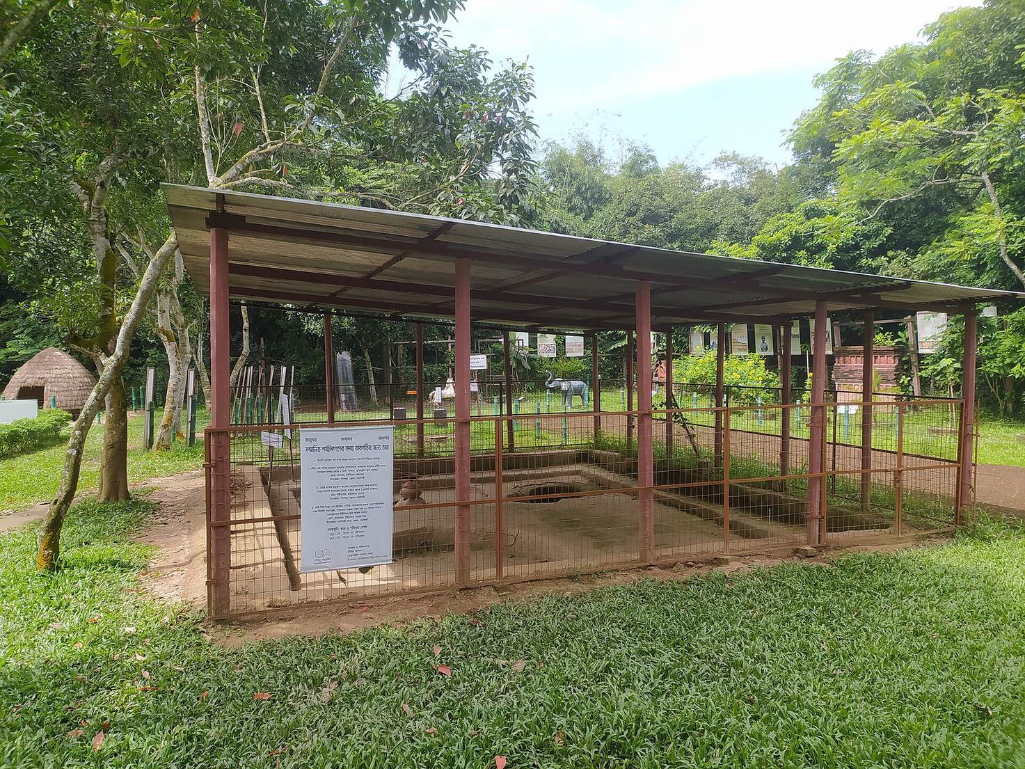
A complex found east of the urban center in 2004 measures 2.60 by 2.20 by 0.52 m. It includes a pit, hearth, stepped reservoir, and granary measuring 272 cm around and 74 cm deep. The floor is red earth coated with grey clay, while the granary floor is made of lime and finely ground brick. The complex has been compared with Chalcolithic, or Copper Age, pit dwellings excavated at Inamgaon in South India and dated to 1500-1000 BCE. That comparison does not establish a date for the Wari-Bateshwar complex.
Lotus Temple at Mandir Bhita
A brick-built Buddhist temple at Mandir Bhita in Shibpur Upazila was uncovered in March 2010 during the ninth excavation phase. It is described as nearly 1,400 years old and measures 10.6 m square. Its walls are 80 cm thick, and the foundation base is 1 m wide. The foundations of its clay-masonry walls were laid in three tiers.
On the north, south, and west sides, parallel walls 70 cm thick stand 70 cm from the main wall. A 70 cm-wide circumambulatory path, a walkway for ritual movement around a religious structure, encircles the main wall; another parallel wall, 60 cm thick, lies outside it. On the east, the space between the main and outer walls is 3.5 m wide, and an additional ritual path and veranda occupy that side. Two construction phases have been identified. Part of the earlier brick-paved floor is exposed, while the later phase includes a brick-paved altar in the southeast corner. Excavators also found a mostly intact, eight-petaled lotus that gives the temple its Lotus Temple name.
Stupas at Sonarutala
Two votive stupas, mound-shaped monuments made as religious offerings, were found at Sonarutala, one of stone and the other of terracotta. Their construction and firing techniques suggest use during the Chalcolithic period.
Artifacts and evidence of activity
Coins and exchange
Finds include punch-marked coins, metal pieces bearing symbols struck by separate punches. One group, the regional Janapada series, dates to 600-400 BCE; a Janapada was an early territorial community or polity. These coins are thought to have circulated locally in the Vanga region and differ from those associated with Anga, another ancient eastern region. A second group belongs to the Mauryan imperial series, associated with the empire ruled by the Mauryan dynasty, and dates to 500-200 BCE.
Coin designs include solar and six-armed marks, a mountain with three arches and a crescent, animals, and geometric forms. Regional coins carry four symbols on one side and either a blank field or a smaller mark on the other. Their motifs include a boat, lobster, fish on a hook or scorpion, and cross-shaped leaf. Nandipada, an ancient taurine symbol, also appears among the coin designs.
Beads, pottery, and metalwork
Stone beads are made from rock crystal, citrine, amethyst, agate, carnelian, chalcedony, and green or red jasper. Glass finds include colorful beads and sandwich-glass beads, probably used from the fourth century BCE to the first century CE. Other objects include copper bangles and a dagger, handled vessels made of bronze with a high tin content, dome-shaped vessels of high-tin bronze and pottery, and terracotta plaques. Pottery types include black-and-red ware, polished black wares, Northern Black Polished Ware, Rouletted Ware with its impressed decoration, and knobbed ware.
Cultivation and textile production
Carbonized seeds and seed fragments indicate that rice was the principal crop, with japonica more common than indica rice. The crop range also included barley, oats, small quantities of summer millets, summer and winter pulses, cotton, sesame, and mustard. The abundance of cotton-seed fragments points to the importance of textile production in the local economy.
Tools and symbolic objects
Four stone artifacts may date to the prehistoric Stone Age. Other stone tools are tentatively placed around the middle of the second millennium BCE. The dates of the numerous iron axes and spearheads remain uncertain, although chemical analysis has suggested 700-400 BCE. Iron knives have also been found. Nandipada and swastika marks appear on stone querns, tools used to grind grain; these motifs have been interpreted as evidence of Hindu religious presence.
Other objects collected from the area include a bronze galloping horse, a Shiva offering bowl, fragments of a relic casket, stone weights and seals, ring stones, and bronze figures of Garuda, a mythological bird associated with Vishnu. Finds also include representations of the Triratna, the Buddhist Three Jewels of the Buddha, the teachings, and the monastic community, alongside depictions of animals, plants, crescents, stars, and the sun. Terracotta amulets and kinnaras, semi-divine beings often shown as celestial musicians, form part of this varied collection.