Vorgium: Gallo-Roman Capital of the Osismii in France


Site at a Glance
- Rating
- 4.4
- Popularity
- Low
- Country
- France
- Primary era
- Classical
- External website
- Open
- Eras represented
- Classical
- Civilizations
- Roman
- Site type
- Museum
On this page13 sections
History
Vorgium was a Gallo-Roman city in France, at present-day Carhaix-Plouguer, whose earliest evidence of occupation dates to the fourth century BC. Established by the Roman administration during the Gallo-Roman period, its foundation date remains unknown. The city became the capital of the Osismii, a Gallic people whose territory covered western Armorica, broadly corresponding to parts of modern Brittany.
Osismian capital and Roman foundation
Vorgium is mentioned as Vorganium in Ptolemy’s second-century Geography, a work that preserves ancient place names and geographical information. It also appears in the Peutinger Table, a medieval copy of an ancient Roman road map. The settlement was created from the ground up on a plateau suited to urban development and positioned near the center of Osismian territory.
The identification of Vorgium with Carhaix was proposed by Robert Mowat in 1874, following the discovery of a milestone at Maël-Carhaix. Louis Pape later confirmed the identification, and Jean-Yves Éveillard supported it by noting that the distance between Darioritum and Carhaix corresponds to the 44 Roman leagues given in the Peutinger Table.
Urban growth and regional connections
During the first half of the third century AD, Vorgium reached an area of approximately 130 hectares. It was the largest city on the Breton peninsula, although it remained a medium-sized settlement by wider Gallic standards, where some cities exceeded 200 hectares. The city served as the center of a radial network of at least eight ancient roads, combining Gallic and Roman routes.
One major route linked Tours and Angers with Aber-Wrac’h through Rieux, Castennec, and Carhaix. Other roads connected Vorgium with Darioritum, later known as Vannes. Excavations in the hospital area show that Roman architectural models were brought to the settlement and adapted for a relatively small urban center. Its civic and religious life included a forum, baths, temples, and a district occupied by artisans.
The forum’s proposed location at the intersection of the present-day Rue Brizeux and Rue G.-Lambert is based on Louis Pape’s interpretation of those streets as the cardo and decumanus, the principal north-south and east-west streets of a Roman city. This interpretation remains a hypothesis. Two aqueducts also demonstrate the scale of the city’s public infrastructure.
Late Roman changes and archaeological rediscovery
Two coin hoards found within the urban area date from the late third century. Their burial reflects the practice of hoarding money during the economic crisis of that period. The water-supply system was abandoned during the fourth century, while urban occupation continued in other forms. A large fourth-century domus, or Roman town house, stood at the site of the present hospital before being abandoned during the third quarter of the fourth century.
During the fourth and fifth centuries, the city was known as Othysmus or Civitas Osismorum. A civitas was a Roman territorial and administrative unit commonly organized around an urban capital. The changing names reflect Vorgium’s continuing place within the late Roman organization of Osismian territory.
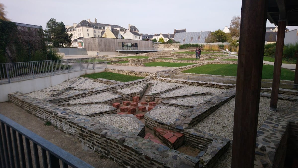
Archaeological excavations began in the eighteenth century and became systematic from 1995 onward. Their results established the extent of urban development more clearly and drew the attention of the antiquarian Théophile Malo Corret de la Tour d’Auvergne. In 2000, an archaeological reserve was designated on Rue du Docteur-Menguy, at the former Le Manac’h wine establishments, to protect ruins discovered southwest of the town center. The land later became property of the Finistère departmental council.
Two explanations have been proposed for the name Vorgium. One connects it with the Gaulish root verg, often associated with a fortified construction. The other derives it from the Gaulish word worra, meaning willow. The willow interpretation has been favored in connection with the character of the remains identified at the site.
Remains
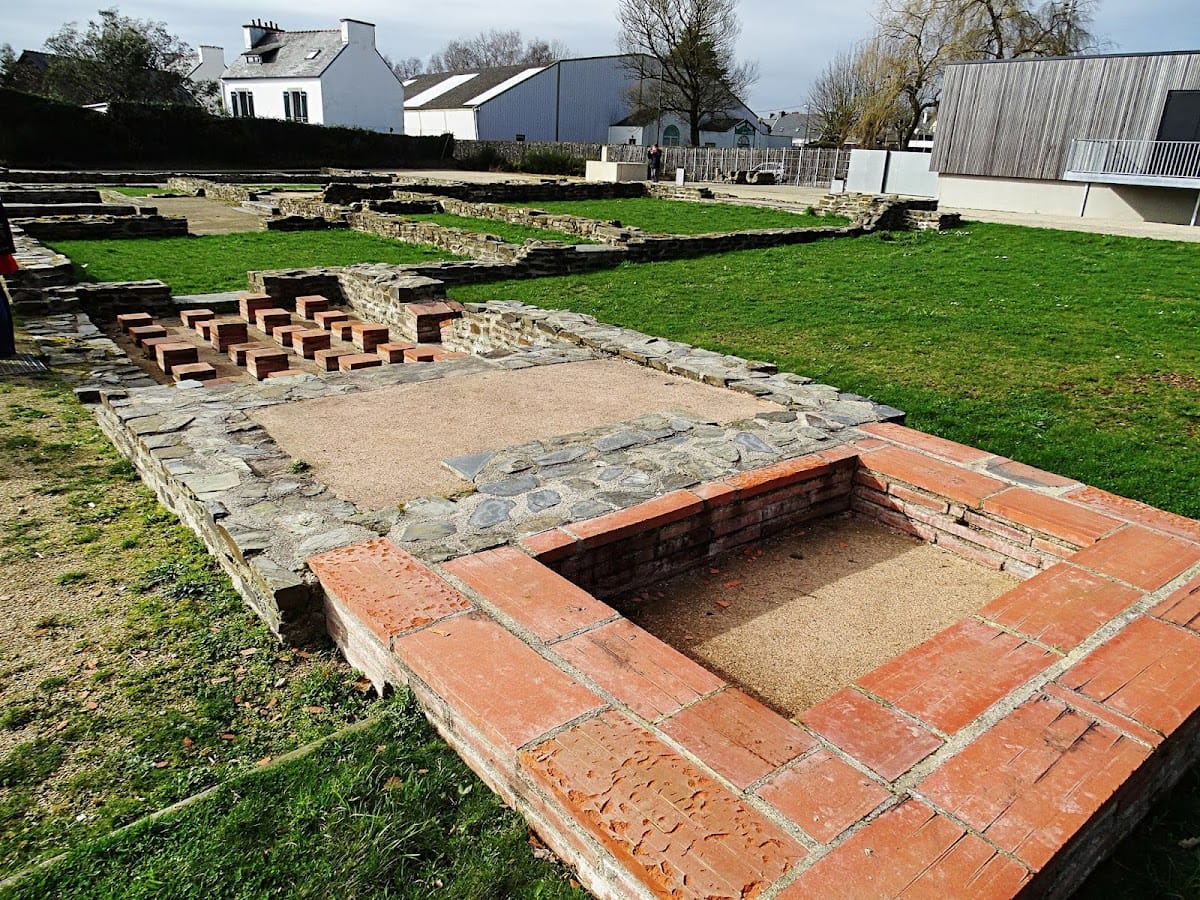
Vorgium occupied a plateau and extended across approximately 130 hectares at its maximum size. Its layout was organized around roads radiating from the settlement, while public buildings, religious structures, artisan areas, houses, and water infrastructure formed the physical components of the urban center. Surviving remains include parts of two aqueduct systems, a small temple, a monumental staircase, a large town house, coins, and a decorated vase.
Aqueducts and water supply
First aqueduct
The first aqueduct was built during the second half of the first century AD to bring water from a stream about 11 kilometres away. It followed a regular gradient around irregularities in the ground and crossed an aqueduct bridge near Vorgium. The bridge was approximately one kilometre long and 14 metres high, carrying the water to a water tower at the highest part of the settlement. Parts of the system used wooden conduits joined with iron plates, while other sections were built in masonry.
Second aqueduct
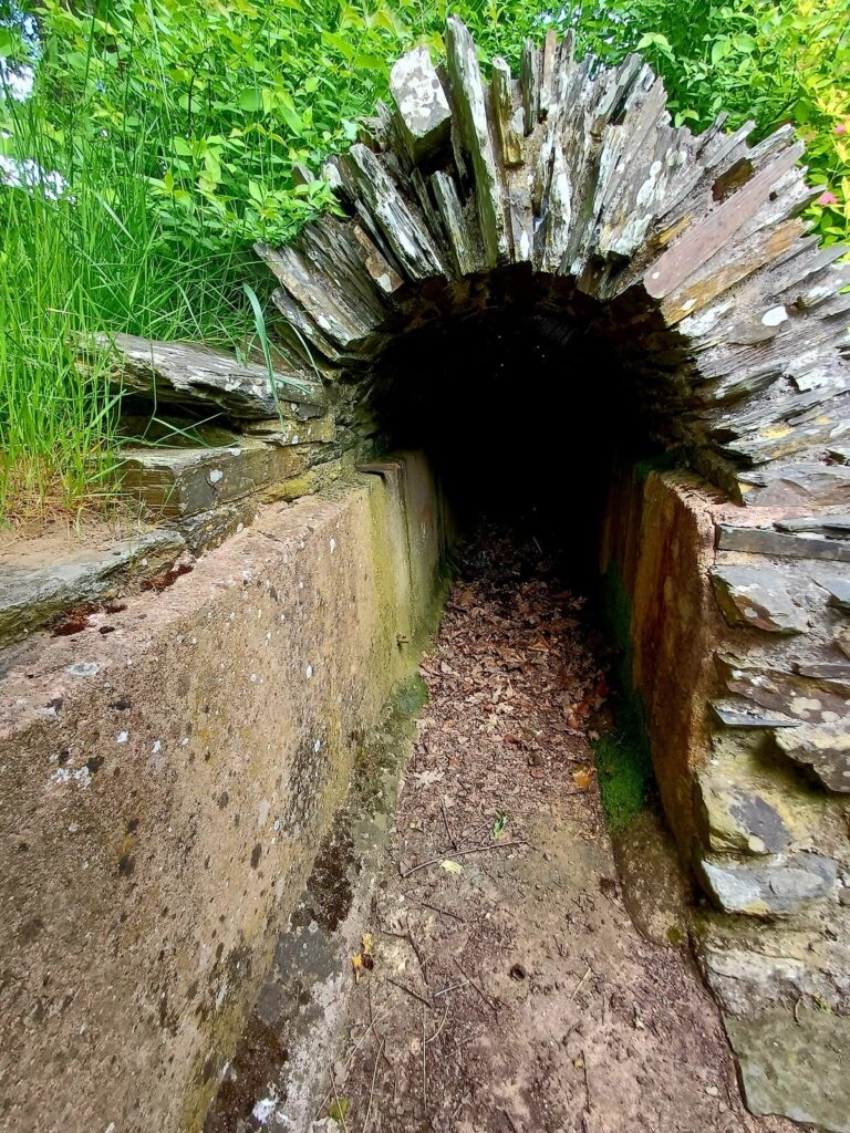
A second aqueduct was constructed in the late second century along a sinuous route of about 27 kilometres from the areas of present-day Paule and Glomel. Its average gradient was 0.27 metres per kilometre. Near Kervoaguel in Le Moustoir, the channel passed through a tunnel roughly 900 metres long, cut through schist at a depth of about 25 metres beneath a hill. Shafts set between 20 and 44 metres apart allowed excavated material to be removed during construction.
The second aqueduct used a masonry channel coated with pink hydraulic mortar containing crushed tile fragments to improve watertightness. Schist slabs and a thin covering of earth generally protected the channel while allowing maintenance access. Near Kerampest, an aqueduct bridge of similar length to the tunnel reached approximately 13 metres in height. Elements of both water systems survive and help define the infrastructure that supplied Vorgium.
Public, religious, and residential buildings
Kerdaniel temple
A fanum was discovered at Kerdaniel. This type of small Gallo-Roman temple combined indigenous religious traditions with Roman architectural forms, placing the structure within the religious landscape of the settlement.
Monumental staircase
A monumental staircase uncovered at the Champ de Foire in 2004 may have belonged to Roman baths. Its association with the baths remains uncertain, but the scale of the staircase indicates a substantial architectural feature within the urban remains.
Hospital-area domus
A large fourth-century domus was found beneath the site of the present hospital. The building represents the domestic architecture of the later settlement and was abandoned during the third quarter of the fourth century.
Objects and archaeological finds
A Gallo-Roman vase found at Carhaix is decorated with a warrior, Bacchus, and vine foliage. Bacchus was the Roman god associated with wine, viticulture, and ecstatic celebration. The vessel dates from approximately AD 180 to 250 and provides evidence of the imagery and material culture present in Vorgium during the Roman period.
The two late-third-century coin hoards found within the urban area belong to the period of monetary hoarding associated with the economic crisis of that time. Together with the surviving aqueduct elements and architectural remains, they contribute to the understanding of Vorgium’s changing urban life from its Roman expansion into late antiquity.