Urquhart Castle: A Medieval Fortress on Loch Ness
Site at a Glance
- Rating
- 4.5
- Popularity
- Very High
- Country
- United Kingdom
- Primary era
- Medieval
- External website
- Open
- Eras represented
- Medieval, Early Modern
- Civilizations
- Kingdom of Scotland
- Site type
- Military
- Remains
- Castle
On this page17 sections
History
Urquhart Castle is a ruined medieval castle in Scotland, United Kingdom, at Drumnadrochit on the shore of Loch Ness. It developed from an early medieval fortification and became a major stronghold during Scotland’s conflicts with England and the rival struggles of the Scottish Highlands. The surviving castle belongs chiefly to the medieval and early modern periods, while excavations have revealed occupation on the site between the fifth and eleventh centuries.
Early medieval origins
Urquhart occupies a rocky promontory that held an extensive fort between the fifth and eleventh centuries. Vitrified stone, produced when intense heat fused parts of a stone structure, and radiocarbon-supported excavations indicate the presence of this early fortification. The name derives from the seventh-century form Airdchartdan, combining Old Irish for a point or promontory with Old Welsh for a thicket or wood.
Adomnán’s Life of Columba, written by the abbot of Iona about Saint Columba, describes Columba’s visit between 562 and 586 to Emchath, a Pictish nobleman, his son Virolec, and their household at a place called Airdchartdan. Saint Columba was an influential Christian missionary associated with the foundation of Iona. Archaeological interpretation has identified Urquhart more plausibly with Emchath’s residence than with the fortress of Bridei, king of the northern Picts, whose base was more likely at Inverness or Craig Phadrig.
The Durward and Comyn castle
A royal castle associated with William the Lion has sometimes been placed at Urquhart in the twelfth century, but excavations found no evidence for that attribution. After the final Meic Uilleim rebellion was suppressed in 1229, Alexander II granted Urquhart to his hostarius, a royal official responsible for guarding or overseeing an entrance, named Thomas de Lundin. The estate passed to Thomas’s son Alan Durward, and the first stone castle was probably built soon afterward around the raised earthwork at the southwest corner. In 1275 Alexander III granted Urquhart to John II Comyn, Lord of Badenoch.
Wars with England and royal control
Urquhart first appears in surviving records in 1296, when Edward I of England captured it during his invasion of Scotland. This invasion began the Wars of Scottish Independence, a series of conflicts between the two kingdoms that continued intermittently until 1357. Edward appointed Sir William Fitz Warin as constable, but Andrew de Moray ambushed him in 1297 and then failed to take the castle in a night assault. The Scots recovered Urquhart by 1298, although an English attack succeeded in 1303. Edward then appointed Alexander Comyn governor.
Robert Bruce seized the castle in 1307 during his campaign through the Great Glen. It subsequently became a royal castle administered by successive constables. Robert Lauder of Quarrelwood held that office in 1329 and returned to defend Urquhart after the Scottish defeat at Halidon Hill in 1333. At that time it was one of only five castles in Scotland still held by the Scots. David II spent the summer hunting at Urquhart in 1342, making him the only Scottish king recorded as having stayed there.
The Lords of the Isles and the Grants
For the next two centuries, the MacDonald Lords of the Isles repeatedly raided the Great Glen while pursuing a claim to the earldom of Ross. Domhnall of Islay seized Urquhart in 1395 and held it for more than fifteen years. The crown later recovered the castle, but Alexander, Earl of Ross, raided Glen Urquhart in 1437, prompting royal money for stronger defenses. His son John captured the castle again in 1452 and received it and its lands for life. After John allied with Edward IV of England against James III in 1462, James removed his titles in 1476 and transferred Urquhart to his ally George Gordon, Earl of Huntly.
Huntly brought Duncan Grant of Freuchie to restore order in the district. Duncan’s son John received a five-year lease of Glen Urquhart in 1502, and James IV granted him the castle, Glen Urquhart, and Glenmoriston in perpetuity in 1509, on condition that he repair and rebuild the stronghold. Donald MacDonald of Lochalsh occupied Urquhart in 1513, during the disorder that followed the Scottish defeat at Flodden. The Grants recovered it before 1517, but MacDonald’s forces had carried away 300 cattle, 1,000 sheep, and the castle’s provisions. John Grant’s attempt to secure compensation failed.
Sixteenth- and seventeenth-century conflict
James Grant of Freuchie succeeded his father and joined Huntly and Clan Fraser in their feud with the Macdonalds of Clanranald. In 1545, MacDonald forces and their Cameron allies captured Urquhart in retaliation. During this Great Raid they took 2,000 cattle and hundreds of other animals and stripped the castle of furniture, cannon, and gates. Grant later recovered the castle and received Cameron lands as compensation.
Hector Boece described the walls as ruinous in 1527, but the Grants rebuilt the castle by the end of the sixteenth century. Repairs and alterations continued until 1623, although Urquhart had ceased to be a favored residence. In 1644, Covenanter forces entered the castle, robbed Lady Mary Grant, and expelled her because she supported Episcopalian church government. An inventory from 1647 found the castle virtually empty. During Oliver Cromwell’s invasion of Scotland in 1650, Urquhart was disregarded while forts were constructed at both ends of the Great Glen.
Destruction and preservation
After the Revolution of 1688, Ludovic Grant of Freuchie supported William of Orange and placed 200 soldiers in Urquhart. Though short of weapons, the garrison resisted 500 Jacobites, supporters of the exiled James VII of Scotland and II of England, until the main Jacobite force was defeated at Cromdale in May 1690. When the soldiers withdrew, they blew up the gatehouse to prevent its reoccupation. Parliament awarded Grant £2,000 in compensation, but the castle was not rebuilt. Local removal of stone and other materials caused further damage.
The Grant Tower partly collapsed during a storm in 1715. By the 1770s the castle had lost its roofs and had become a romantic ruin for painters and visitors to the Highlands. Urquhart passed to Caroline, Dowager Countess of Seafield, in 1884. Her will placed the castle in state care after her death in 1911, and responsibility transferred to the Commissioners of His Majesty’s Works and Public Buildings in October 1913. Historic Environment Scotland, successor to the Office of Works and Historic Scotland, now maintains the site. Urquhart is a scheduled monument, a nationally significant historic or archaeological site protected under Scottish law, and remains in state care.
Remains
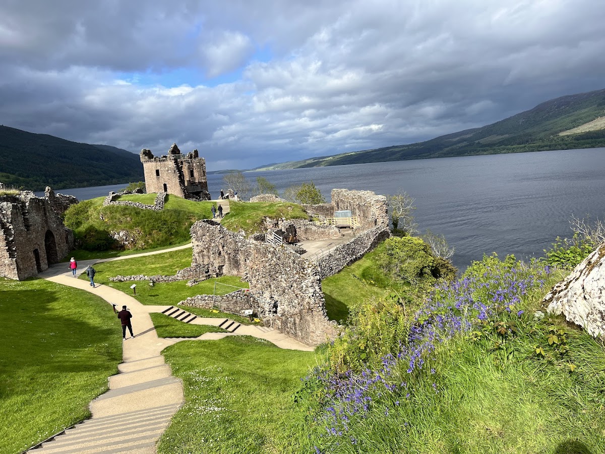
Urquhart Castle stands on Strone Point, a triangular promontory on the northwestern shore of Loch Ness. The site lies close to water level, with low cliffs along its northeastern side. Its position overlooks the route along this side of the Great Glen and the entrance to Glen Urquhart. The walled castle follows the shoreline in an elongated figure-eight plan, approximately 150 metres long and 46 metres wide. The northern Nether Bailey occupies the lower ground, while the Upper Bailey rises on the rocky mound at the southwest end.
Outer defenses and enclosures
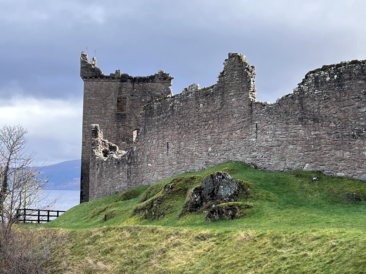
The landward approach is protected by a dry moat up to about 30 metres wide, probably excavated in the early Middle Ages. A stone causeway crosses it, with a former drawbridge at the center. On the castle side, walls enclosed the causeway in a protected entrance area resembling a barbican, an outer defensive space before a gate. The curtain walls, meaning the enclosing defensive walls between strongpoints, are mainly fourteenth-century, although later additions substantially enlarged and strengthened them.
The inland ground outside the walls provided a large area for mustering troops and probably held service buildings. Gardens and orchards occupied this area in the seventeenth century. The ground rises sharply toward the northwest, where the later visitor centre and the A82 now stand.
Nether Bailey
Gatehouse
The sixteenth-century gatehouse stands on the inland side of the Nether Bailey. Twin D-shaped towers flank its arched entrance passage. The approach originally included a portcullis, two sets of doors, and guard rooms on either side, while rooms above the passage may have housed the castle keeper. After the garrison withdrew in 1690, the gatehouse was deliberately destroyed, leaving collapsed masonry around the entrance.
Grant Tower
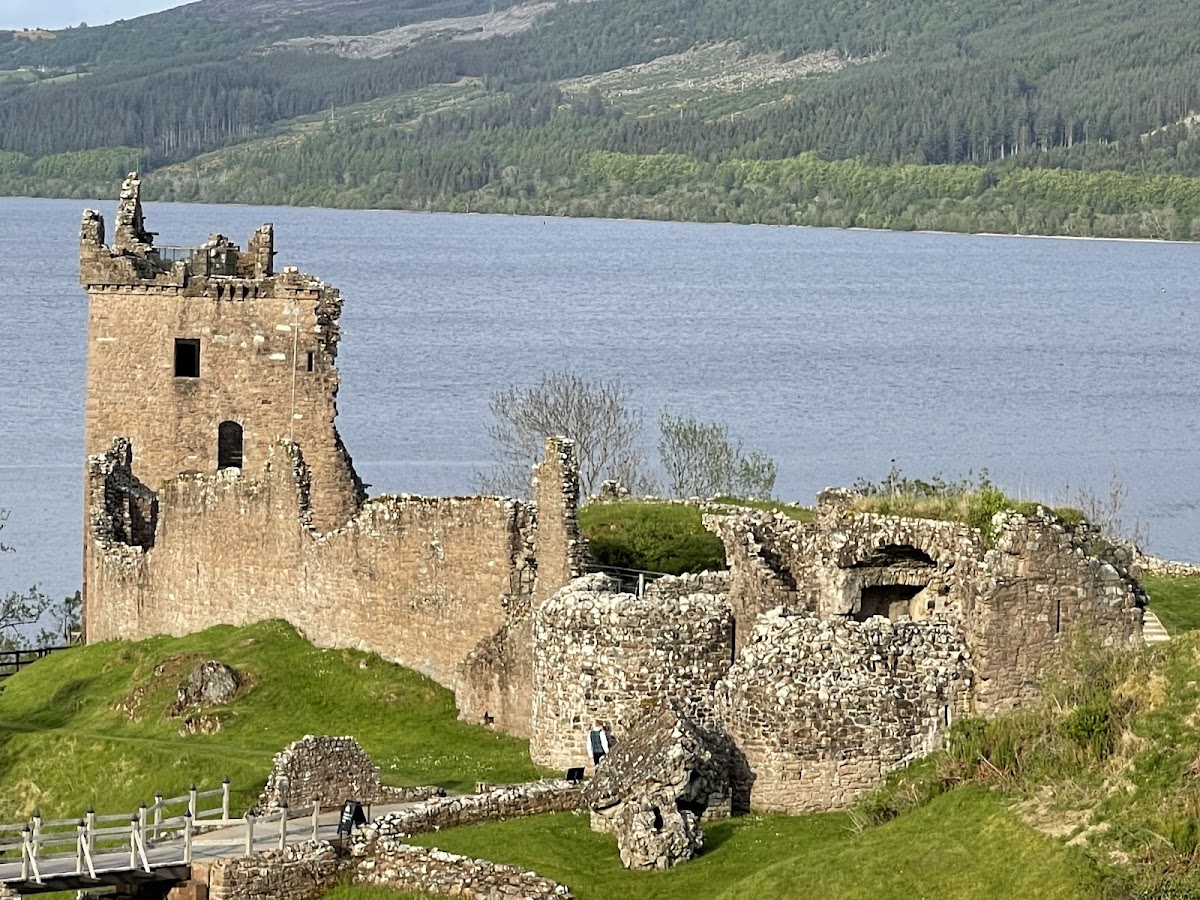
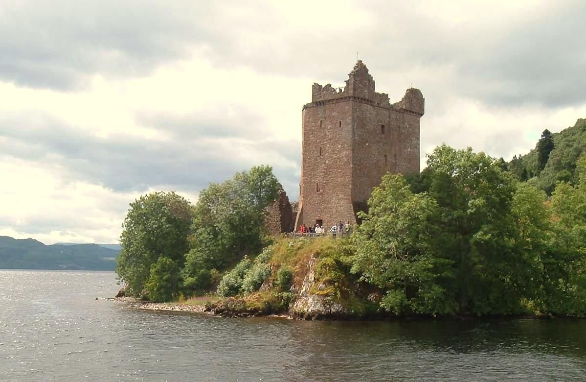
The Grant Tower anchors the northern end of the Nether Bailey and served as the castle’s principal tower house, or keep. It measures approximately 12 by 11 metres, with walls reaching 3 metres in thickness. Its foundations date from the fourteenth century, while most of the standing structure reflects rebuilding in the sixteenth century. Originally five storeys high, it remains the tallest surviving part of Urquhart, although its southern wall collapsed during an early-eighteenth-century storm.
The parapet was remodelled in the 1620s and originally carried corner bartizans, projecting wall turrets supported by corbels. Machicolations, openings in a projecting parapet for dropping objects onto attackers, stood above the western main entrance and eastern postern. The western entrance had its own ditch and drawbridge and opened toward a cobbled Inner Close, which was separated from the main bailey by a gate.
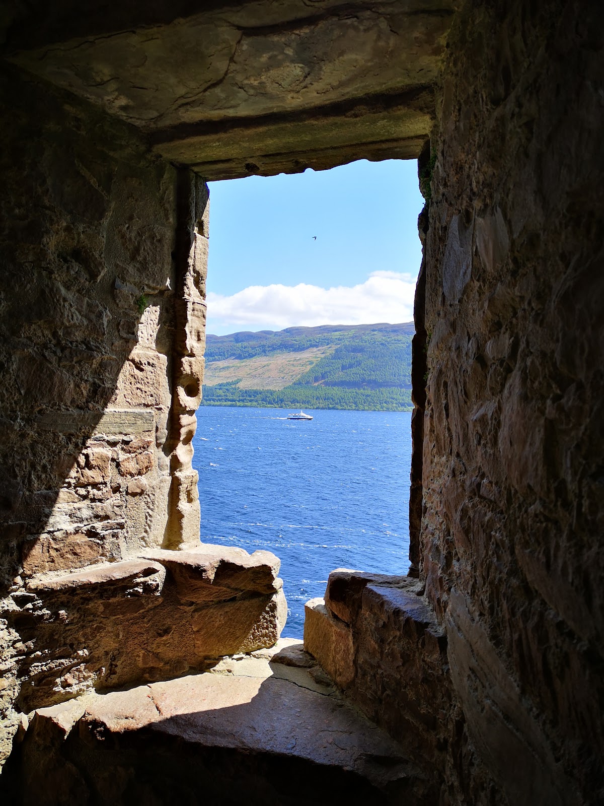
A circular staircase built into the tower’s eastern wall provides access to surviving interior sections. The first floor contained a hall, with rooms on the two floors above and attic chambers in the turrets. The principal rooms had large sixteenth-century windows with small pistol holes beneath them.
Domestic range
South of the Grant Tower, buildings were constructed against the thick, buttressed fourteenth-century curtain wall. The central section held the great hall, while the northern block contained the lord’s great chamber and solar. Kitchens occupied the southern section. Foundations on a rocky mound within the Nether Bailey are tentatively identified as a chapel.
Upper Bailey
Early fortification and shell keep
The Upper Bailey occupies the highest point of the promontory, a rocky mound at its southwest corner. Vitrified material on its slopes belongs to the early medieval fortification revealed through excavation. In the thirteenth century, the mound became the motte of the first castle associated with the Durwards. A motte is a raised earthwork supporting a fortified residence. The fragmentary walls that survive there form a shell keep, a hollow stone enclosure built around the summit of a motte, with evidence for towers to the north and south.
Watergate and southern buildings
A sixteenth-century watergate in the eastern wall of the Upper Bailey leads down to the loch shore. Buildings beside it may have served as stables. Farther south are the base of a doocot, or pigeon house, and scant remains of thirteenth-century buildings that may originally have formed a great hall before later reuse as a smithy.
Excavation and surviving finds
Repairs and excavations began after the castle entered public ownership. Work was interrupted by the First World War, resumed afterward, and was completed by 1922. Finds included a fifteenth-century bronze ewer, coins, jewellery, crosses, and other objects dating from the thirteenth to the seventeenth centuries. Most of the collection is held by the National Museum in Edinburgh. The excavation records were later criticized because find locations and layers of soil were not preserved, limiting the information available about the objects’ original archaeological contexts.