Umm Al Maa: A Coastal Burial Ground and Archaeological Area in Qatar
Site at a Glance
- Popularity
- Medium
- Country
- Qatar
- Primary era
- Bronze Age
- Eras represented
- Bronze Age, Classical
- Civilizations
- Unclassified
- Site type
- Burial
- Remains
- Necropolis
On this page15 sections
History
Umm Al Maa is an archaeological area on Qatar’s west coast, in Al Khor municipality near the boundary with Al Shamal. Its burial ground contains mounds whose age and cultural affiliation remain uncertain, and the area may have belonged to Dilmun, an ancient Gulf civilization centred on Bahrain. The name means “mother of water” in Arabic and refers to the area’s many freshwater wells.
Burial-ground chronology
The cemetery is ancient, but the burial mounds have received widely differing date proposals. Danish archaeologists suggested that they belonged to the Bronze Age, a prehistoric period when bronze became a major material for tools and objects, and proposed a date around 3000 BC. A Japanese mission later suggested that some burial complexes dated from the first century BC to the first century AD. Their cultural affiliation remains uncertain.
Historical records and occupation
In 1908, British diplomat J. G. Lorimer described the area as a bay and recorded a fort built by Ali bin Khalifah, Bahrain’s ruler, who spent part of the cold season there. During the 1937 conflict between Qatar and Bahrain, Sheikh Jassim bin Mohammed Al Thani’s forces besieged Zubarah. The Al Jabor faction of the Al Naim tribe, loyal to Bahrain’s emir, withdrew from Zubarah to Umm Al Maa. In 1950, anthropologist Henry Field recorded about 30 tents belonging to the Bu Rumaih tribe in the area.
Archaeological investigations
Investigations in 1957 and during the 1970s examined the burial ground and settlement remains. In 1957, Danish archaeologists Geoffrey Bibby and Peter Glob identified 50 mounds. Comparing them with similar mounds in Bahrain, they proposed a Bronze Age date for the mounds and associated pottery. Beatrice de Cardi and her team later became the first to investigate the settlement in detail, assigning its material to the Sasanian period, when a Persian empire ruled from the third to the seventh centuries AD.
A Japanese mission including Masatoshi A. Konishi, Takeshi Gotoh and Yoshihiko Akashi surveyed Qatar between 1988 and 1991. Its dating proposal drew on similarities between pottery and other finds from Umm Al Maa and material from a site on Failaka Island associated with the Seleucids, rulers of a Hellenistic kingdom founded after Alexander the Great’s death. In 2008, a German team considered the mounds potentially the work of nomadic groups rather than settled people, reasoning that the climate and geography discouraged permanent settlement. Archaeologist Muhammad Abdul Nayeem compared the burials with graves near Dhahran, Saudi Arabia, attributed to nomads around the third millennium BC.
Remains
Landscape and distribution
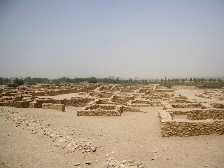
The area is mostly level, rocky ground marked by low limestone hillocks, depressions and furrows, with sand and other sedimentary deposits. The hillocks rise about 10–20 m. Human activity appears to have centred mainly on Mleiha, a depression covering about 25 km². The burial ground extends from the coast in the west to the Al Jemailiya–Al Ghuwariyah highway in the east, and from the Zubarah–Al Ghuwariyah highway in the north to the Dukhan Highway in the south, spanning at least about 600 km². Depressions collect substantial rainwater in the rainy season and supplement the freshwater wells. One well remains in use for a date-palm plantation. Salt flats line the coast, where vegetation includes sparse desert shrubs, prickly bushes and occasional acacia trees.
Burial mounds
Distribution and form
Mounds are often grouped around low hillocks or within depressions. They commonly measure 3–6 m across and range from 10 cm to 1 m in height. The mounds measured in the 1957 Danish survey averaged about 10 m in diameter and 1 m high. Their condition is generally poor because of grave robbing, chemical and wind weathering, human traffic and recreational off-roading.
Mound examined in 1957
One mound investigated in 1957 measured 6 m across and 0.6 m high. It contained a stone cist, a stone-built burial chamber, fitted into the underlying rock and aligned north to south. Three roof slabs covered the chamber, and smaller stones surrounded it. A skeleton lay facing north, but it could not be dated. Pit-fired pottery and alabaster bowl fragments recovered from the mounds informed the Danish team’s Bronze Age proposal.
J-2 burial mound
The J-2 mound formed an oval arrangement measuring 3.4 by 2.5 m. Beneath its roof slabs was a cist about 1.7 m long and 0.3 m wide, made from five or six substantial stone sections set around a rectangular pit cut into the underlying rock. The skeleton belonged to a woman probably in late adulthood. Her head lay on a roughly north-northwest to south-southeast axis and had been fractured into several pieces by fallen slabs.
Complexes J-3 and J-4
Excavated in 1990–91, the J-3 and J-4 complexes included oval mounds 4–8 m across. Made mainly from light-coloured, gently sloping sand, they rested on a level layer of dark sand 4–8 cm thick. Beneath the mounds, closely piled stones formed oval arrangements with recessed centres; roof slabs and heaps of pebbles covered the chambers. Some arrangements had been disturbed by grave robbers. The chamber layouts varied, with some accommodating bodies in contracted positions and others apparently intended for more than one body. Finds included a skeleton too decayed to identify, a small circular bead of dark transparent flint glass, fragments of a bronze or copper bowl, a cylindrical agate bead, two circular flint-glass beads, fragments of bronze or copper rings, an intact ring, a stone mortar and pottery fragments.
Settlement and historic structures
Wells and fort
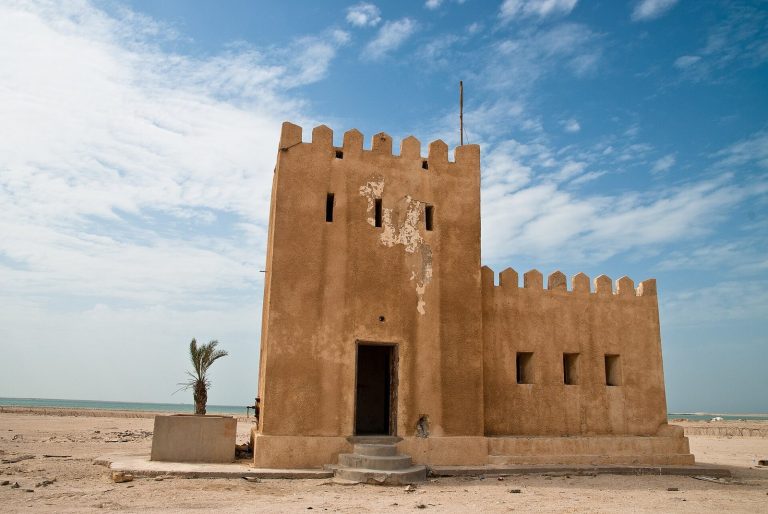
Lorimer’s description of the area records masonry wells inland and a fort in ruins. The account places these features within an area known for its freshwater wells.
Structures at Mleiha
During the 2008 survey, stone structures were associated with fire pits, prayer areas, barns or tent corrals, which the team considered more likely to be recent. The clearest trace of an older building was a visible remnant in the Mleiha depression near the only well still in use. The team estimated that an earthenware fragment found there was at most two or three centuries old, suggesting the area may also relate to more recent habitation.
Settlement pottery
Settlement investigations yielded Indian red polished pottery and glazed earthenware. The Danish excavations recovered pit-fired pottery and fragments of an alabaster bowl.