Ponale Road Fortification: An Austro-Hungarian Defensive Work in Italy
Site at a Glance
- Popularity
- Medium
- Country
- Italy
- Primary era
- Modern
- Eras represented
- Modern
- Civilizations
- Austria-Hungary, Austrian Empire, Habsburg
- Site type
- Military
- Remains
- Fort
On this page15 sections
History
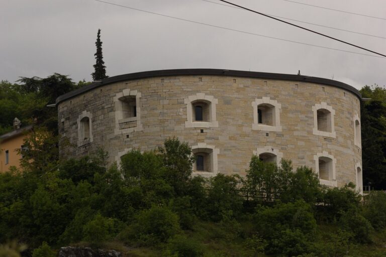
The Ponale Road Fortification, also known in Italian as Tagliata del Ponale, is an Austro-Hungarian defensive complex beside the Ponale road in Riva del Garda, Italy. Its modern construction was ordered in 1904, building on earlier defenses intended to block an invasion route through Val di Ledro toward Riva and the northern shore of Lake Garda.
Early defenses, 1859 to 1866
In 1859, during the Second Italian War of Independence, part of the wider struggle to unify Italy, Austrian officer August von Degenfeld-Schonburg proposed a field-gun position on the Ponale road. Together with a fortification near Storo, it was meant to deter an advance from the Brescia area through Valle del Chiese and Val di Ledro. The following year, Trento’s engineering section prepared plans for a gate at what was then the third tunnel from Riva, now the fifth, and a gun position above the second tunnel, now the third. The proposed gate would have firing openings and a portcullis, a heavy gate lowered to close a passage. The plan also called for a three-gun masonry position, a powder store, and barracks.
The work eventually built was a masonry battery for four guns behind a protective wall. A guard hut nearby was linked to it by a path sheltered by a wall. Designed for a garrison of 30 men, the position was valued for its commanding location.
After Austria’s defeat at the Battle of Bezzecca on 21 July 1866, during a later conflict between Italy and Austria, military authorities considered withdrawing from Riva if Italian forces under Giuseppe Garibaldi advanced again. The retreat did not take place. The Italian advance along the Ponale road was stopped by crossfire from Lake Garda’s flotilla and Battery San Nicolo. Nevertheless, the road battery was blown up on 25 July 1866.
Renewed plans and construction, 1867 to 1910
Several proposals for a replacement fortification followed between 1867 and 1904, but a lack of state funds delayed construction. Smaller works included mine chambers at the then-third road tunnel in 1879 and repairs in 1897–98 to a defensive wall built in 1866. A plan for a protected infantry position to fire along the road was sent to the Trento engineering directorate in December 1901. The Imperial War Ministry ordered construction in April 1904, and a fortification commission later that year urged completion in 1905.
Riva’s municipal council opposed the project, fearing that military restrictions would hinder the town’s tourist development. The engineering directorate sought land near the second road tunnel and access to the Ponale spring. After negotiations failed, it began compulsory acquisition proceedings. An agreement was reached on 19 October 1905, after the governor in Innsbruck objected to the proposed price. The municipality accepted the sale reluctantly and obtained concessions concerning the restricted zone and water supply. The military also received permission to install two iron gates at the tunnel.
By 1909, the tunnel and its approaches formed part of a connected road defense planned for two officers and 72 men. In 1910, Riva was declared a fortress, prompting another round of construction. The following year, work added an underground machine-gun position and replaced an open infantry post on the eastern rocky spur with two positions aligned with the tunnel. A small concrete shelter, a separate observation post, and wire defenses strengthened the arrangement.
Wartime expansion, 1911 to 1918
Italy entered the First World War on 23 May 1915. Construction at Ponale continued during the conflict. Plans for gun positions were submitted in February 1916, and work extended through the mountain in stages. The resulting underground system included shelters, ammunition stores, command rooms, artillery observation posts, searchlights, and a telephone exchange. Construction probably continued into 1918.
Decline and restoration
After 1918, the fort deteriorated. Iron fittings were removed, some entrances were partly walled up, and parts of the complex were used for a time to store road-maintenance materials. During work on the Ponale road in 2003–04, crews cleared rubble and rubbish from the fort and carried out restoration and protective measures.
Remains
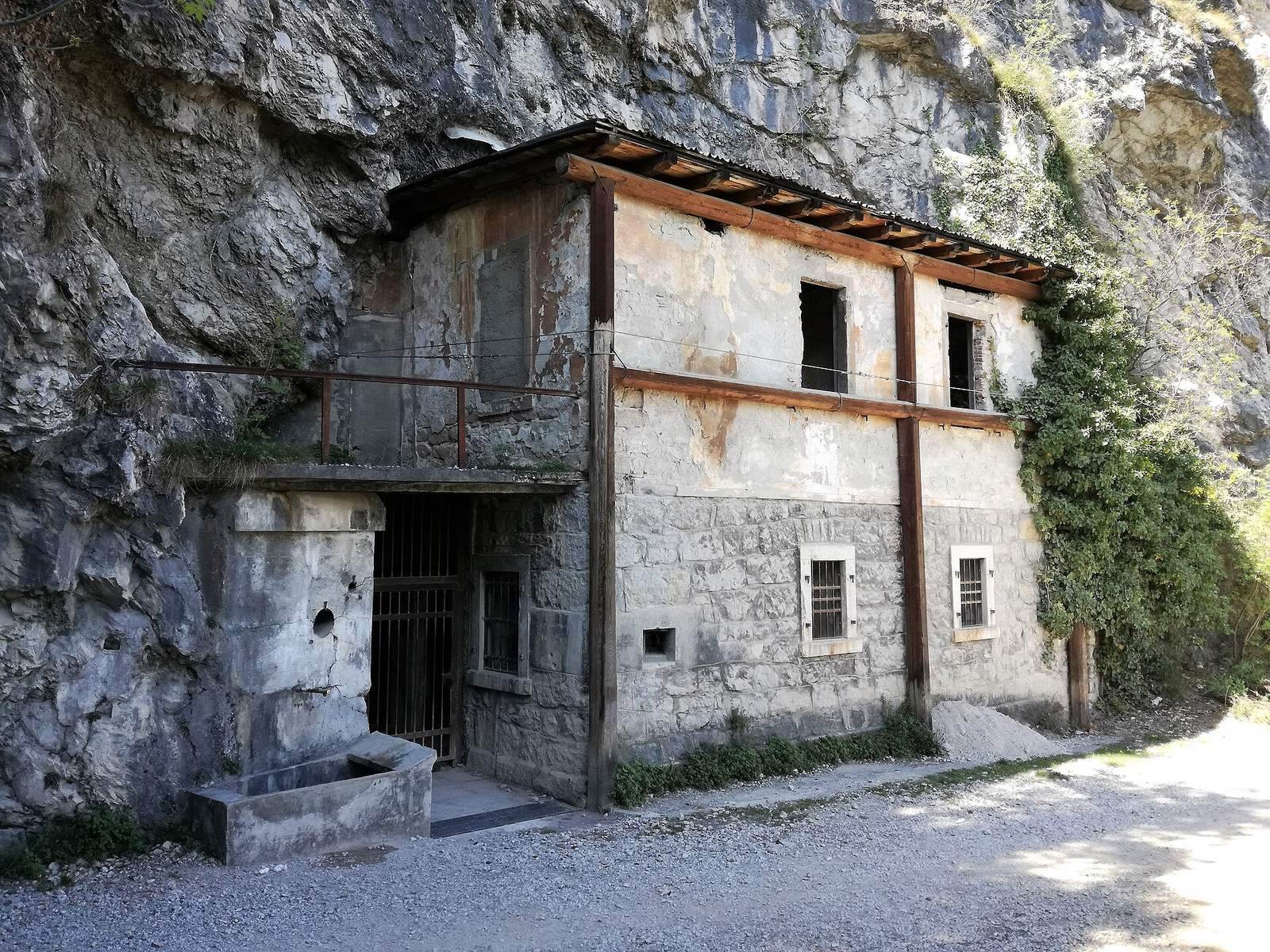
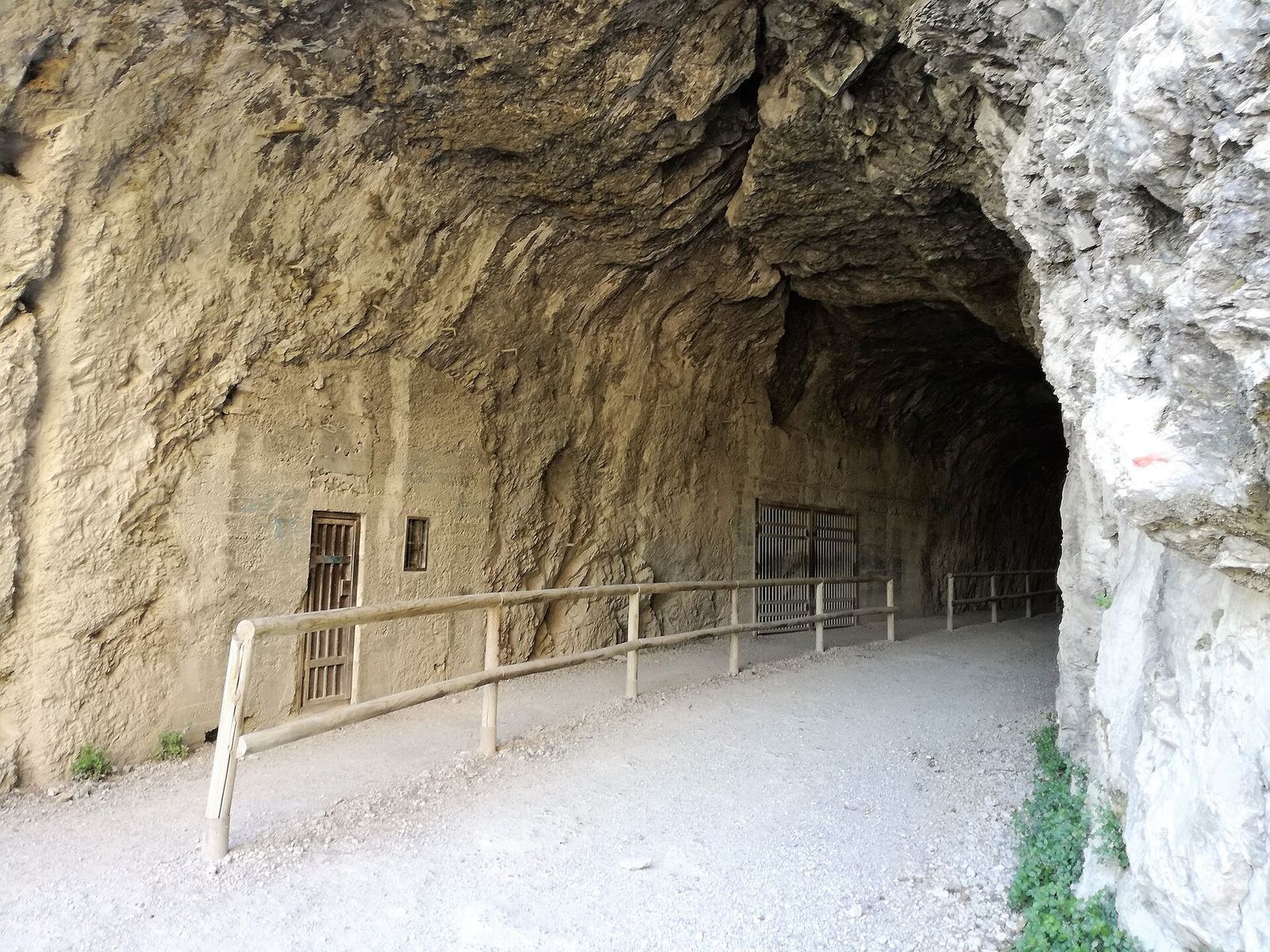
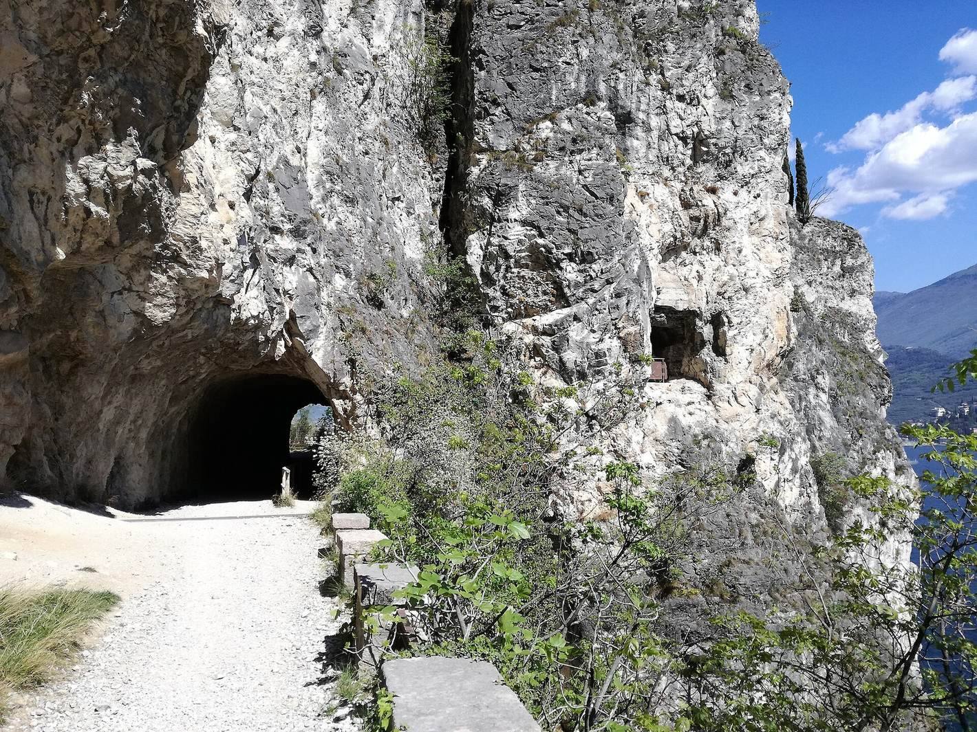
The fort is cut mostly into the bare rock of the Rocchetta and extends on both sides of the Ponale road. Its five levels contain more than a kilometre of passages and span about 120 metres of elevation. The lower part reaches almost to lake level, while the highest section lies about 80 metres above the road. The complex is inconspicuous from outside, and barred gates secure entrances to the rock-cut areas.
Lower and road-level defenses
First level
Slightly above the former lakeside road, the first level faces Torbole and the eastern shore. It contains two artillery chambers for rapid-fire guns, an observation post, a room for plotting gun alignment, a telephone room, quarters for officers and crew, a duty room, and an ammunition store. A well bears the year 1918. A concrete staircase of nearly 200 steps climbs about 40 metres to the next level. A munitions lift once ran on rails beside it, and parts of the track bed remain visible. The old lakeside road, the Gardesana Occidentale, was built after this level and is now abandoned.
Road-tunnel defenses
The second level lies at the height of the old Ponale road. At the top of the staircase, one gate opens into the road tunnel and another into a former kitchen and storeroom. A long passage reaches an observation post in the near-vertical cliff above the lake, where a searchlight was installed. At the tunnel’s northern entrance, a guardhouse contains an optical signaling station directed toward Fort San Alessandro on Monte Brione, which housed a radio station. West of the tunnel, another entrance leads to a second gun battery cut into the rock. Its chambers include crew and commander accommodation, an ammunition store, an observation post, and two gun positions aimed toward the coast between Torbole and Riva. One gun chamber has since been walled up. Near the southern exit, an underground machine-gun position and a protected side-firing work about 80 metres to the southwest covered the road.
Forte Teodosio
On a rocky spur east of the tunnel is a fortified area called Forte Teodosio, a name associated with Roman coins from the period of Emperor Theodosius I, who ruled from 379 to 395. The area includes several protected enclosures, an artillery observation post with a surviving range board, a covered infantry position, and an open gun emplacement. Two memorial stones stand there. One commemorates a fortress officer killed at the site in 1917, while the other marks the discovery of the Roman coins.
Higher levels and communication routes
Third level
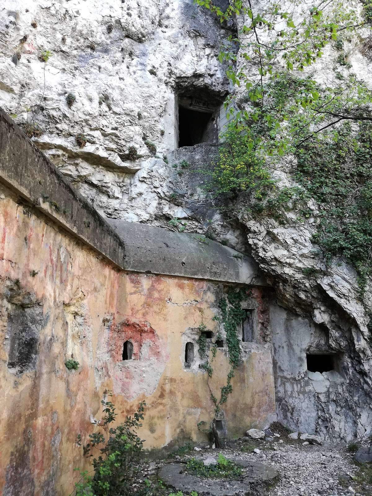
At the southern tunnel exit, a long passage on the west side turns south and divides after about 50 metres. One branch climbs to the surface, where the motor for a material cableway that supplied the upper levels once stood. The main passage continues to another junction. One branch reaches the flanking work, also called the Red Work because of its exterior paint, by a bomb-resistant passage connected to the close-defense position. The other forms a spiral passage that emerges above the work. A communication trench, partly open and partly roofed, leads from there to the next level.
Fourth level
A passage about 300 metres long runs through the cliff above the northern exit of the fourth road tunnel. It has numerous narrow openings for rifle fire. The material cableway ended here; its access opening and the foundations for the cableway remain visible.
Fifth level
The highest level is a concrete rifle gallery about 20 metres above the fourth. It was positioned to cover Val Sperone opposite and the continuation of the Ponale road. Iron girders were removed after the war, and the gallery is now almost completely destroyed.
Armament and firing fields
In 1916, the main artillery consisted of four 8-centimetre M 75/96 rapid-fire guns divided between the two underground batteries. Their firing areas covered the coast from Riva to Torbole, the eastern shore, and the lake. The fort also had two machine-gun positions, three protected rifle galleries, a searchlight position, and several artillery observation posts. Its guns were aimed toward the rear and lake to discourage Italian landings on the northern shore. Machine-gun and rifle fire protected the front approach.