Snodhill Castle: A Norman Border Fortress in Herefordshire



Site at a Glance
- Rating
- 4.7
- Popularity
- Very Low
- Country
- United Kingdom
- Primary era
- Medieval
- External website
- Open
- Eras represented
- Medieval
- Civilizations
- English, Norman
- Site type
- Military
- Remains
- Castle
On this page17 sections
History
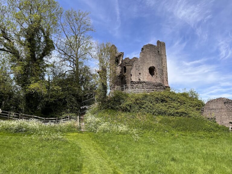
Snodhill Castle is a ruined Norman motte-and-bailey castle in the United Kingdom, built in stone in 1067 in the Norman period. It stands in the Golden Valley of west Herefordshire, about 1 mile (1.6 km) south of Dorstone, and was established to secure the border between Norman England and the Welsh princes. The castle is regarded as one of the major fortresses of the Welsh Marches, the borderlands where powerful lords exercised military and administrative authority between England and Wales.
Norman Foundation
Snodhill was first referred to in 1142, but its origins were long debated. Earlier interpretations attributed its foundation either to a follower of William FitzOsbern, 1st Earl of Hereford, before 1086, or to Roger de Chandos after a land exchange with Malvern Priory in 1127. Archaeological investigation has revised this picture. An early stone hall keep lies beneath and within the surviving polygonal keep, while early stone curtain walls enclosed a small triangular bailey. Together, these remains support the interpretation that FitzOsbern founded Snodhill in stone in 1067 and that the castle was completed before his death in 1071.
FitzOsbern granted the castle to Hugh L’Asne before 1071, as part of the division of the border territories between Chepstow and Shropshire among his supporters. When Hugh L’Asne died in 1101, the castle and his manors passed through marriage to Robert de Chandos I. The Chandos family then held and developed Snodhill for several centuries, making it part of the network of lordly fortresses that controlled the Welsh border.
The Chandos Family and the Welsh Revolt
In 1401, Henry IV ordered John Chandos to refortify Snodhill against the Welsh Revolt led by Owain Glyndŵr. The revolt, which began in 1400, challenged English rule in Wales and affected the neighbouring border counties. John Chandos added a large tower in the main bailey, giving the castle a second keep, and strengthened the cross-wall dividing the bailey. These measures helped Snodhill withstand Glyndŵr’s attacks in Herefordshire.
John Chandos died without an heir in 1428. His holdings then passed to the Beauchamp family through his wife’s relatives. Snodhill was briefly held by Richard Neville, 16th Earl of Warwick, before passing through the marriage of Anne Beauchamp to Richard of York, who later became Richard III. The castle subsequently became a royal possession.
Decline and Later Ownership
In 1540, the antiquary John Leland described Snodhill as somewhat ruined. He also noted a walled park, a chapel, and a marble quarry beneath the castle. Elizabeth I later granted Snodhill, together with other Warwick holdings, to Robert Dudley, 1st Earl of Leicester.
The castle may have been besieged during the English Civil Wars, the seventeenth-century conflicts between the monarchy, Parliament, and their supporters. Physical evidence indicates that the keep was deliberately slighted, meaning that it was damaged or partly demolished to reduce its defensive value, and that organized demolition followed the war. By the middle of the seventeenth century, the manor and castle had passed to the Prosser family and their relatives, the Powells. They retained the property until its sale in 1940. Although the castle was described as decaying by the mid-sixteenth century, it is thought to have remained in use during the seventeenth century.
Protection and Archaeological Investigation
The Royal Commission on the Historical Monuments of England surveyed Snodhill briefly, and the castle was scheduled under the Ancient Monuments Act in July 1933. Continued deterioration led to its inclusion on the Heritage at Risk Register in 1988. Historic England obtained a 999-year lease in 2013 to facilitate repairs. The lease first passed to the Vivat Trust and then, in 2016, to the Snodhill Castle Preservation Trust, a charity formed by local people with Historic England’s support.
Vegetation clearance began in 2016, followed by masonry consolidation in 2017 and 2019. The charitable trust has also organized annual archaeological excavations led by Herefordshire Archaeology since 2016. The surviving medieval fabric remains substantially ruined, but the castle has been described as fully repaired.
The Royal Free Chapel
The Royal Free Chapel had chaplains appointed personally by the monarch from at least the thirteenth through the sixteenth century. A royal free chapel was exempt from ordinary local ecclesiastical jurisdiction and connected directly with the monarch. Snodhill’s chapel was unusual because it stood within a lordship castle rather than a royal castle. It was still in use in 1597, but was later demolished so thoroughly that its location was lost for more than four centuries.
Archaeologists identified the chapel’s remains in 2022. The building has since been fully excavated and placed on public display, adding an important religious dimension to the understanding of the castle’s later medieval history.
Remains
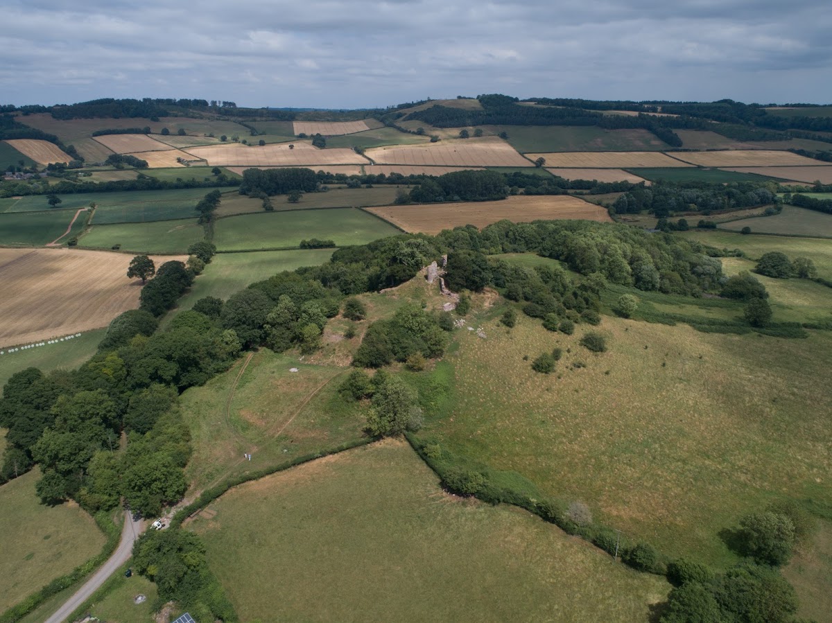
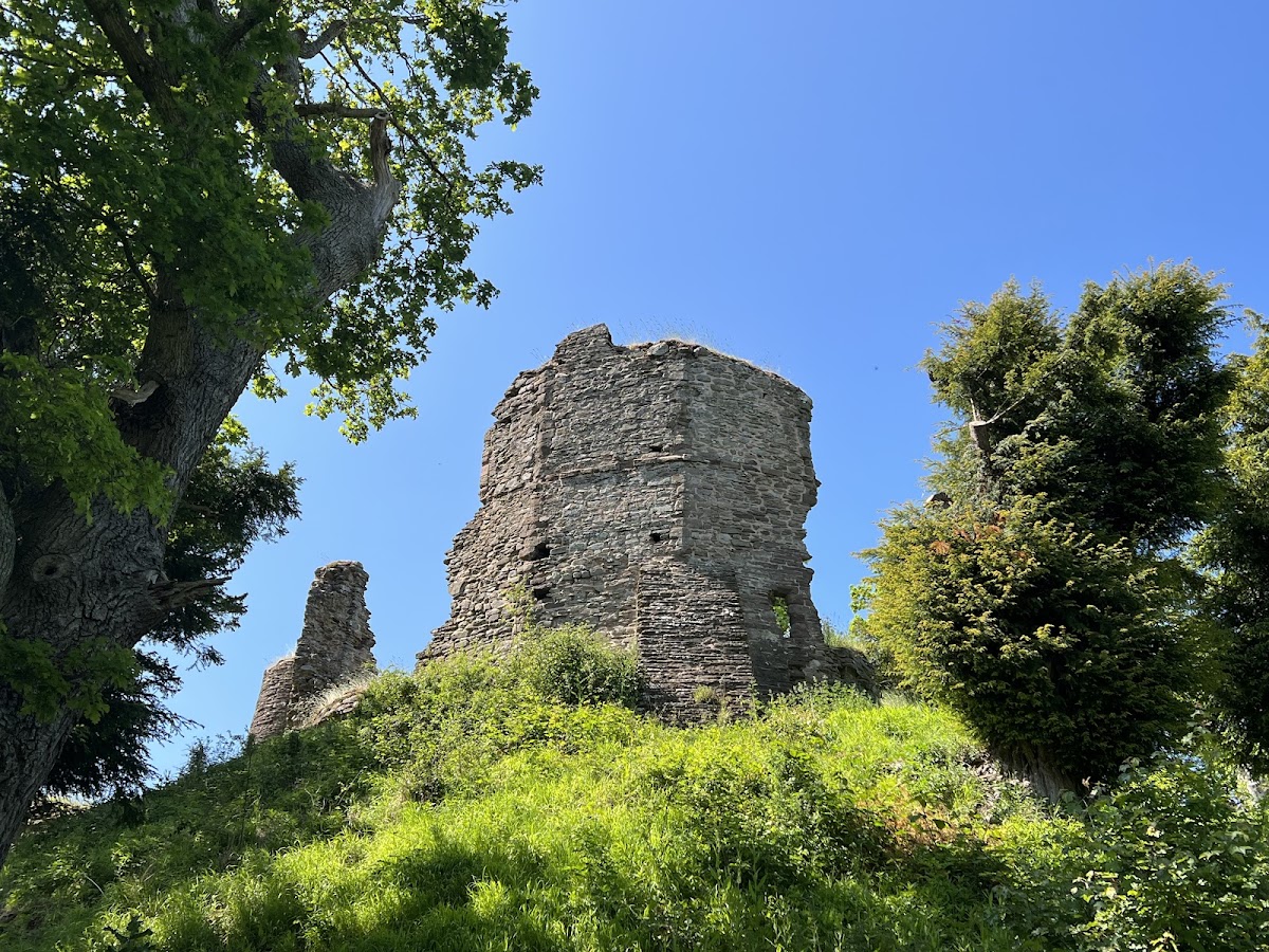
Snodhill Castle occupies the summit of a small, steep-sided hill between the River Dore and the Snodhill Stream at the northwestern end of the Golden Valley. Its surviving layout combines a high motte, an inner bailey, defensive walls, towers, and terraces. The principal masonry remains are concentrated around the summit and the bailey extending west from it, while further enclosed areas are indicated on the ground below and east of the motte.
Earthworks and Enclosed Areas
The Motte
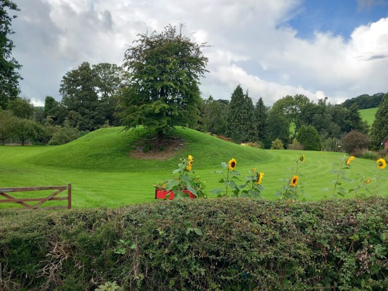
The motte is a raised defensive mound whose date remains uncertain. It rises between 7.5 metres (25 ft) and 14 metres (46 ft) above the surrounding earthworks and measures about 44 metres (144 ft) across at its base. The summit is occupied by the masonry keep, which was adapted to the shape of the mound.
The Inner and Outer Baileys
The inner bailey extends west of the motte and is defined by a steep earthen rampart. A shallow ditch runs along the east side of the mound, while unusual terraces surround the main bailey. A possible outer bailey occupied level ground below and west of the inner-bailey ditch. A further, larger bailey is indicated east of the motte. If both areas are confirmed as baileys, the combined arrangement would make Snodhill one of the largest early Norman castles in England.
Keep and Defensive Structures
The Polygonal Keep
The summit keep, or principal fortified tower, is a substantial masonry structure with a polygonal plan. Its base appears to have been thirteen-sided, while the surviving southern section above first-floor level suggests an irregular ten-sided form adapted to the summit. An early collapse caused the change in configuration, and the building preserves evidence of several construction and repair phases.
The polygonal keep dates from about 1160 and is comparable in form to the nearby keep at Richard’s Castle. Beneath it lies the early stone hall keep associated with the castle’s Norman foundation. That earlier building was incorporated into the later structure, allowing successive phases of the castle to survive within the same masonry complex.
The Western Gateway
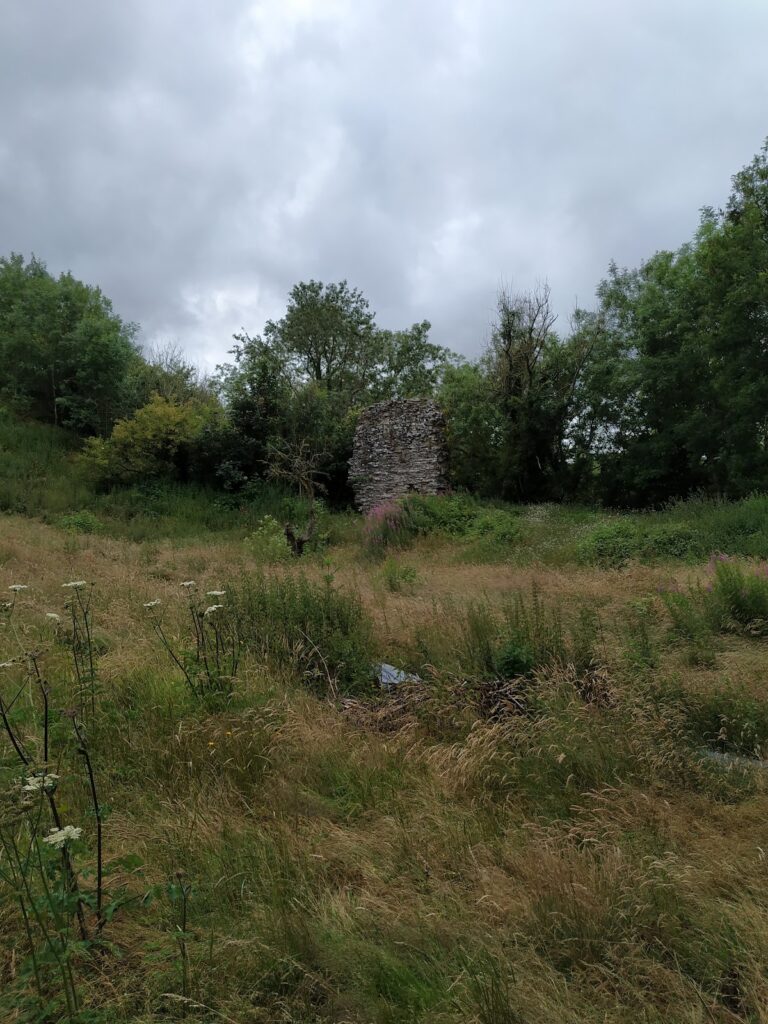
The western front was remodelled with a solid, drum-shaped tower at the southwest. A second drum tower probably stood at the northwest, although excavations found no discernible trace of it. The two towers flanked an arched gateway. The head of the arch survives, together with a groove for a portcullis, a gate that descended vertically to close the entrance. The drum towers may date from the late fourteenth or early fifteenth century.
Walls, Towers, and Internal Buildings
Remains of a stone curtain wall, a defensive wall enclosing the castle, can be seen on the south side of the bailey and partly along its west and north sides. A very large tower survives in the north and has been excavated. A cross-wall followed the line of the early Norman walls and divided the bailey into two sections. Traces of several substantial internal buildings remain within these enclosures.
Investigation, together with a seventeenth-century plan, places the principal entrance at the southwest corner of the bailey. A heavily fortified postern, or small secondary entrance, was discovered in the northeast. Its identification confirmed the southwest position of the main entrance by eliminating the remaining alternative location.
Chapel and Associated Manor
The Royal Free Chapel
The Royal Free Chapel stood in the southeast corner of the main bailey. Its remains were located and confirmed in 2022, then fully excavated and placed on public display. Carved corbels from the chapel excavations match corbels incorporated into the nearby seventeenth-century manor house, linking the chapel’s masonry with later building activity in the surrounding landscape.
Snodhill Court
Snodhill Court is a substantial seventeenth-century stone manor house about 200 metres (220 yd) west of the castle. It probably incorporates stonework removed from the castle, including carved corbels at its main entrance and elsewhere. The associated landscape also included a walled park and a marble quarry beneath the castle.