Llanthomas Castle Mound: A Norman Motte-and-Bailey Castle


Site at a Glance
- Rating
- 5
- Popularity
- Very Low
- Country
- United Kingdom
- Primary era
- Medieval
- External website
- Open
- Eras represented
- Medieval
- Civilizations
- Norman
- Site type
- Military
- Remains
- Castle
On this page12 sections
History
Llanthomas Castle Mound is a Norman motte-and-bailey castle in Germany, United Kingdom, built during the late eleventh or early twelfth century after the Norman Conquest of England. A motte-and-bailey castle combined a raised earth mound with a timber defensive structure and an enclosed lower courtyard. Llanthomas formed part of the early Norman network in the Middle Wye Valley and was associated with the Llanthomas lordship, a sub-lordship of the lordship of Hay.
Norman foundation and regional control
The castle was probably constructed after the Norman invasion of Wales in 1081 and before 1215, although its builder is unknown. Its position may have helped control the route towards the River Wye and the nearby ford of Little Ffordd-Fawr. Llanthomas Castle Mound and Llowes Castle Tump stood on opposite sides of the river, and their possible role in controlling the crossing reflects the wider Norman use of castles and lordships in the Welsh Marches, the borderlands between Wales and England.
The mound was historically linked with Llanthomas, Llanigon, Hay-on-Wye, the former settlement of Trefynys, and the ford across the Wye. Trefynys was associated with Llanthomas from the first century until the Norman period. Later forms of its name included Seint Thomas chirche, Thomascherche, Llandomas, and eventually Llanthomas.
Later interpretations and landholding
Earlier activity at the mound remains uncertain. Some antiquarian scholars proposed that the Norman castle occupied an Iron Age tumulus, a prehistoric burial mound or earthwork, but the evidence for that interpretation is limited. The site was consequently labelled a tumulus on many maps.
John Leyland, a sixteenth-century English antiquary and topographical writer, described the castle during a visit to Llanigon between 1536 and 1539, saying that it was intended to guard against “evil-doers.” William Camden, an English antiquary and historian, later referred to a castle or tower at Llanigon. These accounts, written roughly 350 years after the castle was built, have encouraged the possibility that the original wooden keep was later strengthened with a shell keep, a stone defensive enclosure around the summit, or with a stone keep, a more substantial fortified tower. This later development remains uncertain.
The castle and its surrounding lordship continued to be associated with high-status landholders. Around the time of Leyland’s visit, Llanthomas was held by Sir Walter Deveraux, Lord Chief Justice of South Wales.
Archaeological investigation and protection
In 1921, William Morgan, vicar of the pre-Conquest church of St. Eigon at Llanigon and an amateur archaeologist, excavated a small trench on the summit during a visit by the Woolhope Club. In 1988, archaeologist Peter Dorling and the Clwyd-Powys Archaeological Trust investigated a possible bailey area through topsoil stripping, levelling, and foundation-trench excavation. The work identified activity associated with the motte, including a medieval cooking-pot sherd and several stone-filled features. The investigators interpreted the area as the probable location of a kitchen within the bailey.
Llanthomas Castle Mound is a scheduled monument under the official name Llanthomas Castle Mound, reference BR078. Its protection derives from the Historic Environment (Wales) Act 2016 and the Ancient Monuments and Archaeological Areas Act 1979. The scheduled area includes the motte and a substantial grassed area at its base, where structural evidence and archaeological deposits may survive. Cadw, the Welsh Government’s historic-environment service, regards the mound as an important relic of medieval architecture and landscape, with potential to improve knowledge of medieval defensive practices. Historic-environment records were maintained by the Clwyd-Powys Archaeological Trust and, from 2024, by Heneb, the merged archaeological organisation for Wales.
Remains
Motte and ditch
Earthwork mound
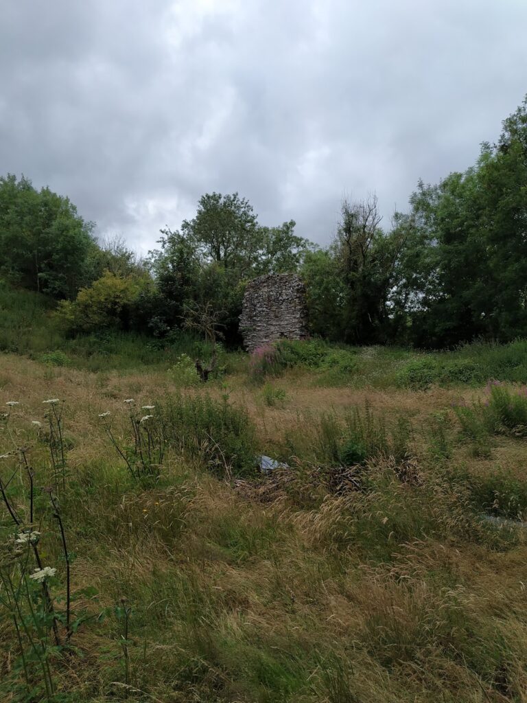
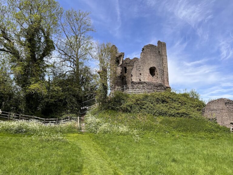
The surviving castle is centred on an earthen motte formed from earth and rubble, with timber once providing the principal defensive construction. The mound rises approximately 3 metres above the surrounding ground. Its summit measures about 9 metres across, while its base is approximately 24 metres in diameter. The earth used to build it was probably obtained from the surrounding ditch, and nearby woodland may have supplied the timber.
Ditch and watercourse
A ditch surrounds the mound, with the Digeddi Brook, a tributary of the River Wye, running along its base. The motte may occupy a high point that once overlooked the Wye, less than a mile away. Hedges, trees, and buildings now intervene between the mound and the river. The ford of Little Ffordd-Fawr lies between the castle mound and the southern bank of the Wye.
Bailey and buried structures
Enclosure walls
Buried walls supported the timber enclosure around the bailey along Llanthomas Lane and continued near the top of the ditch towards the brook on the northern and north-western sides. The bailey probably extended across much of the level ground from the mound along the single-carriageway section of Llanthomas Lane towards Llanigon. Llanthomas Lane and the Digeddi Brook appear to have defined parts of this enclosed area. During the 1980s, ground at the base of the motte and to its east was used for sheep grazing and was known as Bailey Court. It has since been divided between private dwellings and agricultural land.
Possible kitchen area
A possible kitchen lay about 50 metres south-east of the motte. Excavation revealed a distinctive stone-filled pit or ditch butt-end, whose basal fill contained a quantity of charcoal, together with other stone-filled features. These remains provide evidence for activity within the former bailey and support the interpretation of a domestic working area.
Strategic landscape
The mound had a direct line of sight to Llowes Castle Tump on the northern bank of the River Wye. The paired positions may have served a strategic river-control function, although that interpretation remains a possibility. The documented physical remains consist principally of the motte, ditch, buried enclosure walls, and possible kitchen area, while the former bailey may have contained the living, storage, workshop, stable, and military facilities normally associated with a motte-and-bailey settlement.
Nearby sites