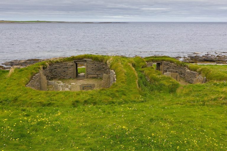
Skara Brae: A Neolithic Settlement in Orkney


Site at a Glance
- Rating
- 4.7
- Popularity
- Medium
- Country
- United Kingdom
- Primary era
- Stone Age
- External website
- Open
- Eras represented
- Stone Age
- Civilizations
- Unclassified
- Site type
- Domestic
- Remains
- House
On this page18 sections
History
Skara Brae is a Neolithic settlement in the United Kingdom, on the west coast of Mainland Orkney in the Bay of Skaill. Built by farming and fishing communities during the later Stone Age, it was occupied from approximately 3180 BC to 2500 BC. The settlement is regarded as one of Britain’s oldest agricultural villages and as the most complete Neolithic village in Europe.
Neolithic occupation
The inhabitants belonged to communities associated with Grooved Ware, a Neolithic pottery tradition distinguished by horizontal grooves on its vessels. They kept cattle, pigs, and sheep or goats, cultivated at least barley, and supplemented farming with fishing, shellfish gathering, seabird hunting, deer and wild boar hunting, seal hunting, and the use of occasionally stranded whales. The economy was largely self-sufficient, although hematite from Hoy and other finds point to exchange with neighbouring communities.
Skara Brae probably housed no more than about 50 people at one time, perhaps fewer than 20 families. The broadly similar size and arrangement of most houses has been interpreted as evidence of a relatively egalitarian community without centralized authority. Individuals with particular expertise may nevertheless have exercised authority in specific activities. Connections with other Orcadian settlements helped support exchange and probably reduced the risks of close intermarriage.
A Neolithic route from Skara Brae passed near the Ring of Brodgar and the Standing Stones of Stenness before ending at Maeshowe, a prehistoric chambered tomb built around stone burial chambers and covered by a mound. These connections place Skara Brae within the wider ceremonial and settlement landscape of Neolithic Orkney. They do not establish that the settlement was controlled by a privileged priestly or theocratic class.
Construction phases and abandonment
The settlement developed through several building phases. The visible houses largely represent the final period of occupation, while earlier construction survives beneath them. The buildings were progressively enlarged and rebuilt over an earlier settlement after roughly 300 years of occupation. This earlier settlement was levelled before new houses were built above it, while two early structures survived beneath thick midden because later buildings were not placed directly over them.
Skara Brae was abandoned around 2500 BC after the climate became colder and wetter. The precise reason remains uncertain. An older interpretation proposed that a violent storm caused a sudden flight, but Anna Ritchie argued that burial of the settlement was gradual and that the inhabitants had already left. A gradual decline, partly related to changing social organization and the movement of younger people to independent farms, offers one possible explanation.
The inhabitants’ identity and origins remain unresolved. Links with Caithness and Shetland have been proposed, while possible Mesolithic occupation elsewhere in northern Scotland leaves open the possibility of population movements within the region. Symbols carved on stone objects, lintels, and bed posts have sometimes been described as runic or runelike, but they do not provide conclusive evidence of a developed writing system. The meaning of the name Skara Brae is also uncertain. Its elements may reflect Scots and Old Norse influences, and the settlement was also historically called Skerrabra.
Rediscovery and archaeological investigation
Coastal erosion had probably already carried away part of the settlement before its discovery. In the winter of 1850, a severe storm stripped soil and sand from the mound known as Skerrabra and exposed roofless stone houses. William Graham Watt of Skaill began an amateur excavation and uncovered four houses before ending the work in 1868. The site was later plundered in 1913, when an unknown quantity of artefacts was removed.
Another storm in 1924 exposed and damaged further remains. The site was then secured and systematically investigated. Professor Vere Gordon Childe of the University of Edinburgh first visited in 1927 and directed excavations from 1928 to 1930. Earlier excavators, including Childe, had dated the settlement to around 500 BC and regarded it as Pictish. Radiocarbon dating from excavations in 1972 and 1973 established its Neolithic age. Radiocarbon dating estimates age by measuring radioactive carbon remaining in once-living material, such as bone, grain, and shell.
The 1972 and 1973 excavations reached waterlogged deposits that preserved organic material and provided evidence about diet, agriculture, tools, fuel, and construction. Forty-one radiocarbon dates are recorded, most based on animal bone, with others obtained from charred grain and shell. David V. Clarke and Alexandra Shepherd directed this later fieldwork, which allowed the settlement to be examined through more detailed archaeological techniques.
Protection and continuing risk
Historic Environment Scotland, the public body responsible for Scotland’s nationally important historic environment, manages Skara Brae with the Orkney Islands Council, NatureScot, and the Royal Society for the Protection of Birds. A seawall built after the storm of 1924 has protected the site since 1926. The wall is deteriorating, and its presence may contribute indirectly to erosion on either side of the protected area.
Skara Brae forms part of the Heart of Neolithic Orkney World Heritage Site, inscribed by UNESCO in 1999 with Maeshowe, the Ring of Brodgar, the Standing Stones of Stenness, and other nearby monuments. The designation recognizes the exceptional survival and importance of these Neolithic remains. A 2019 risk assessment concluded that the World Heritage Site, especially Skara Brae, is extremely vulnerable to rising sea levels, increased rainfall, coastal erosion, and possible partial destruction by an unusually severe storm. Proposals have included a new seawall or moving the remains stone by stone, but the site’s future remains uncertain.
Remains
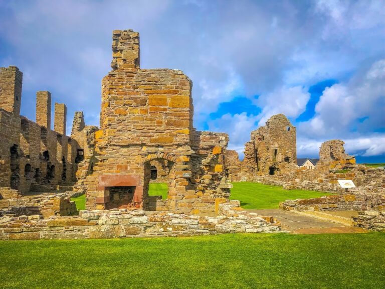
The surviving settlement consists of eight excavated houses joined by low passages, while ten structures have been exposed or identified across the wider remains. The buildings belong to three construction phases dating broadly from about 3100 BC to 2500 BC. They were built almost entirely from locally available red sandstone, divided into slabs of suitable thickness. Domestic midden, an accumulated deposit of food waste, shells, bones, broken pottery, and other refuse, was packed around and beneath the buildings to stabilize them and insulate them against wind and cold.
Houses and connecting passages
Domestic houses
Most dwellings were single rectangular or broadly square rooms measuring approximately 20 to 40 square metres. A central stone hearth provided heat and a place for cooking, and six hearths have been identified. Seven houses share a broadly similar arrangement, with a stone dresser opposite the entrance, beds on either side of the hearth, and built-in storage furniture. Low entrances were closed by stone slabs secured with bars made from bone, including whale bone, or wood. The bars slid into holes cut into the stone door jambs. The low doorways and passages helped retain heat rather than reflecting the height of the inhabitants.
Stone furniture
Stone furnishings survive inside the houses in the form of beds, dressers, shelves, seats, cupboards, chests, and storage boxes. Beds in the older houses were built into the walls, while those in later houses stood within the rooms. Some may have been filled with moss and bedding made from straw, heather, or fern, then covered with sheep or seal skins. The dressers stood against the wall opposite the entrance and were the first furnishings visible on entering. In most comparable houses, the larger bed was on the right of the doorway and the smaller on the left. Stone pillar stumps beside the beds may have supported fur canopies.
Passages and drainage
The connecting passages were less than about one metre high and roughly half a metre wide. Midden covered their roofs and formed part of the integrated insulating structure surrounding the houses and tunnels. Drainage channels ran beneath at least five houses and belonged to a settlement-wide drainage system. Each house appears to have had a simple toilet, while stone-lined drains may have carried waste towards a nearby cliff and the sea. The earliest known surviving toilet associated with the settlement dates to about 2800 BC.
House 8
House 8 differs from the other dwellings. It is a free-standing, above-ground structure with walls more than two metres thick and a porch protecting its entrance. It has no surrounding midden insulation, lacks the dressers and storage boxes found in the other houses, and is divided into small cubicle-like spaces. Heat-damaged stone, a possible flue, and fragments of stone, bone, and antler suggest that it may have served as a workshop, perhaps for producing bone needles or flint axes.
Setting and construction materials
Landscape position
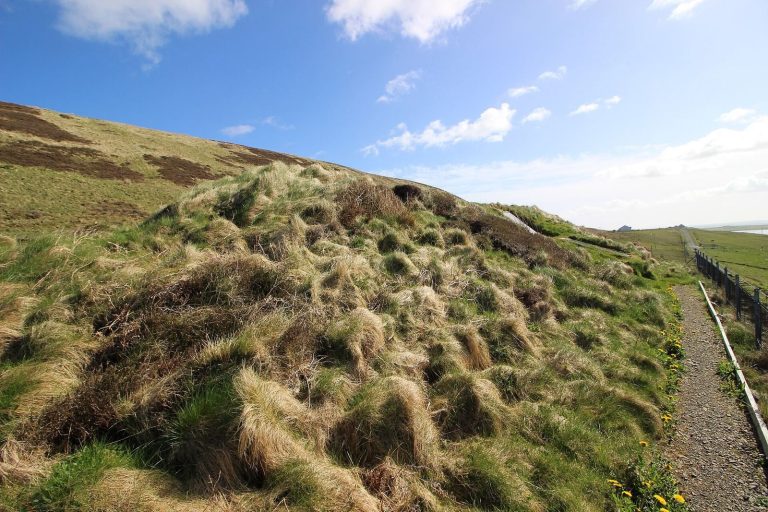
The settlement originally stood more than 1,500 metres from the sea, possibly beside a freshwater lagoon protected by dunes. Coastal erosion has brought the shoreline much closer and has created the modern impression that the houses were built beside the beach. Midden deposits reached almost four metres in depth in one excavated area between the houses. Remains also survive in fields immediately beside the monument, while other remains of uncertain date can be seen eroding from the cliff farther south. The full extent of the settlement lost to the sea is unknown.
Stone building tradition
Timber was scarce on the treeless island, so stone was used not only for walls but also for furniture, doors, beds, storage fittings, and other domestic installations. The roofs and their supports may have involved driftwood and whale bone, with turf or hay secured by ropes twisted from heather. Sandstone roofing has also been considered. Waterlogged deposits excavated in 1972 preserved a wooden handle and a twisted skein of heather, one of the few known examples of Neolithic rope. Dried seaweed may have been used as fuel, although proposed hearth fuels also include peat, driftwood, animal dung, and seaweed.
Artefacts and organic evidence
Pottery, tools, and carved objects
Finds include Grooved Ware pottery, vessels with capacities of up to about 30 litres, red ochre, polished hematite nodules, carved stone balls, and stone tools. Some carved stone balls bear spiral ornament stylistically linked with objects from the Boyne Valley in Ireland. Red ochre may have been used for body painting, while polished hematite may have helped finish leather. Other excavated objects include awls, needles, knives, beads, adzes, shovels, small bowls, jewellery, pottery, bone and antler tools, and ivory pins up to 25 centimetres long.
The materials include mammal, fish, bird, whale, walrus, and orca bone, as well as whale and walrus ivory. Skaill knives were common cutting tools. They were made from large sharp flakes struck from sandstone cobbles, and similar tools have been found throughout Orkney and Shetland. Stone balls and other artefacts from the settlement are displayed in a museum or visitor centre rather than all remaining in their original archaeological contexts.
The Skara Brae Buddo
A carved whalebone figurine known as the Skara Brae Buddo was found during excavations in House 3 in 1860. It was lost and rediscovered in an archival box at Stromness Museum in 2016. The figurine is about 9.5 centimetres high and 7.5 centimetres wide. Nineteenth-century descriptions treated it as a possible fetish or deity image, although its original meaning remains uncertain.
Preserved biological remains
The waterlogged deposits provide evidence for the settlement’s food, farming, tools, fuel, and construction. They also preserve organic materials that would otherwise decay, including the wooden handle and heather rope. The site preserves the earliest known European record of the human flea, Pulex irritans, an insect that can live on humans and other mammals.