Sisupalgarh: An Ancient Fortified City in Odisha
Site at a Glance
- Rating
- 4.2
- Popularity
- Very Low
- Country
- India
- Primary era
- Classical
- Eras represented
- Iron Age, Classical
- Civilizations
- Unclassified
- Site type
- City
On this page11 sections
History
Sisupalgarh is a fortified urban settlement near Bhubaneswar in Odisha, India, built by the people of ancient Kalinga and first inhabited around the seventh or sixth centuries BCE. The city developed before the Mauryan Empire, the imperial power that expanded across much of the Indian subcontinent from the fourth to the second centuries BCE. It has been identified interpretively with Kalinganagara, associated with the Kalingan ruler Kharavela, and with Tosali, a settlement linked to the Mauryan period and the emperor Ashoka.
Origins and urban development
Different investigations place the city’s main period of development within a broad span. Visitor information dates the site to approximately 800–500 BCE, while B. B. Lal placed the flourishing of the fortified city between the third century BCE and the fourth century CE. Later research argued that it flourished from around the fifth century BCE and may have remained in use well after the fourth century CE. Early radiocarbon dates place occupation between 804 and 669 BCE inside the city and between 793 and 555 BCE outside it, while the northern rampart dates to 510–400 BCE.
The settlement may have housed approximately 20,000–25,000 people. This provisional estimate draws on geophysical survey, systematic surface collection, selected excavations, and studies of domestic, civic, and individual-house architecture within the fortified area. The ancient city was not necessarily built up densely across its entire enclosure, since open areas may have supported grazing.
Excavation and modern pressures
B. B. Lal carried out the first excavations in 1948. An American–Indian team began further work in 2001, and excavations directed by M. L. Smith and R. K. Mohanty from 2005 to 2009 identified early occupation in five sampled locations. Paul Alan Yule is also associated with archaeological work at the site. Ground-penetrating radar in 2005 indicated the probable position of the southern moat, while three-dimensional laser scanning and other survey methods recorded structures and remains across the settlement.
When Lal worked at Sisupalgarh, the area was described as wilderness. Much of the land within the ancient enclosure later passed from protected status into private possession, although the nationally protected monument remains under the Archaeological Survey of India. An Indo-German team documented substantial illegal construction in 2005, and satellite imagery from 2002 onward recorded expanding encroachment, especially in the north-western quarter after 2010. Development also extended into the southern city wall, bringing new construction close to surviving historical structures. Gold coins and terracotta pottery recovered during the first excavations were later lost, creating further concerns about the preservation of material from the site.
Remains
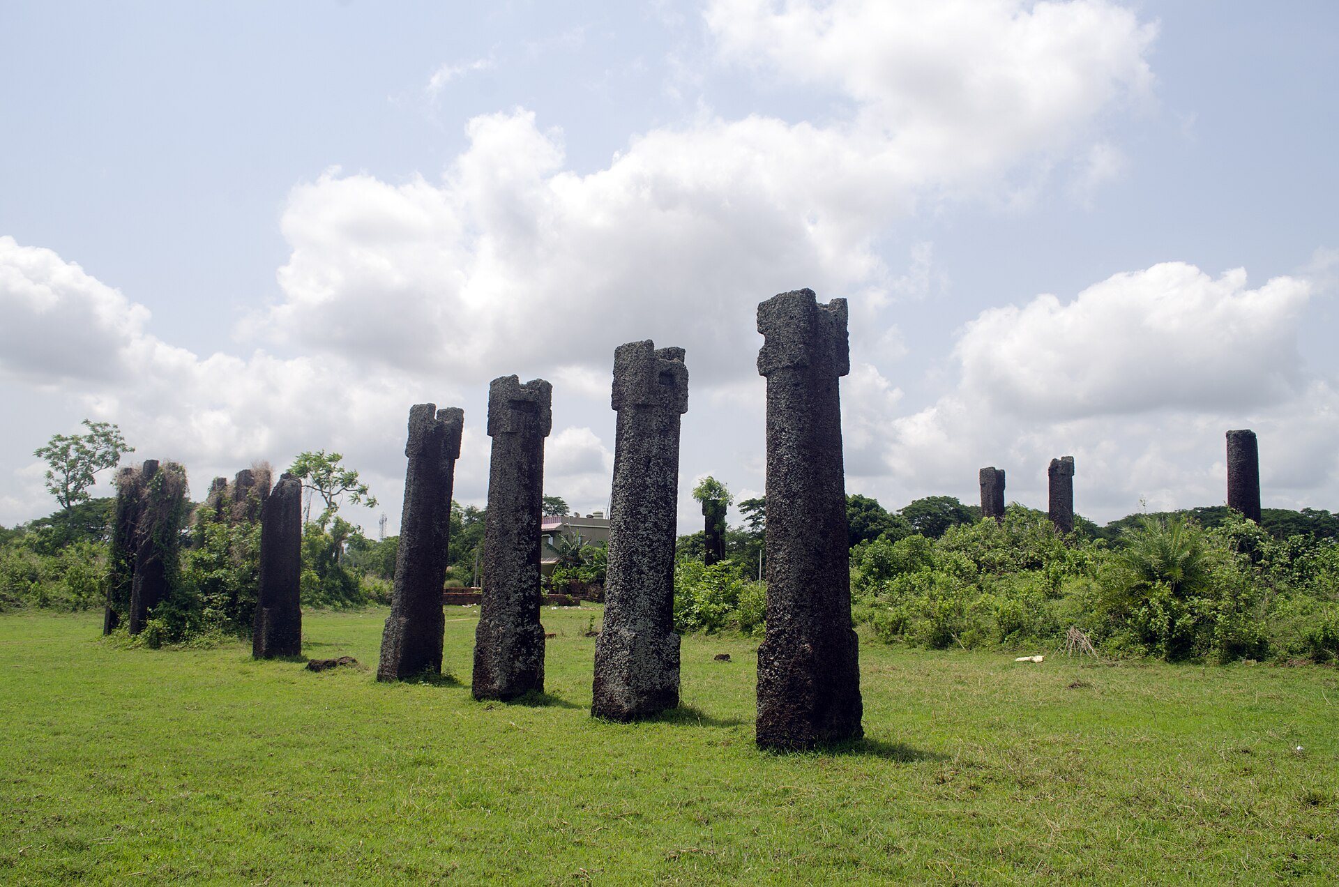
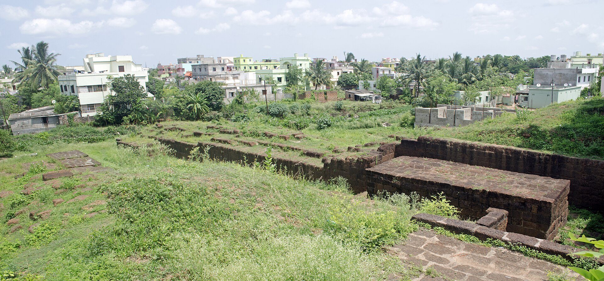
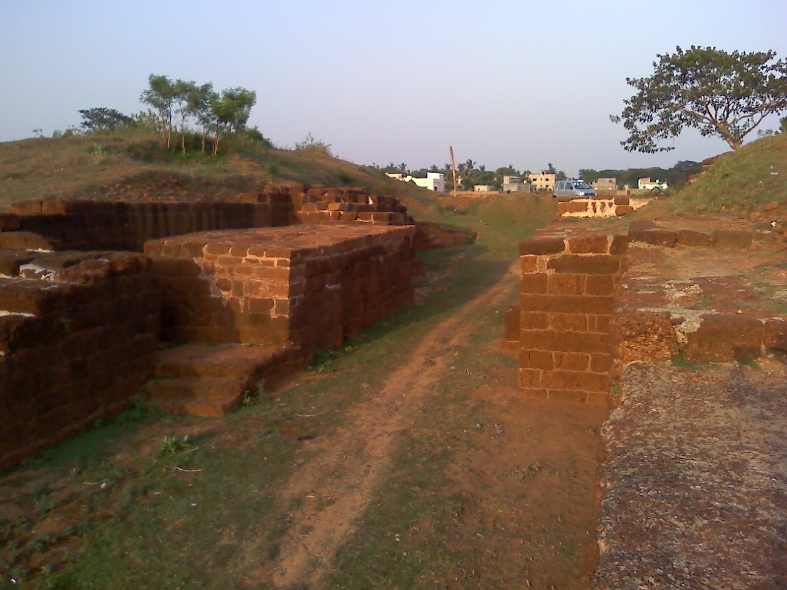
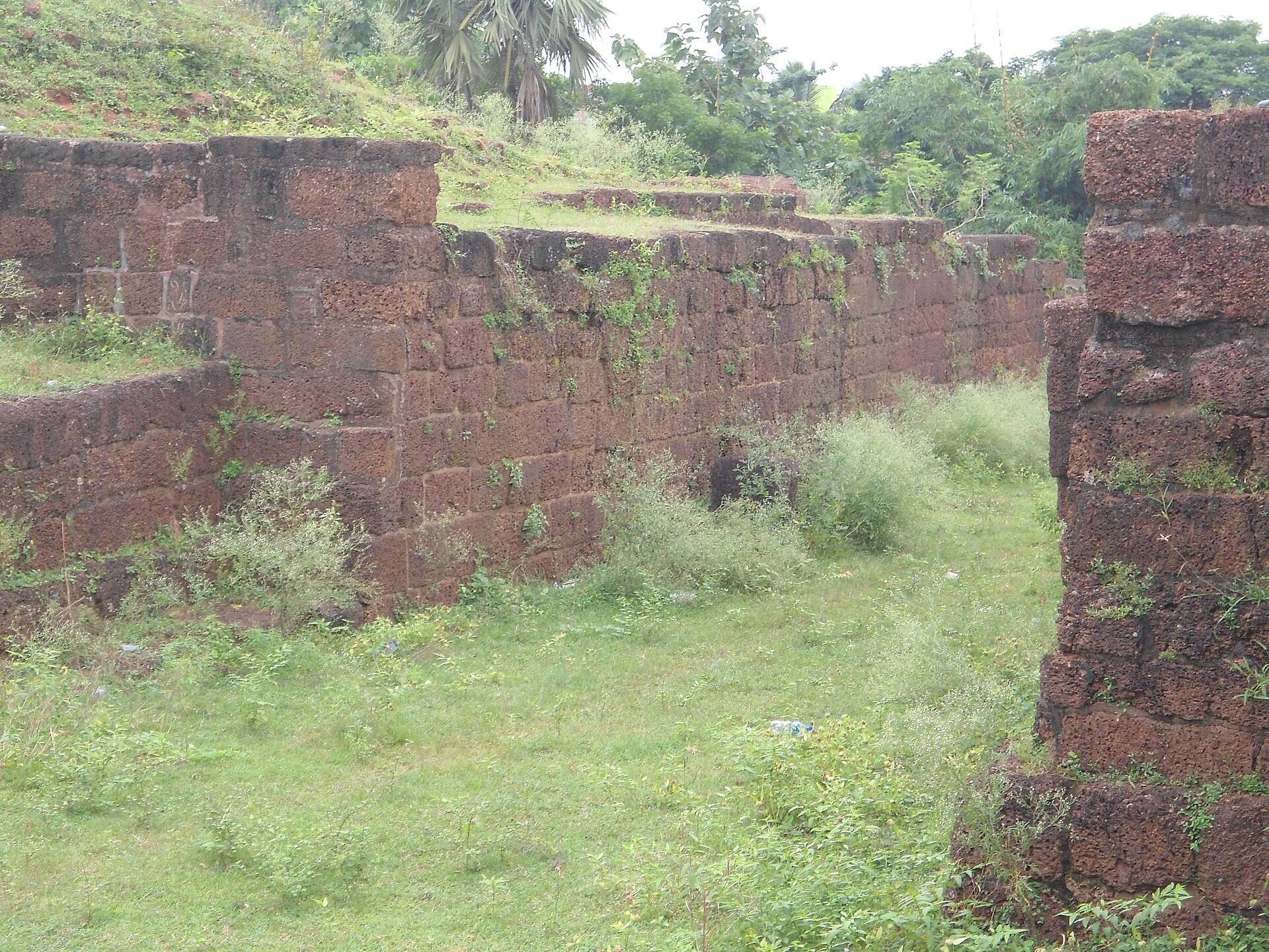
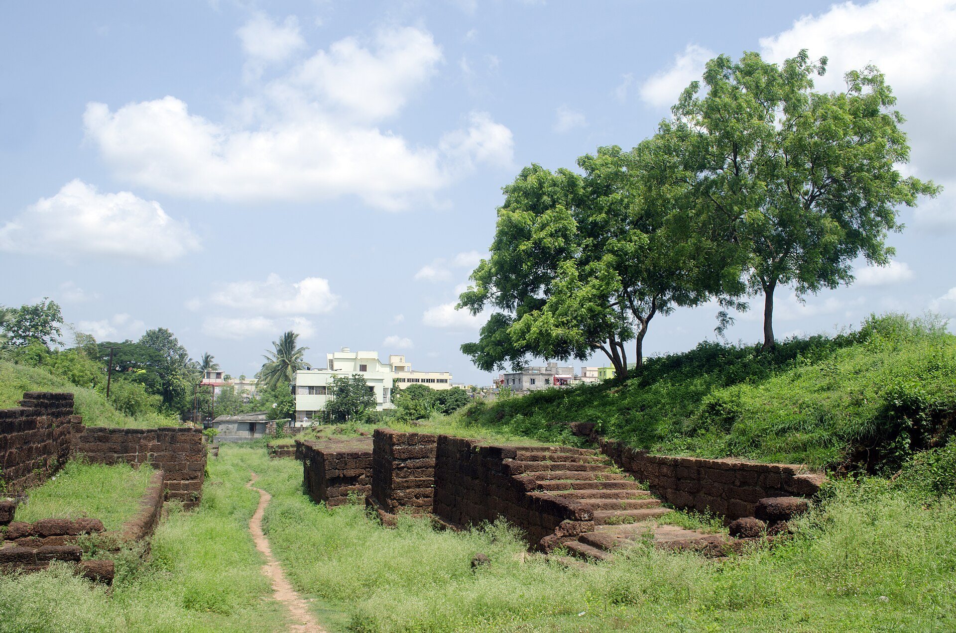
The surviving remains belong to a large quadrangular city whose fortifications measure approximately 1,125 by 1,115 metres along the crest. The plan lies about 10 degrees clockwise from north. Defensive earthworks, ruined gateways, scattered stones, and pillar complexes survive within an area now incorporated into a neighbourhood on Bhubaneswar’s southern outskirts. The principal archaeological areas are the northern gateway of the western wall and the Shola Khamba pillar complex.
City defences
Quadrangular fortifications
Each side of the quadrangular enclosure was formed with a sloping or raised defensive earthwork, known as a glacis, and each glacis was pierced by two gates. The city therefore had eight gateways. Its defensive works are described as the highest known in India for this period, and the fortified area covers a greater surface extent than the contemporary site of Jaugada in Odisha. The northern rampart belongs to the period dated to 510–400 BCE.
Northern gateway
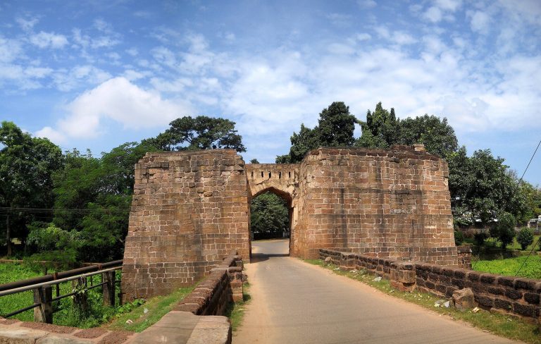
The northern gateway of the western wall survives as ruined masonry and earthwork. It was formerly a large entrance structure containing guardhouses and watchtowers. The gateway forms one of the two principal surviving archaeological areas at Sisupalgarh, although modern construction now approaches the historical remains within a few metres.
Southern moat
Ground-penetrating radar indicated the probable position of a moat along the southern side of the city. The feature formed part of the settlement’s defensive system and complements the surviving ramparts and gateway remains in defining the structure of the ancient enclosure.
Internal and palace areas
Nineteen-column structure
Near the centre of the fortress, Area D contains a structure with 19 columns. Three-dimensional laser scanning recorded the remains, which are disturbed and incomplete. The original form of the building is not fully preserved.
Shola Khamba complex
The Shola Khamba, a name meaning “16 pillars,” is a pillared complex also called Rani Mahal. It was probably part of a royal palace, although that interpretation remains uncertain. Excavations in 2008 revealed additional pillars nearby, but the structure formed by them cannot yet be determined. The complex is one of the two principal archaeological areas at the site, and its remains are threatened by construction close to the historical structures.