Sausenburg Castle: Ancestral Castle of the Hachberg-Sausenberg Margraves
Site at a Glance
- Popularity
- Medium
- Country
- Germany
- Primary era
- Medieval
- Eras represented
- Medieval, Modern
- Civilizations
- Grand Duchy of Baden, Holy Roman Empire
- Site type
- Military
- Remains
- Castle
On this page12 sections
History
Sausenburg Castle is a medieval ruin near Kandern, Germany, built in the 13th century by the Margraves of Hachberg as the ancestral castle of the Hachberg-Sausenberg line. Construction is generally placed between 1232 and 1246, and the castle served as a residence for the margraves from 1246.
Acquisition and foundation
In 1125, the Lords of Kaltenbach granted land to St. Blasien Abbey, a Benedictine monastery in the Black Forest. It is uncertain whether the Sausenberg was part of that grant. The abbey established monastic centers at Bürgeln, Sitzenkirch, and Weitenau. The Zähringers held protective authority over these establishments, which passed to the Margraves of Hachberg after the Zähringer line ended.
The Margraves of Hachberg acquired the Sausenberg from the abbey in 1232. An earlier timber-and-earth fortification, perhaps used as a refuge in wartime, has been proposed, but its existence is uncertain. A document issued at Sausenberg in 1240 may refer to a castle; one from 1246 names a castle explicitly, without establishing whether its tower was already built.
The Hachberg-Sausenberg line
In 1306, the brothers Margrave Henry III and Rudolf I divided their inheritance. Rudolf received the Sausenberg lordship, including the castle and the Breisgau landgraviate, a territory governed by a landgrave. The division established the Hachberg-Sausenberg branch of the House of Baden, named for its castle and territory.
Rudolf and his wife Agnes of Rötteln inherited half of the neighboring Rötteln lordship in 1310 from Agnes’s brother Walter. After Rudolf died in 1313, their son Henry received the remaining half in 1315 from Lüthold II, Agnes’s uncle and the last male member of the Rötteln house. This inheritance probably tripled the territory held by the Sausenberg margraves.
The family had moved its residence to Rötteln, probably before 1317. After Henry’s early death in 1318, his younger brothers Rudolf and Otto governed together for a time. That year Rudolf II pledged the Breisgau landgraviate to the Counts of Freiburg, retaining the landgravial rights around Sausenburg. The territory ruled by his family consequently became known as the Landgraviate of Sausenberg. Otto later acted as regent for the underage Rudolf III and then ruled alongside him. Otto focused on Sausenburg and was buried at Sitzenkirch; apparently, no later margrave lived at the castle.
In 1428, the year his father, Margrave Rudolf III, died, William of Hachberg-Sausenberg began building work at Sausenburg despite the family’s considerable inherited debts. In 1444, the lordship of Badenweiler passed to the margraves. Together with Rötteln and the Landgraviate of Sausenberg, it formed the territories later known as the Markgräflerland, a historical region in southwestern Germany.
Inheritance and the Peasants’ War
When Margrave Philip, the last male heir of the Hachberg-Sausenberg house, died in 1503, an inheritance agreement transferred his territories, including Sausenburg, to Baden’s senior line. Margrave Christoph secured the inheritance despite opposition from Philip’s widow and daughter, with support from the Landschaft, the territorial assembly. Its representatives had taken possession of Sausenburg, Rötteln, and Badenweiler before the widow’s newly appointed bailiff could do so.
During the German Peasants’ War, a widespread rural uprising of 1524–25, peasants occupied Sausenburg and the other margravial castles. The margrave’s lawyers accused them of taking provisions and other goods. Representatives of the Landschaft acknowledged the occupation but said it was meant to protect the castles from other peasant bands, particularly the Black Forest group led by Hans Müller. The peasants viewed the castles both as the margrave’s fortifications and as strongholds of the territory. The occupation began on 14 or 15 May and had probably ended by 30 May, after neighboring bands suffered major defeats and local peasants withdrew from northern Breisgau.
Wartime destruction and later work
Sausenburg changed hands during the Thirty Years’ War, the conflict that lasted from 1618 to 1648. In May 1633, imperial troops under Count Montecuccoli, supported by Margrave Hermann Fortunat of Baden-Rodemachern, captured the castle after taking Badenweiler. Swedish troops under Rhinegrave Otto Ludwig retook it after seizing Rötteln and Badenweiler in June and July. After the Swedish defeat at Nördlingen in September 1634, Swedish forces withdrew from many fortified places. Artillery from evacuated areas was moved to safety at Hochburg and Strasbourg, and imperial garrisons had returned to abandoned positions such as Rötteln by February 1635. In 1638, troops led by Bernhard of Weimar captured Sausenburg after his victory over imperial forces at Rheinfelden.
During the Dutch War, a 1672–78 conflict involving France and its opponents, Sausenburg burned along with the nearby castles of Brombach and Badenweiler. The castle was subsequently abandoned.
Major maintenance work on the tower took place in 1891. From 1960, state building and forestry offices, the heritage authority, and the Schwarzwaldverein secured and renovated the ruins. Three archaeological surveys carried out between 2000 and 2006 recovered numerous pottery finds and confirmed the foundation period inferred from written records.
Remains
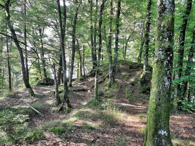
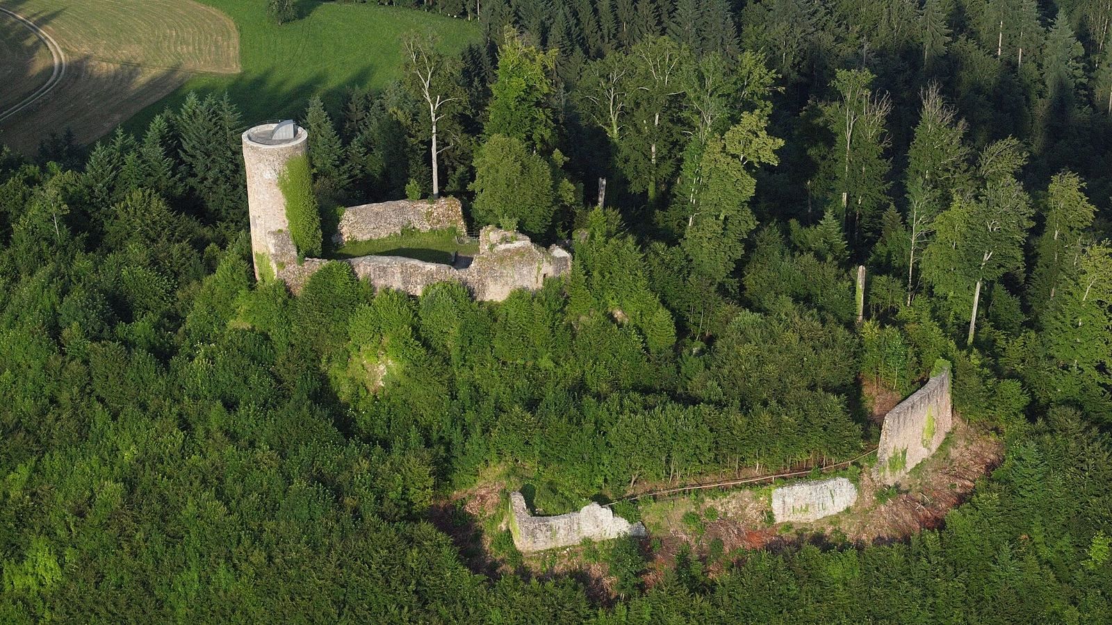
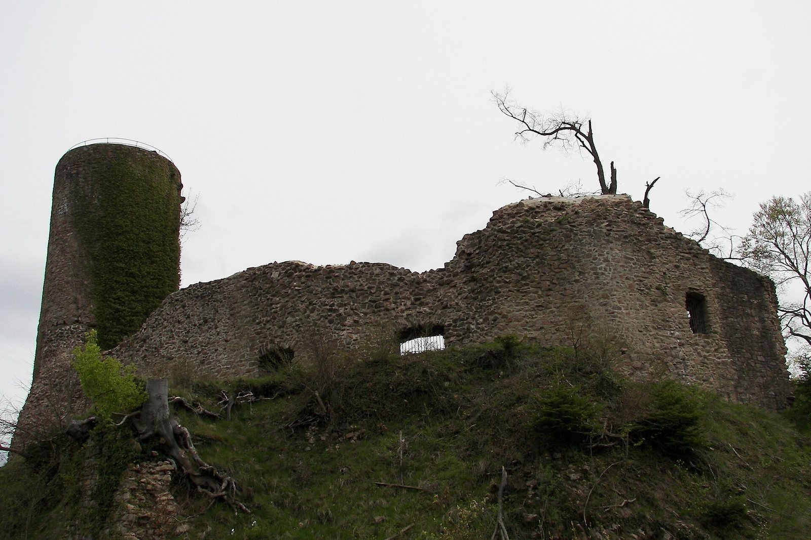
The castle occupies the summit plateau of the 665-metre Sausenberg, a spur of the Hochblauen, about 1.3 kilometres east of Sitzenkirch and 3.3 kilometres northeast of central Kandern. Its inner enclosure covers roughly 30 by 50 metres. A ditch, as much as 17 metres wide, and an outer rampart encircle it; a polygonal wall follows the edge of the plateau. The outer ward adjoins the inner castle to the south and west and has its own ditch and rampart.
Inner castle
Perimeter wall and tower
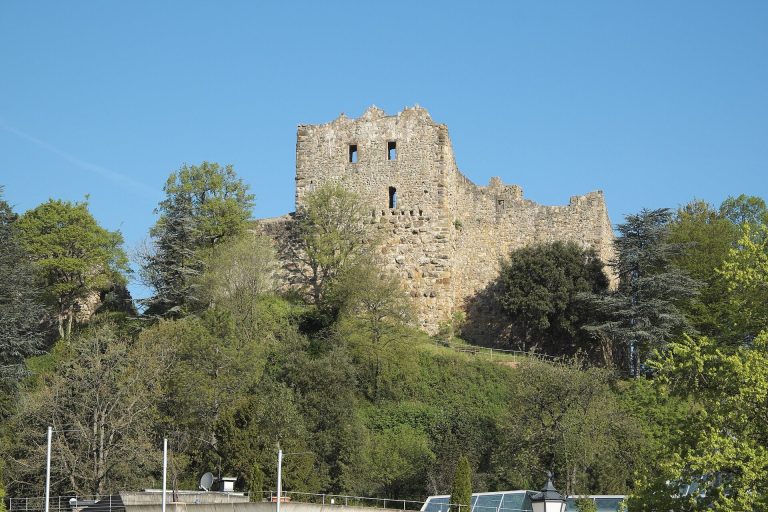
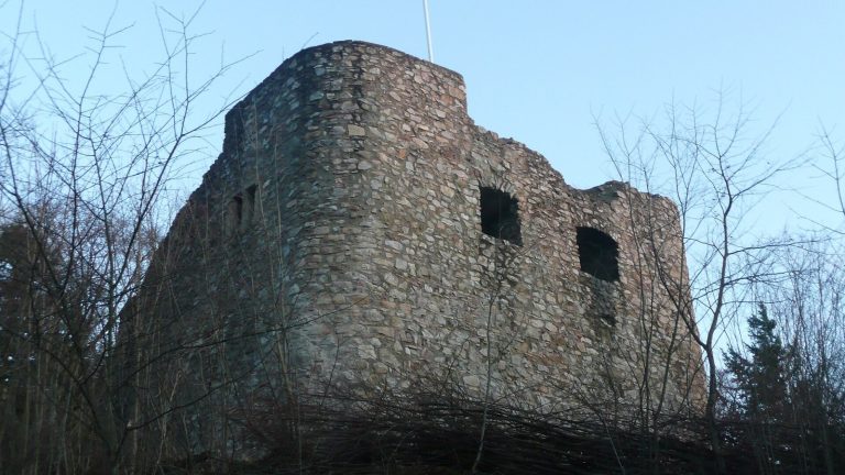
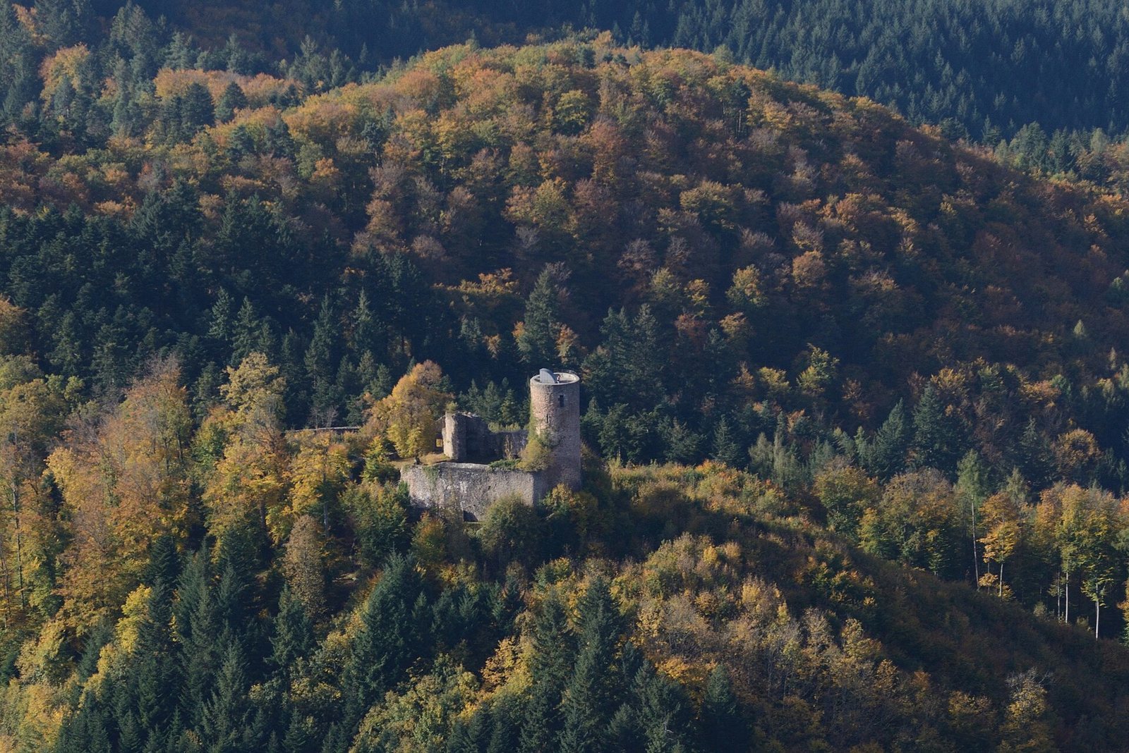
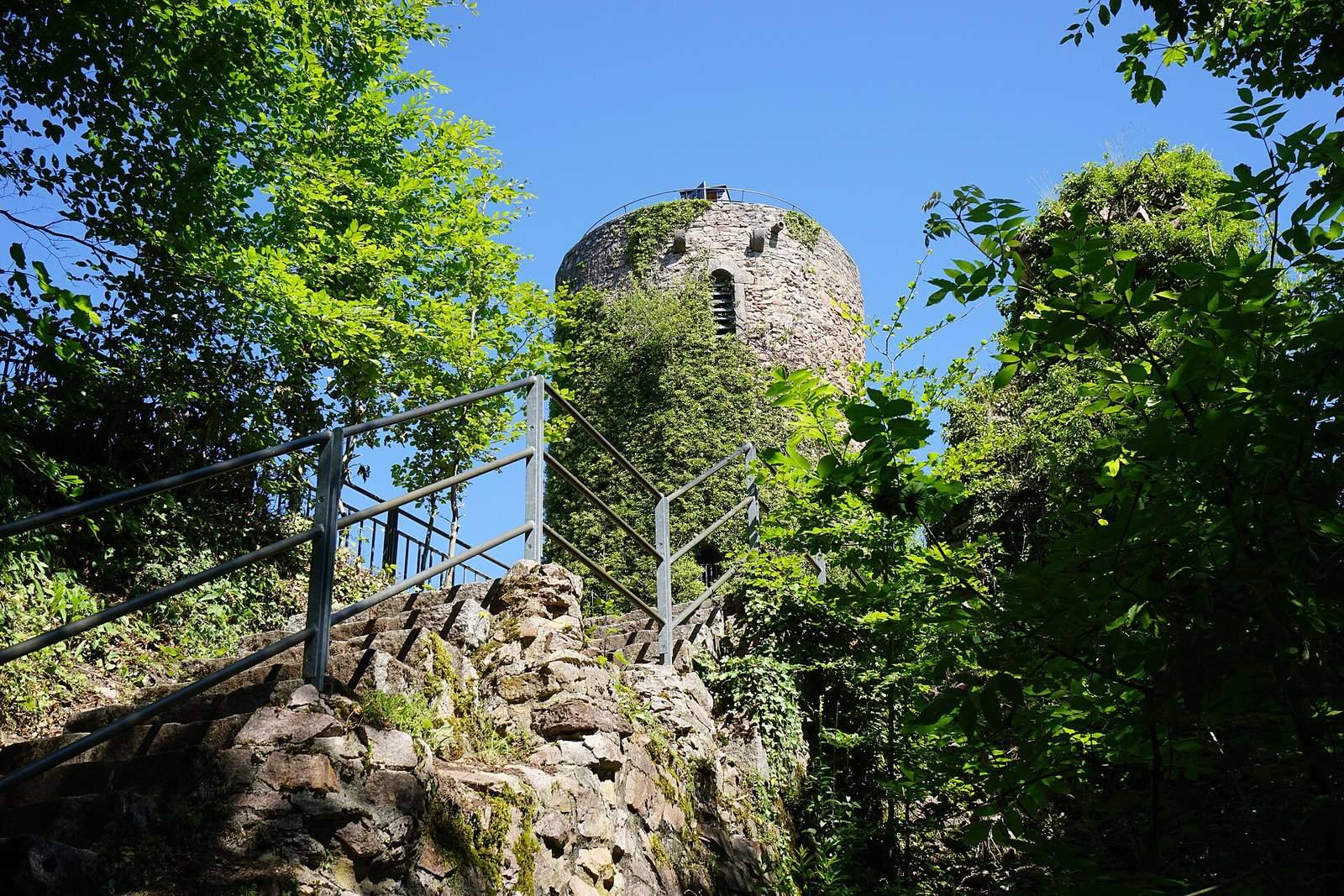
Parts of the polygonal perimeter wall survive, and some sections have been restored. On the north side stands the restored round keep, the castle’s principal defensive tower. It rises about 19 metres and measures nearly 8 metres across, with walls as thick as 2.7 metres. Its medieval entrance is 9 metres above ground level, where the wall is 2.1 metres thick. The tower’s present ground-level entrance was cut through the masonry in 1856. A drawing from 1844 shows it as a tall masonry stump without its uppermost section. It now has a lookout platform.
Residential remains and approach
Within the perimeter wall, the remains of a building at least two storeys high stand in the south. It may have been the principal residential hall, and part of a barrel vault, a curved masonry ceiling, survives there. The original approach to the inner castle came from the south by bridge. Restoration obscured the earlier entrance arrangement; the present staircase was added during a restoration later described as historically unsound. A once-proposed close resemblance between the layout of the residential building and defenses and that of Zähringen Castle is now questioned.
Outer ward and bridge
Outer ward
The outer ward’s defenses included a ditch, a rampart, and an outer wall built of granite rubble. About 18 metres of the wall survive in part. Its entrance is thought to have stood at the western end.
Bridge connection
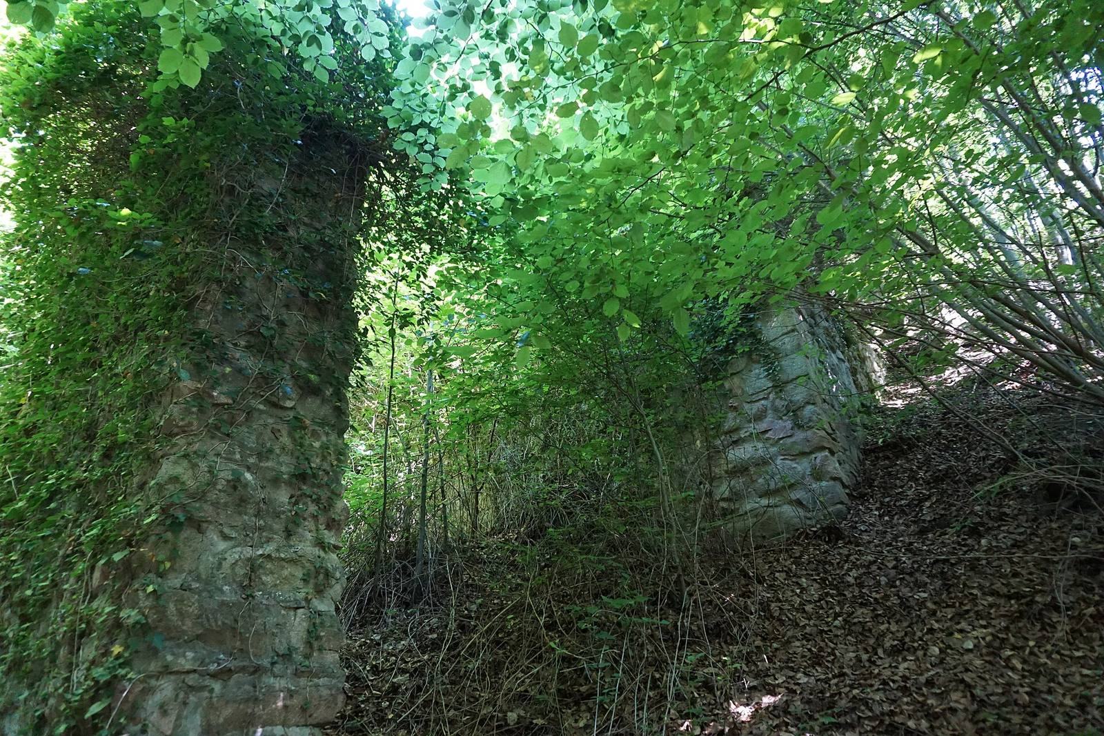
A bridge linked the outer ward to the inner castle. A large masonry pier, several metres high and wide, remains as the support for a drawbridge, along with traces of the bridge’s outer support. A projection of masonry above the pier may have formed the base of a gate tower.