Samuil’s Fortress: Ohrid’s Hilltop Defensive Complex
Site at a Glance
- Country
- North Macedonia
- Primary era
- Medieval
- Eras represented
- Classical, Medieval, Modern
- Civilizations
- Byzantine, First Bulgarian Empire, Kingdom of Macedon, Ottoman, Serbian
- Site type
- Military
- Remains
- Citadel
On this page16 sections
History
Samuil’s Fortress is a hilltop defensive complex in Ohrid, North Macedonia, with fortifications dating to antiquity and surviving walls and towers chiefly of late-medieval form. It protected the ancient city of Lychnidos and later became a seat of power when Samuel made Ohrid the capital of the First Bulgarian Empire, a medieval Bulgarian state that lasted from the seventh century until the Byzantine conquest in 1018.
Ancient Lychnidos
The earliest settlement occupied the old part of Varoš and extended across two hills. Finds from the Hellenistic period, the era from the late fourth to the first century BC that followed Alexander the Great’s conquests, mark early activity there. Lychnidos developed on the higher western hill, while the eastern hill served as its cemetery. Rich burials from the third and second centuries BC have been found there.
Fortifications on the site date to antiquity. A defensive structure from the fourth century BC is probably connected with Philip II of Macedon. The Greek historian Polybius later described an enlargement of the walls. In the late fifth century, a Gothic king failed to capture Lychnidos. Slavic incursions in the late sixth and seventh centuries affected the city, and Slavs eventually took Ohrid and its fortress. Byzantine authority, that of the eastern continuation of the Roman Empire, was later restored.
Bulgarian and Byzantine rule
In the mid-ninth century, the Bulgarian ruler Boris I took Ohrid from the Byzantines. At the end of the tenth century, Samuel made the city the capital of the First Bulgarian Empire and carried out major work on its defenses. The fortress later took his name.
After Samuel’s death, Byzantine emperor Basil II entered Ohrid without resistance. Bulgarian ruler John Vladislav then strengthened the fortress and placed the state treasury there in 1016–17. Ohrid became a capital alongside Prespa. After John Vladislav died in early 1018, Basil II entered the city again, took the treasury to pay his soldiers, and destroyed the fortress.
Medieval contests and rebuilding
During the uprising led by Bulgarian noble George Voiteh in 1072, the commander Petrila took Ohrid. In the winter of 1082–83, the city surrendered to Norman forces. The Normans, a people of Scandinavian origin who had established power in southern Italy and campaigned in the Balkans, did not take the fortress, which remained under a Byzantine garrison. Emperor Alexios I Komnenos strengthened it after taking the throne in 1081, in response to the Norman threat to the empire’s western frontier.
Control later passed among Byzantines, Bulgarians, Normans, Albanians, and Serbs. Serbian ruler Stefan Dušan captured the fortress in 1334, and it remained under Serbian control until the death of Prince Marko. During his rule over the Ohrid region from 1371 to 1385, the local Albanian ruler Andrea Gropa expanded the fortress. Silver coins bearing signs of Gropa’s authority and church inscriptions from 1378 and 1379 connect him with the area.
In the fourteenth century, the fortifications were extensively rebuilt to meet the demands of artillery, large weapons that fire projectiles. The late-medieval form took shape over earlier Byzantine defenses, and most of the surviving towers and walls belong to this period.
Ottoman rule
The Ottomans took Ohrid between 1385 and 1408 without a fight. The fortress thereafter played a smaller part in the city’s history. Ottoman settlement contributed to the town’s growth beyond the defenses. Within the fortress, the northern section served as barracks and the southern section as a residence. Ohrid was for a time an administrative center for Ottoman districts, while people of standing, courtiers, and wealthy residents also lived inside the walls.
The Ottomans abandoned the city walls but kept a garrison in the fortress. Its recorded strength fell from 41 men in 1530 to seven in 1560. Christian residents were required to repair the defenses during the fifteenth and sixteenth centuries. By the late seventeenth century, the fortress was no longer being renewed. Buildings and grounds there included a small mosque, the garrison commander’s house, a granary, and gardens.
An Ottoman residence built in 1808 with materials from a palace belonging to Ismail Pasha burned in 1830. It was associated with Jeladin Bey, the last Ottoman administrator of the fortress.
Excavation, conservation, and recognition
Specialists from Berlin and Belgrade investigated the monumental walls in 1931–32 and identified a fortified high area with a building for a ruler. A major excavation and conservation campaign followed in 2000–03, involving archaeologist Pasko Kuzman. Further work in 2007–08 examined 150 square metres. Repeated repairs and restorations have also renewed much of the battlement.
The fortress lies within the Natural and Cultural Heritage of the Ohrid Region, a UNESCO World Heritage property recognized for cultural and natural importance. Ohrid’s fortress was declared a cultural monument in 1998 and appears on the city’s coat of arms and flag. In 2022, negotiations between North Macedonia and Bulgaria included discussion of whether the fortress’s name should continue to refer to Samuel.
Remains
Setting and overall layout
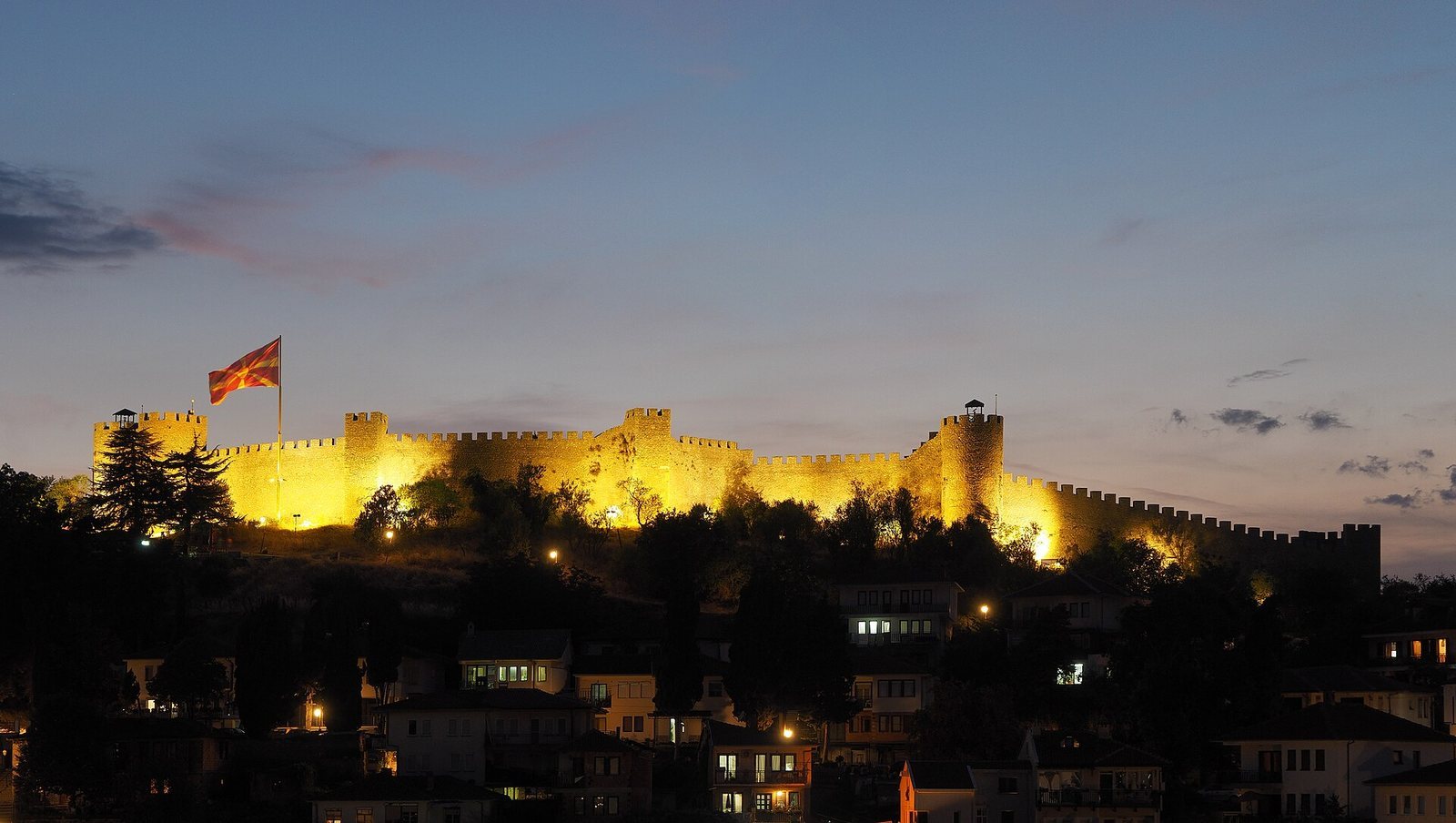
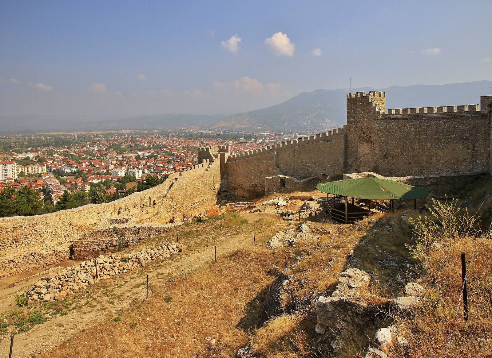
The fortress occupies a hill above Lake Ohrid, at about 780 metres above sea level and roughly 50–100 metres above the lake. The citadel, a fortified stronghold within a larger defensive complex, stands on the larger hill of Gorni Saraj. The city wall extends to the smaller hill of Deboj and encloses the old town. The lake forms a natural barrier on the southwestern side. Woodland covers the northern and western slopes down toward cliffs by the lake; urban development meets the southern side, while part of the eastern slope remains open.
Walls and gates
The wall circuit
The enclosure is roughly triangular, with walls extending around its western, northern, and eastern sides. The circuit is about three kilometres long. Its limestone walls are reported as 1.8 metres thick and between 3 and 16 metres high. The western stretch ran from the hill above the Labino shore northward, then turned northeast and climbed toward the citadel. A stone path now follows part of its former line. The northern wall includes unrestored sections, a bend by a ruined tower, and a restored stretch leading to the Upper Gate. The eastern wall curves south before turning northeast beneath the Deboj ridge toward a former northeastern gate. Its southern continuation passes the Lower Gate and ends at the lake; much of this stretch has been demolished, though the Lower Gate has been restored.
Gates and towers
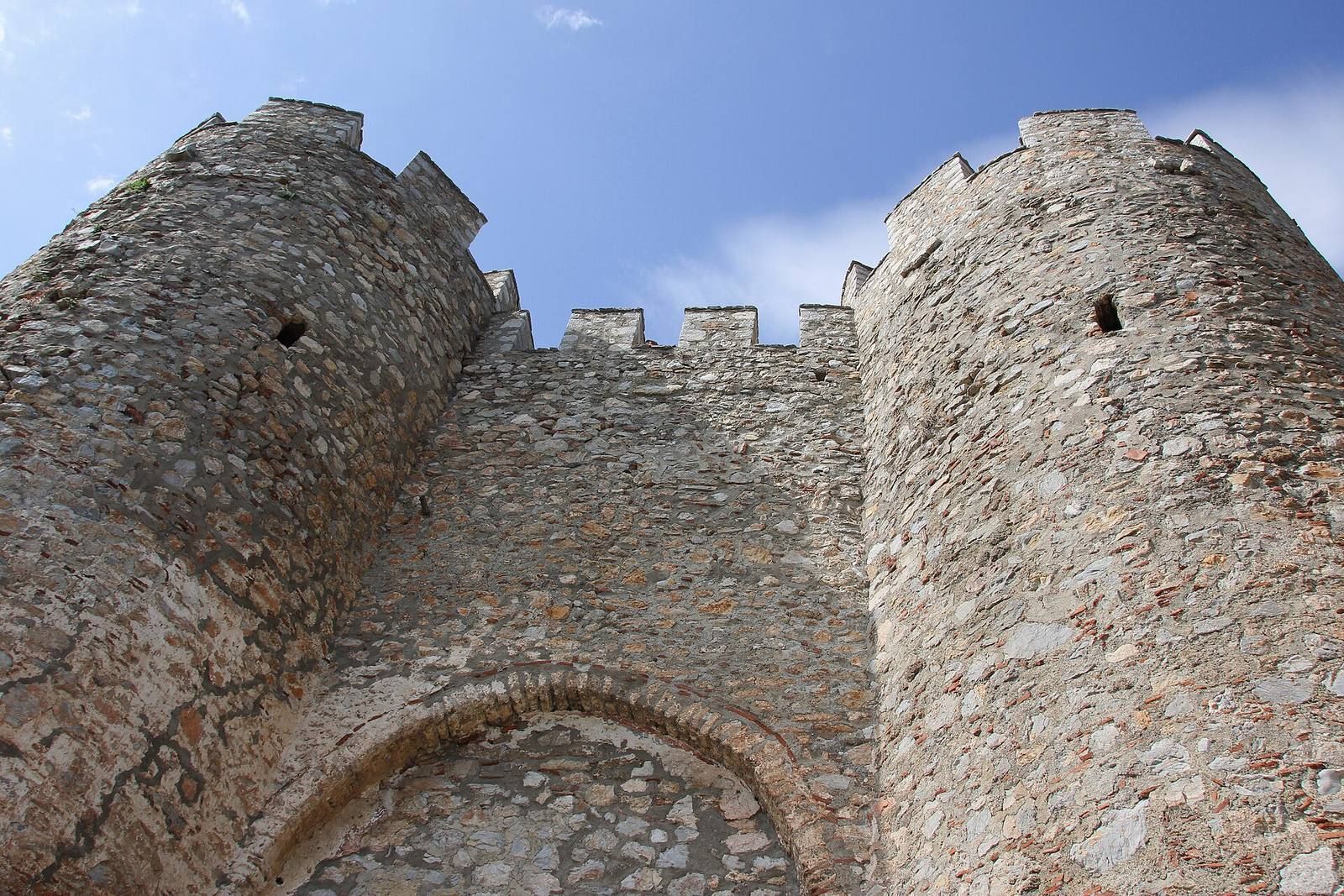
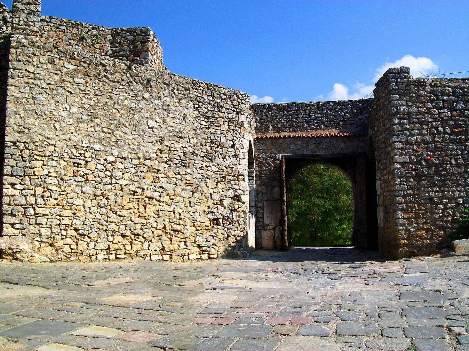
The complex has 18 towers and four gates. The Upper Gate stands on the saddle between Gorni Saraj and Deboj and is now the site’s only entrance. A former northern city gate gave access to the lower residential quarter. The main citadel gate is flanked by two semicircular towers with loopholes, narrow openings for firing weapons. Ancient marble columns were reused as building stone and can be seen at the Upper Gate.
Citadel and internal remains
The citadel
The citadel has a closed U-shaped plan, divided from west to east by a wall into two open areas. Ruins of buildings remain within them. Its walls contain seven square defensive towers and one semicircular tower. Restored sections have parapets with rectangular crenellations, raised alternating sections along a defensive wall.
Residential areas and palace foundations
The fortified area was divided into an upper, southern section, where a ruler’s residence stood, and a lower, northern residential quarter known as Varoš. The later Turkish term Saraj referred to the residence. Foundations of various buildings have been exposed by archaeological work. Investigations in 2021–22 uncovered foundations attributed to the palace whose materials were used for the Ottoman residence.
Archaeological finds
Excavations have produced silver objects, two gold masks, a gold bracelet, a ring, and amber objects. The masks are now in the National Museum in Belgrade. These finds support the view that the site was fortified before the Slavs arrived. A black wine bowl from Megara, found in 2002, bears the Star of Vergina, a symbol associated with ancient Macedonian royal imagery, and dates to the third century BC.
Water reservoir
A few years after the 1931–32 investigations, a water reservoir was built within the fortress to supply Ohrid. Its elevated position suited the city’s water system.