Rodoni Fortress: A Fifteenth-Century Defensive Stronghold in Albania


Site at a Glance
- Rating
- 4.2
- Popularity
- Low
- Country
- Albania
- Primary era
- Medieval
- External website
- Open
- Eras represented
- Medieval
- Civilizations
- Venetian
- Site type
- Military
- Remains
- Castle
On this page7 sections
History
Rodoni Fortress is a fifteenth-century defensive stronghold on Cape Rodon in Albania, built for the League of Lezhë during its resistance to Ottoman expansion. Construction began in 1450 after the League, an alliance of Albanian nobles, resolved to reinforce its fortifications following the First Siege of Krujë. Skanderbeg, the Albanian nobleman and military leader George Kastrioti, chose the cape as the site, and the fortifications were completed around 1452.
Skanderbeg and the Ottoman Wars
During the Ottoman siege of Krujë in 1466, Skanderbeg withdrew to Rodoni Fortress. He, his family, and many other Albanians were subsequently taken from the fortress to Brindisi, a port city in southern Italy, aboard fourteen ships.
Ottoman forces destroyed the fortress in 1467, an event recorded by Marin Barleti, a sixteenth-century Albanian historian. The destruction followed the fortress’s use as a defensive position against the Ottoman Empire, the expanding imperial power that threatened the Albanian alliance.
Venetian Reconstruction and Later Condition
The Republic of Venice rebuilt Rodoni Fortress in 1500. Venice was a major maritime state with territories and interests along the Adriatic coast. The fortress is classified as a cultural monument of Albania and survives today as a ruin.
Remains
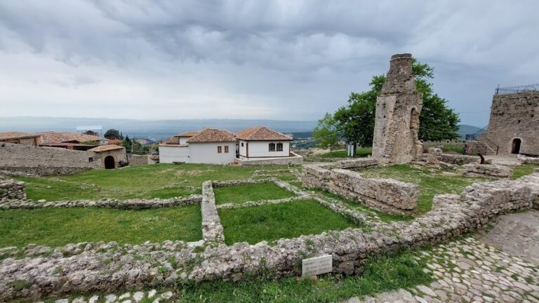
Rodoni Fortress occupied a rocky promontory approximately 1 metre above sea level. Its enclosing walls extended for about 400 metres, creating a substantial defensive perimeter along the cape. Marine erosion has carried part of the fortifications beneath the waters of the Adriatic Sea, while sections of the enclosure and a tower remain visible above ground.
Surviving Fortifications
Enclosing Walls
The outer walls formed the fortress’s main boundary and stretched for approximately 400 metres around the rocky promontory. Visible sections survive on the right-hand side of the site. Other portions have been submerged by marine erosion, leaving the defensive enclosure partly beneath the Adriatic waters.
Intersection Tower
A tower stands at the point where sections of the enclosing walls meet. It is one of the principal visible remains of the ruined fortress and survives as part of the fortification system on the low coastal promontory.