Ringwall Dünsberg: An Iron Age Fortified Settlement in Germany


Site at a Glance
- Rating
- 5
- Popularity
- Very Low
- Country
- Germany
- Primary era
- Iron Age
- Eras represented
- Bronze Age, Iron Age
- Civilizations
- Celtic
- Site type
- Military
- Remains
- Fortified Town
On this page10 sections
History
Ringwall Dünsberg is an Iron Age fortified settlement, or oppidum, in Germany near Wetzlar and Giessen. Associated with the Celtic world of the later Iron Age, it occupied the summit of the 498-metre Dünsberg and developed through several phases from the eighth century BC to the final decades of the first century BC. Its approximately 90-hectare enclosure, three ring walls, iron production, and position above the Lahn valley made it an important settlement in the region, although the identity of its inhabitants remains disputed.
Early fortification and Iron Age development
Evidence from the southern slope points to a fortified settlement in the eighth century BC, during the Late Bronze Age Urnfield culture. The inner ring is associated with this early phase, but the three defensive circuits were probably constructed at different times, and their exact sequence is not yet resolved. The steep slopes of the mountain were also occupied during the Iron Age, extending settlement beyond the summit enclosure.
Intensive settlement began around the middle of the third century BC, at the transition to the Middle La Tene period. The La Tene period was a later Iron Age cultural era covering much of central and western Europe before the Roman period. During the third century BC, Dünsberg entered a prosperous phase connected with the increased extraction, smelting, and working of local iron ore. Houses, workshops, and storage areas formed part of a settlement whose internal arrangement is still only partly understood.
The outer ring wall belongs to the Late La Tene period and has been dated more precisely to about 120 to 100 BC through tree-ring analysis of preserved wood. Occupation continued into the final decades of the first century BC. This was later than at many other Celtic hilltop settlements in southern Germany, where traces of occupation generally disappear during the second half of that century.
The question of the inhabitants
The population of Dünsberg has been connected with the Ubii, an ancient people known from Roman-era historical and archaeological evidence, but this interpretation remains contested. Studies of coins, especially the type known as the “Dancing Little Man,” have been used to suggest that part of the population moved toward the Cologne region during the third decade of the first century BC. Some researchers have therefore interpreted Dünsberg as a central place of the Ubii before Marcus Vipsanius Agrippa, a Roman general and statesman, relocated them to the Rhineland in 19 or 18 BC.
The disappearance of the “Dancing Little Man” series at Dünsberg around 20 BC, followed by related but altered coins in the Rhineland, at military camps on the Lippe, and at Waldgirmes, has been cited in support of this interpretation. The identification is not established. The settlement has features associated with a Celtic site, while Gaius Julius Caesar described the Ubii as Germanic. His geographic classification placed Dünsberg east of the Rhine in Germanic territory, although his writings also describe the Ubii as having fortified settlements.
Decline, Roman-period activity, and later refuge
The end of the oppidum cannot be dated more closely from the archaeological material. Proposals that it was attacked during the campaigns of Drusus in 10 to 9 BC, or destroyed during Roman preparations for the settlement at Waldgirmes, remain unproven. In the Roman period, Dünsberg lost economic and strategic importance. It lay outside the Limes, the Roman frontier system in the German provinces, and became part of the territory of the Chatti, who did not use the mountain.
Renewed occupation began on the eastern slope in the fifth century AD. Weapons from this area indicate the establishment of a refuge fortress, giving the mountain a later defensive role after the end of the Iron Age settlement.
Investigation and protection
Johann Georg Liebknecht first recorded the archaeological monuments of Dünsberg in a work published in 1730, which also mentioned Roman coins from the mountain. Metal finds became increasingly frequent from the eighteenth century onward, attracting further attention. A local estate and forest owner, A. van der Hoop, assembled what was probably the most extensive private collection connected with the site.
Emil Ritterling, director of the Wiesbaden Museum, carried out the first systematic excavations from 1903 to 1906 for the Reich Limes Commission. He cut sections through the ring walls and found a Celtic wooden spring installation at Schulborn. His successor, Eduard Brenner, continued the work in 1912, and Wolfgang Dehn prepared the first comprehensive plan of the complex in 1958.
Construction work brought further archaeological evidence to light during the 1960s and 1970s. In 1974, Fritz-Rudolf Herrmann of the Hessian State Office for Monument Protection investigated part of the summit during construction of a television tower. Frankfurt University of Applied Sciences surveyed the ring walls in 1984, after which the Hessian Parliament approved special funding for research. Annual excavations by the Roman-Germanic Commission under Karl F. Rittershofer followed from 1999 to 2004. In early 2005, the association Archaeology in the Gleiberger Land, also known as the Dünsberg Association, was founded to continue research and stewardship.
The ring-wall complex and oppidum are archaeological monuments protected under the Hessian Monument Protection Act. Excavation and deliberate collection of finds require official permission, while chance discoveries must be reported to the monument authorities. Some objects from the site are displayed at the KeltenKeller Museum in Biebertal-Rodheim.
Remains
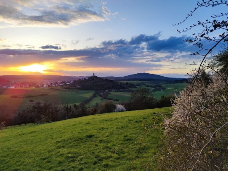
Ringwall Dünsberg occupies the mountain summit above the Lahn valley, about 11 kilometres northeast of Wetzlar and approximately 9 kilometres northwest of Giessen. Its position provided access toward the settlement-favourable Wetterau to the north, while the steep slopes contributed to the defensive setting. Three concentric ring walls enclose the summit and surrounding settlement area. In places, the walls survive to roughly 10 metres high, and surveys have identified 14 gate passages distributed among the three circuits.
Ring walls and settlement terraces
The early inner fortification was a substantial timber-and-earth structure, identified through characteristic traces of burning. The middle ring may belong to the third century BC, although its date remains uncertain. The outer circuit, dated to about 120 to 100 BC, was built as a post-slot wall, a timber-reinforced rampart in which upright posts were set into prepared slots or trenches and incorporated into an earthen or stone defensive structure. An external pointed ditch strengthened this wall, while several smaller walls extended outward from it for purposes that remain unknown.
Within the enclosure, builders created broad terraces or platform-like surfaces on the steep slopes. Excavation has examined only limited areas, so the settlement’s internal layout is incompletely known. Investigated buildings included timber houses coated with clay, craft-working areas, and storage pits. Local iron ore was smelted and processed within the settlement, linking the physical remains to the period of intensified production during the third century BC.
Spring installations
Water was obtained from natural springs enclosed by wooden basins. Two installations, at Grinchesweiher and Schulborn, were excavated by Emil Ritterling. The Schulborn installation was examined again in 2003 with modern methods. Its timbers indicate use during the fourth or third century BC, followed by a repair in the late second century BC and a final repair during the first century BC.
Gate 4 and evidence of conflict
Recent excavation has concentrated on Gate 4 on the southern slope and the area around it. Partly undisturbed deposits in front of the gate contained horse remains, wagon components, and gold and silver coins. These materials could be connected with a military conflict, but the archaeological observations favour interpreting the place as a ritual site associated with horse burial. Because the soil is acidic, only horse teeth survived among the animal remains.
Close to Gate 4, a section of the fortification had been provisionally repaired. Numerous Roman weapons, including sling bullets and projectile bolts, point to fighting involving Roman forces during the Augustan period. The opposing forces, the Roman units, and the precise date are unknown. The nearby Dorlar camp or the settlement at Waldgirmes may belong to the same context.
Small finds and archaeological context
Objects associated with Dünsberg include Celtic glass beads, bronze fibulae, a pair of fibulae joined by a chain, and part of an iron Celtic horse bit decorated with red enamel inlays. A fibula form sold as the “Dünsberg type” has not been confirmed in regular excavation.
Most known objects came from illegal metal-detector collecting, which means that their original layers and relationships cannot be established. The excavated gates, walls, springs, buildings, craft areas, and storage pits therefore remain especially important for reconstructing the settlement’s construction, economy, ritual activity, and changing defensive use.