Pundranagar: An Ancient Administrative and Cultural Center in Bangladesh
Site at a Glance
- Popularity
- Medium
- Country
- Bangladesh
- Primary era
- Medieval
- Eras represented
- Iron Age, Classical, Medieval, Early Modern, Modern
- Civilizations
- Bengal Sultanate, Gupta, Mauryan, Mughal
- Site type
- Settlement
- Remains
- City
On this page22 sections
History
Pundranagar, identified with Mahasthan about 10 kilometres northeast of Bogra in Bangladesh, was a major city of ancient Bengal. It served as an administrative, religious, and cultural center in the territory known as Pundravardhana Bhukti, an administrative region, and was prominent from the 3rd century BC through the 12th century AD. Its excavated occupation layers extend from the city’s earliest phases to its abandonment in the 13th century.
Early city and Mauryan connections
The name Pundra has several proposed origins. It may refer to a disease called Pandu, a variety of sugarcane, or the Pundra people, whom later Vedic texts placed east of the Sadanira River. The name Pundravardhana appears in the 1st-century-AD text Ashokadana.
A third-century-BC inscription from Mahasthan is identified as Bengal’s earliest engraved inscription. Found in 1931, it addresses a high-ranking official, a Mahamatra, and orders the distribution of grain and money from state stores to people struck by famine or other natural disasters. Its appeal for aid has led to the suggestion that the order may have been issued by Ashoka, the Mauryan emperor. The city’s early Buddhist connections are also associated with the Mauryan period.
Post-Mauryan and Gupta periods
After Mauryan rule ended, the city continued to thrive. Terracotta figurines from the Shunga period point to ongoing activity, while a gold coin bearing the image of the Kushana ruler Kanishka suggests a connection with the Kushanas. The coin alone does not establish that they ruled the city.
From the 4th century, Bengal appears to have come under Gupta control, and Pundranagar became a stronghold on the empire’s eastern frontier. A copper plate of Buddha Gupta indicates that the city served as the capital of northern Bengal and remained within the Gupta Empire until the end of the 5th century.
Early medieval city
In the early 7th century, Shashanka established independent rule in Gauda, a historical region of Bengal, and persecuted Buddhists. Pundranagar’s strong Buddhist influence may have weakened during this period. The Chinese Buddhist monk Xuanzang visited between 638 and 645. He described Buddhist and Brahmanical religious establishments, traditions associated with the Vedas, as well as numerous Jain ascetics. He also reported a large stupa, a Buddhist monument often associated with relics, near the city. The site he described has been tentatively identified with Vasu-Vihara, a Buddhist educational institution. Xuanzang’s account connected the stupa with Ashoka and a bodily relic of the Buddha, and related a tradition that the Buddha had visited and preached there for three months.
Under Gopala, founder and ruler of the Pala dynasty, Pundranagar again became the seat of an independent government. His son Dharmapala moved the capital to Magadha, an ancient region in eastern India, but the city continued to prosper under the Palas and the later Sena rulers. A 6th-century compendium by Varahamihira lists Paundra among six eastern janapadas, or territorial communities. The Arthashastra, an ancient treatise on statecraft, describes Pundra silk as smooth as emerald and comparable to Magadhi silk. In the 12th century, the poet Sandhyakar Nandi portrayed Pundranagar as prosperous in his Ramacharita, calling it the “crown jewel of Varenda,” a historical region of northern Bengal.
River route, decline, and archaeological investigation
The city stood on the Karatoya, part of a north–south river route linking the Bay of Bengal with Nepal and Tibet. The military commander Ikhtiyar Uddin Muhammad bin Bakhtiyar Khilji used the Teesta–Karatoya navigation route during an attempt to conquer Tibet in 1205–06. A 16th-century Persian account also describes an army sailing down the river. Pundranagar’s prosperity continued until Muslim powers arrived in the early 13th century. Bengal’s sultans established their capital in the Gauda region, after which the city declined and was abandoned. Settlement within the old enclosure and later mosque construction nevertheless show that the site continued to be used and reused.
Archaeological exploration began with Alexander Cunningham’s visit in 1879, when dense vegetation and extensive brick remains made investigation difficult. Later work took place under K. N. Dixit during British rule and N. Ahmed during the Pakistan period. French investigations led by Jean-François Salle began in 1991, followed by Bangladesh–France excavations from 1993. By 2003, the joint missions had identified eighteen construction layers. Their findings indicate occupation from the earliest levels until abandonment in the 13th century.
Remains
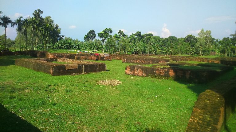
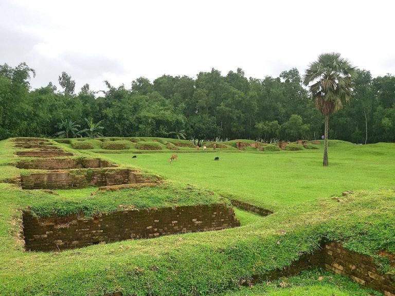
The remains extend across a fortified rectangular enclosure and surrounding mounds. The city’s built landscape included walls and gates, residences, assembly halls, temples, Buddhist monasteries, shops, and ponds. Descriptions also refer to markets, a garrison, a state secretariat, and residences for nobles and merchants. Suburban areas included homes for laborers and middle-class residents, along with temples and monasteries.
Fortified enclosure and surrounding settlement
Ramparts, moat, and river
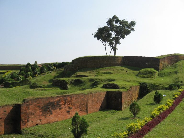
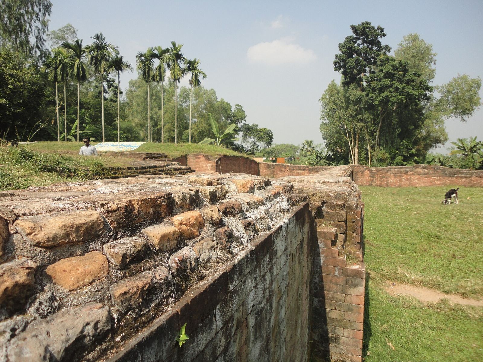
The fortified city covered about 22,500,000 square feet. Its central enclosure measured approximately 1.523 kilometres from north to south and 1.371 kilometres from east to west, with high, broad ramparts on all sides. A deep moat ran along the south and west and part of the north. The eastern rampart and part of the northern one overlooked the Karatoya River. The surrounding land lies about 36 metres above sea level, and the elevated position is believed to have influenced the choice of site.
The Karatoya once flowed as a mighty river along the enclosure’s eastern side, but is now a small stream. Ancient literature, including the Mahabharata, describes it as sacred, while the 12th- or 13th-century Sanskrit work Karatoya Mahatyam compares its scale to the sea. A devastating flood in 1787 shifted the Teesta’s channel toward the Brahmaputra and greatly reduced the Karatoya.
Gates and suburbs
Four named gateways mark the enclosure’s sides: Kata Duar to the north, Dorab Shah Toran to the east, Burir Fatak to the south, and Tamra Dawaza to the west. Mounds and ruins beyond the fortifications indicate suburbs. Xuanzang estimated the city’s circumference at about five miles, or 30 li, a traditional Chinese unit of distance; Cunningham later estimated it at about eight miles.
Xuanzang also described ponds, orchards, flowers, and pleasure gardens. Thirty-one other sites and mounds have been identified around Mahasthan, adding to the evidence for settlement beyond the central enclosure.
Archaeological occupation sequence
Pre-Mauryan remains
The earliest identified period yielded Northern Black Polished Ware, a distinctive ancient pottery, along with rouletted ware, pottery decorated with impressed patterns, black-and-red pottery, and black polished pots. Other finds include stone blocks, mud houses with mud floors, cooking furnaces, and pillar pits. This occupation may represent the earliest settlement on the Pleistocene landscape of the Barind Tract, an elevated region of northwestern Bangladesh.
Mauryan period
Remains assigned to the Mauryan period include broken tiles and bricks, pottery fragments, ring stones, bronze mirrors and lamps, dice-cast coins, terracotta plaques, and stone beads. A limestone tablet bearing six lines in Ashokan Brahmi, an ancient Indian writing system, was found at Mahasthan.
Shunga and Kushana periods
Layers attributed to the Shunga and Kushana eras contain substantial brick structures, brick-strewn floors, and pillar pits. Finds include Shunga-style terracotta plaques, semiprecious stones and beads, and temple pinnacles.
Kushana–Gupta period
This period has yielded broken clay pots, figurative terracotta plaques, decorated cooking pots and dishes, semiprecious-stone and glass beads, and terracotta seals. Its architectural remains are fewer than those in the layers immediately above and below it.
Gupta and late Gupta periods
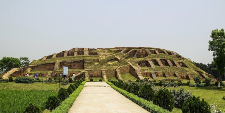
Buildings from this phase include brick houses, floors, and streets. Finds include terracotta plaques in a characteristic style, seals, beads of terracotta, glass, and semiprecious stone, terracotta balls, copper and iron objects, and stamped pottery. A massive brick temple called Govinda Bhita stands close to the fortified city.
Pala–Sena period
Architectural remains from this period occur at several sites within the city, while Buddhist monasteries were also built outside the enclosure.
Muslim period
Chinese celadon, a glazed ceramic commonly green in color, and other glazed wares are associated with this period, alongside evidence of continued occupation and building within the old city.
Mounds, religious buildings, and later structures
Mounds and water features
Several named mounds and structures within the fortifications carry local associations. Jiat Kunda is a well linked with life-giving power, and Mankalir Dhap is a place consecrated to Mankali, a local deity. Parasuramer Basgriha is identified as the palace of a king called Parasuram, while Bairagir Bhita is described as a palace belonging to a female religious recluse. Khodar Pathar Bhita is associated with a stone believed to have been bestowed by God, and Munir Ghon is a bastion. Finds have been recovered from these mounds and from Jiat Kunda.
Excavated sites on the eastern side of the city include Khodar Pathar Bhita, Mankalir Kunda, the mound identified as Parasuram’s palace, and Bairagir Bhita. Their remains belong to the range of structures associated with the Pala–Sena phase.
Temple and monastery remains
Govinda Bhita is a large brick temple near the fortified city. Buddhist establishments also formed part of the landscape beyond the enclosure during the Pala–Sena period.
Mosques
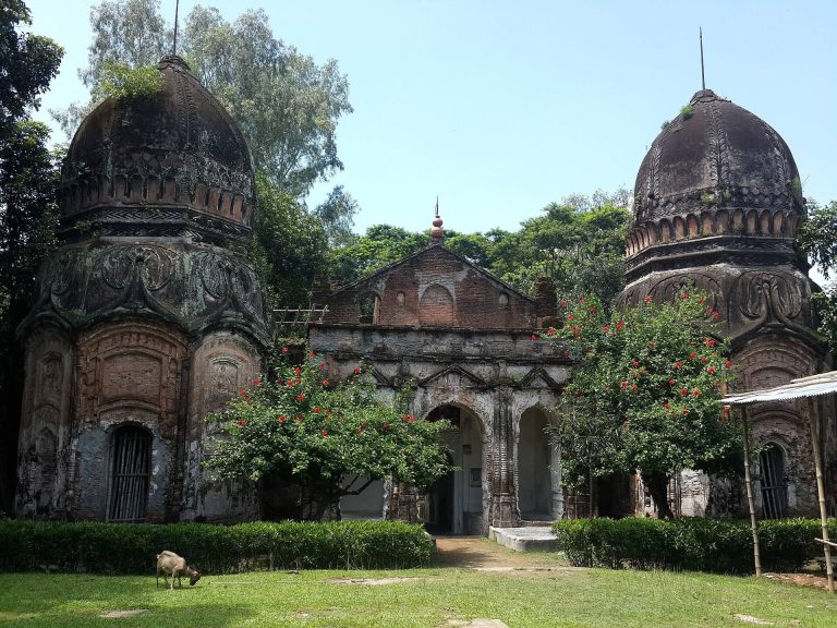
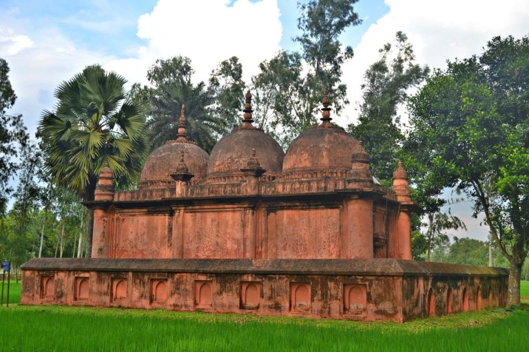
Two mosques represent later building within the old city: a 15-domed mosque from the Sultanate period and a single-domed mosque built by the Mughal emperor Farrukh Siyar.
Inscription and domestic remains
A dwelling excavated in 1907 and 1961 has a plan assigned to the late 18th or early 19th century. A deeper trench exposed fragmentary building phases thought to date to the 8th century. Scientific dating of a northern building investigated during a later excavation phase yielded one result in the 1st century AD and another in the 2nd century AD.