Ponte di Cecco: A Roman Republican Bridge in Ascoli Piceno
Site at a Glance
- Country
- Italy
- Primary era
- Classical
- Eras represented
- Classical, Medieval
- Civilizations
- Papal States, Roman
- Site type
- Infrastructure
- Remains
- Bridge
On this page5 sections
History
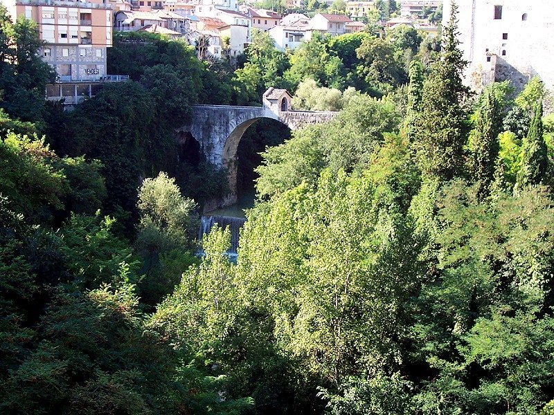
Ponte di Cecco is a Roman bridge spanning the Castellano in Ascoli Piceno, Italy, and dates to the Roman Republican period, approximately 500–30 BCE. The Roman Republic was Rome’s system of government before imperial rule. The bridge is considered the oldest in Ascoli Piceno.
Roman date and road
For a long time, the bridge was thought to be medieval. The architect and archaeologist Giambattista Carducci argued for a Roman Republican date, noting similarities between its construction and other Roman bridges along the Via Salaria, an ancient road linking Rome with the Adriatic coast. Ponte di Cecco may have marked the road’s eastern exit as it crossed ancient Asculum, now Ascoli Piceno.
Medieval name traditions
A popular story links the bridge’s name to Cecco d’Ascoli, a local poet and astrologer who lived from 1269 to 1327. In the tale, the Devil built the bridge in one night using Cecco’s plans. Another attribution connects the name to Cecco Aprutino, a medieval master builder said to have rebuilt the bridge in 1349 for Galeotto I Malatesta, a 14th-century Italian lord.
Destruction and reconstruction
On 16 June 1944, German troops destroyed Ponte di Cecco and nearby Ponte Maggiore as they retreated from the city, intending to prevent Allied forces from advancing north. In the 1960s, the bridge was reconstructed from original stones recovered from the stream. The rebuilt structure follows the form of the bridge that stood before its destruction.
Remains
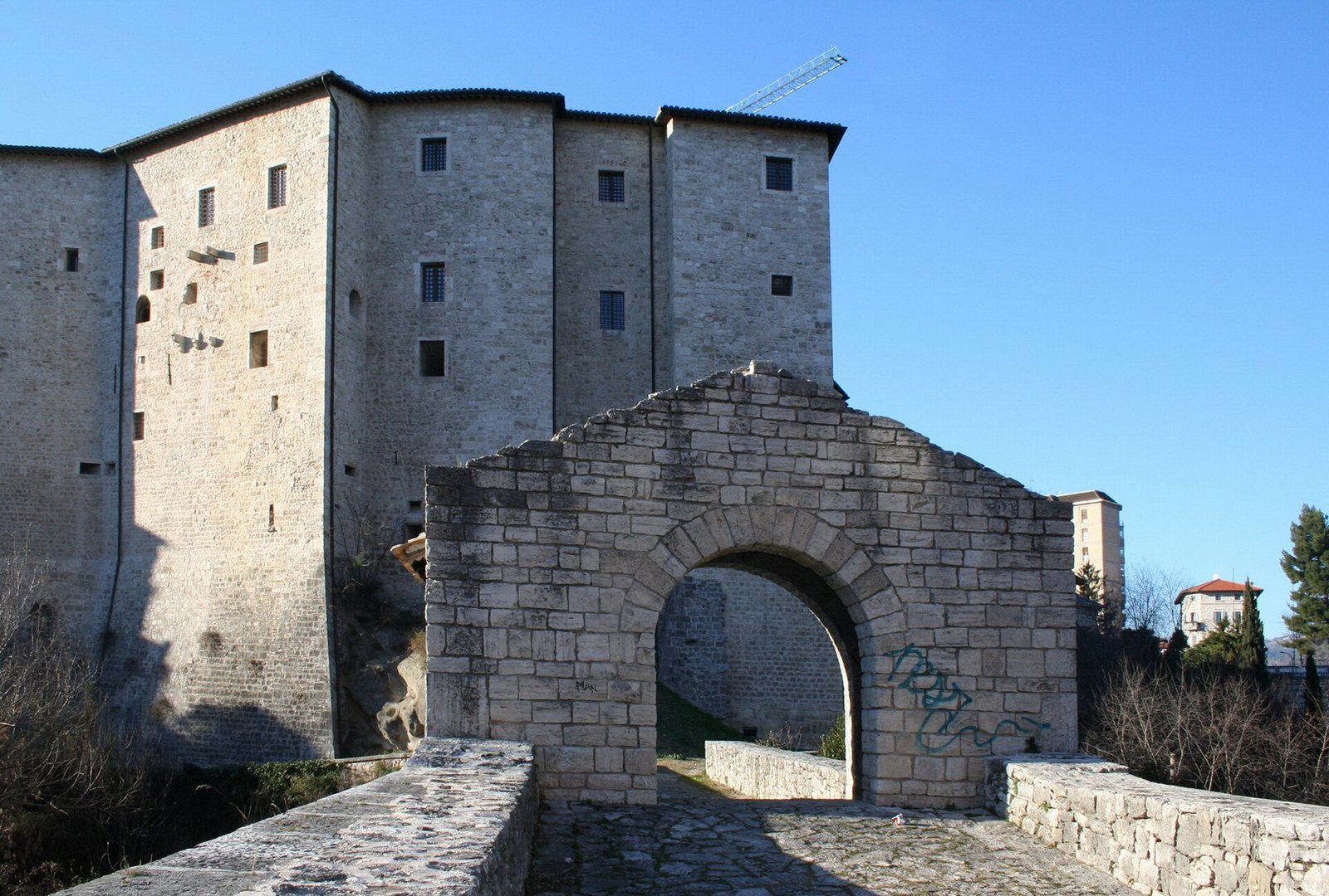
The pedestrian bridge crosses the Castellano in southern Ascoli Piceno, connecting the Porta Maggiore district with Forte Malatesta, a medieval fortress used for the city’s defense. The river flows north into the city and joins the Tronto in the center. The bridge is about 25 m long and 6 m wide, with the roadway roughly 25 m above the water. Two travertine arches carry the crossing: the central span is about 14.5 m wide, and the smaller side span about 7.2 m. Its stone blocks are squared and laid in smooth, regular courses, with vertical joints set above the solid centers of the blocks below. A small stone structure at the bridge’s center, known as the tollhouse, marked the southern entrance to the city and housed the fittings for its entrance gate. The route passes through it toward Forte Malatesta, and the bridge remains in use as a pedestrian crossing.