Necropolis of Sovana: Etruscan Tombs around Ancient Suana
Site at a Glance
- Popularity
- Medium
- Country
- Italy
- Primary era
- Classical
- Eras represented
- Bronze Age, Iron Age, Classical, Medieval
- Civilizations
- Etruscan, Lombard, Roman
- Site type
- City
On this page23 sections
History
The Necropolis of Sovana is an Etruscan burial landscape around the ancient settlement of Suana in Italy. Its tombs expanded from the early Hellenistic period, while settlement in the area reaches much further back. The Etruscans, an ancient people of central Italy whose cities flourished before and during Rome’s expansion, reoccupied Sovana at the end of the eighth century BC.
Early settlement and the Etruscan city
Human presence in the area dates to at least the Upper Paleolithic. A village occupied the western slope during the Late Bronze Age, but the area appears to have been deserted in the early Iron Age, along with much of the surrounding district. One explanation is that people moved to the developing center at Vulci. Sovana was settled again at the end of the eighth century BC, during the Orientalizing period, an Etruscan cultural phase shaped by strong eastern Mediterranean connections.
The settlement stood where routes met in the Fiora valley. One ran north and south between Vulci and the centers of Orvieto and Chiusi; another connected Vetulonia with inland southern Etruria and the Faliscan territory, home of the ancient Faliscans. The name Suana is linked to the modern name Sovana. Ancient writers also referred to the place: Claudius Ptolemy recorded a Greek form of its name, and Pliny the Elder called its people the Suanenses. The Etruscan name is unknown. A proposed form, Sveama, rested on an inscription reading later revised by linguist Helmut Rix in 1991, weakening the proposed identification.
During the Archaic period, which followed the Orientalizing phase, Sovana may have had considerable independence from Vulci. One argument for this depends on a disputed reading of an inscription at Vulci’s François Tomb. The city experienced the wider downturn affecting centers in the Fiora valley at the end of the sixth century BC, yet remained prosperous enough for Attic red-figure pottery to reach it in the early fifth century BC.
A broader recovery in the fourth century BC brought construction of the city walls. Rock-cut Etruscan tombs spread from the early Hellenistic period, a phase extending from the later fourth to the first century BC. Interpretations of the changing tomb types connect the large temple tombs around the fourth-to-third-century transition with a small elite linked culturally to Vulci. The rapid growth of more modest cube tombs after the first quarter of the third century BC has been associated with the emergence of a wider intermediate social group.
Rome’s victory over Vulci in 280 BC does not appear to have damaged Sovana. Instead, the city reached a high point in the second half of the third century BC. One proposal is that it became a small, formally independent state loyal to Rome, perhaps taking over territory formerly controlled by Vulci. Names preserved on tomb fronts differ from those associated with Vulci and resemble names found farther north in Etruria and around Viterbo.
Most funerary assemblages and votive offerings from the town and surrounding area belong to the third and second centuries BC. Public development included new terraces and a planned settlement on the western plateau. In the second century BC, a cemetery was laid out according to a unified plan along the southern bank of the Folonia. A Rhodian amphora, a two-handled jar for transporting goods, found in one grave points to continuing trade in the first half of that century.
Roman-period Sovana
Hardship in the late second and early first centuries BC coincided with the Social War, the 91–88 BC conflict between Rome and its Italian allies, and with Roman civil wars. The settlement continued, and substantial building took place late in the first century BC. A black-glazed plate from a tomb at San Sebastiano carries Sovana’s earliest known Latin inscription, dating to the first century BC.
In the late Republican and early imperial periods, large villas spread across the plateau around the city. At La Biagiola, a Roman villa with productive installations occupied ground where an Etruscan settlement had existed from the fifth century BC. Another villa complex stood near the Fiora. African red-slip pottery from disturbed settlement layers shows that Sovana remained connected to commercial networks in the second and third centuries AD.
Lombard rule and the early Middle Ages
From the sixth century AD, as diocesan boundaries took shape, Sovana became more closely oriented toward the Lombard world. The Lombards were a Germanic people who established rule in parts of Italy during the early Middle Ages. Sovana became the seat of a Lombard gastaldate, an administrative district led by an official with civil and military duties, and held a military role on the frontier facing Byzantine territories, the eastern continuation of the Roman Empire.
A large cemetery developed over earlier Etruscan and Roman remains. Excavations at San Mamiliano in 2004 clarified phases in the church’s construction and uncovered numerous burials beneath it. The site’s long sequence of settlement and use thus continued into the early Middle Ages.
Rediscovery and archaeological work
Antiquarians recognized ancient Suana in the eighteenth century, helped by the continuity between its Latin and modern names and by three Latin inscriptions known since the Renaissance. Interest in the remains was followed by extensive clandestine digging in the early nineteenth century. A local physician identified the Cavone votive deposit in 1827; in 1833, a local resident sold Etruscan vessels and Attic-Chalcidian black-figure vases, decorated with dark figures, to galleries in Florence. Samuel James Ainsley’s drawings and travel writing, published in 1843, drew scholarly attention to the rock-cut tombs, and George Dennis later investigated the site.
The Colombaria Society of Florence excavated in three campaigns from 1859 to 1861. After surveying the area, its members opened more than 150 tombs, most of them already looted, and made brief records. Professional excavators Boccanera and Casagrande worked at Sovana in 1893. Riccardo Mancinelli excavated in the settlement and northeast of the cathedral in 1895, where an ancient building yielded many architectural terracottas from the middle Hellenistic period. Francesco Merlini’s campaigns in 1901, 1904, and 1912 uncovered an altar and a repository for offerings at the Cavone outlet; most of the terracotta offerings were later destroyed.
Gino Rosi published the temple tomb now called Ildebranda in 1925, naming it for Ildebrando of Sovana, later Pope Gregory VII. Ranuccio Bianchi Bandinelli’s 1929 study became an important reference for the site. The University of Pisa excavated in the necropolis from 1962 to 1964, and the Tomba della Sirena was explored in 1970. From 1980 to 1994, excavation and restoration work directed by Adriano Maggiani covered parts of the necropolis and historic center, including the cube tombs beside the Folonia.
From 1989 to 1999, the University of Milan excavated around the cathedral, documenting settlement phases from the Late Bronze Age through the Archaic period. Archaeological work connected with the creation of the park identified the San Sebastiano chamber tombs in 1996–1997. Preventive excavation investigated the western plateau’s Pyrgos area in 2001. In 2004, excavations uncovered the Tomb of the Winged Demons near the Tomb of Ildebranda and brought the San Mamiliano coin hoard to light. Part of the archaeological area lies within the Città del Tufo Archaeological Park.
Remains
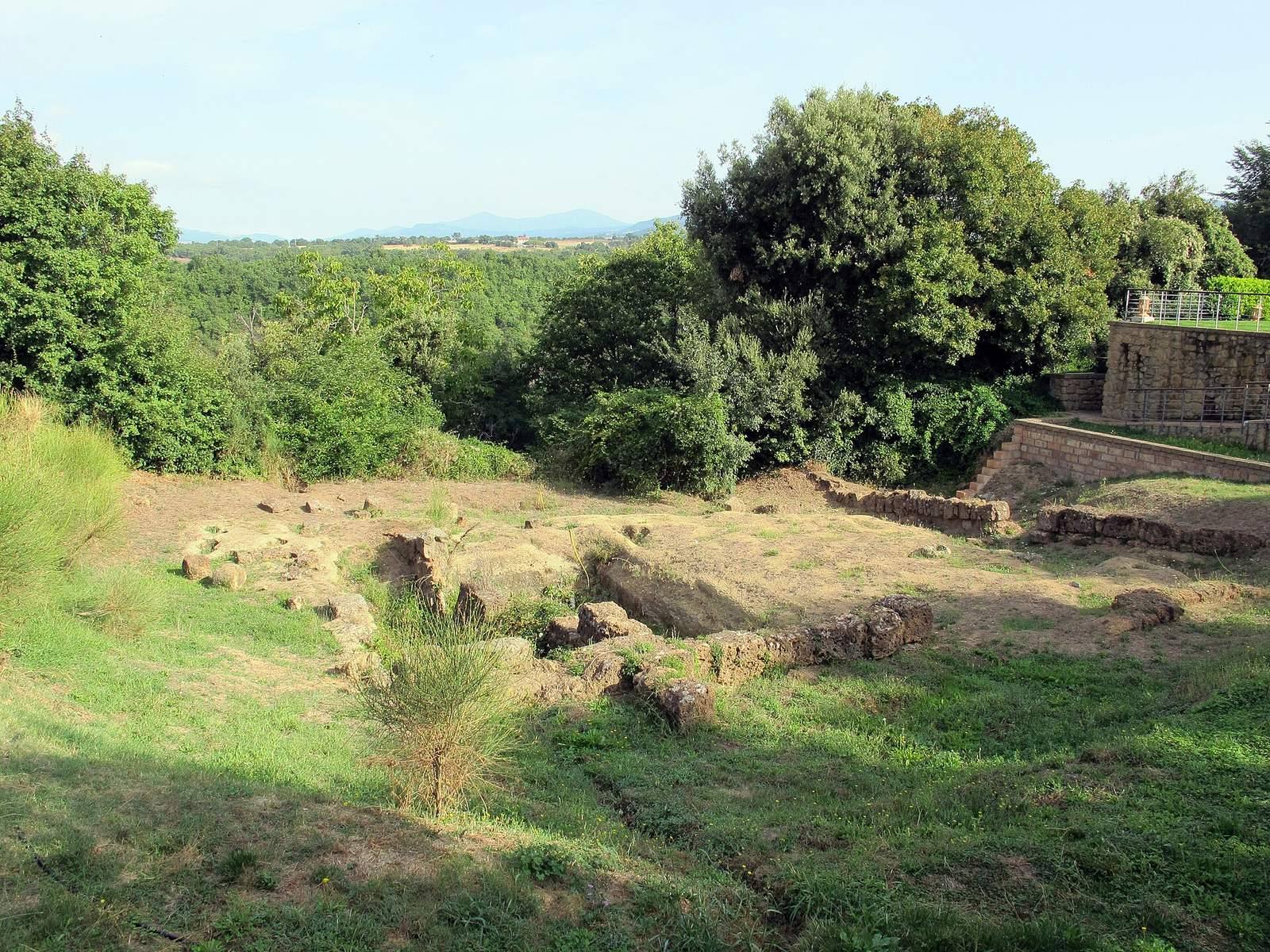
The archaeological area covers about 3.49 square kilometers. Its core is a tuff plateau, a formation of volcanic rock, between the Folonia ravine to the south and the Calesine ravine to the north. A partly human-cut ditch separates the plateau from the ground to the east. The settlement and its defenses occupy the plateau; Etruscan burial grounds extend across the surrounding hillsides and slopes.
Settlement and defenses
Early settlement
The Late Bronze Age village lay on the western slope beneath the present village, where oval huts formed its earliest known settlement remains. Excavations around the cathedral revealed layers spanning the Late Bronze Age to the Archaic period; Late Bronze Age materials were also found in the Pyrgos area.
Walls and terraces
Walls built from tuff blocks enclosed slightly more than seven hectares of a plateau of roughly ten hectares. Surviving stretches remain on the southern slope. On the northern side, the wall circuit ran back from the plateau edge, with terraces near the elementary school marking its course. Scattered remains also occur below the Aldobrandesca fortress, near the washhouse on the Folonia slope, and below the cathedral. Excavations between 1980 and 1994 revealed defensive terraces with phases reaching from the Archaic into the Hellenistic period. A partly exposed section found in 1999 is built from large blocks with deliberately rough, projecting faces, laid in regular courses.
Water management and northern building
Traces of drainage tunnels lie beneath the settlement and below Poggio Grezzano. Excavation on the northern slope in 2001 exposed a 17-meter-long wall in checkerboard masonry. The structure incorporates parts of an older building, including a trapezoidal room and a square pit linked to a channel for managing water.
Sacred and residential areas
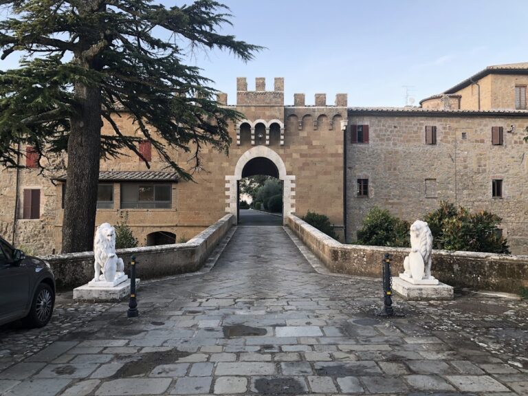
Northeast of the cathedral, at Campo della Piazzetta toward the ruined church of San Benedetto, an ancient building was associated with sacred architecture. Architectural terracottas attributed to it and dated to the middle Hellenistic period are now in a Florence museum. The western sector included a planned suburban quarter of rectangular houses, some partly cut into the tuff. They faced a large open area thought to have been intended for a monumental fountain. At La Biagiola, Roman productive installations occupied the site of the earlier Etruscan settlement; another Roman villa complex was identified near the Fiora.
Rock-cut necropolises
The burial grounds occupy Monte Rosello, the Folonia escarpment, Sopraripa, Melaiolo, Poggio Prisca, Poggio Felceto, Poggio Stanziale, and Poggio Grezzano. Smaller groups of Orientalizing and Archaic tombs tend to occupy lower slopes, while later Hellenistic cemeteries generally developed without disturbing those earlier graves. Sunken roads, routes cut deeply into rock, cross the western necropolis, including the Cavone, San Sebastiano, and Poggio Prisca roads. Another runs through Poggio Stanziale. The Cavone votive deposit was found near the road’s outlet, where an altar and repository were also uncovered.
Tomb forms and painted surfaces
The earliest Etruscan graves were pits cut into the tuff. Chamber tombs with benches and burial niches followed and continued through later phases; tiles or tuff slabs closed the niches. Tomb forms and locally made pottery show close connections with the Faliscan area, as well as contacts with Vulci. Many funerary monuments were originally covered in plaster and painted in bright colors. Investigations have identified systematic coloring on sculpted and architectural surfaces, including pink and blue on the black background of the Tomb of the Winged Demons pediment, and red and blue panels recessed into the ceiling of the Tomb of Ildebranda’s portico.
Tomb of Ildebranda
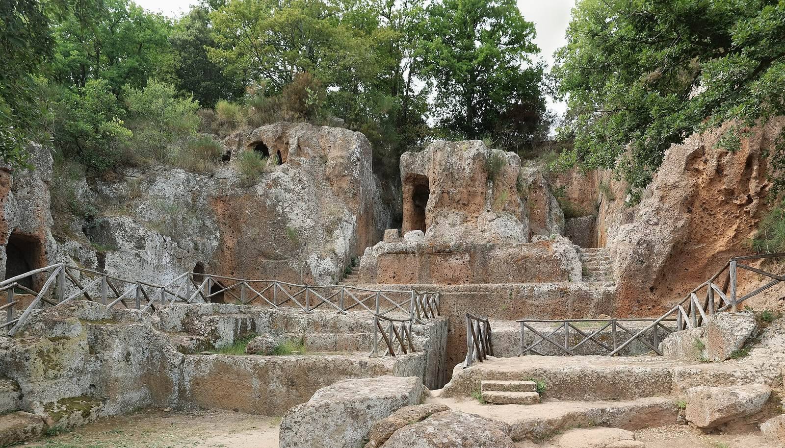
At Poggio Felceto, the Tomb of Ildebranda is a monumental temple tomb and the largest burial monument in the necropolis. Its front has a colonnade, and its portico ceiling retains evidence of colored recessed panels. Bianchi Bandinelli regarded the tomb’s plan and composition as the sole Etruscan instance of a tomb designed as a true temple.
Tomb of the Winged Demons
This shrine-fronted tomb near Ildebranda has a niche containing a painted figure of the deceased reclining at a banquet. Two female winged demons once flanked the figure; part of Vanth, an Etruscan underworld demon, survives on the left. A winged sea monster of the Scylla type decorates the triangular pediment, and a free-standing lion remains on the platform in front. Red Etruscan letters on plaster fragments preserve part of the tomb owner’s name.
Tomb of Pola
The Tomb of Pola, also known as Grotta Pola, stands on the Poggio Prisca escarpment at the southwestern edge of the necropolis. Clearing earth from its platform showed that the façade had eight columns, rather than the four pairs shown in earlier drawings. One fluted column still supports part of the upper structure, and stumps of the other columns remain. The single chamber is 18.50 meters long, reached by a particularly deep entrance passage, and was planned to receive numerous burials.
Other sculpted tombs
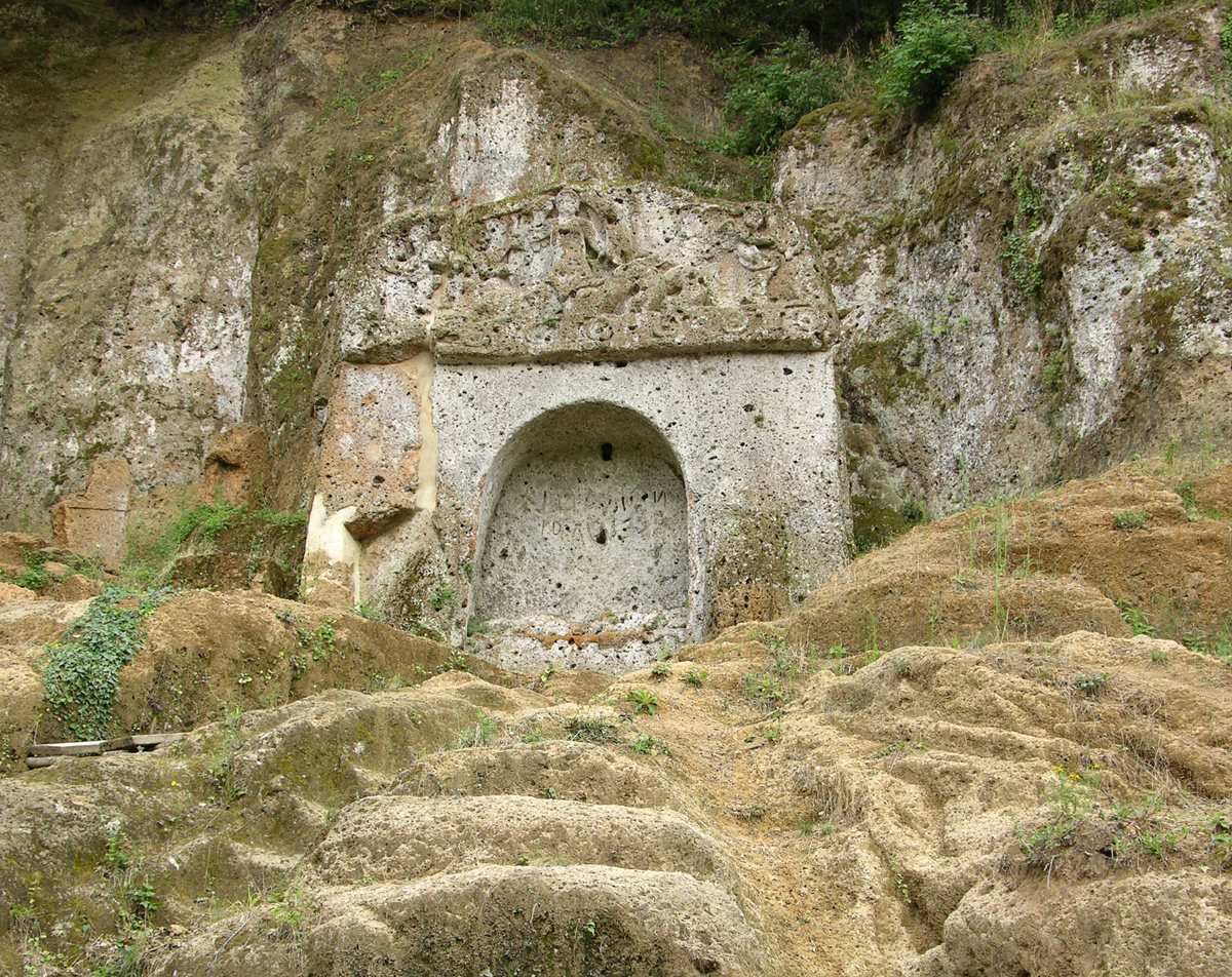
The Tomba della Sirena at Poggio di Sopraripa has a shrine-like façade and a figured pediment showing a sea monster of the Scylla type, providing a local comparison for the Winged Demons tomb. In the nineteenth century, it was popularly called Fontana; Dennis first referred to it as the Tomb of the Spring. At Poggio Stanziale, the Tomba del Tifone has a central sculpted head among plant forms on its pediment and is in poor condition. Other features in this area include the Tomba del Sileno, the Tomba Pisa, and the Poggio Grezzano columbarium, a funerary building with niches for cremation urns.
San Sebastiano and Poggio Grezzano burials
The San Sebastiano chamber tombs lie behind the church of the same name, low on the Sopraripa slope where the Folonia and Calesine meet. Two were found intact with complete Hellenistic grave assemblages, including locally made jugs decorated with flowers and dating to the third century BC. At Poggio Grezzano, two funerary sculptures associated with cremated remains, known as Chiusi-type cinerary statues, date to about the middle of the fifth century BC. They came from a chamber with a recessed-panel ceiling and painted walls.
Early medieval and other remains
Lombard-period cemetery
At Nuovo Frantoio, the Lombard-period cemetery contains subrectangular graves cut into tuff and covered with stone slabs. Some objects from the cemetery date to the seventh century AD. Human remains from fourteen people were examined.
San Mamiliano hoard
A small coarseware pot held a hoard of 498 gold solidi, standard Roman gold coins, minted in the fifth century under emperors from Honorius to Zeno and at several mints. The coins are displayed in the museum established in the church of San Mamiliano.
Rock-cut oratory
Along the road from Sovana toward San Martino sul Fiora are the remains of an oratory of uncertain origin, cut into tuff. A large cross is scratched into its ceiling.
Inscriptions in the town square
Three Latin inscriptions are associated with the square: two are funerary, and one is dedicated to the Nymphs, female nature divinities in Greek and Roman religion.