Megalithic Monuments of Alcalar: A Prehistoric Settlement and Burial Complex
Site at a Glance
- Popularity
- Medium
- Country
- Portugal
- Primary era
- Stone Age
- Eras represented
- Stone Age, Classical, Early Modern
- Civilizations
- Portuguese, Roman
- Site type
- Burial
- Remains
- Necropolis
On this page18 sections
History
Prehistoric settlement and burial landscape
The Megalithic Monuments of Alcalar are a prehistoric settlement and burial complex near Portimão, Portugal, occupied chiefly from about 3200 to 2000 BC during the Copper Age, when communities used copper alongside stone tools. Its tombs are megalithic, built from large stones. Human activity in the area extended more broadly from the fifth to the second millennium BC.
Alcalar developed along the Algarve’s limestone coastal strip, close to a stretch of the Torre River that was once navigable. The settlement covered more than 25 hectares, with a central area of about 10 hectares near the river’s navigable limit. Nearby waterways, the coast and the Alvor lagoon system offered varied resources. Residents practiced agriculture and animal herding, and also hunted, fished, gathered shellfish, wove textiles, made pottery and worked copper.
Alcalar was the center of a wider settlement landscape that included smaller communities at Monte Canelas, Poio, Freiras, Amoreira and Mosqueiro. Other burial places lay near Monte Velho, south of Amoreira, and east of Poio. The settlement and its burial grounds formed distinct parts of this landscape. The tombs served people regarded as influential within the community, while other members were buried elsewhere.
Later Roman activity is indicated by storage pits at Monte António José Serrenho and a burial near Monument 4. The burial was excavated in 1882 and investigated again in 1933. Work in 2000 examined it alongside the storage pits.
Rediscovery and archaeological study
In 1880, António José Nunes da Glória, a priest at Mexilhoeira Grande, uncovered the first tomb known to modern investigators while examining an unusually shaped mound. He drew the monument and sent the recovered objects, enough to fill five large boxes, to archaeologist Estácio da Veiga. Around 1882, the two began broader investigations. Estácio da Veiga examined tombs 2 to 7 and published his findings; trenches dug in search of objects damaged the structures.
Joaquim Pereira Jardim discovered tombs 8 and 9 in 1903, including a tomb about 300 metres west of those already known, and excavated them for the Figueira Archaeological Society. António dos Santos Rocha published the discoveries in 1904. Jardim also excavated three tombs near Monte Velho. A triton shell found during work at Alcalar in December 1901 was later proposed by Rocha, in 1952, as a possible musical instrument, based on comparison with fishermen’s practices.
The complex was designated a National Monument by decree on 16 June 1910. Georg and Vera Leisner visited the burial grounds in 1930 and included them in their study of megalithic tombs. In 1933, José Formosinho began conservation work, investigated the Roman burial and identified three more tombs, now numbered 11 to 13. In 1957, archaeologist Octávio da Veiga Ferreira warned that local removal of tomb stones for building material threatened the monuments.
Two archaeological teams independently identified the prehistoric settlement in 1975: one led by José Arnaud and Teresa Gamito, the other by Carlos Tavares da Silva and Joaquina Soares. Arnaud and Gamito excavated it in 1979, uncovering evidence of daily life. A wider research project began in 1980, and from 1982 investigations expanded from Monument 7 to the settlement and surrounding territory, first under Rui Parreira and later with archaeologist Elena Morán. Excavations at Monte Canelas in the 1990s also revealed an ossuary, a place for human bones, and funerary practices that included laying the dead in a fetal position.
The Portuguese state acquired part of Monument 7 in 1975 and fenced it the following year. From 1997, work focused on the eastern burial grounds, combining research and conservation; the protected area was enlarged. Monument 7 was repaired in 1998, with stones reassembled and drainage improved. Monument 9 was consolidated in 2008 and underwent further recovery work in 2018. Research also contributed to expanding protection to cover remains of the prehistoric settlement.
Remains
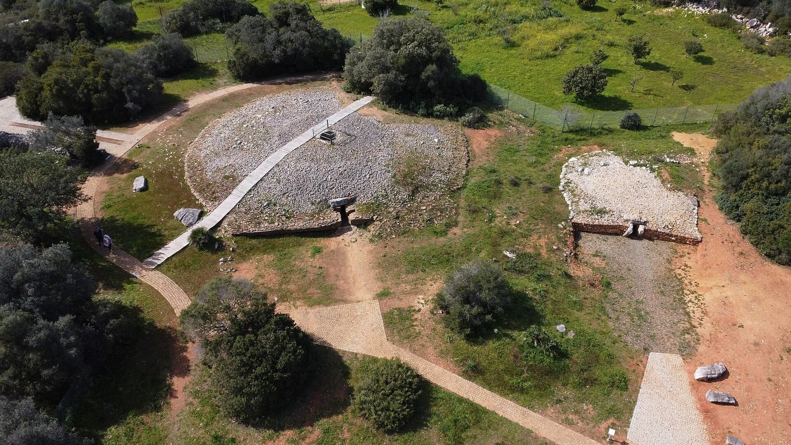
The complex occupies naturally defensible hilltop terrain. The settlement lay on one hill, while tombs were distributed across the surrounding heights. Its surviving funerary architecture includes burial mounds, passage tombs and circular chamber tombs, some with side niches or roofs formed by courses of stone projecting inward. Six tombs make up a central group west of Municipal Road 532; Monument 10 lies beside Monuments 1 to 6.
The central tomb group
Monument 1
Monument 1 is a passage tomb beneath a mound and is now badly degraded. Its passage and polygonal burial chamber together measure 8.5 metres, and the mound is 36 metres across. Eight sandstone slabs lean slightly inward to form the chamber, which measures about 2.6 by 2.7 metres. The slabs are roughly 0.4 metres thick, 2.4 metres high and 1.6 metres wide.
Two stone objects were found in the chamber: a rounded limestone cylinder about 55 centimetres high near the left wall, and an elongated schist slab, 1.7 metres long and 0.4 metres wide, lying diagonally near the center. Estácio da Veiga interpreted them as an altar-like table.
Monuments 2–6 and 10
Monuments 2 and 3 are circular chamber tombs beneath mounds. The second is in poor condition, while the third survives in good condition. Monument 4 is a mound containing a circular chamber tomb; parts of the chamber and two large entrance stones remain visible, and its condition is fair. Monuments 5 and 6 shared a mound and are destroyed. Monument 10, beside this group, is a circular chamber tomb in good condition.
Monument 7
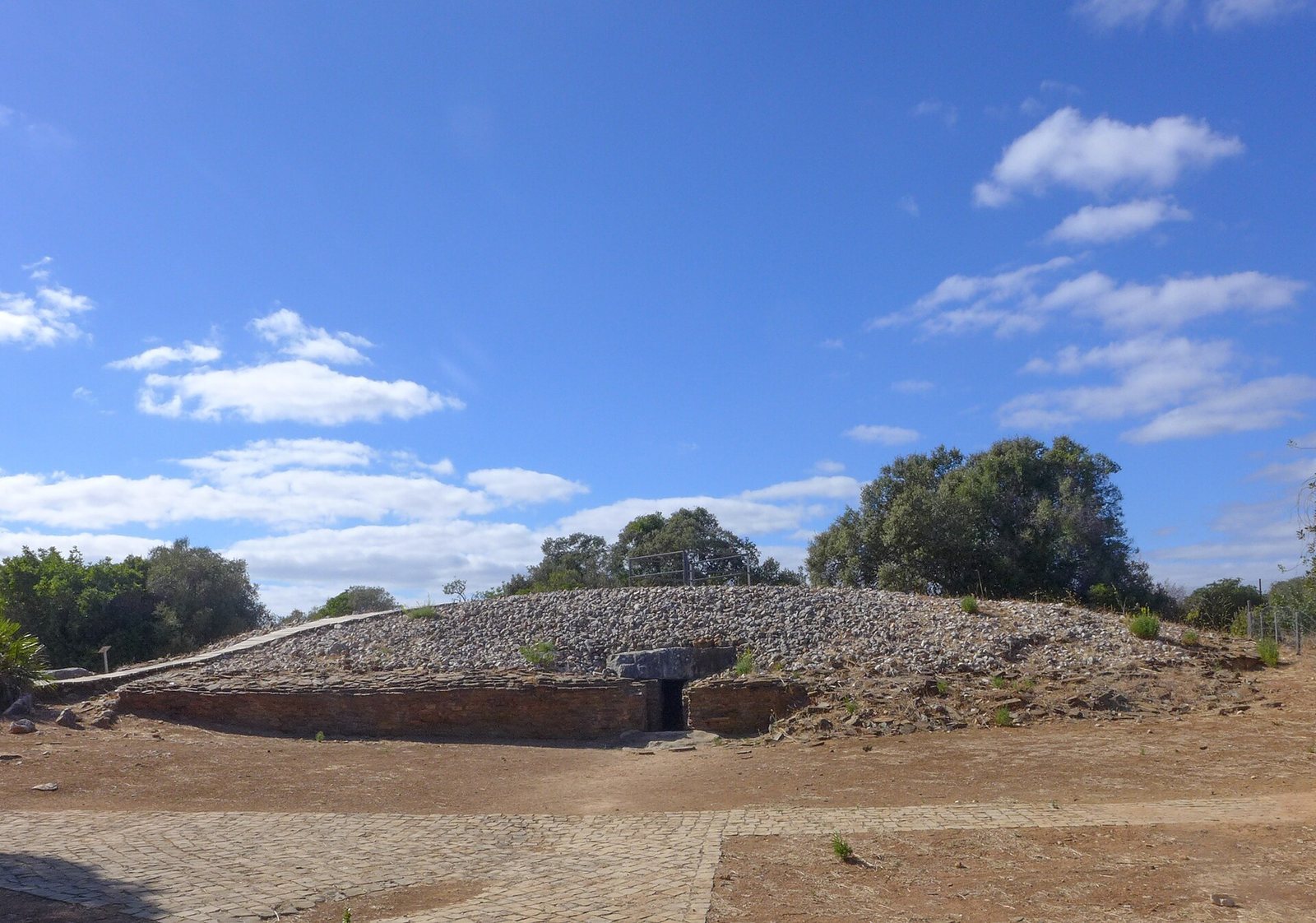
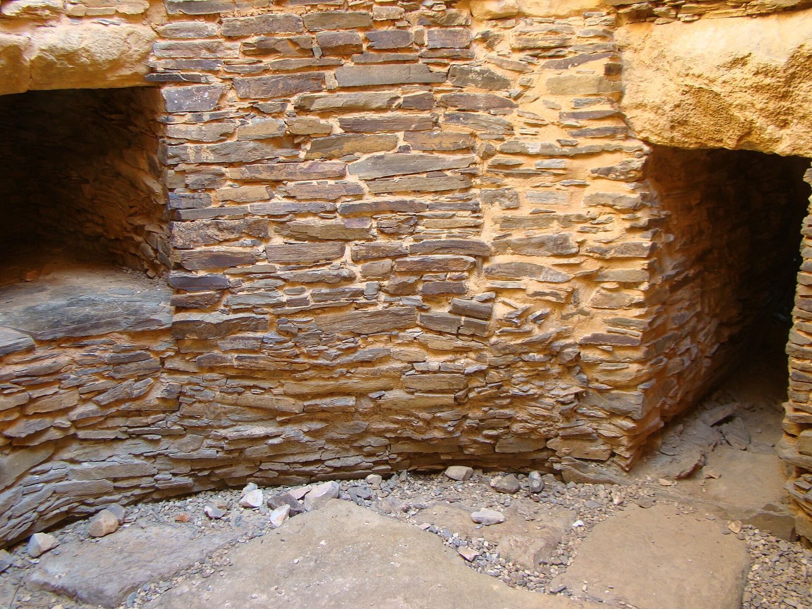
Monument 7 is a large mound, 27 metres across, built around a circular chamber tomb. Its entrance faces east, near the mound’s midpoint, and an approximately 9-metre passage leads to a circular chamber about 3 metres across. Three substantial side niches open from the chamber. Schist forms the base, and a surrounding wall creates a path around the structure.
Large limestone slabs cover the passage and guide access to the chamber. A limestone slab covers the chamber’s central space, while the false dome is formed by schist slabs laid in clay and supported by natural rock. A two-tier mound of schist and calcareous sandstone covers the tomb; masonry on its lower exterior helped stabilize it. A large block in the northern side chamber may have served as an altar. Monument 7 dates to the middle of the third millennium BC.
Monument 9
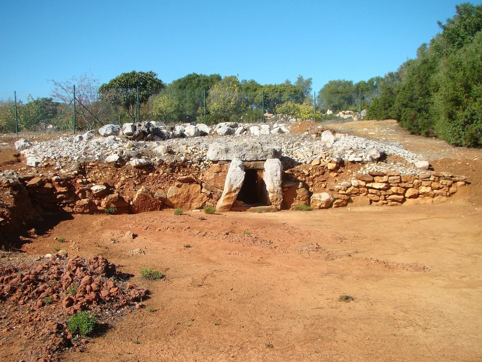
Smaller than Monument 7, Monument 9 has an inner chamber and a passage lined with large limestone or sandstone slabs. Smaller stones, at times bound with clay, cover the chamber and passage to create a circular mound. Mainly white limestone stones crown the mound, which is finished with slabs. A retaining wall of limestone and yellow sandstone surrounds it. A large slab covered the chamber’s upper opening rather than a vaulted roof.
Monument 9 was built about 200 to 300 years after Monument 7, in the late third or early second millennium BC, after Monument 7 had been sealed. Its exterior was robust, but the tomb collapsed while still in use, apparently because of weaknesses in its internal structure. Some stones in its exposed form are tilted by the collapse. Its open forecourt is nearly as large as the tomb and has been interpreted as a place for ritual activity, social meetings and shared community events. The raised position and breast-like profiles of Monuments 7 and 9 may have made them visible from a distance and may have expressed the builders’ power.
Burials and finds
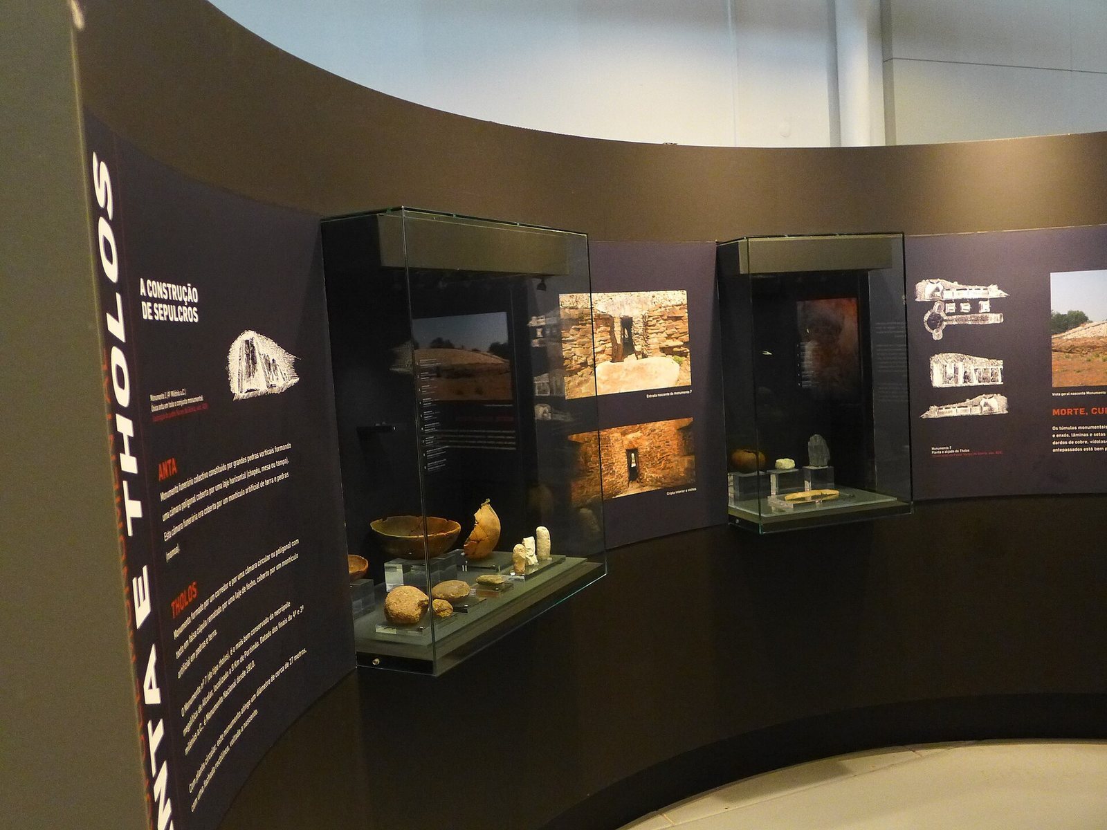
Excavation of Monument 9 recovered a later burial placed above two ceramic bowls. It included long bones and the skull of a robust, middle-aged man whose healed head injury shows that he survived the trauma, as well as remains of four other people, including adults and children. A small stone cylinder decorated with eye figures, often called an eye idol, was also found. One decorated half came from within the tomb; the other was recovered from soil removed during nineteenth-century excavations. The restored object is exhibited at the Portimão Museum.
A toe bone found at Monument 9 was first identified as belonging to a horse, then attributed to an extinct wild member of the horse family that lived in the region until the fifteenth century. It was undecorated, unlike toe bones found in other tombs. Estácio da Veiga also described incomplete, fragmented human bones from the tombs, including worn teeth, strongly ridged thigh bones, flattened shin bones and unusual upper-arm fragments. He compared some features with early European human remains and Neolithic material, but cautioned that they could not support firm conclusions.
Western and outlying burial grounds
Western group
The western group comprises tombs 8, 11, 14, 15 and 16. Tombs 8 and 11 were circular chamber tombs beneath mounds; tomb 8 is destroyed, and tomb 11 is in very poor condition. Tomb 14, also a circular chamber tomb, is badly decayed. Tomb 15 was a circular chamber tomb with a mound, while tomb 16 was another tomb of the same general type.
Vidigal Velho group
Tombs 12 and 13 formed the Vidigal Velho group. Both were circular chamber tombs and are destroyed.
Monte Canelas
Monte Canelas lies about 700 metres north of Alcalar. Its tomb has two chambers, one relatively rectangular and the other relatively round, linked by a passage. Excavations recovered the remains of more than 140 people.
Settlement and later features
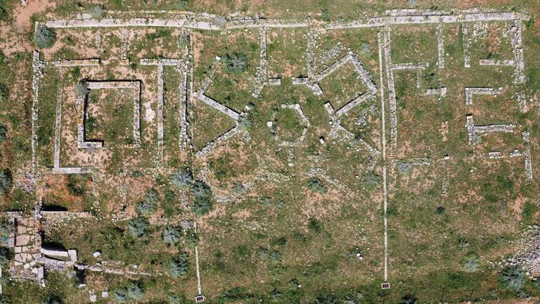
Excavations at the settlement revealed buildings and storage pits partly cut into the ground, within an enclosure marked by ditches. Other remains include installations for making fires and semicircular houses with masonry foundations. Animal bones and shells, polished stone objects and ceramic vessels provide further evidence of activity at the settlement.
Roman-period remains and lime kiln
Roman remains
Three Roman-period storage pits lie at Monte António José Serrenho. A burial near Monument 4 contained fragments of a glass urn, a small blue glass bead and a coin possibly dating to Emperor Claudius’s reign, AD 41–54.
Lime kiln
A traditional-type lime kiln near the monuments probably dates to the eighteenth century.